Hiking Around Las Vegas, Death Valley National Park
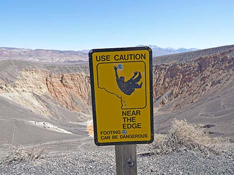
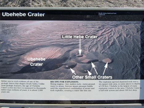 Ubehebe Crater sign at the trailhead |
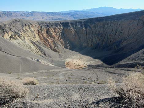
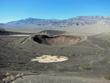
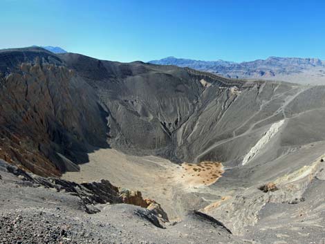
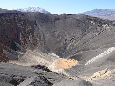
Overview The 1.5-mile Ubehebe Crater Loop Trail runs around the perimeter of Ubehebe Crater, a geologically interesting area in the Death Valley Wilderness Area. The crater was formed when this area was volcanically active. Magma was moving towards the surface, and it might have erupted and formed a volcano or a cinder cone, but it encountered groundwater along the way. The hot magma superheated the groundwater, converted it to steam, and blew a giant hole (0.5 miles across) and several smaller holes in the ground. Even if you don't hike the trail, just seeing this place and imagining what it would have been like to see the blast is worth driving over here from the main road. The hike is fairly easy and provides great views of the crater and surrounding area. Link to map. |
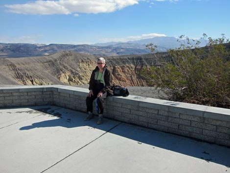 Visitor at Ubehebe Crater trailhead overlook (view SE) |
Watch Out Other than the standard warnings about hiking in the desert, ...this is a fairly safe hike, but the sides of the crater are steep and loose, and a slip from the trail could make for a long slide into the crater. Some parts of the trail might not be good for small children unless you watch them carefully. Going the first half-mile to Little Hebe Crater is pretty safe, but stay back from the edge. While hiking, please respect the land and the other people out there, and please try to Leave No Trace of your passage. Also, this hike is fairly short, so just bring what you need of the 10 Essentials. |
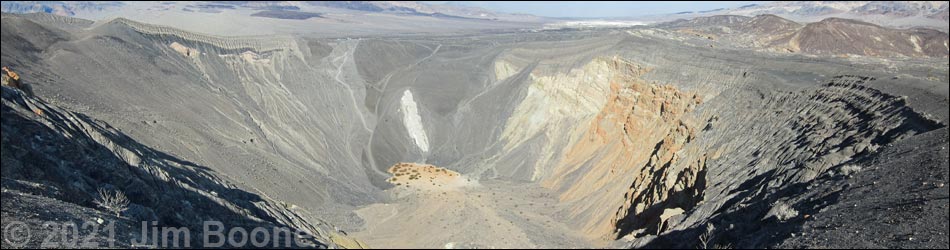
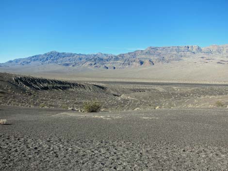
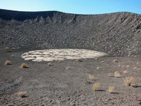
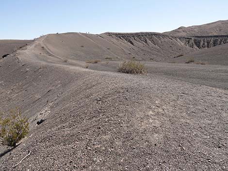
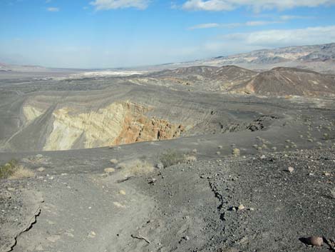
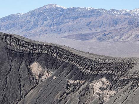
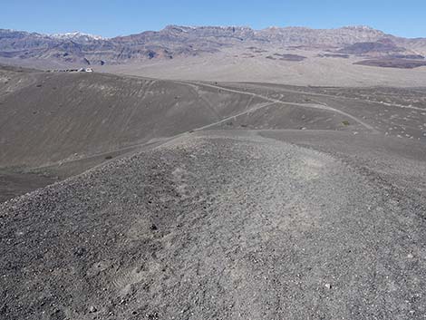
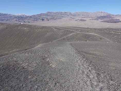
 Ubehebe Crater (view SE from trailhead overlook) |
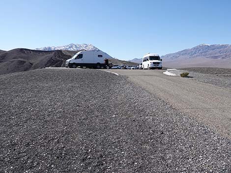
Getting to the Trailhead This hike is located in Death Valley National Park, about 4 hours northwest of Las Vegas. From town, drive out to Death Valley. From the Furnace Creek Visitor Center (Table 1, Site 0712), drive north on Highway 190 for 17.4 miles to Scotty's Castle Road (Site 0763). Turn right onto Scotty's Castle Road and drive north for about 33 miles to the Grapevine Entrance Station, which is a tollbooth in the middle of the road (with water and restrooms at the nearby ranger station). Continue north for 0.2 miles to Ubehebe Crater Road (Site 0754). Turn left (west) onto Ubehebe Crater Road and drive northwest for 6.0 miles to the parking area at Ubehebe Overlook (Site 0755). Stop here; this is the trailhead. |
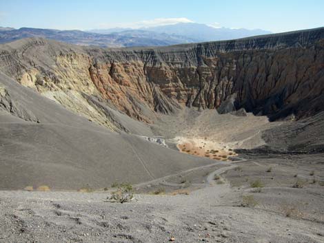
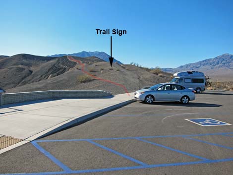 Ubehebe Crater Trailhead (view SW) |
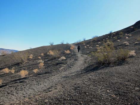
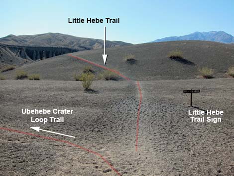
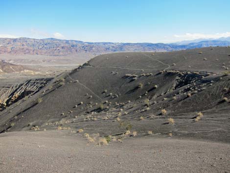
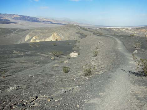
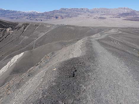
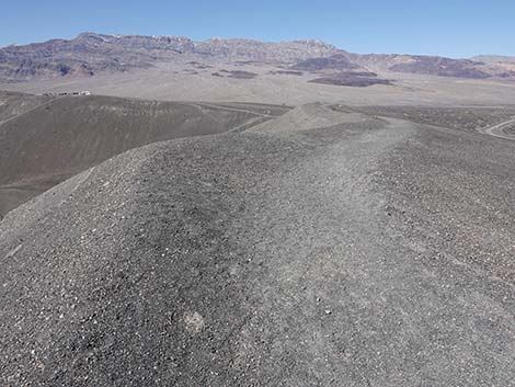
The Hike From the trailhead (Table 2, Waypoint 05), hikers can walk the Ubehebe Crater Loop Trail in either direction, but I walked it by starting to the southwest (right) heading up the hill. Going this way, there are great views from high on this side of the crater and the desert valleys beyond. Despite the loose volcanic soils, the walking is fairly easy. The Ubehebe Crater Loop Trail runs out about 0.5 miles to a little hilltop (Wpt. 06), then descends slightly to a trail junction (Wpt. 07) with a short spur trail (about 2 minutes) leads to Little Hebe Crater (Wpt. 08), a smaller crater perched on the back of "Big Ubehebe." For details on the hike up to this point, see the Little Hebe Trail. |
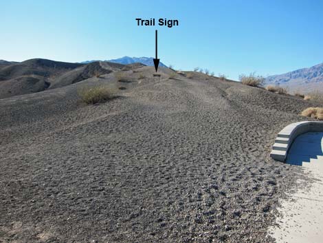 Little Hebe Crater trailhead sign visible from parking area (view SW) |
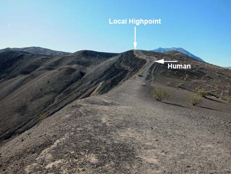
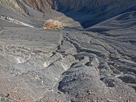
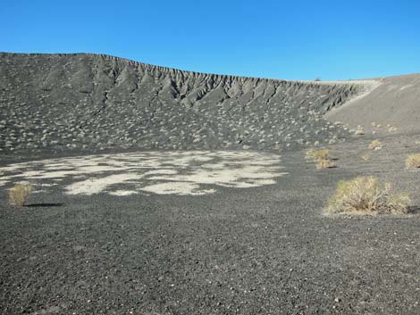
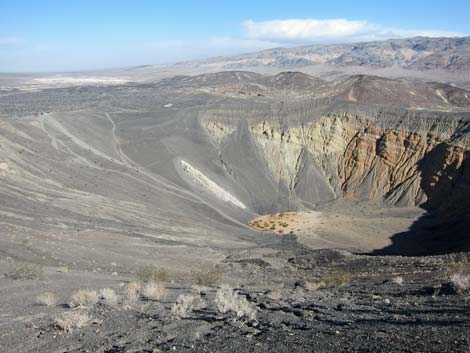
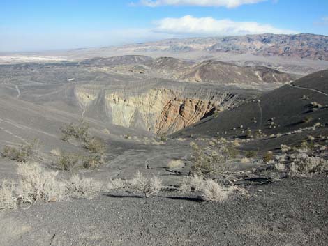
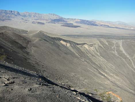
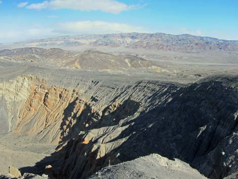
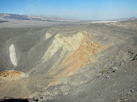
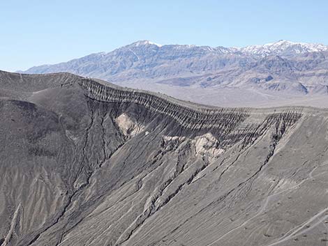
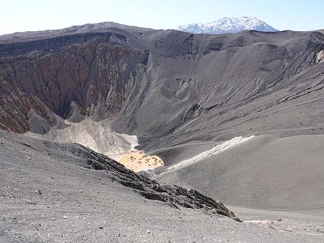
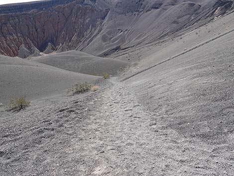
From the Little Hebe trail junction (Wpt. 07), the Ubehebe Crater Loop Trail continues up and around the main crater, shortly arriving at the highest point on the trail (Wpt. 09), which ironically has a great view of Little Hebe and a poor view of the main crater. From there, the Ubehebe Crater Loop Trail continues circling eastward (Wpt. 10) and then northward around the crater. Some parts of the trail run inside the rim of the crater, which gives great views of the bottom, but also carries the risk of giving hikers a quick ride to the bottom. From the far side, the Ubehebe Crater Loop Trail provides some great views to the north and east out across the region, and there are great views down into the crater. In the crater, hikers can see rocks and sediments of various colors, including black and white banding, red cliffs, and what looks like white sediment from the bottom of the crater that was blasted up onto the side of the crater. Visitors can see these from the trailhead too, but somehow views from the far side seem better. |
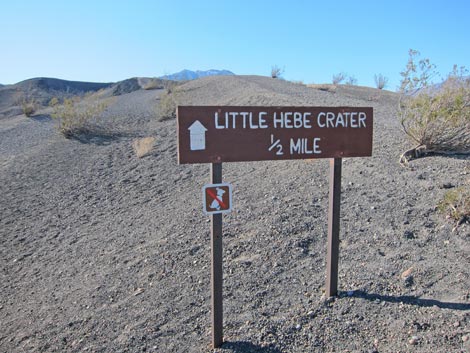 Little Hebe Crater trailhead sign (view SW) |
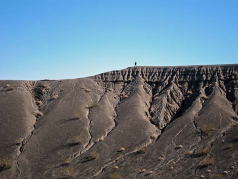
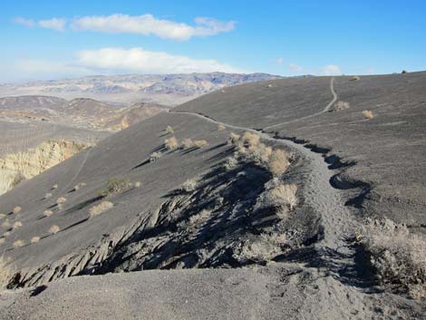
The Ubehebe Crater Loop Trail continues around the crater until returning to the trailhead. In addition to hiking around the crater, there are several trails down into Ubehebe Crater. These trails are steep and loose, and while the direct route down from the parking area might be a good way to get down, getting up that way looks pretty hard. One person, who was having trouble climbing back up that steep route, ended up crawling much of the way out. An alternative and less steep route out of the crater runs to the east (right on the way out) of the direct route (hits the rim at Wpt. 11). Hikers should take a look at this route before going down, so they know an easier way to climb back out. |
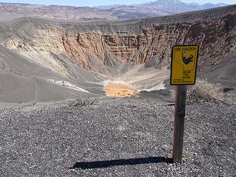 Caution sign: Use caution near the edge (view NE) |
 Caution sign: Use caution near the edge (view NE) |
 It would be a long tumble into Big Ubehebe Crater (view NE)! |
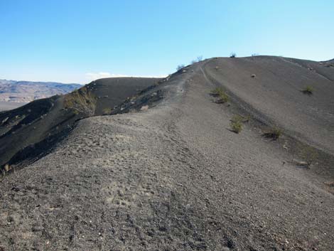
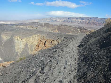
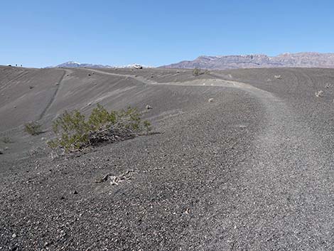
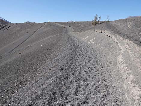
 Ubehebe Trail runs on edge of crater (view S) |
 Don't tumble into the crater (view NE)! |
 From crater rim, gentle terrain outside the crater (view W) |
 Looking back: trail runs on lip of the crater (view N) |
 Ubehebe Trail continues along edge of crater (view S) |
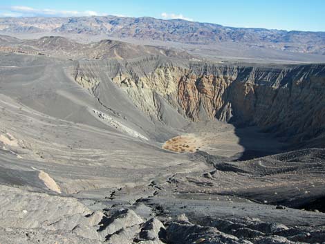 Grand view into Big Ubehebe Crater (view NE) |
 Ubehebe Trail approaching a small crater (view S) |
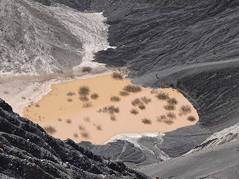
 Mud flat in the bottom of small crater (view SW) |
 Trail continues out of the small crater (view SE) |
 Trail junction: Little Hebe Trail stays right (view S) |
 Ubehebe Crater Loop Trail stays left (view SE) |
 Ubehebe Trail continues along the rim (view E) |
 Ubehebe Crater (view NE from Ubehebe Trail) |
 Hiker on trail across the crater (view NE from Ubehebe Trail) |
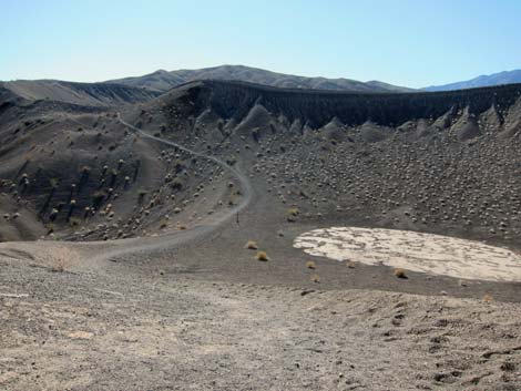
 Little Hebe Crater (view W from Ubehebe Trail) |
 Big Ubehebe Crater (view NE from Ubehebe Trail) |
 Ubehebe Crater Trail ahead in the distance (view NE from trail) |
 Ubehebe Crater Trail; stay left a fork (view NE) |
 Ubehebe Crater Trail crossing steep slope (view NE) |
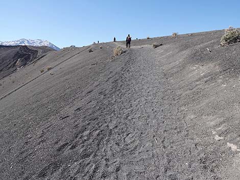
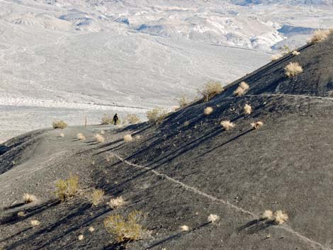 Hiker ahead on Ubehebe Crater Trail (view NE) |
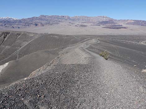
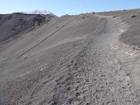
 Grand view (view NW from Ubehebe Crater Trail) |
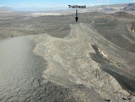
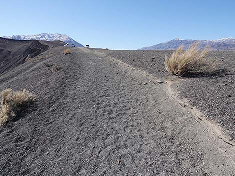
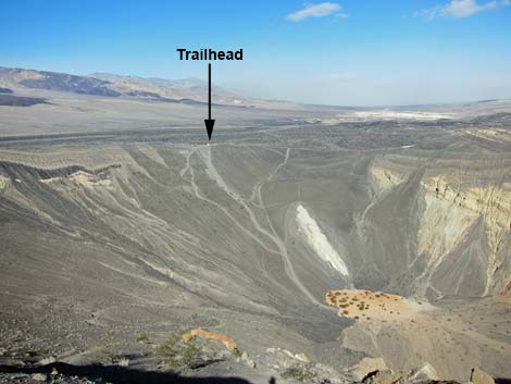 Grand view including trailhead (view NW from Ubehebe Crater Trail) |
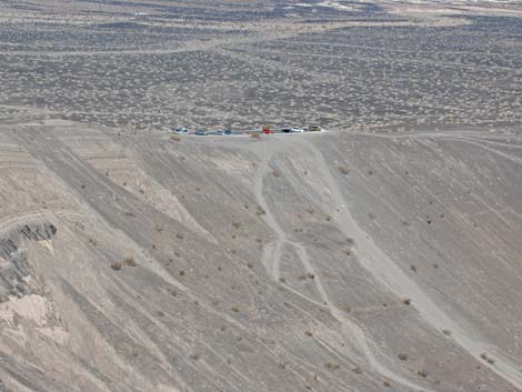 Zoom: Ubehebe Trailhead (view NW from Ubehebe Crater Trail) |
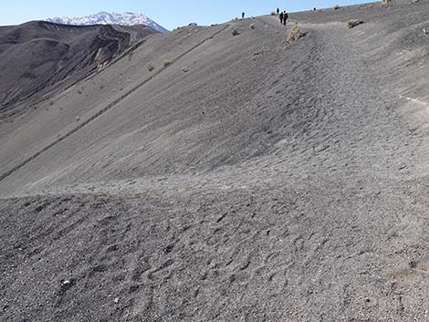
 Grand view (view NE from Ubehebe Crater Trail) |
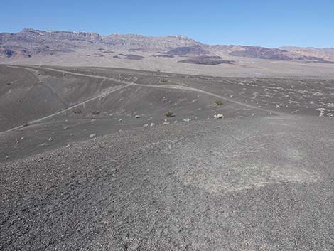
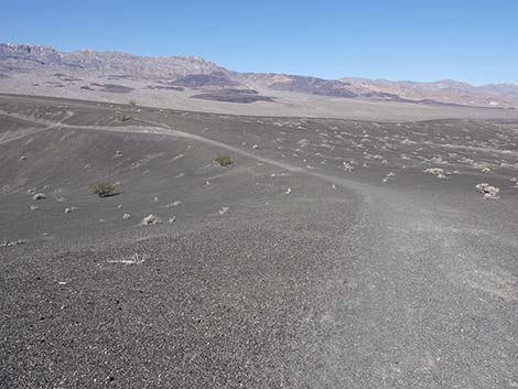
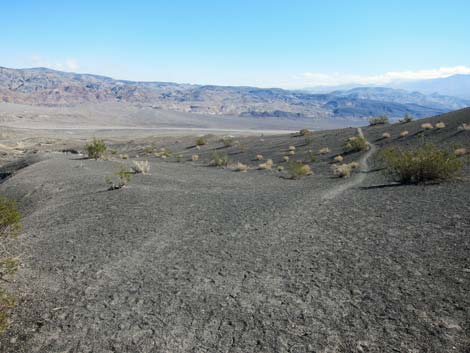 Trail continues across gentle slopes (view NE) |
 Trail continues across gentle slopes (view NE) |
 Trail continues across gentle slopes (view NE) |
 Trail runs back to the crater rim (view N) |
 Trail continues across gentle slopes (view NE) |
 Trail runs back to the crater rim (view N) |
 Grand view (view SW from Ubehebe Crater Trail) |
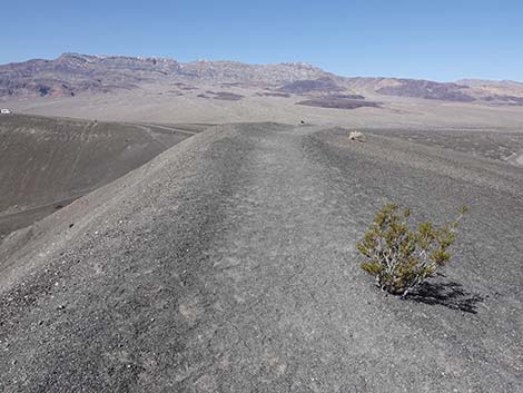
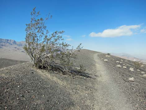 Lonely Creosote Bush growing on the crater rim (view NW) |
 From the local high point, trail continues down along rim (view NW) |
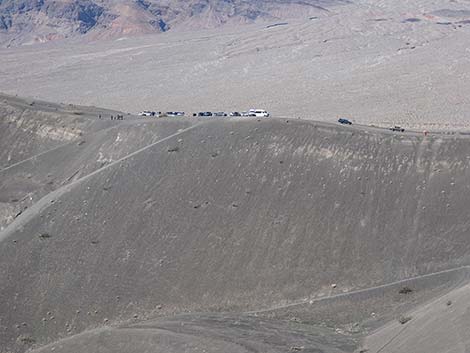 The trailhead can be seen in the distance (view NW; zoom) |
 Another nice view into the crater bottom (view SW) |
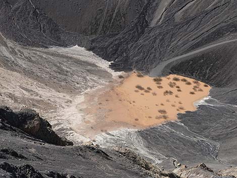 Muddy pond in the bottom of the crater (view SW; zoom) |
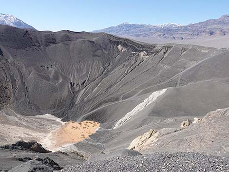 Interesting layers on the far side of the crater (view SW) |
 Interesting layers on the far side of the crater (view SW; zoom) |
 Interesting layers on the far side of the crater (view SW; zoom) |
 Trail continues along crater rim (view NW) |
 Trail runs along crater rim (view NW) |
 Another lonely Creosote Bush on the crater rim (view NW) |
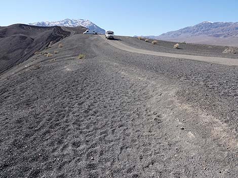
 Trail continues along crater rim; trailhead in near distance (view NW) |
 Another nice view into the crater bottom (view S) |
 Hiker on trail at the crater-bottom pond (view S; zoom) |
 Trail continues along crater rim (view NW) |
 Crater-bottom Trail comes into view (view NW) |
 Trail continues along crater rim (view NW) |
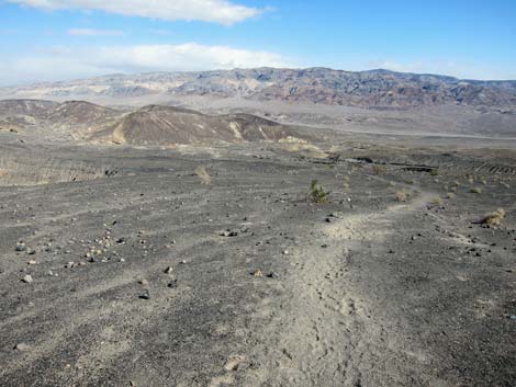
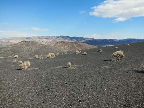 Desert Holly dot the black, volcanic soils along the trail (view E) |
 After descending from local high point, trail climbs again (view W) |
 Climbing toward junction with Crater-bottom Trail (view W) |
 Arriving at junction with Crater-bottom Trail (view SW) |
 Junction with Crater-bottom Trail (view W) |
 Ubehebe Crater-bottom Trail (view S from Loop Trail) |
 Trail continues climbing past the trail junction (view SW) |
 Trail returns to the crater rim (view SW) |
 Nearing the trailhead, trail parallels Ubehebe Crater Road (view SW) |
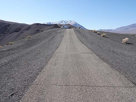 It becomes easier to hike on the pavement (view SW) |
 Ubehebe Crater Loop Trail returning to the trailhead (view SW) |
Table 1. Highway Coordinates Based on GPS Data (NAD27; UTM Zone 11S). Download Highway GPS Waypoints (*.gpx) file.
| Site # | Location | Latitude (N) | Longitude (W) | Easting | Northing | Elevation (ft) | Verified |
|---|---|---|---|---|---|---|---|
| 0712 | Furnace Creek Visitor Center | 36.46159 | 116.86574 | 512030 | 4034954 | -186 | Yes |
| 0754 | Scotty's Castle Rd at Ubehebe Rd | 36.99863 | 117.36605 | 467429 | 4094580 | 2,292 | Yes |
| 0755 | Ubehebe Crater Parking | 37.01086 | 117.45395 | 459614 | 4095970 | 2,616 | Yes |
| 0763 | Hwy 190 at Scotty's Castle Rd | 36.63910 | 117.03531 | 496843 | 4054636 | 104 | Yes-2 |
Table 2. Hiking Coordinates Based on GPS Data (NAD27, UTM Zone 11S). Download Hiking GPS Waypoints (*.gpx) file.
| Wpt. | Location | Time | Easting | Northing | Elevation (ft) | Verified |
|---|---|---|---|---|---|---|
| 05 | Ubehebe Crater trailhead | 1517 | 459614 | 4095970 | 2,550 | GPS |
| 06 | Little hilltop | 1528 | 459693 | 4095463 | 2,682 | GPS |
| 07 | Trail junction | 1530 | 459828 | 4095358 | 2,756 | GPS |
| 08 | Edge of Little Hebe Crater | 1532 | 459871 | 4095287 | 2,785 | GPS |
| 09 | Highest point on the trail | 1540 | 460062 | 4095281 | 2,865 | GPS |
| 10 | High point on NE edge | 1556 | 460114 | 4096167 | 2,603 | GPS |
| 11 | Trail out of the crater | 1605 | 459663 | 4096170 | 2,535 | GPS |
Happy Hiking! All distances, elevations, and other facts are approximate.
![]() ; Last updated 240324
; Last updated 240324
| Death Valley | Hiking Around Las Vegas | Glossary | Copyright, Conditions, Disclaimer | Home |