Hiking Around Las Vegas, Hiking Around Death Valley National Park
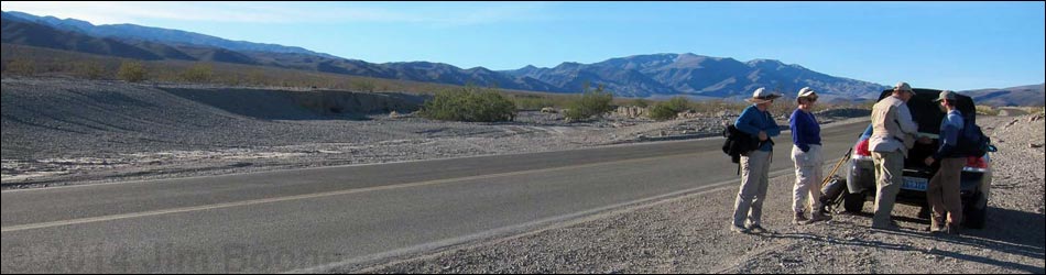
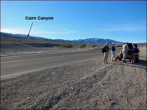 Cairn Canyon Trailhead along Hwy 190 (view S) |
Cairn Canyon Trailhead is located along Highway 190 in Death Valley National Park, about 2-1/2 hours northwest of Las Vegas. From town, drive out to Death Valley. From the Furnace Creek Visitor Center (Table 1, Site 0712), drive north on Highway 190 for 24 miles to Stovepipe Wells (Site 0751). From the Stovepipe Wells General Store, continue west 14.5 miles to where Emigrant Wash crosses the highway at a deep dip in the pavement. In the wash crossing, pull off into the large, dirt, unmarked pullout on either side of the highway (Site 1536). Park here; this is the trailhead. Note: don't park here if there is a chance of flash flooding in Emigrant Wash. Link to Trailhead Map. Trails: Cairn Canyon. |
Table 1. Highway Coordinates Based on GPS Data (NAD27; UTM Zone 11S). Download Highway GPS Waypoints (*.gpx) file.
| Site # | Location | Latitude (N) | Longitude (W) | Easting | Northing | Elevation (ft) | Verified |
|---|---|---|---|---|---|---|---|
| 0712 | Furnace Creek Visitor Center | 36.46159 | 116.86574 | 512030 | 4034954 | -186 | Yes |
| 0751 | Hwy 190 at Stovepipe Wells | 36.60654 | 117.14594 | 486948 | 4051034 | 0 | Yes |
| 1536 | Hwy 190 @ Cairn Canyon Trailhead Parking | 36.53287 | 117.21649 | 480620 | 4042874 | 1,366 | Yes |
Happy Hiking! All distances, elevations, and other facts are approximate.
![]() ; Last updated 240324
; Last updated 240324
| Hiking Around Death Valley | Hiking Around Las Vegas | Glossary | Copyright, Conditions, Disclaimer | Home |