Hiking Around Las Vegas, Death Valley National Park
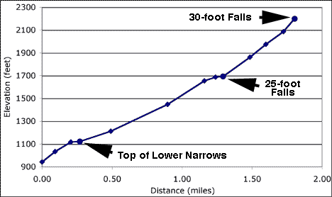
This profile is based on waypoints, not track data. I was unable to get a good GPS position at the last point (2,200 ft), so I estimated from a topo map. See comments in the route description.
Happy Hiking! All distances, elevations, and other facts are approximate.
![]() ; Last updated 110214
; Last updated 110214
| Upper Mosaic Canyon | Hiking Around Death Valley | Glossary | Copyright, Conditions, Disclaimer | Home |