Hiking Around Las Vegas, Death Valley National Park
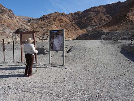 Hiker at Mosaic Canyon Trailhead (view S) |
Overview This 1.4-mile (one-way) hike runs up into the Death Valley Wilderness Area and involves scrambling up a narrow, water-polished, marble canyon to a 25-ft pour-over that marks the end of the official trail. Hiking up the canyon is moderately strenuous, but the tread is firm and fairly easy to walk on, and it is less steep than is typical for gravel washes, although there are some low scramble-ups. The narrows in the first quarter-mile of the hike are the most spectacular in the canyon, so for hikers who don't want to hike the entire canyon, at least see the Lower Narrows -- which alone is worth the trip. The 25-ft pour-over at the end of the official trail can be passed on a steep, narrow use-trail. Hikers continuing up the canyon will encounter interesting obstacles until the canyon is blocked by a 30-ft pour-over, which is about 0.4 miles past the end of the official trail. Link to map or elevation profile. |
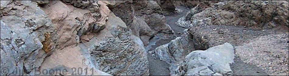
 Top of the very best of the Lower Narrows (view SE) |
Watch Out Other than the standard warnings about hiking in the desert, ...the hike to the first pour-over is pretty safe, but stay out of the canyon if rain threatens because of flash flood dangers. There are several small pour-overs and scramble-ups in the canyon that are easy to pass, but the rock is water-polished, slick, and covered with dust and gravel, so there is greater than usual risk if slipping. The most obvious way to pass the 25-ft pour-over involves a bit of 3rd-class climbing (which is to say, fairly easy), but be careful or use the longer use-trail. While hiking, please respect the land and the other people out there, and please try to Leave No Trace of your passage. Also, this is a moderately long hike, so be sure to bring what you need of the 10 Essentials. |
 Last of the Lower Narrows (view E) |
Getting to the Trailhead This hike is located in Death Valley National Park, about 3.5 hours northwest of Las Vegas. From town, drive out to Death Valley. From the Furnace Creek Visitor Center (Table 1, Site 712), drive north on Highway 190 for 24 miles to Stovepipe Wells (Site 751). Continue west on Highway 190 for another 0.25 miles to Mosaic Canyon Road (Site 750), a graded dirt road. Turn south (left) onto Mosaic Canyon Road, and drive for 2.3 miles to the end of the road at the edge of the mountains (Site 749). Park here; this is the trailhead. |
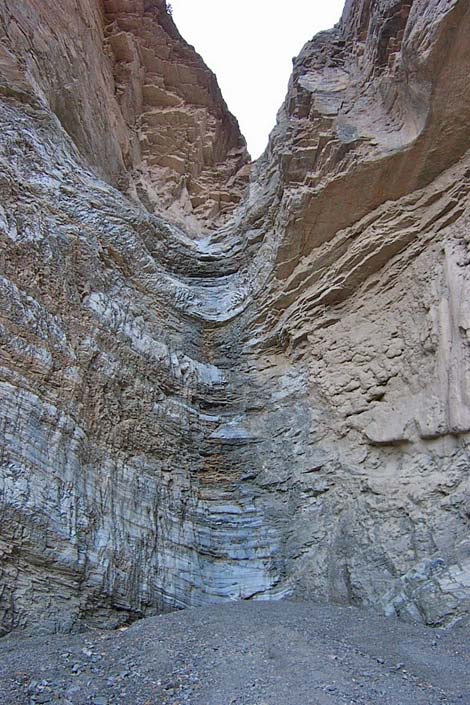
 Exiting the Lower Narrows (view E) |
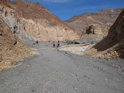
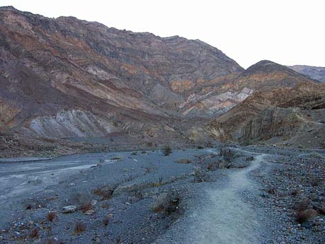
The Hike From the trailhead (Table 2, Waypoint 01), the trail runs up the wash into Mosaic Canyon. About 0.09 miles from the trailhead, the route enters the first narrows where the rock is water-sculpted and water-polished, and there are many examples of the marble mosaic in the walls of the canyon. For details on this part of the canyon, see the Lower Mosaic Canyon Trail. Near the top of the first narrows, 0.28 miles out, the canyon bends sharply to the east (left) (Wpt. 04) and runs up another 0.2 miles of narrowish canyon. The canyon abruptly opens (Wpt. 05) to about 200-yards wide. In the open canyon, the sides are the high cliff of Tucki Mountain (dark, desert varnished rocks). On the north (left) side of the canyon, the colors are quite spectacular with light-colored marble, brown, dark gray layers, orange, purple, a big swatch of green, reddish tan, light tan, purple, and dark reddish brown. In the wash, pygmy cedar, desert stingbush, desert holly, and creosote bush are common. |
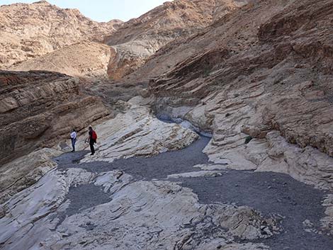
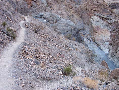
 Entering the wide canyon (view E) |
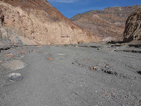
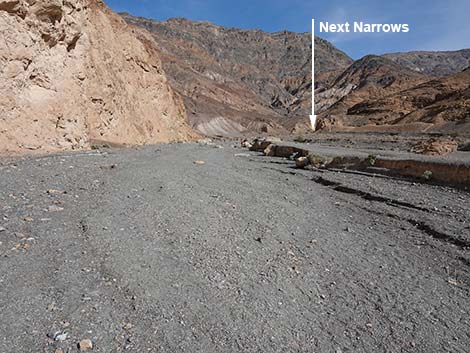
Continuing on, the canyon slowly bends back to the south (right) and begins to narrow (Wpt. 06) to about 40-ft wide, but here the sides are laid back and it is not a slot canyon. Farther up, this section gets narrower, and the route arrives at a pour-over formed of boulders that fell and blocked the canyon (Wpt. 07). This is about 1.3 miles from the trailhead. To get around the pour-over, go back down the canyon a few feet to a place on the east side (left on the way up) where hikers can do a minimally 3rd-class scramble-up behind some big boulders to a passage that leads through a little slot and around the pour-over. Above the boulder pour-over, the route passes several water-polished 2nd-class scramble-ups. Just above the scramble-ups, the canyon bends (Wpt. 08) east and runs straight for about 100 yards to the 25-ft pour-over that marks the end of the official route (1.4 miles out). |
 The wide canyon bends to the right (view SE) |
From the bend (Wpt. 08), hikers can see the pour-over, but before leaving this spot, look for the use-trail that cuts up the gully above of the trail to the south; this is the safest way to bypass the 25-ft pour-over (Wpt. 09). Continue on to the pour-over. The wall of the canyon on the north side overhangs the bottom of the wash, making this an interesting section of trail. The pour-over is capped by a big flat rock, and water seems to mostly run down the side of the wall, but a flash flood rolling over the main pour-over would be something to see. At this point, the end of the official route (Wpt. 09), either return to the trailhead (Wpt. 01) or continue on to the 30-ft pour-over, which is another 0.5 miles up the canyon. |
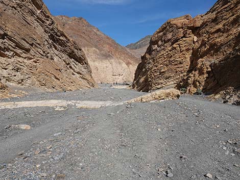
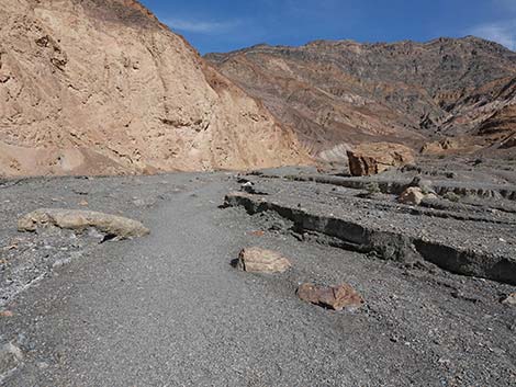
 The wide canyon eventually narrows up again (view E) |
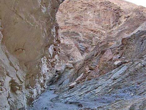
Continuing on, walk back down to the bend (Wpt. 08) in the canyon and hike up the use-trail through a gully of broken boulders. The use-trail cuts up steeply, then runs out more-or-less level and parallel to the wash. Walking out the level use-trail, hikers can see that the canyon ahead bends sharply to the south (right) just past the 25-ft pour-over. On the corner of the bend, just above the pour-over, the use-trail forks. Take the fork down into the wash. The other fork runs along ledges and dirt slopes high above the wash for a fair way up the canyon. This route eventually is blocked by cliffs, where hikers are forced to downclimb a sloping, dirty, 3rd-class cliff face. There are many places to cut down to the wash; pick any place to cut down, but don't wait until the end. It probably is best to just cut down to the top of the pour-over; besides, you will want to look down from the top of the pour-over. Above the 25-ft pour-over, the canyon runs straight south for about 0.2 miles. Along the upper part of the straight section, there are several more water-polished scramble-ups. The canyon then hooks to the east and runs up towards more narrows. |
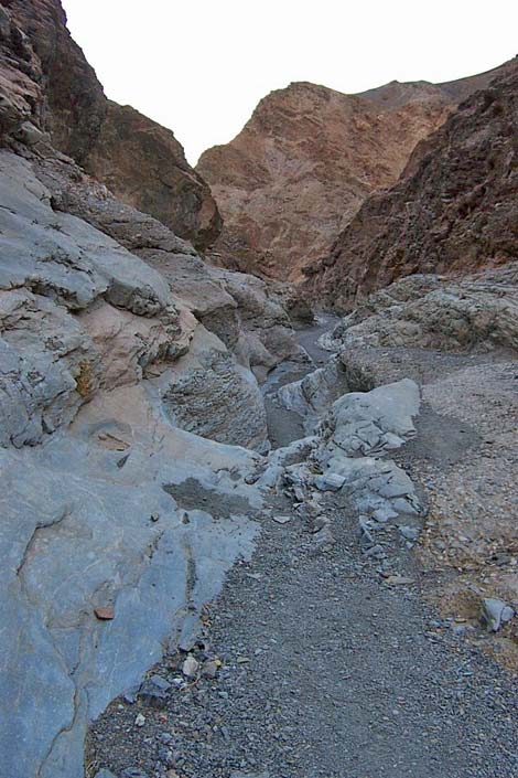
 Approaching the Upper Narrows (view SE) |
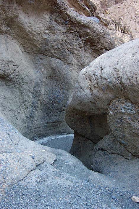
In these narrows, there is another narrow spot with another little water-polished pour-over (Wpt. 10) that can be climbed around on the north side. After this little pour-over, the canyon bends to the south again, and quickly arrives at the 30-ft pour-over and the end of the hike (Wpt. 11), which is about 1.8 miles from the trailhead. At the pour-over, rest and relax in the cool shade, then head back down to the trailhead (Wpt. 01) following your footprints. Starting back down, just before the first bend in the canyon, notice a steep use-trail running up the northeast side of the canyon. I did not follow this trail, but Claire B (2011) comments: it links with a trail that bypasses the 2nd and 3rd narrows. Definitely not recommended unless you are sure-footed and don't mind steep, exposed trails on talus slopes. We turned back a little beyond where the use-trail disappears from view from the canyon floor. |
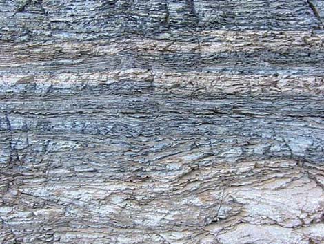 Layers of time written in the rock walls |
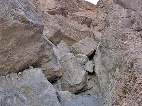 "Boulder pour-over" (view S) |
 25-foot pour-over and end of official trail (view E) |
 Looking back: use-trail above 25-foot pour-over (view W). |
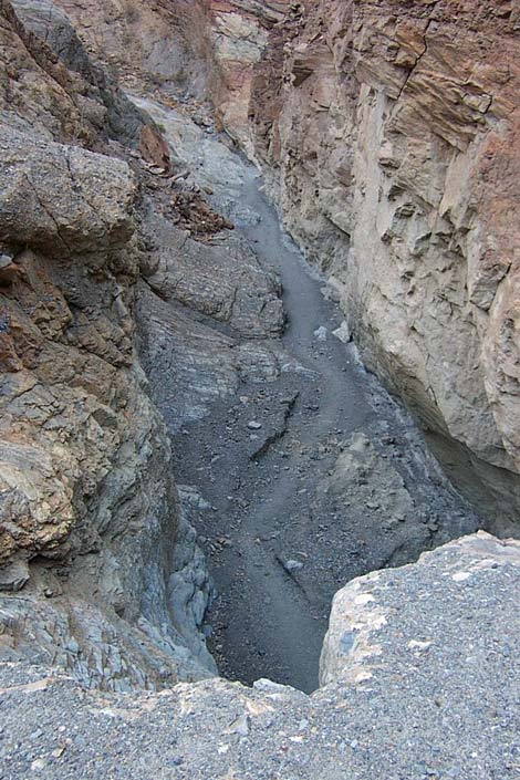 Looking down from the top of the 25-foot pour-over (view W) |
 Looking back: Looking towards the 25-foot pour-over (view N) |
 Looking back: water polished rock (view NW) |
 30-foot pour-over blocking the canyon (view S) |
Table 1. Highway Coordinates Based on GPS Data (NAD27; UTM Zone 11S). Download Highway GPS Waypoints (*.gpx) file.
| Site # | Location | Latitude (N) | Longitude (W) | Easting | Northing | Elevation (ft) | Verified |
|---|---|---|---|---|---|---|---|
| 0712 | Furnace Creek Visitor Center | 36.46159 | 116.86574 | 512030 | 4034954 | -186 | Yes |
| 0749 | Mosaic Canyon Parking | 36.57194 | 117.14349 | 487161 | 4047195 | 942 | Yes |
| 0750 | Hwy 190 at Mosaic Canyon Rd | 36.60457 | 117.14758 | 486801 | 4050816 | 32 | Yes |
| 0751 | Hwy 190 at Stovepipe Wells | 36.60654 | 117.14594 | 486948 | 4051034 | 0 | Yes |
Table 2. Hiking Coordinates Based on GPS Data (NAD27, UTM Zone 11S). Download Hiking GPS Waypoints (*.gpx) file.
| Wpt. | Location | UTM Easting | UTM Northing | Elevation (ft) | Point-to-Point Distance (mi) | Cumulative Distance (mi) |
|---|---|---|---|---|---|---|
| 01 | Mosaic Canyon Trailhead | 487170 | 4047185 | 942 | 0.00 | 0.00 |
| 02 | Bottom of First Narrows | 487209 | 4047057 | 1,033 | 0.09 | 0.09 |
| 03 | Old Stairs | 487241 | 4046841 | 1,118 | 0.15 | 0.24 |
| 04 | Top of First Narrows | 487212 | 4046784 | 1,122 | 0.04 | 0.28 |
| 05 | Canyon Abruptly Widens | 487567 | 4046771 | 1,213 | 0.28 | 0.56 |
| 06 | Bottom of Upper Narrows | 488133 | 4046478 | 1,448 | 0.44 | 1.00 |
| 07 | Pour-Over of Boulders | 488206 | 4046067 | 1,655 | 0.27 | 1.27 |
| 08 | Start of Bypass | 488241 | 4045941 | 1,702 | 0.10 | 1.37 |
| 09 | End of Official Route | 488324 | 4045935 | 1,688 | 0.06 | 1.43 |
| 10 | Low Pour-Over | 488467 | 4045646 | 1,862 | 0.27 | 1.70 |
| 11 | 30-ft Pour-Over | 488590 | 4045669 | 1,853 | 0.09 | 1.79 |
| 01 | Mosaic Canyon Trailhead | 487170 | 4047185 | 942 | 1.79 | 3.58 |
Happy Hiking! All distances, elevations, and other facts are approximate.
![]() ; Last updated 240324
; Last updated 240324
| Death Valley | Hiking Around Las Vegas | Glossary | Copyright, Conditions, Disclaimer | Home |