Overview | North Section | Middle Section | South Section
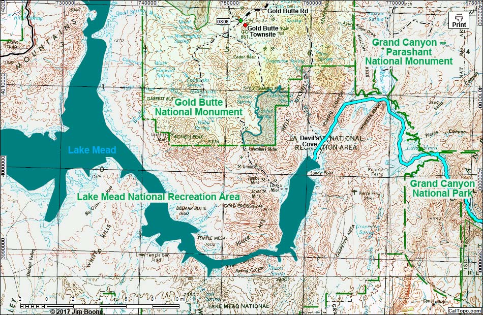
Note: Map based on USGS 7.5 minute topo map, which may have red grid lines and various numbers. North is at the top. Grid is UTM NAD27 CONUS. Roads are black (solid = paved; dashed = unpaved; width implies quality). Trails and routes are red (solid = main; dashed = adjacent or alternate). Wilderness Areas (boundaries solid green, fill light green) based on BLM data. National Conservation Areas (boundaries dashed green, fill light green) based on BLM data. National Park areas (boundaries dashed green, fill light green) based on NPS data. National Monument Areas (boundaries dot-dashed green, fill light green) based on BLM data. Urban areas (yellow) based on Google Earth (9/2016) image. BLM areas (no overlay) based on BLM data. Download waypoint coordinates from route description page.
| GBNM Overview Map | Gold Butte Area Overview | Hiking Around Las Vegas | Glossary | Copyright, Conditions, Disclaimer | Home |