Basin and Range National Monument, Rock Art Around Las Vegas
Rock art is a precious resource. Please help protect and preserve these sites.
| Echo Rock | Paiute Rock | Shaman Knob | Shaman Hill |
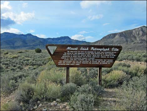 First BLM sign (view NW) |
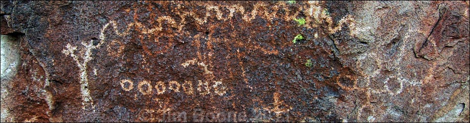
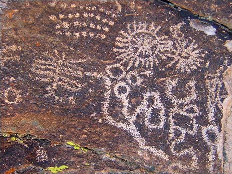
Overview The Mt. Irish Rock Art and Archeological District, located in Basin and Range National Monument, is a broad, open area at the top of the bajada below the Mount Irish Range, of which Mt. Irish is the highest peak. Scattered about the area are many boulder piles and low bands of cliffs formed from rhyolite (a hard, light-colored volcanic ash-flow tuff) that are covered with desert varnish, a naturally occurring dark patina that forms on the surface of rocks in the desert. Native peoples created petroglyphs by pecking away the desert varnish to reveal the underlying light-colored rock. A few bits of painted artwork (pictographs), stone flakes, pot shards, and living areas can also be found in the district. There are four main public sites: Echo Rock, Paiute Rock, Shaman Knob, and Shaman Hill. Trails at the later three sites have numbered signs corresponding to information in a brochure. Links to Area Overview Map and Site Map. |
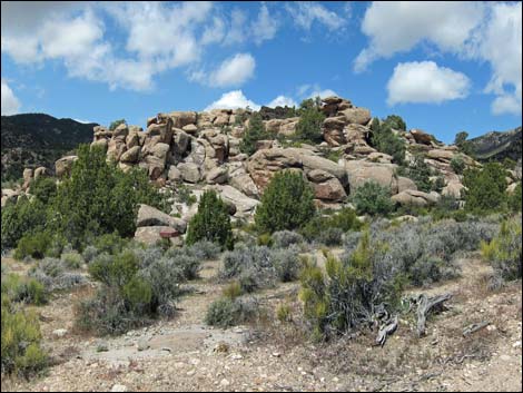
 Echo Rock (view S from Logan Canyon Road) |
The BLM and Lincoln County opened this area to the public, and Lincoln County printed a 55-page brochure as part of their Get Primitive tourism campaign. Download the brochure from Lincoln County or snatch a copy here. The BLM printed a nice 21-page guide to the Mt. Irish area, which is available here. A newer guide (4MB PDF) is also available (or here). Access is via Logan Canyon Road, a maintained dirt road subject to washout at a broad wash in the rock art district. High-clearance vehicles should have no trouble with the road, and assuming the road is not washed out, carefully driven sedans should make it to Paiute Rock (second BLM sign). Many petroglyph panels in the district are easily accessible from Logan Canyon Road. Visitors in sedans should park at Paiute Rock, but those in high-clearance vehicles can continue up the road another minute or two to a junction where a spur road to the left runs south to Shaman Hill and Shaman Knob. Sedans can be driven to the end of the spur road too, but low-hanging parts (bumpers, under carriage, mufflers, tailpipes, etc.) will hit bottom and scrape on rocks at the two gully crossings (note the voice of experience here) on the short access road. |
 Paiute Rock and second BLM sign (view NW) |
Location Mt. Irish Rock Art and Archeological District is located in the northwest edge of the Pahranagat Valley, about 110 miles north of Las Vegas. From town, drive north on Interstate 15 to US Highway 93 (Table 1, Site 0674). Turn left onto US Highway 93 and drive north past the towns of Alamo (95 miles) and Ash Springs (102 miles) to the intersection of Highway 93 and Highway 318 (107 miles; Site 0677). Gasoline is available in Alamo and Ash Springs. Turn left onto Highway 318 and drive west for 0.7 miles to Crystal Spring, which is marked by a stand of tall cottonwood trees (Site 0676). The road forks here, stay right on Highway 318. The other fork, Highway 375 (the Extraterrestrial Highway), continues west towards the secret military base at Area 51 and the town of Rachel. |
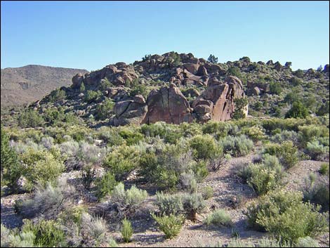
 Shaman Knob (view E from Shaman Hill) |
Drive north on Highway 318 for another 2.5 miles to an unmarked dirt road on the left (Logan Canyon Road; Site 1130) with a barbed-wire gate. The turn is about 0.2 miles north of the large dirt parking lot on the right side of the highway for Nesbitt Lake, a part of the Key Pittman Wildlife Area. Open the barbed-wire gate, drive through, and close the gate behind you. Drive west and up the hill on Logan Pass Road for 6.8 miles to the Archeological District, the beginning of which is marked by a large BLM sign (Site 1131) announcing the area. The road forks here: Silver Canyon Road forks right, but Logan Canyon Road stays left. Just beyond the first sign, look for a wide spot in the road (Echo Rock Parking; Site 1132) opposite a large rockpile out in the wash on the south side of the road. This is Echo Rock, which has some nice petroglyphs. |
 Shaman Hill (view W from Shaman Knob) |
Continuing on about 0.3 miles past the first BLM sign, the road crosses a broad gravel wash. This is where the road sometimes is washed out and could pose a problem for sedans. Farther along, continue straight at a fork (Site 1133) where the left fork is marked with a Mt. Irish Wilderness Area sign. At 1.7 miles beyond the first BLM sign, the second BLM sign (Site 1134) marks Paiute Rock, a nice rockpile with many spectacular petroglyphs. Be sure to walk all the way around the boulders. Continue up Logan Canyon Road for 0.3 miles to a fork in the road (Site 1135). In a sedan or other 2WD vehicle, park here; otherwise, stay to the left (south) and drive about 300 yards to a broad parking area near the end of the road. The boulder-covered hill on the right side of the spur road is Shaman Hill (Site 1136), and the isolated rock pile left of the road is Shaman Knob (Site 1137). There are hundreds of petroglyphs in the area; wander about and look for them. |
 |
These sites are just the tip of the iceberg. Wander around and explore the area looking for petroglyphs and other evidence of past human use of the area. Remember, however, petroglyphs are national treasures that are easily damaged. Please take care of the area and leave it as you found it for generations to come. Hours The area is always open, but it probably should be considered day-use only. There are no established camping areas or other amenities. Fees None. |
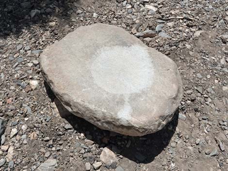 Portable metate just lying on the ground |
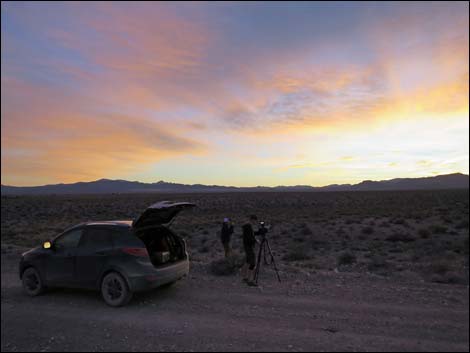
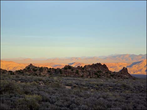 Last of the sunshine on the hills to the east (view NE) |
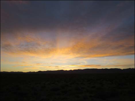
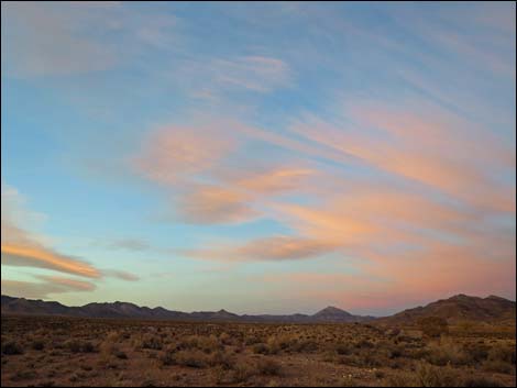 Sunset over the Mt. Irish Range (view W) |
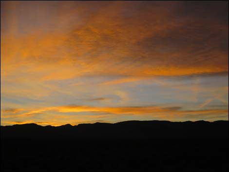
 Sunset over the Mt. Irish Range (view W) |
 Sunset over the Mt. Irish Range (view W) |
 Sunset over the Mt. Irish Range (view W) |
Table 1. Highway Coordinates based on GPS data (NAD27; UTM Zone 11S). Download Highway GPS Waypoints (*.gpx) file.
| Site # | Location | UTM Easting | UTM Northing | Latitude (N) | Longitude (W) | Elevation (ft) | Verified |
|---|---|---|---|---|---|---|---|
| 0674 | I-15 at Hwy 93 | 689188 | 4028063 | 36.38091 | 114.89089 | 2,215 | Yes |
| 0676 | Hwy 318 at Hwy 375 | 656355 | 4155179 | 37.53219 | 115.23044 | 3,803 | Yes |
| 0677 | Hwy 93 at Hwy 318 | 657363 | 4154834 | 37.52891 | 115.21911 | 3,831 | Yes |
| 1130 | Hwy 318 at Mt Irish Rd | 656276 | 4158994 | 37.56657 | 115.23051 | 3,844 | GPS |
| 1131 | Mt Irish Rd at BLM Sign #1 | 646336 | 4163120 | 37.60538 | 115.34220 | 5,169 | GPS |
| 1132 | Mt Irish Rd at Echo Rock Parking | 646228 | 4163120 | 37.60542 | 115.34346 | 5,185 | GPS |
| 1133 | Mt Irish Rd at Ash Cliff Rd | 645112 | 4162865 | 37.60327 | 115.35610 | 5,368 | GPS |
| 1134 | Mt Irish Rd at BLM Sign #2 | 643676 | 4163153 | 37.60610 | 115.37231 | 5,651 | GPS |
| 1135 | Mt Irish Rd at Shaman Rd | 643284 | 4163380 | 37.60821 | 115.37670 | 5,746 | GPS |
| 1136 | Shaman Rd at Shaman Hill | 643202 | 4163232 | 37.60688 | 115.37767 | 5,769 | GPS |
| 1137 | Shaman Rd at Shaman Knob | 643213 | 4163196 | 37.60656 | 115.37755 | 5,734 | GPS |
Happy Hiking! All distances, elevations, and other facts are approximate.
![]() ; Last updated 240323
; Last updated 240323
| Rock Art | Glossary | Copyright, Conditions, Disclaimer | Home |