 |
| Home | Wilderness | Hiking | Mojave National Preserve | Barber Loop Trail | Overview Map |
Barber Peak Loop Map - North Section
Hiking Around Las Vegas,
Mojave National Preserve
Overview | North Section | South Section |
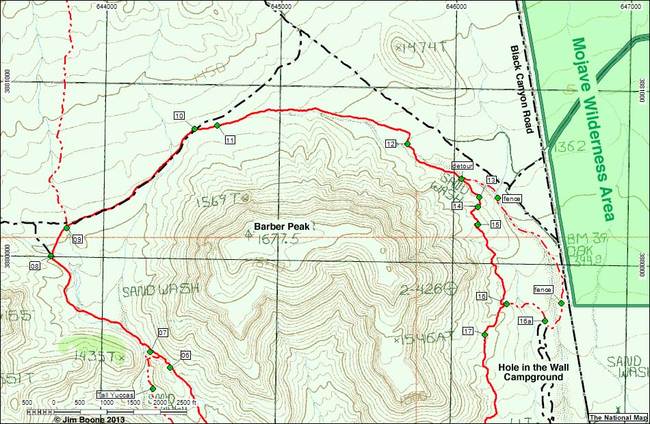 |
| Note: Roads are black (solid = paved; dashed = unpaved). Trails and routes are red (solid = main; dashed = adjacent or alternate). Map based on USGS 7.5-minute topo map, which may have red grid lines and various numbers. North is at the top. Grid is UTM NAD27 CONUS. Wilderness Areas (boundaries solid green, fill dark green) based on BLM data. National Park Areas (boundaries dashed green, fill light green) based on NPS data. |
Note: All distances, elevations, and other facts are approximate.
 ; Last updated 130521 ; Last updated 130521 |
|