Birding Around Las Vegas, Outside the Las Vegas Valley, Pahranagat Valley
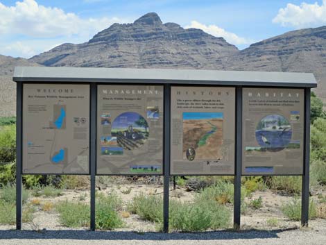
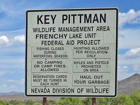
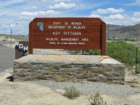 Key-Pittman WMA Headquarters sign in north Hiko (view N) |
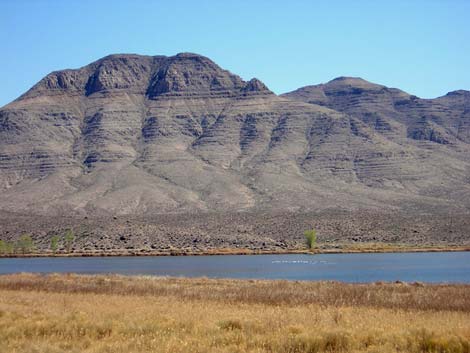
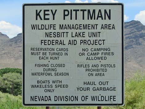
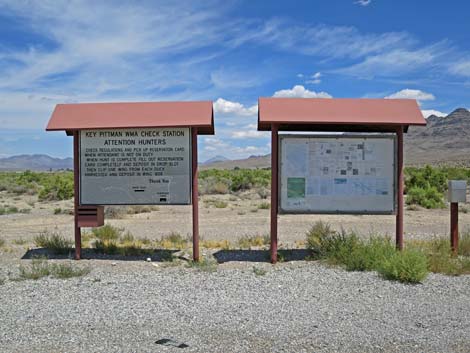
Description Key Pittman Wildlife Management Area includes two small lakes near the town of Hiko. The town and the lakes are located in a broad valley with mountain ranges on both sides. In the bottom of the valley, farmers use spring water to maintain fields that attract a variety of waterfowl, shorebirds, cranes, hawks, and other birds. Beyond the farm fields, the desert rises gradually to the west and more abruptly to the east. The desert vegetation is composed largely of saltbush, blackbrush, desert thorn, with some yucca and a bit of cactus mixed in. This is the edge of the Great Basin Desert, so vegetation common just a few miles to the south (e.g., creosote bush and Joshua trees) is rare or absent here. Key Pittman is a Nevada State Wildlife Management Area, which means that it is managed for hunting. If you visit during hunting season, be careful and read the signs before entering. The area may be closed to non-hunters during hunts. Link to map. |
 South end of Nesbitt Lake (view N) |
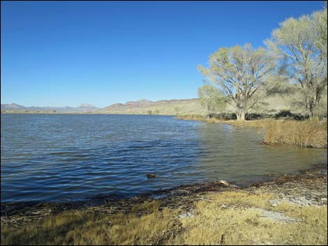
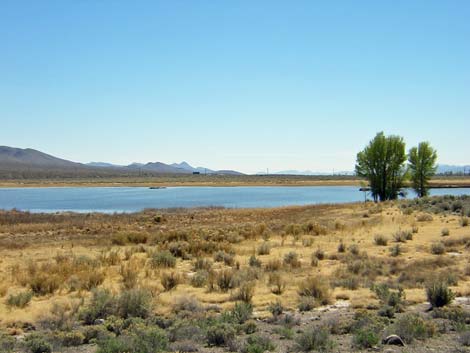
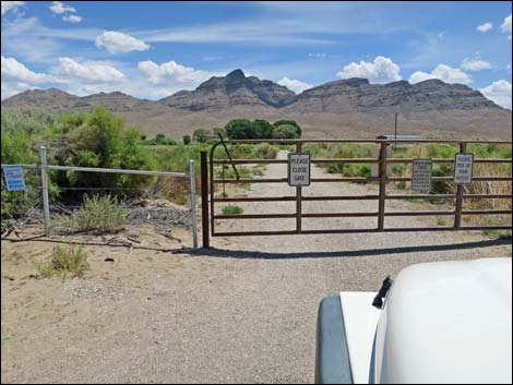
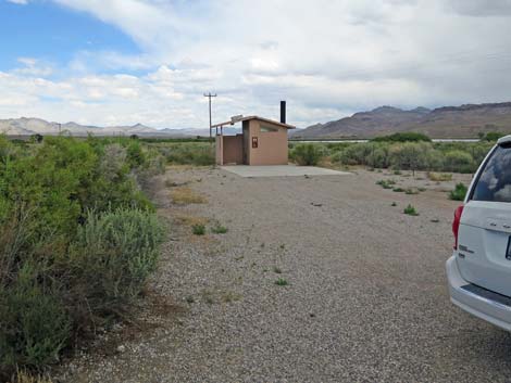
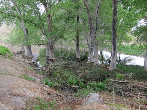
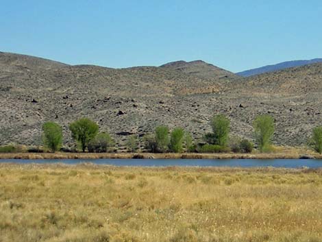
Nesbitt Lake, the northern of the two lakes, is a broad, moderately deep lake with open water all year. There are cottonwood trees on the south end, shrub and willow thickets on the southwest side, and an extensive marshy area at the northern end. Most of the edge of the lake is bordered by cattail and reeds. Vegetation from the surrounding desert (e.g., saltbush, desert thorn, and rabbitbrush) grows down to the water in some places. Trees are also starting to grow along the east side of the lake. A good dirt road runs across Nesbitt Lake Dam (actually a low dike) at the south end of the lake. The road then runs north along the east side of the lake to a gate. During the breeding season (February to August), the gate is locked and access to the marshy area beyond is prohibited. I've never been here when the area was open. Restroom facilities are available along the access road on the southwest corner of Nesbitt Lake. |
 Nesbitt Lake dam (view E) |
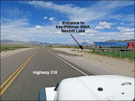
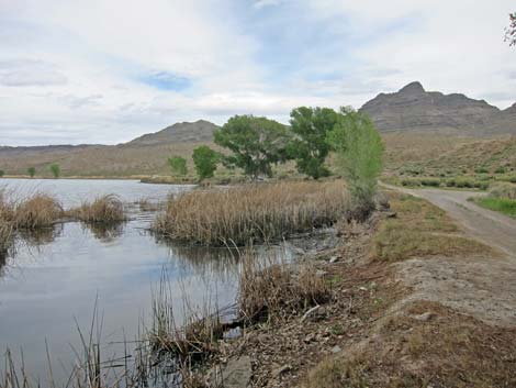
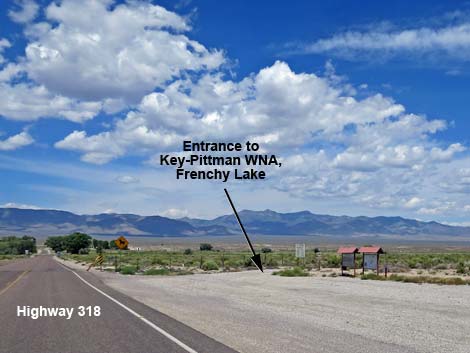
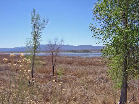
Frenchy Lake, the southern lake, is broad and very shallow, with open water only during some years. When it is wet, an extensive marsh surrounds almost the entire lake. A road from the south runs up along the east side of the lake, providing access to the water and views of the islands, plus access to the cottonwood grove at the northeast corner of the lake. Location Key Pittman is located in the Pahranagat Valley, about 110 miles north of Las Vegas. From town, drive north on Interstate 15 to US Highway 93. Turn left onto Highway 93 and drive north past the towns of Alamo (95 miles) and Ash Spring (102 miles) to the intersection of Highway 93 and Highway 318 (107 miles) (Table 1, Site 677). |
 Northern end of Nesbitt Lake (view W) |
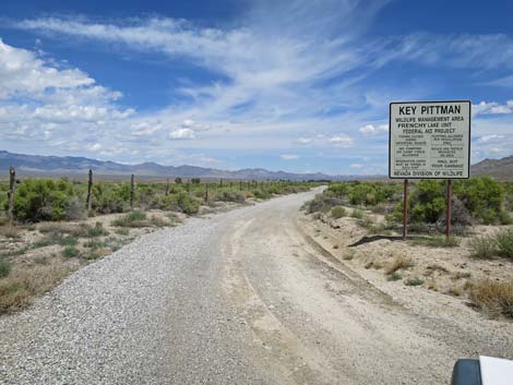
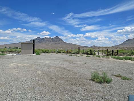
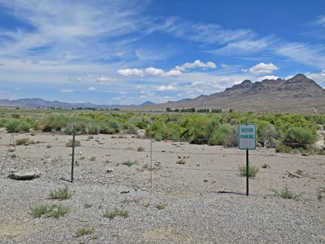
Frenchy Lake Unit. From the intersection of Highway 93 and Highway 318, drive west on Highway 318 for 0.3 miles. Just before a cattle guard, notice a wide gravel area on the right with Wildlife Management Area signs (Site 0680). Between the signs and a barbed-wire fence, drive north on the dirt access road to another parking area with more signs, an outhouse, and a closed gate (Site 0681). If the gate is unlocked, open the gate, drive in, and close the gate behind you. Drive up to the southeast corner of the lake, and then continue northward along the east side of the lake to a parking area behind the grove of cottonwood trees (Site 0636). The road loops around the north side of the lake, but it may be washed out and impassable for vehicles. The road to the cottonwood grove is a bit rough, but it should be suitable for a sedan if the road is dry. Use your own good judgment. |
 Frenchy Lake (view SE) |
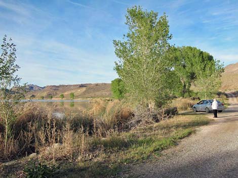
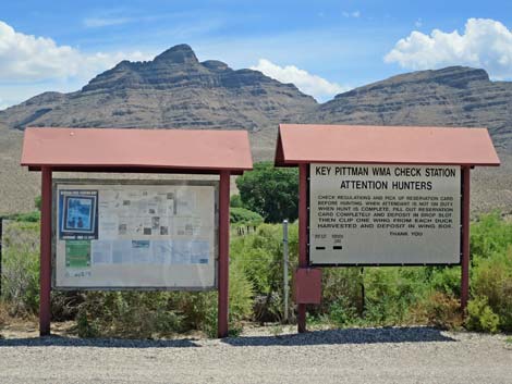
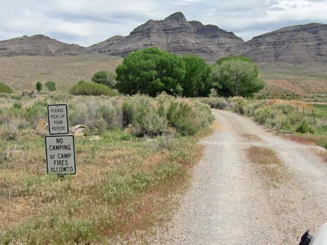
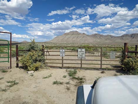
Nesbitt Lake Unit. From the intersection of Highway 93 and Highway 318, drive west then north on Highway 318. Pass a cattle operation and alfalfa fields, then at 2.9 miles out, watch for a wide dirt parking area (Site 0678) on the east side of the road with Wildlife Management Area signs. The gate is always closed, but open the gate, drive in, and close the gate behind you. Drive down the dirt access road 0.2 miles to the dam (Site 0679) and parking area just beyond the dam. From there, drive or walk the road on the east side of the lake. You can also walk up behind the willow thickets on the southwest corner of the lake. There is an outhouse near the entrance gate. Hours The Wildlife Management Area is always open, but it probably should be considered day-use only. There are "no camping" and "no fires" signs at the entrance to both lakes. |
 Frenchy Lake (view E) |
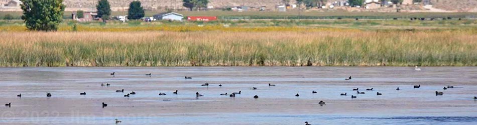
Fees None. Specialties Surrounded by seemingly endless miles of dry desert terrain, these lakes provide habitat for waterfowl, wading birds, shorebirds, pelicans, cranes, hawks, and even elk. During migration, watch for swallows, nighthawks, flycatchers, and warblers. During summer, the willow thickets on the west side of Nesbitt Lake are said to provide nesting sites for Western Willow Flycatchers and Yellow-billed Cuckoos. Turkey Vultures roost in the cottonwood trees along Nesbitt Dam, and on summer evenings you can watch dozens of them flying in to roost. Be sure to bring a spotting scope. |
Nesbitt Lake Unit
 Approaching entrance to Nesbitt Lake (view E) |
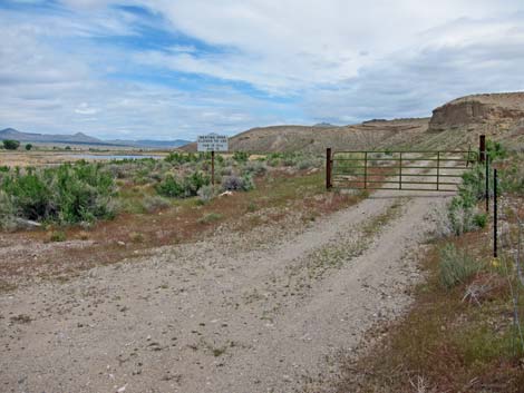
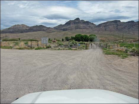 Entrance to Nesbitt Lake (view E) |
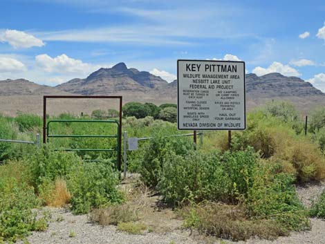 Signs outside the entrance and "man gate" (view E) |
 |
 |
 |
 Open the gate, drive in, and close the gate (view E) |
 Vault toilets usually are clean (view N from access road) |
 |
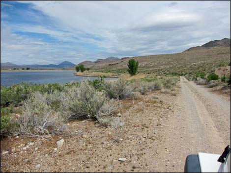
 Nesbitt Lake access road (view E) |
 Popular fishing hole |
 Arriving at the parking area (view E) |
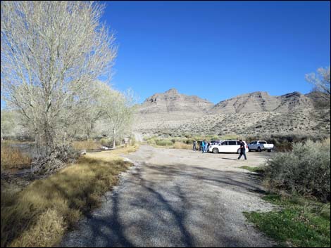 Red Rock Audubon birders in the parking area |
Early spring birding: ducks are gone, summer birds haven't arrived |
 Before spring green-up |
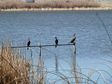 Double-crested Cormorants before spring green-up |
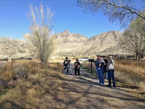 Red Rock Audubon birders |
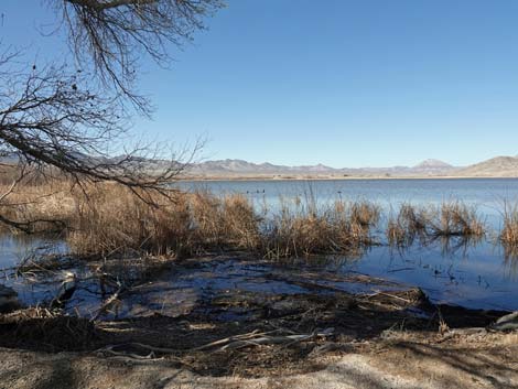
 Don't miss the swampy area south of the dam (view SE) |
East side of Nesbitt Lake (view N) |
Quiet, peaceful times in the desert (view NE) |
 East side of Nesbitt Lake (view N) |
 Gate on east side of Nesbitt Lake (view N) |
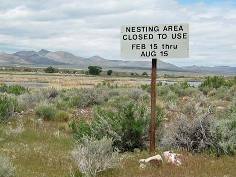 Sign by gate on east side of Nesbitt Lake (view NW) |
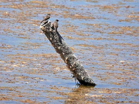 Young swallows on a post |
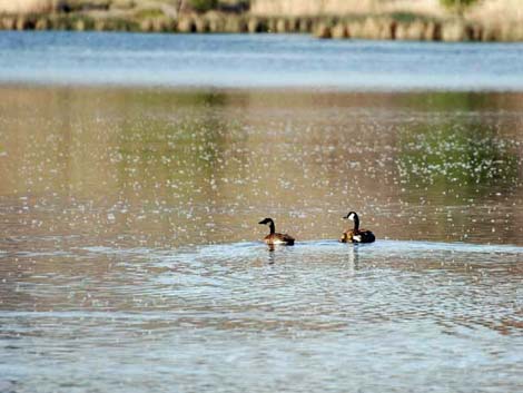 Pair of Canada Geese |
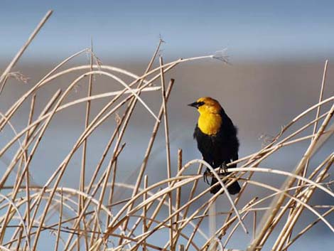 Yellow-headed Blackbird |
 Spotted Sandpiper during spring migration |
Frenchy Lake Unit
 Highway 318 at Frenchy Lake Road (view W) |
 Info signs at the start of Frenchy Lake Road (view N) |
 Start of Frenchy Lake Road (view N) |
 Sign at start of Frenchy Lake Road (view N) |
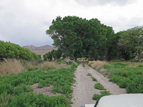
 Frenchy Lake Road (view N) |
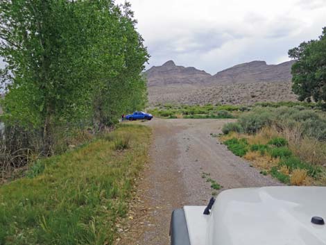
 Approaching the end of Frenchy Lake Road (view N) |
 Gate at the end of Frenchy Lake Road (view NE) |
 Visitor parking at the end of Frenchy Lake Road (view NE) |
 Frenchy Lake (view E) |
 Marsh at the NE corner of Frenchy Lake (view SW) |
Frenchy Lake (view SE) |
Frenchy Lake (view E) |
Table 1. Highway Coordinates based on GPS Data (NAD27; UTM Zone 11S). Download Highway GPS Waypoints (*.gpx) file.
| Site | Location | UTM Easting | UTM Northing | Latitude (N) | Longitude (W) | Elevation (ft) | Verified |
|---|---|---|---|---|---|---|---|
| 0681 | Frenchy Lake gate | 656960 | 4155236 | 37.53260 | 115.22358 | 3,810 | Yes |
| 0680 | Frenchy Lake entrance | 656943 | 4155004 | 37.53051 | 115.22383 | 3,810 | Yes |
| 0679 | Nesbitt Lake dam | 656766 | 4158640 | 37.56330 | 115.22505 | 3,830 | Yes |
| 0678 | Nesbitt Lake entrance | 656407 | 4158601 | 37.56301 | 115.22912 | 3,846 | Yes |
| 0677 | Hwy 93 at Hwy 318 | 657363 | 4154834 | 37.52891 | 115.21911 | 3,831 | Yes |
| 0676 | Hwy 318 at Hwy 375 | 656355 | 4155179 | 37.53219 | 115.23044 | 3,800 | Yes |
| 0636 | Frenchy Lake NE corner | 657276 | 4156569 | 37.54455 | 115.21972 | 3,790 | Yes |
| 0441 | Crystal Spring | 656162 | 4155128 | 37.53176 | 115.23263 | 3,819 | Yes |
| 0440 | Nesbitt Lake | 657169 | 4159591 | 37.57180 | 115.22028 | 3,840 | Yes |
Happy birding! All distances, elevations, and other facts are approximate.
![]() ; Last updated 240322
; Last updated 240322
| Birding Around Las Vegas | Southern Nevada Birds | Guide Service | Copyright, Conditions, Disclaimer | Home |