Backroads Around Las Vegas
overview | north section | south section
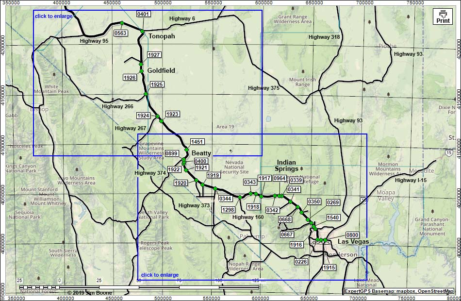
Note: Roads are black (solid = paved; dashed = unpaved). Map based on OpenStreetMap. North is at the top. Grid is UTM NAD27 CONUS. Download waypoint coordinates from route description page.
Happy Hiking! All distances, elevations, and other facts are approximate.
![]() ; Last updated 191128
; Last updated 191128
| Highway 95 | Backroads | Glossary | Copyright, Conditions, Disclaimer | Home |