(aka Horsethief Canyon Road)
Backroads Around Las Vegas, Lake Mead National Recreation Area

 Horse Thief Canyon Road |
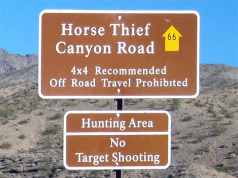
Overview Horse Thief Canyon Road (NPS Road 66) is a backcountry road off Highway 93 south of Hoover Dam in Arizona. The road follows the bed of Horse Thief Wash through the wild backcountry of Lake Mead National Recreation Area up to the base of Wilson Ridge and the Mount Wilson Wilderness Area (no vehicle access to the edge of wilderness). The road dead-ends about 4 miles out where a high pour-over blocks the wash at Horse Thief (primitive) Campground, but drivers in 2WD-HC vehicles should stop before entering the camp area because of deep sand. This road provides hiker access to Mount Wilson Wilderness Area and 4WD vehicle access to Horse Thief Canyon Backcountry Campground. Link to map. |
 |
Watch Out Other than the standard warnings about hiking in the desert, ...this is a bumpy but easy drive for most of the way out, but the road gets narrower and rougher, but firm, until reaching the sandy campground at the end of the road (my jeep handled it in 2WD. Check with NPS rangers on road conditions before driving into the backcountry. Maps of approved backcountry roads are available online and at the Alan Bible Visitor Center. While out, please respect the land and the other people out there, and try to Leave No Trace of your passage. Also, even though this road is short, be sure to bring what you need of the 10 Essentials. |
 |
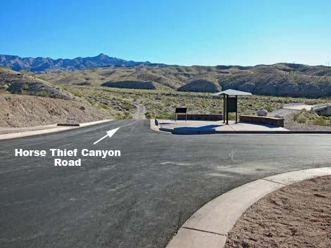
Getting to the Roadhead This road is located in Lake Mead National Recreation Area, about 45 minutes southeast of Las Vegas. From town, drive out towards Hoover Dam, then continue south on Hwy 93 for about 4 miles to White Rock Canyon Trailhead. At the trailhead parking area, watch for a brown backcountry road sign giving the name of the road and a numbered yellow arrow. Approved roads are signed with yellow arrows and a number, which is the road number. Driving on roads or trails not marked with the yellow arrow is prohibited. Driving off roads, in washes, or cross country damages the fragile desert soil and is prohibited by National Park Service regulations. |
 |
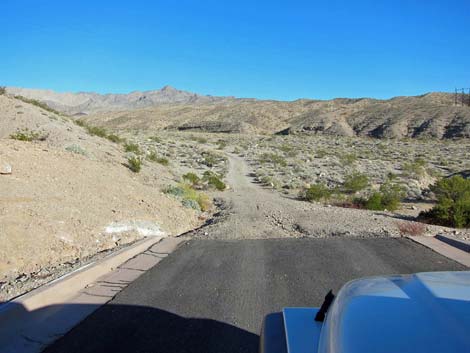
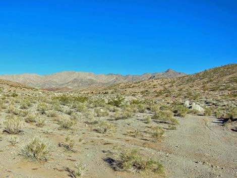
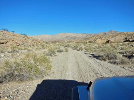
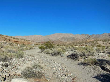
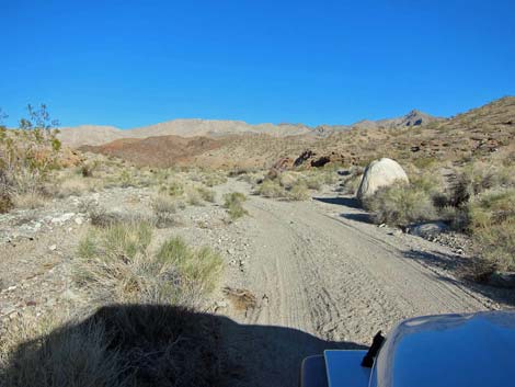
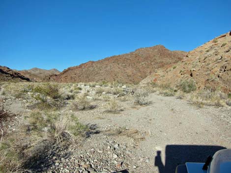
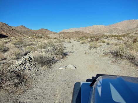
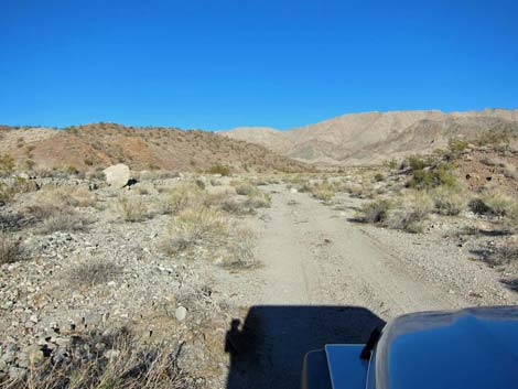
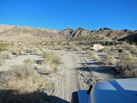
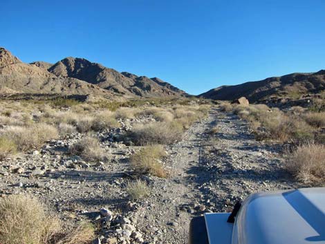
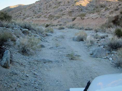
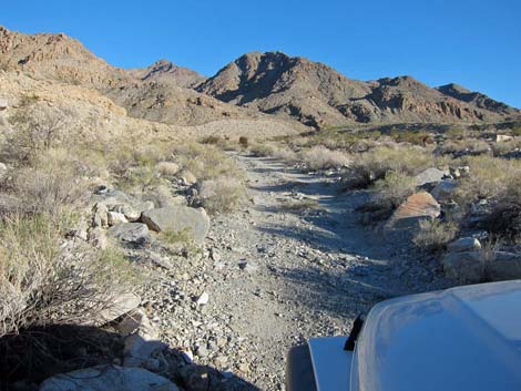
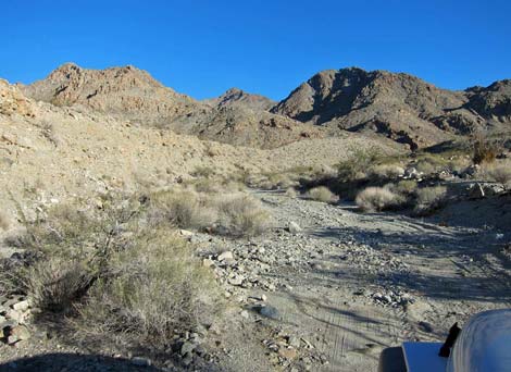
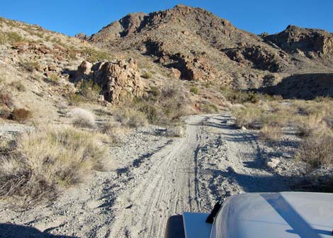
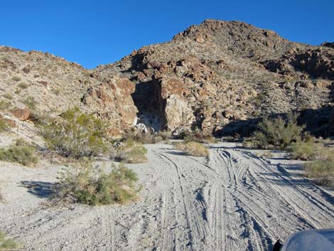
The Road From White Rock Canyon Trailhead parking area (Table 1, Site 1392), the graded dirt road runs out the east end of the parking lot (Site 1417), adjacent to the information kiosk. The road descends gradually into White Rock Wash below (Site 1417). In the wash, the road might have been graded, but for the most part, it is now just a two-track in the wash. Early on, the roadbed is firm, and there are few rough spots or rocks in the road. Farther out, the road is less well used and becomes rougher with more rocks, but the roadbed remains firm and suitable for 2WD-HC vehicles. |
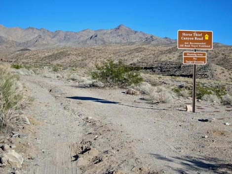 |
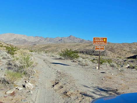
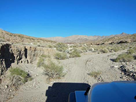
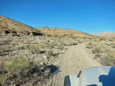
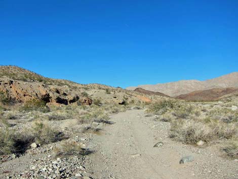
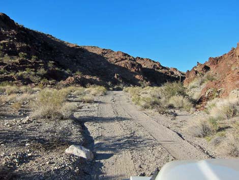
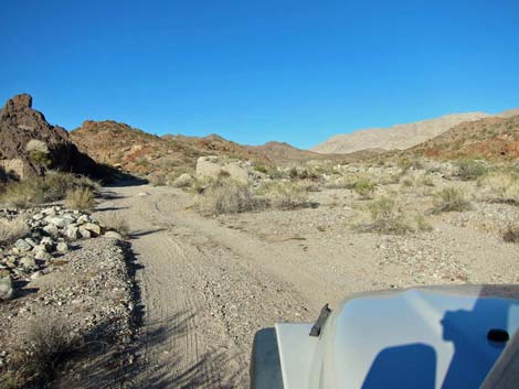
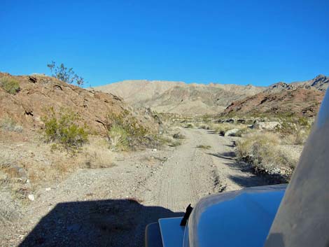
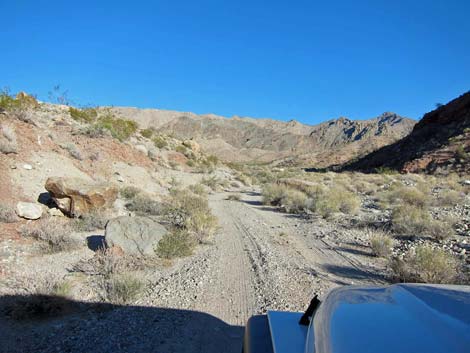
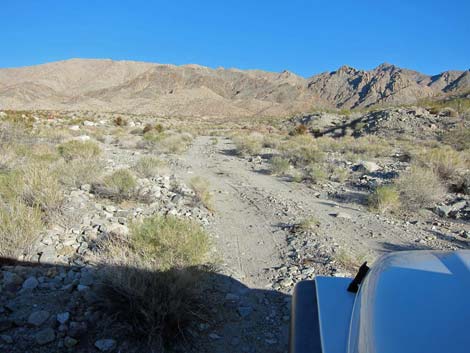
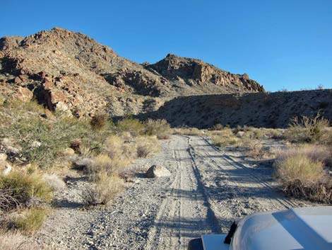
At about 3.1 miles out (Site 1419), the road passes a small "Horsethief Canyon Road" sign, which marks about where the road begins to deteriorate. At 3.7 miles out, the road passes a small "66A; Approved Road" sign, and thereafter the road is considerably rougher, but still suitable for a 2WD-HC vehicle. At about 4.0 miles out, the road splits for no apparent reason, but the two forks merge after about 150 yards. Just before the end of the road, there is a campground symbol sign on the right side of the road, indicating that this is a legal backcountry campsite. Unfortunately, much of the campground is on soft sand, making this a dangerous place without 4WD. The road end (Site 1389) below a pour-over that blocks the wash. |
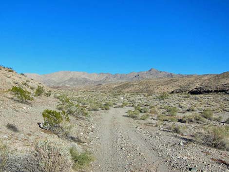 Easy road in the wash (view NE) |
 Easy road in the wash (view NE) |
 |
 |
 |
 |
 Few rocks in the road (view NE) |
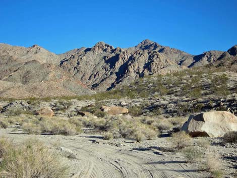
 One of the many "white rocks" in White Rock Wash (view NE) |
 |
 |
 |
 |
 |
 |
 |
 |
 |
 |
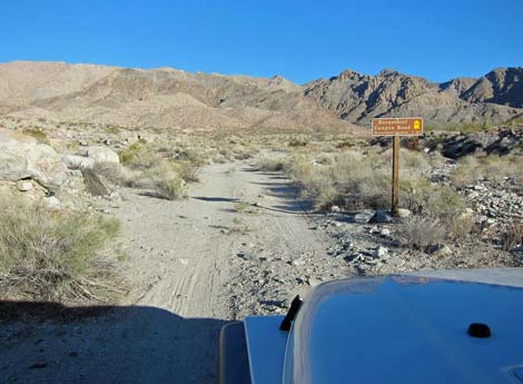 Horsethief Canyon Road sign (view E) |
 Rough road |
 Rough road |
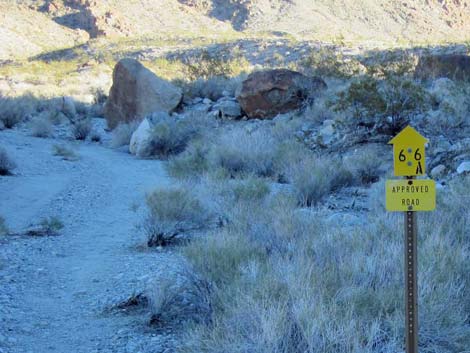 66A; Approved Road sign |
 |
 |
 |
 |
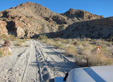 Campground sign (view SE) |
 Road is becoming sandy (view SE) |
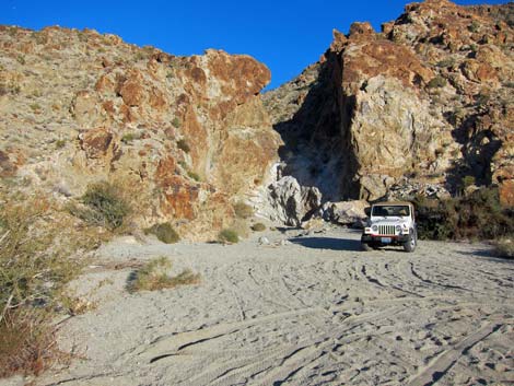 Sandy campsite below pour-over |
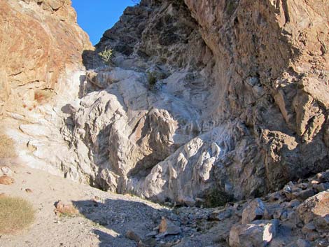 Pour-over at the end of the road (very slick; view E) |
Table 1. Highway Coordinates Based on GPS Data (NAD27; UTM Zone 11S). Download Highway GPS Waypoints (*.gpx) file.
| Site | Location | UTM Easting | UTM Northing | Latitude (N) | Longitude (W) | Elevation (ft) | Verified |
|---|---|---|---|---|---|---|---|
| 1038 | White Rock Canyon Trailhead Parking | 707623 | 3984013 | 35.98028 | 114.69717 | 1,544 | GPS |
| 1389 | Horse Thief Canyon Road, End | 712587 | 3985991 | 35.99703 | 114.64161 | 2,824 | GPS |
| 1417 | Horse Thief Canyon Rd, Start | 707688 | 3984006 | 35.98021 | 114.69645 | 1,540 | GPS |
| 1418 | Horse Thief Canyon Rd, enter wash | 707899 | 3984095 | 35.98096 | 114.69408 | 1,546 | GPS |
| 1419 | Horse Thief Canyon Rd, 66A sign | 711227 | 3986849 | 36.00506 | 114.65647 | 2,412 | GPS |
Happy Hiking! All distances, elevations, and other facts are approximate.
![]() ; Last updated 240326
; Last updated 240326
| Backroads Around Lake Mead | Hiking Around Las Vegas | Glossary | Copyright, Conditions, Disclaimer | Home |