Rock Art Around Las Vegas
Rock art is a precious resource. Please help protect and preserve these sites.
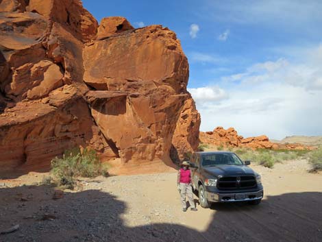
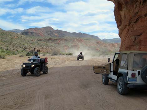
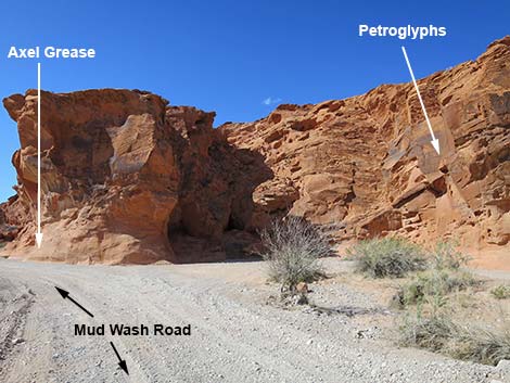 Mud Wash Road approaching Mud Wash Panel (view W) |
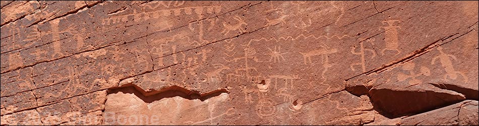
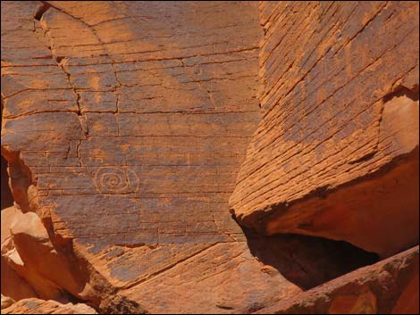
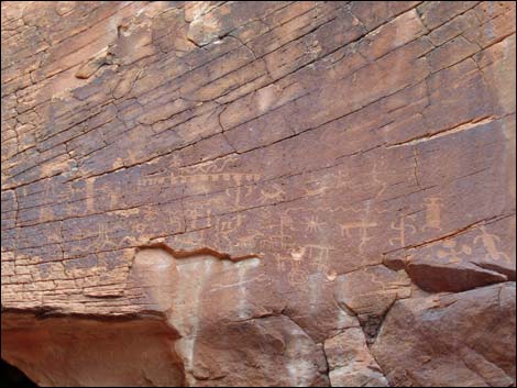
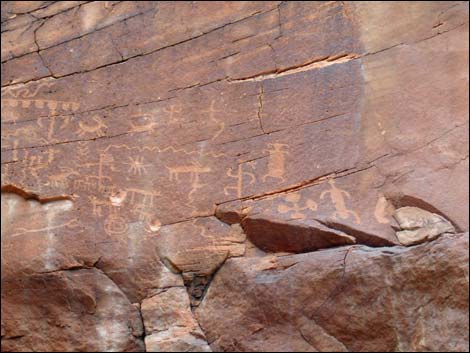
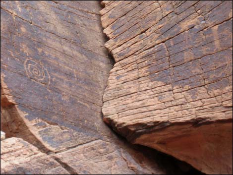
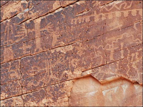
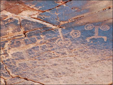
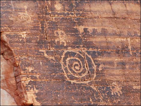
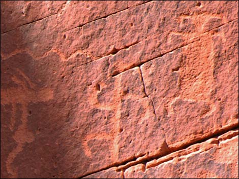
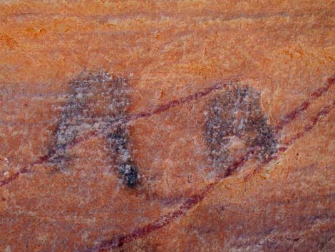
Overview The Mud Wash Petroglyph panel lies high on the side of red sandstone cliffs. The panel is not large or extraordinary, but perhaps the most interesting things about it are (1) how did native peoples get up so high, and (2) why did some moron vandals think that shooting at petroglyphs -- twice -- was a good thing to do? The panel is composed of four parts that depict a variety of images ranging from abstract art (e.g., spirals, wavy lines, dots) to stick figures (e.g., humans, coyotes, and bighorn sheep). Also at this site is a curious USGS survey marker and grease marks left by teamsters around the turn of the 20th century, This panel was defaced by a shooter; please respect this site and report damages or damaging activities to the BLM. While not a destination, this is an interesting spot and worth a visit for visitors transiting Mud Wash en route to Little Finland or when driving the Gold Butte Backcountry Byway. |
 Mud Wash Road approaching Mud Wash Panel (view N) |
Location The Mud Wash Petroglyph panel is located out in Gold Butte National Monument northeast of Lake Mead, about 2.5 hours northeast of Las Vegas. From Las Vegas, drive out the paved Gold Butte Road to Whitney Pocket. Continue south on the unpaved Gold Butte Road for 3.9 miles to Mud Wash North Road on the right. Turn onto Mud Wash North Road and drive southwest 3.2 miles to Mud Wash Road. Stay right onto Mud Wash Road and continue west down the wash for 0.7 miles to Mud Wash Petroglyph panel (Table 1, Site 1656), high on the right. Link to map. |
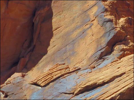
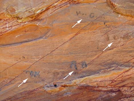
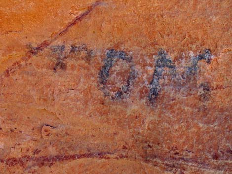
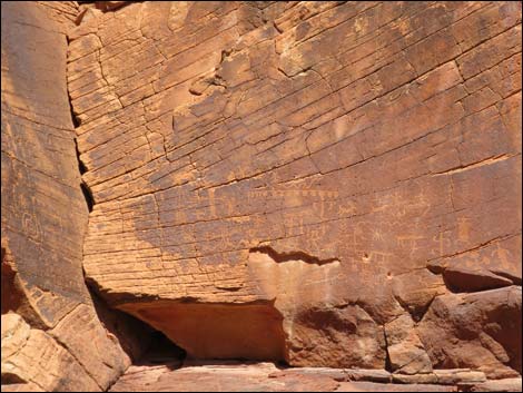 Main panel, lower right |
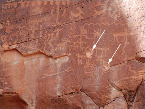 Notice bullet holes in main panel |
 |
 |
 |
 |
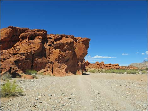 Mud Wash Road approaching Mud Wash Panel (view N) |
 Mud Wash Road at Mud Wash Panel (view N) |
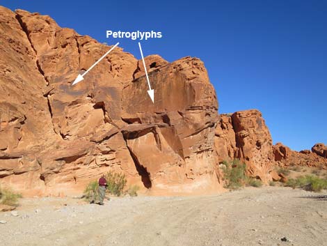
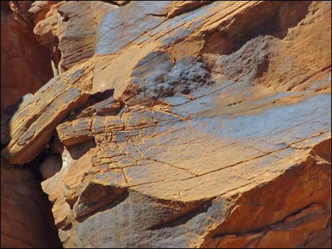
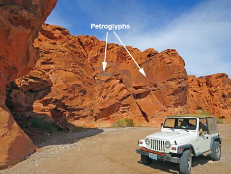
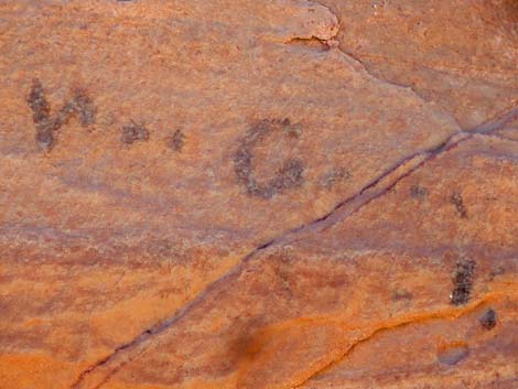
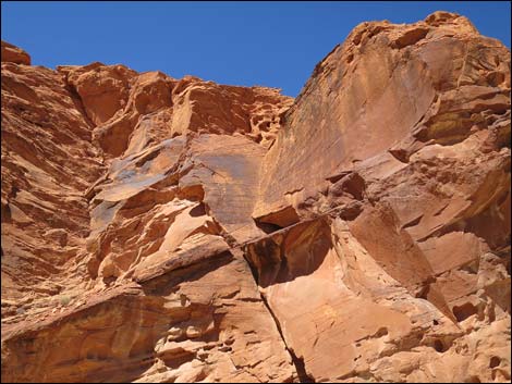
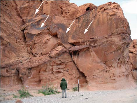 Petroglyphs high on the wall (view N) |
 Petroglyphs |
 |
 |
 |
 |
 |
 |
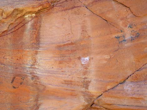
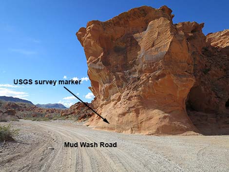 Oddly placed USGS benchmark at Mud Wash petroglyphs site (view S) |
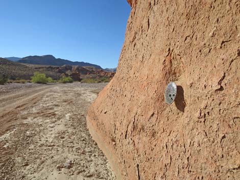 USGS survey marker (view W) |
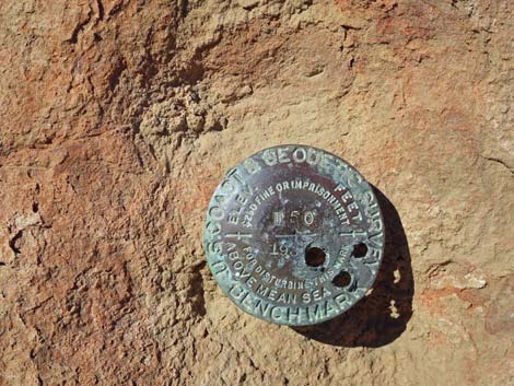 USGS survey marker (view W) |
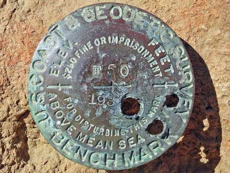 USGS survey marker (view W) |
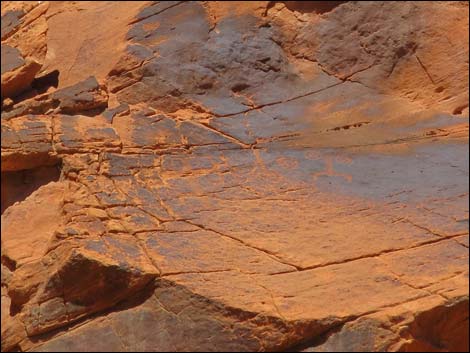
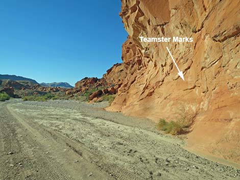 Wall with historic grease marks left by teamsters during mining era |
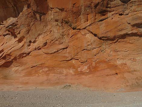 Wall with historic grease marks left by teamsters during mining era |
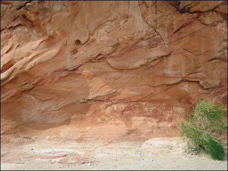 Wall with historic grease marks left by teamsters during mining era |
 Wall with historic grease marks left by teamsters during mining era |
 |
 |
 |
 |
 |
 |
 |
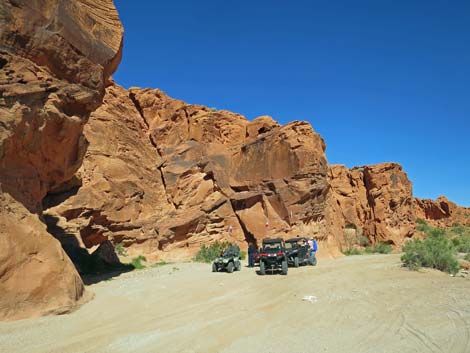 |
Table 1. Highway Coordinates based on GPS Data (NAD27; UTM Zone 11S). Download Highway GPS Waypoints (gpx) file.
| Site | Location | Latitude | Longitude | Easting | Northing | Elevation | Verified |
|---|---|---|---|---|---|---|---|
| 1656 | Mud Wash Rd at Petroglyph Site | 36.43888 | 114.19980 | 751005 | 4036071 | 1,962 | GPS |
Happy Hiking! All distances, elevations, and other facts are approximate.
![]() ; Last updated 240325
; Last updated 240325
| Rock Art | Glossary | Copyright, Conditions, Disclaimer | Home |