Hiking Around Las Vegas, Gold Butte National Monument
 Devils Throat information sign (view W) |
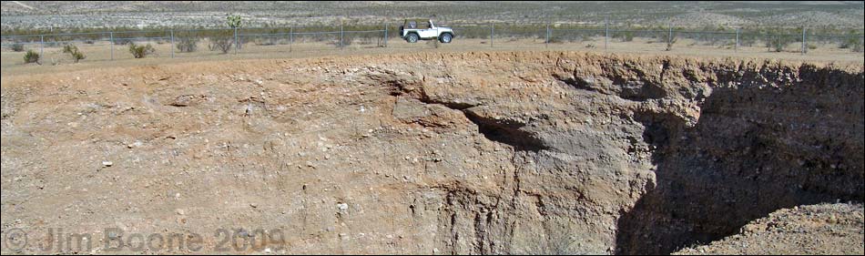
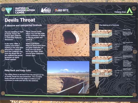
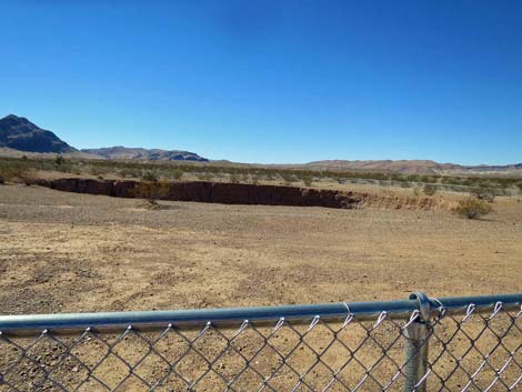
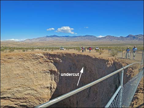
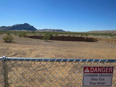
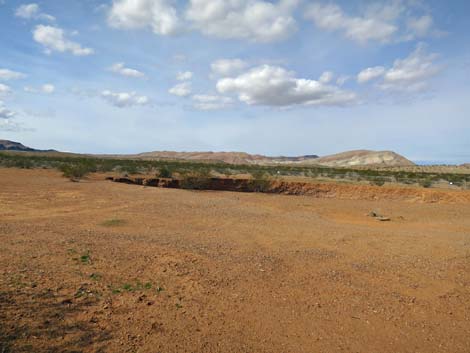
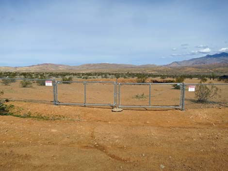
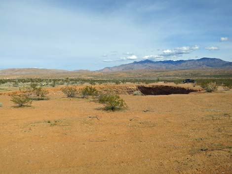
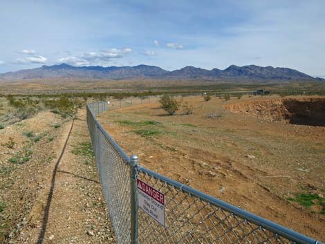
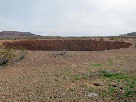
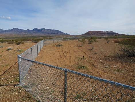
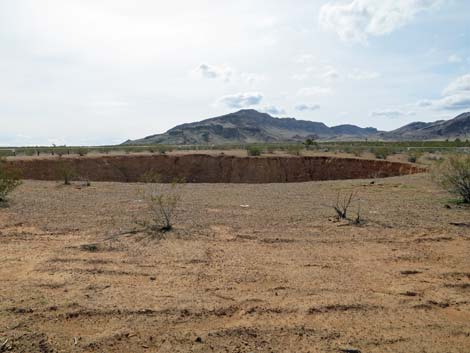
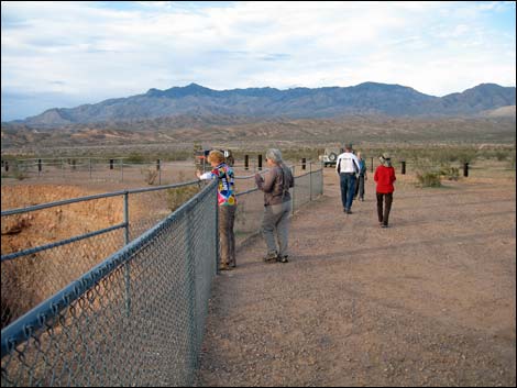
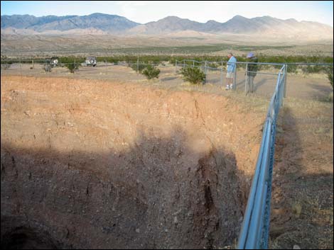
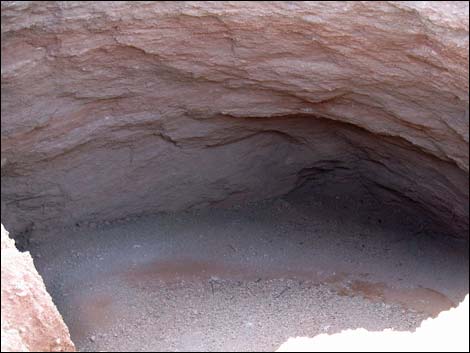
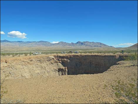
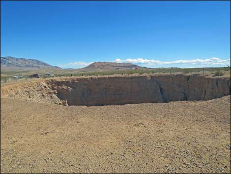
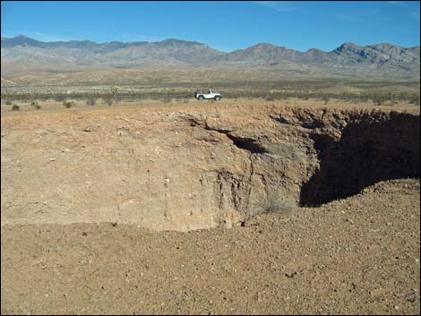
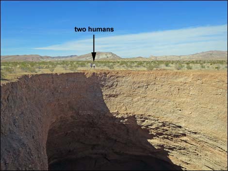
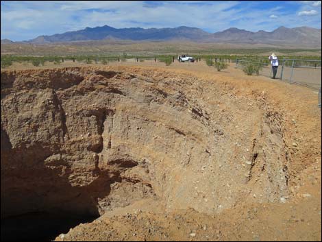
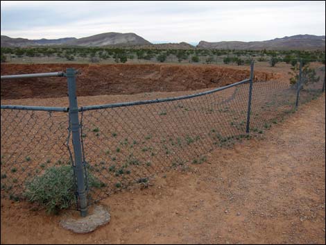
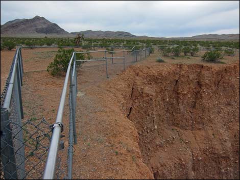
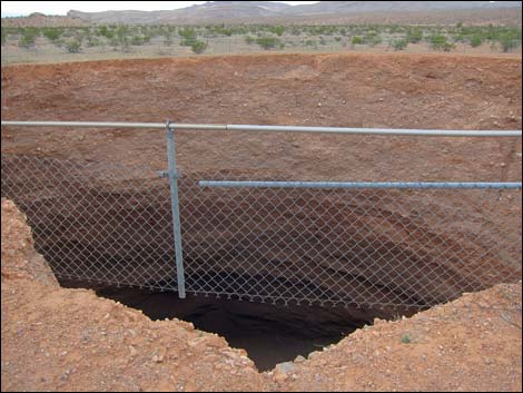
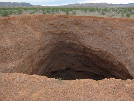
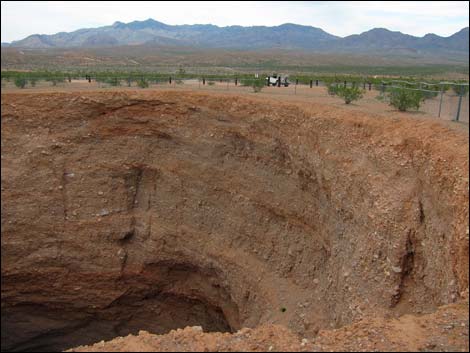
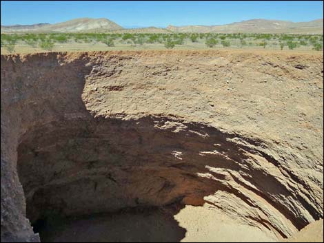
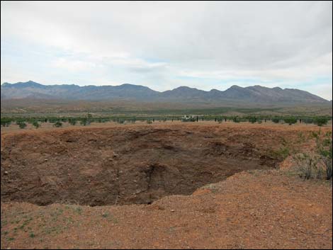
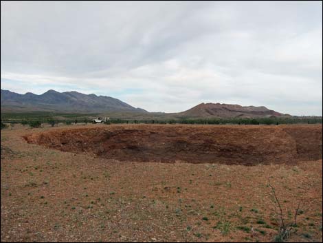
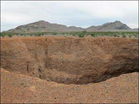
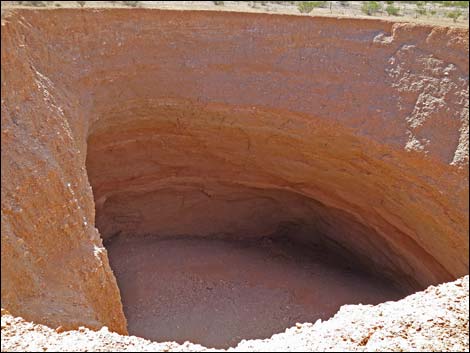
Overview Devils Throat is an interesting, if somewhat disconcerting, geological feature where the roof of a large cave collapsed in 1907 or 1908, leaving a huge sink hole in the middle of the open desert. For those who think terra firma is firm, Devils Throat gives a different point of view. Devils Throat currently is about 120 feet wide and about 120 feet deep with a gravel bottom and no apparent outlet. When the cave first collapsed, the throat was narrower, but over the years the sides have collapsed. Various fences have been erected to keep people a safe distance back from the collapsing edge, but the edge keeps collapsing and the fences fall in. Unfortunately, a new fence in 2018 pushes visitors so far back that it is impossible to see into the sinkhole. This encourages people to jump the fence to get a look, but that is not a safe thing to do. Link to map. |
 Devils Throat information sign |
Watch Out Other than the standard warnings about hiking in the desert, ... well, all I can say is don't fall in the hole. People jump the fence nearest the parking area so they can look into the hole, and although all who have done so have been successful -- understand that the edge nearest the parking area is undercut. Think of the edge nearest the parking area this way: it is a balcony made of unconsolidated gravel -- stay back from the edge! This is a wild and remote area without services of any kind (no restrooms, no water, no gas, no food). Bring what you need to survive. Be prepared and be self-reliant. Someone will find you eventually if you stay on a main road, but be prepared to survive alone for a day or two. Cell phones only work along parts of the paved road. While hiking, please respect the land and the other people out there, and try to Leave No Trace of your passage. Also, this is a remote hike, so be sure to bring what you need of the 10 Essentials. |
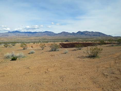
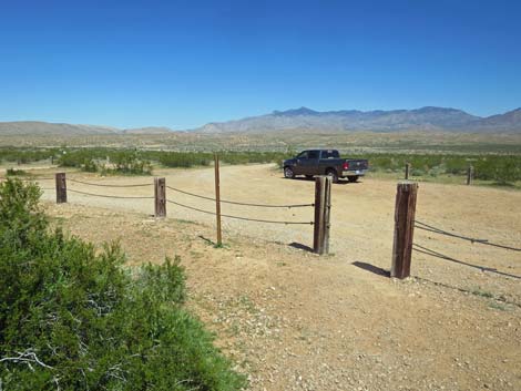
 Devils Throat (view W from parking lot) |
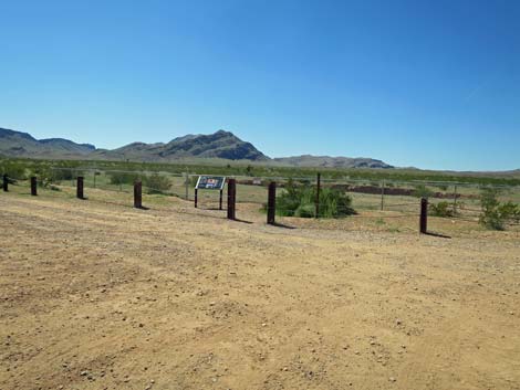
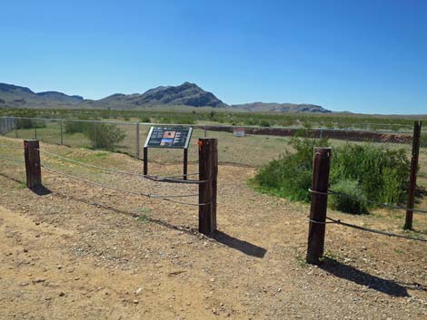
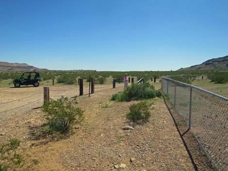
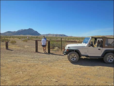
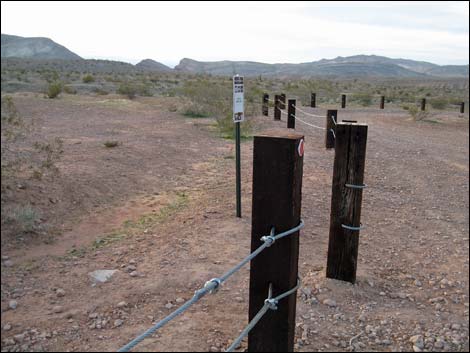
Getting to the Trailhead Devils Throat is located out in Gold Butte National Monument at the northeast end of Lake Mead, about 2.5 hours northeast of Las Vegas in a wild, remote, and scenic area. From town, drive out to Gold Butte National Monument. From Whitney Pocket, continue south on the unpaved Gold Butte Road for 7.2 miles to Mud Wash Road, a signed turnoff to Devils Throat and Little Finland (Table 1, Site 0807). There are no additional signs to guide visitors, but the chain-link fence surrounding the sink hole can be seen from Gold Butte Road. Turn right onto Mud Wash Road and drive southwest 0.3 miles to a fork. Devils Throat Road stays left and quickly arrives at Devils Throat parking area, which is marked by post-and-cable fencing. Park here; this is the trailhead. |
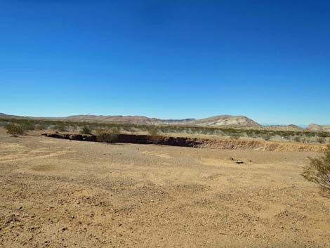
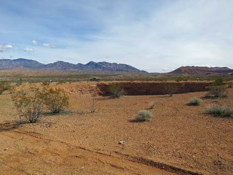
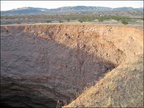
 Devils Throat (view W from trailhead) |
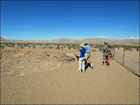
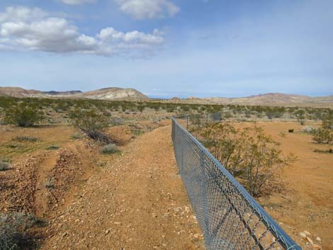
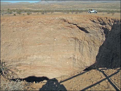
Devils Throat From the parking area (Site 1672), visitors can walk through a gate and over to the chain-link fence that surrounds the sinkhole. The fence keeps visitors a "safe" distance from the edge, but the entire rim is slowly caving in. Staying outside the fence, visitors can not look into the bottom of the pit. This isn't a hike, as it is less than a minute to the sink hole, but visitors can walk all the way around and back to the trailhead, a distance of about 400 yards. The best views into the pit are history, but looking back to the parking area from the far side offers an interesting perspective. Devils Throat isn't the first sinkhole in this area. There are three old sinkholes near Devils Throat, and several more towards the toe of the nearest limestone ridge to the south. |
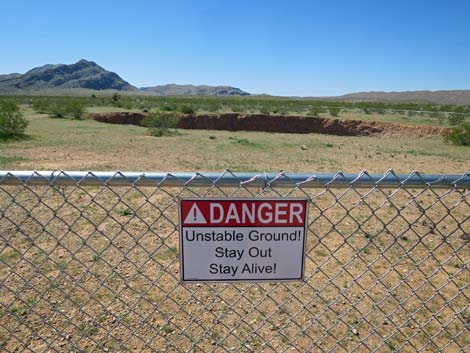 Warning sign on the fence (view W) |
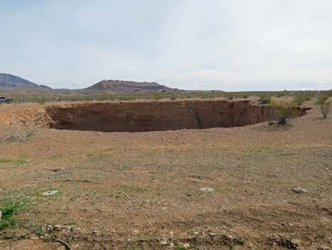
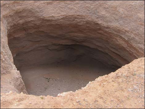
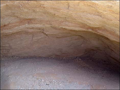
The ground surface in this area is alluvium (poorly consolidated rocks, gravel, sand, and dirt) that eroded off the nearby mountains. The general area is underlain by limestone, but there are thick deposits of gypsum nearby that are exposed at the surface. Thus, beneath the ground surface in this area, it is likely that the basement rock is limestone. On top of that likely is a layer of gypsum, and that is covered with alluvium. If this is correct, then water moving underground dissolved the gypsum beneath Devils Throat and washed it away leaving a large cavern, which later collapsed. Regardless of the exact details, the overlying alluvium fell into the cavern and seems to have completely filled the void. Thus, all that can be seen on the wall of the sinkhole is alluvium. Note that alluvium is not terribly well consolidated, and chunks fall off the wall into the sinkhole from time to time. Don't be standing too close to the edge when the next piece falls in. |
 Devils Throat (view W looking over the fence) |
 Devils Throat (view W looking past the fence) |
 Inside the old fence is a really bad idea ... (view N) |
 ... because the edge is undercut (view NE) |
 Approaching the fence; sign: unstable ground (view W) |
 Along the fence (view S) |
 Along the fence (view S) |
 Over the fence -- it's a long way to the hole (view W) |
 Gate on south side of the fence (view N) |
 Looking over the fence (view N) |
 Fence on the SW side (view W) |
 Looking over the fence (view NE) |
 Looking over the fence (view NE) |
 Fence on the W side (view N) |
 Looking over the fence (view E) Looking over the fence (view E) |
 Looking over the fence (view E) |
 Fence on the N side (view E) |
 Looking over the fence (view SE) |
 Returning to the trailhead (view SE) |
 Exiting through the trailhead gate (view N) |
 Departing the trailhead; Devils Throat in background (view SW) |
 Chain-link fence (view N) |
 Edge of the pit (view NE along old fence) |
 Looking into the belly of the beast from outside the old fence |
 |
 |
 Across the sink hole to the trailhead (view E) |
 Devils Throat sink hole is huge! |
 Devils Throat |
 Devils Throat parking barriers |
 Devils Throat; this is one big hole! |
 Visitor outside the fence (view NE) |
 Old fence - don't get too close to the edge |
 Outside the old fence (view SW) |
 |
 |
 |
 |
 |
 |
 |
 |
 |
 |
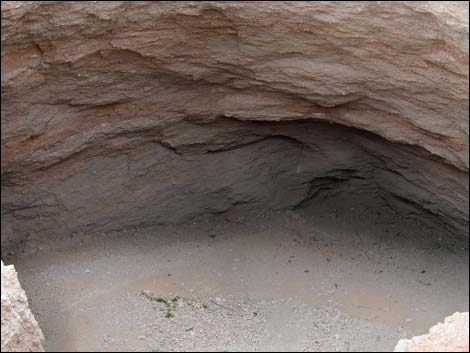
 No tunnels in the lowest part of the pit |
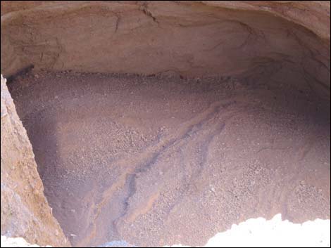 Erosion patterns in the bottom of the pit |
Table 1. Hiking Coordinates Based on GPS Data (NAD27, UTM Zone 11S). Download Hiking GPS Waypoints (*.gpx) file.
| Site | Location | UTM Easting | UTM Northing | Latitude (N) | Longitude (W) | Elevation (ft) |
|---|---|---|---|---|---|---|
| 0807 | GB Rd at Mud Wash Rd | 756119 | 4035522 | 36.43258 | 114.14300 | 2,244 |
| 1672 | Devils Throat Trailhead | 755669 | 4034971 | 36.42774 | 114.14819 | 2,287 |
Happy Hiking! All distances, elevations, and other facts are approximate.
![]() ; Last updated 241108
; Last updated 241108
| Hiking Around Gold Butte | Hiking Around Las Vegas | Glossary | Copyright, Conditions, Disclaimer | Home |