Rocks and Geology Around Las Vegas
Note: All distances, elevations, and other facts are approximate.
![]() ; Last updated 150708
; Last updated 150708
| Nopah | Fossils | Hiking Around Las Vegas | Glossary | Copyright, Conditions, Disclaimer | Home |
| Home | Rocks and Geology | Fossils | Nopah | ||||||
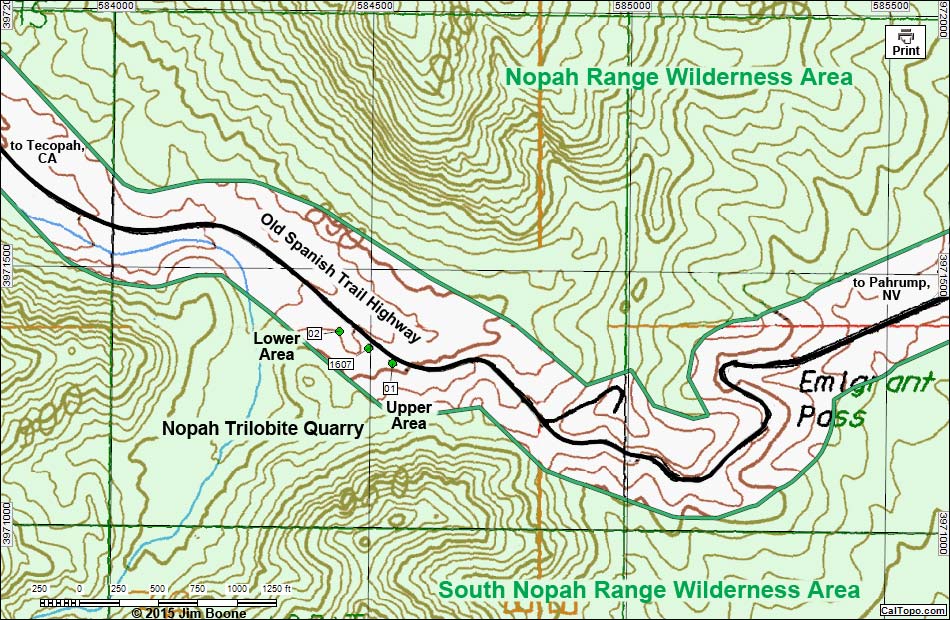
| Nopah Trilobite Quarry Map - Overview Rocks and Geology Around Las Vegas |
||||||
|
||||||
| Note: Roads are black (solid = paved; dashed = unpaved). Trails and routes are red (solid = main; dashed = adjacent or alternate). Map based on USGS 7.5 minute topo map, which may have red grid lines and various numbers. North is at the top. Grid is UTM NAD27 CONUS. BLM areas (white) based on BLM data. Download waypoint coordinates from route description page. Click inside blue rectangles to enlarge those sections of the map. | ||||||
Note: All distances, elevations, and other facts are approximate. |
||||||
|
| Google Ads |