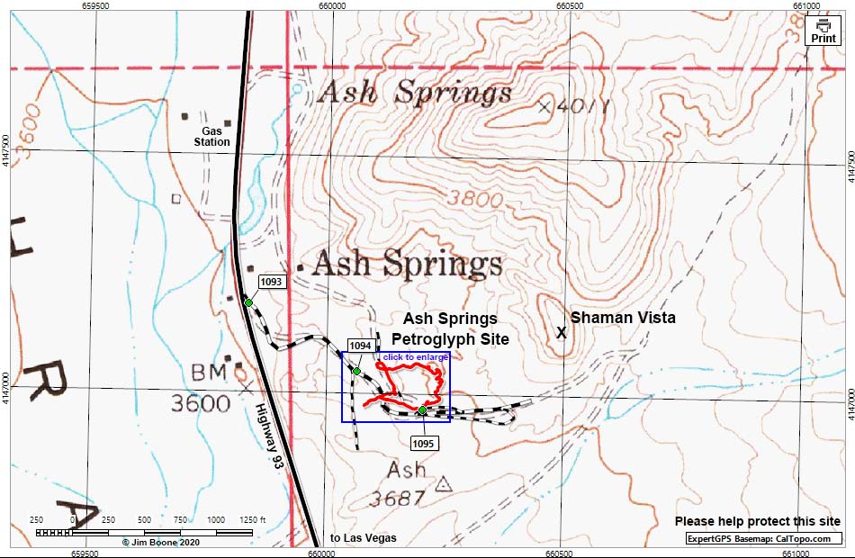
Note: Map based on USGS 7.5 minute topo map, which may have red grid lines and various numbers. North is at the top. Grid is UTM NAD27 CONUS. Roads are black (solid = paved; dashed = unpaved; width implies quality). Trails and routes are red (solid = main; dashed = adjacent or alternate). Washes, streams, and lakes are blue (solid = permanent; dashed = intermittent). Download waypoint coordinates from route description page. Click inside blue rectangles to enlarge that section of the map.
Happy hiking! All distances, elevations, and other facts are approximate.
![]() ; Last updated 200928
; Last updated 200928
| Ash Springs | Petroglyphs Around Las Vegas | Glossary | Copyright, Conditions, Disclaimer | Home |