Birding Around Las Vegas, Urban Las Vegas Valley
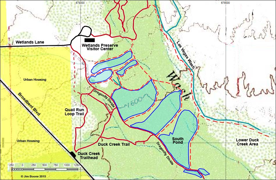
Note: Roads are black. Trails and routes are red (solid = main; dashed = alternate). Water is blue. Urban areas are yellow. Map based on USGS 7.5 minute topo map. North is at the top. UTM Grid is NAD27 CONUS. Pond boundaries change over time.
Happy birding! All distances, elevations, and other facts are approximate.
![]() ; Last updated 231108
; Last updated 231108
| Duck Creek | Overview Map | Birding Around Las Vegas | Copyright, Conditions, Disclaimer | Home |