Birding Around Las Vegas, Lake Mead Area
Happy birding! All distances, elevations, and other facts are approximate.
![]() ; Last updated 170630
; Last updated 170630
| Spring Meadows Road | Birding Ash Meadows | Birding Las Vegas | Copyright, Conditions, Disclaimer | Home |
| Home | Birding | Ash Meadows NWR | Spring Meadows Road | |||||
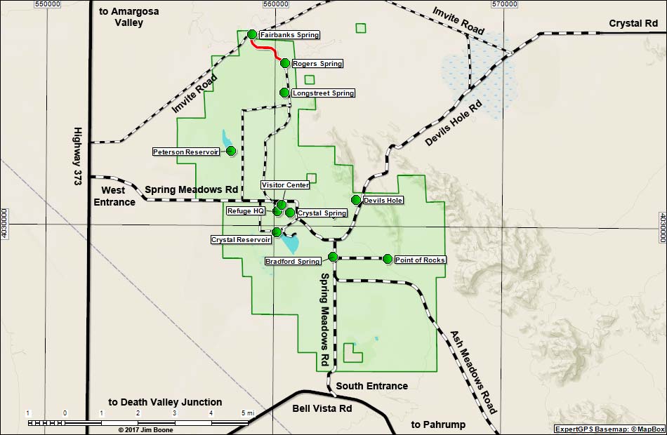
| Spring Meadows Road Map Birding Around Las Vegas, Lake Mead Area |
|||||
|
|||||
| Note: Map based on USGS 7.5 minute topo map, which may have red grid lines and various numbers. North is at the top. Grid is UTM NAD27 CONUS. Roads are black (solid = paved; dashed = unpaved; width implies quality). Trails and routes are red (solid = main; dashed = adjacent or alternate). Wildlife Refuges (boundaries solid green, fill light green) based on USFWS data. BLM areas (no overlay) based on BLM data. | |||||
Happy birding! All distances, elevations, and other facts are approximate. |
|||||
|
| Google Ads |