Hiking Around Las Vegas, Red Rock Canyon National Conservation Area
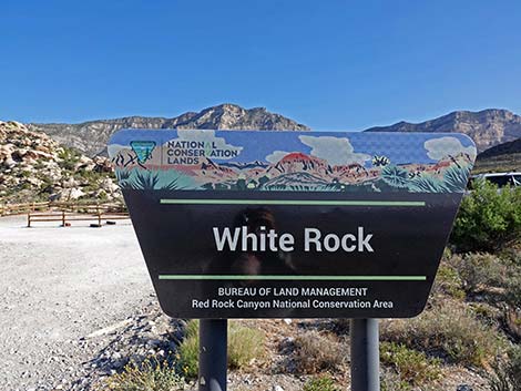
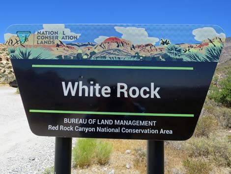 Upper White Rock Trailhead sign (view N) |
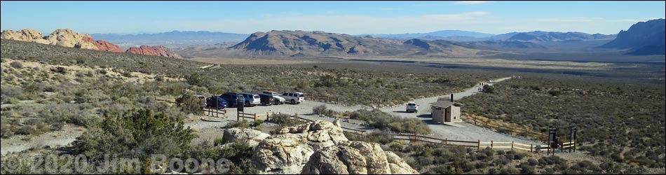
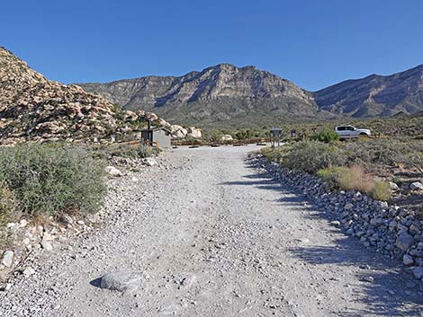
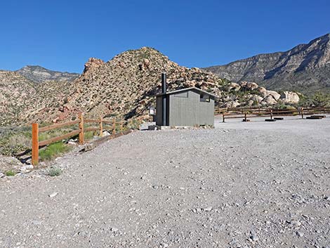
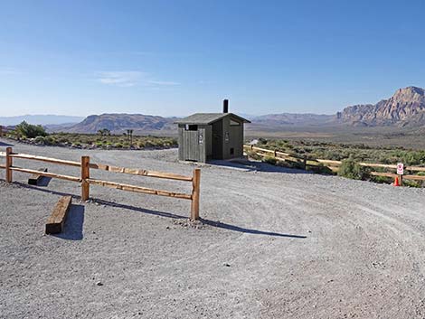
Upper White Rock Trailhead is located along the Scenic Loop Road in Red Rock Canyon National Conservation Area, about 1 hour west of Las Vegas. From town, drive out to Red Rocks. From West Charleston at Scenic Loop Road (Table 1, Site 0519), turn right and drive north for 0.2 miles to the entrance station (Site 0855). Pay the fee, then drive around the one-way Scenic Loop Road to White Rock Road (Site 0525), which is at Mile Marker 6. Turn right onto White Rock Road and drive north for 0.5 miles to the end of the road (Site 0404). White Rock Road is paved for the first 100 feet or so, but the rest is unpaved and always a bit rough; just drive slowly and you will get there soon enough. There is an outhouse at the end of the road. Park here; this is the trailhead. Link to trailhead map. |
 West Trailhead (view NW) |
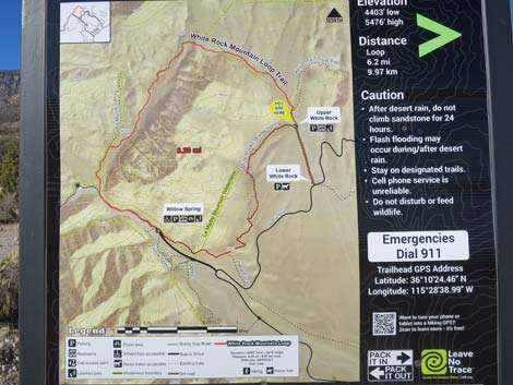
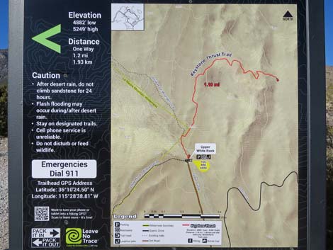
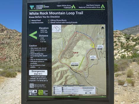
Upper White Rock Trailhead provides access to hikes in the White Rock Hills area, including access to a desert spring, the Keystone Thrust, a number of off-trail hikes, and several miles of moderate to difficult hiking. There are two trailheads: North Trailhead and West Trailhead. Both trailheads are on the White Rock Loop Trail, and hikers can do the loop in either direction from this parking area. North Trailhead provides access to White Rock Loop Trail (counter-clockwise), Keystone Thrust Trail, La Madre Mountain, and Hogback Ridge Summit. West Trailhead provides access to White Rock Loop Trail (clockwise), Grand Circle Trail, and White Rock Spring Trail. Trails: White Rock Loop Trail, White Rock Spring Trail, Keystone Thrust Trail, Grand Circle Trail, La Madre Mountain, Hogback Ridge Summit. |
 White Rock Road approaching Upper White Rock Trailhead (view N) |
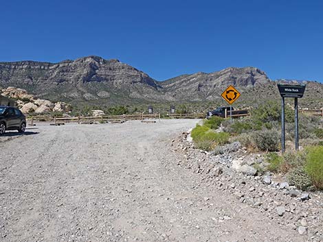 White Rock Road approaching Upper White Rock Trailhead (view N) |
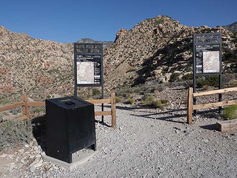
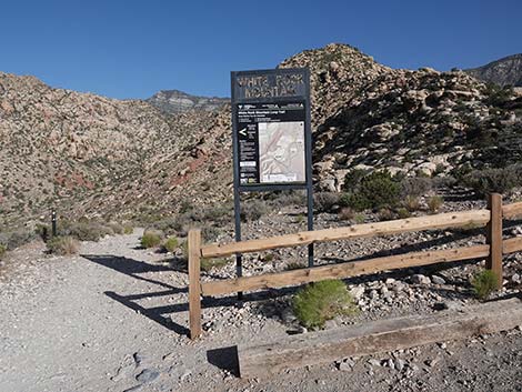
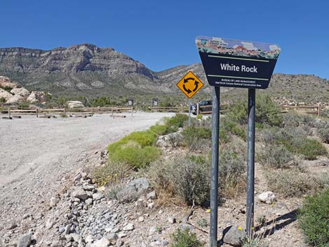 White Rock Road at Upper White Rock Trailhead sign (view N) |
 Upper White Rock Trailhead sign (view N) |
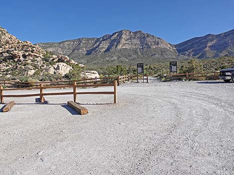
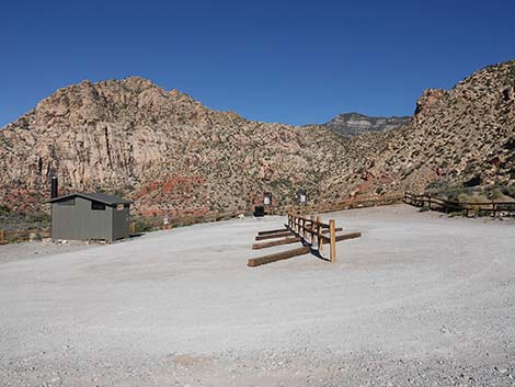
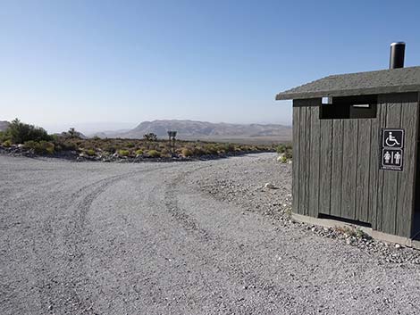
 Best to stay right, away from outhouse, around the circle (view NW) |
 Entering White Rock Road turn-around loop (view SW) |
 Staying right to North Trailhead (view N) |
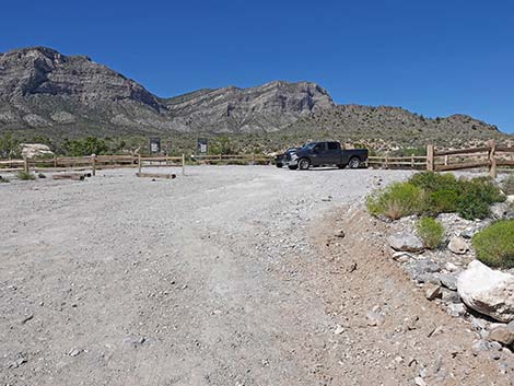
 Approaching the North Trailhead (view N) |
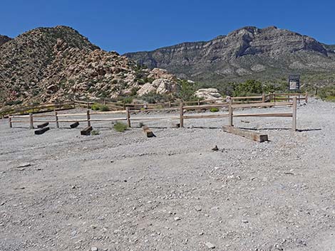 The parking spaces are designed for nosing into the railroad ties |
 Continuing around the turn-around loop (view W) |
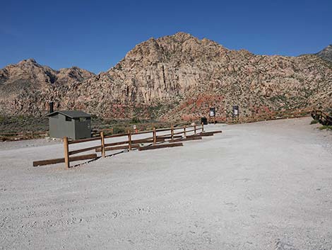 Continuing through the parking area (view W) |
 Approaching West Trailhead (view W) |
 Turning the far corner back to the left (view SE) |
 Turning the far corner back to the left (view E) |
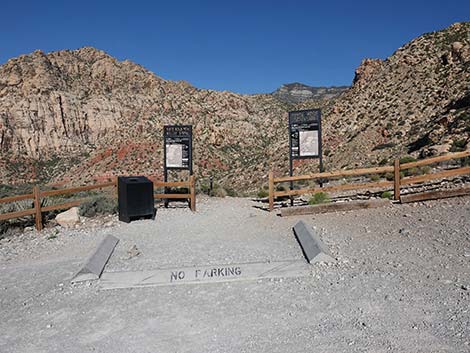
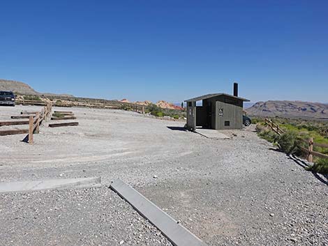
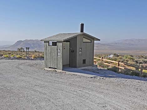 Approaching the Vault toilet (view SE) |
 Exiting the parking area onto White Rock Road (view SE) |
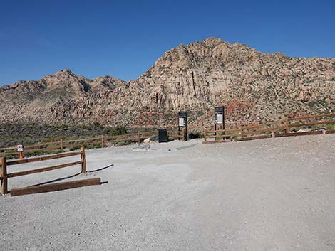
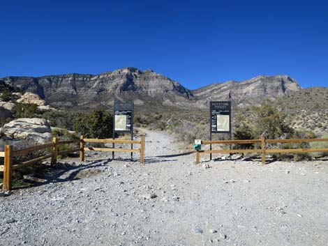
North Trailhead: White Rock Mountain Trailhead and Keystone Thrust Trailhead -- AKA White Rock Loop Trailhead
 North Trailhead (view N) |
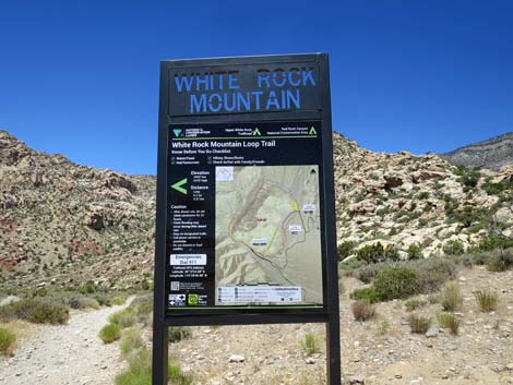
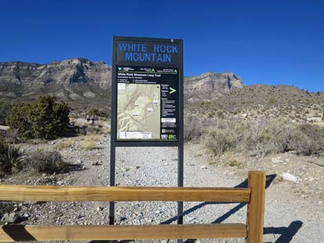 White Rock Loop Trailhead sign (view N) |
 White Rock Loop Trailhead sign (close-up, view N) |
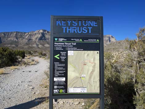 Keystone Trailhead sign (view N) |
 Keystone Trailhead sign (close-up, view N) |
 More to come ... |
West Trailhead: Willow Springs and White Rock Mountain Trailhead -- AKA White Rock Loop Trailhead
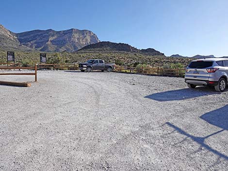
West Trailhead (view W) |
 West Trailhead (view W) |
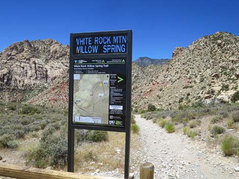 Willow Springs Trailhead sign (view NW) |
 Willow Springs Trailhead sign (view NW) |
 Willow Springs Trailhead sign (view NW) |
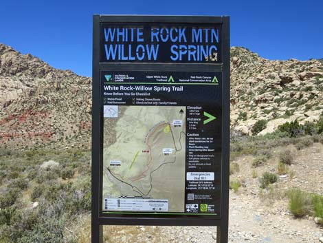
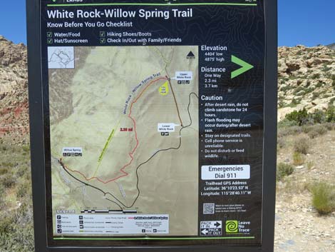
 White Rock Loop Trailhead sign (view NW) |
 White Rock Loop Trailhead sign (view NW) |
 White Rock Loop Trailhead sign (view NW) |
Table 1. Highway Coordinates (NAD27; UTM Zone 11S). Download Highway GPS Waypoints (*.gpx) file.
| Site # | Location | Latitude (N) | Longitude (W) | UTM Easting | UTM Northing | Elevation (feet) | Verified |
|---|---|---|---|---|---|---|---|
| 0404 | White Rock Spring Trailhead | 36.17346 | 115.47697 | 636974 | 4004062 | 4,859 | Yes |
| 0519 | Charleston at Scenic Loop Entrance | 36.13161 | 115.42048 | 642131 | 3999501 | 3,681 | Yes |
| 0525 | Scenic Loop Road at White Rock Road | 36.16619 | 115.47438 | 637220 | 4003259 | 4,664 | Yes |
| 0855 | Scenic Loop Entrance Station | 36.13252 | 115.42282 | 641918 | 3999598 | 3,682 | Yes |
Happy Hiking! All distances, elevations, and other facts are approximate.
![]() ; Last updated 240330
; Last updated 240330
| Hiking Around Red Rocks | Hiking Around Las Vegas | Glossary | Copyright, Conditions, Disclaimer | Home |