Hiking Around Las Vegas, Red Rock Canyon National Conservation Area
 Sandstone Quarry Trailhead |
Overview The Calico Tanks Trail provides a fairly strenuous, 2.4-mile round-trip hike runs up a canyon and over sandstone slickrock to a large natural depression (a "tank" or "tinaja") near the top of the Calico Hills ridge. The tank sometimes holds water, and there are great views of Calico Basin and the Las Vegas Valley from a saddle just beyond the tank. In general, from the trailhead, the trail runs north and east around the northern end of the sandstone quarry hills, then cuts back up a canyon that leads southeasterly into the Calico Hills. There are some nice fossilized ripple marks in the sandstone near the tanks, and see photos of the return hike here. Link to map. Link to BLM Georeference PDF map file. |
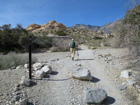
 Entering Sandstone Quarry historic area |
Watch Out Other than the standard warnings about hiking in the desert, ...this is a moderately strenuous hike. After the trail ends, the route requires some 2nd-class scrambling over and around boulders and up slick-rock terraces. The route also requires some route-finding skills. Be careful if you get high enough to fall and hurt yourself, and watch for wet or icy rocks in the canyon and around the pool during winter. Don't drink the water without treating it. While hiking, please respect the land and the other people out there, and try to Leave No Trace of your passage. Also, even though this is a short hike, be sure to bring what you need of the 10 Essentials. |
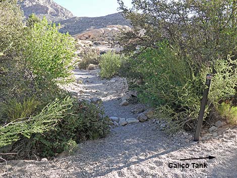
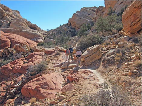
 Calico Tanks Trail exits left of the quarry stones (view N) |
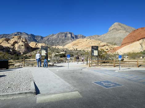
Getting to the Trailhead This hike is located along the Scenic Loop Road in Red Rock Canyon National Conservation Area, about 45 minutes west of Las Vegas. Drive out to Red Rocks, pay the entrance fee, and drive up the Scenic Loop Road for about 3 miles to the Sandstone Quarry Trailhead. Park here; this is the trailhead. |
 Trail exiting the quarry stones area (view NW) |
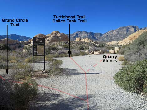
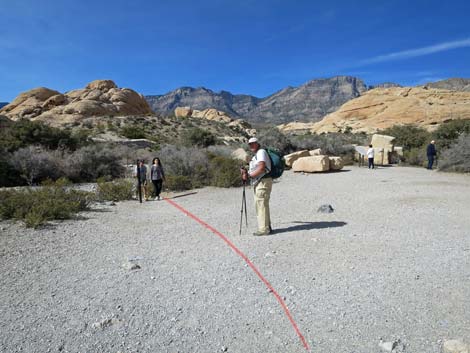
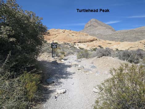
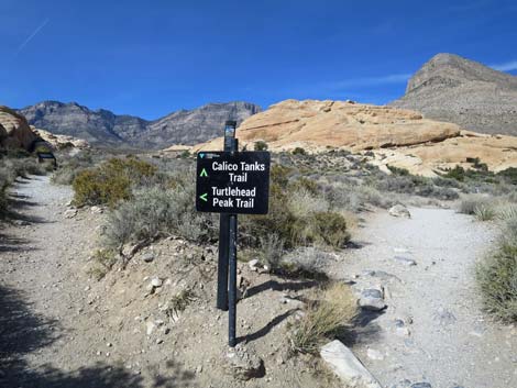
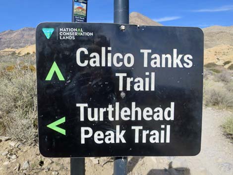
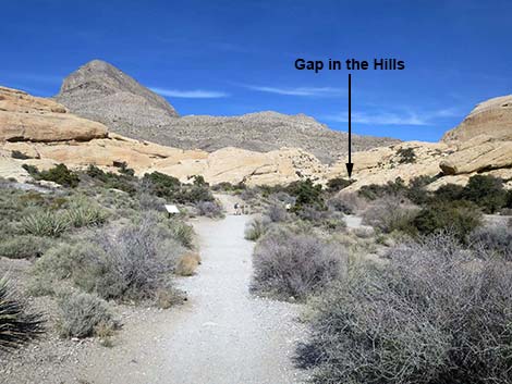
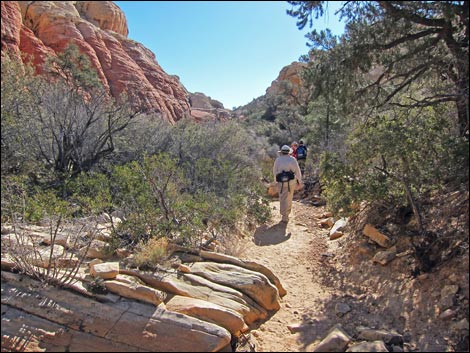
The Hike From the trailhead (Table 1, Waypoint 01), the hike starts on the old road that runs northward into the historic quarry area where evidence of the old stonework remains. As the trail enters the main quarry area, it passes a signed Grand Circle Trail junction (Wpt. 02) on the left and then continues across the open area towards a second trail sign (Wpt. 03) ahead on the left. Passing the Calico Tanks--Turtlehead Peak Trail sign (Wpt. 03), the route bends left into the main wash and heads upstream past an enormous sandstone boulder on the left. The built trail resumes across the wash, and in about 3 minutes, reaches a signed trail junction where the Turtlehead Peak Trail forks off to the left (Wpt. 04). Staying right on the Calico Tanks Trail and heading northeast, the trail passes an agave roasting pit information sign on the left and then drops back into the wash. The trail follows the wash upstream through a narrow gap between sandstone cliffs crowded with canyon live oak trees. |
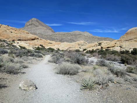
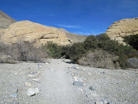
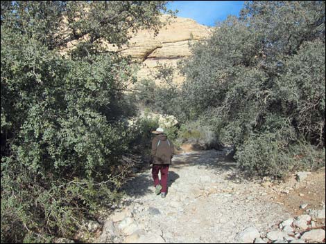
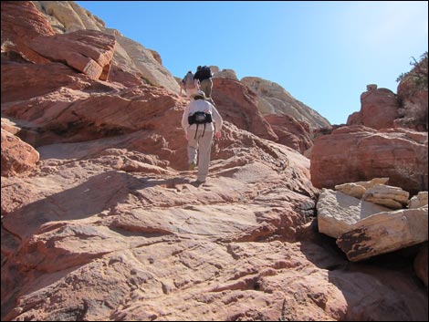
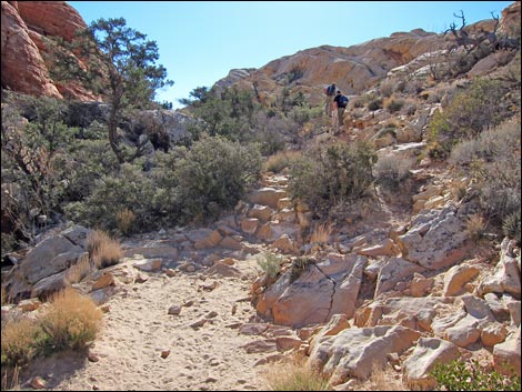
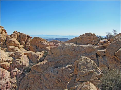
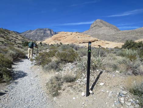 Calico Tanks Trail seems to head for Turtlehead Peak (view N) |
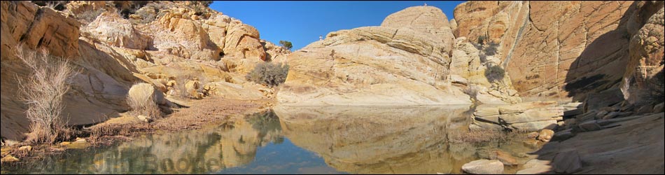
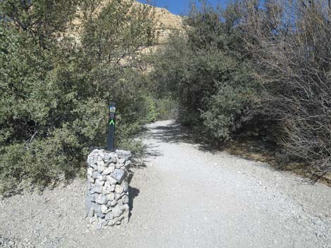
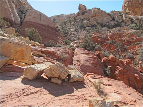
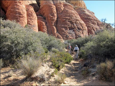
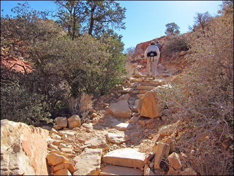
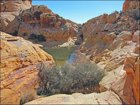
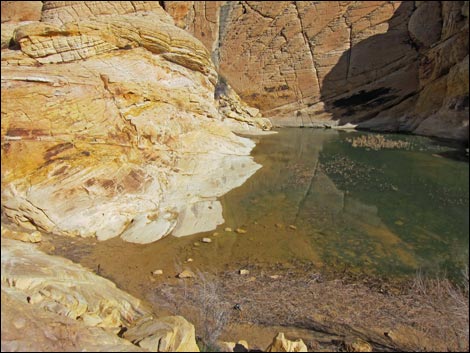
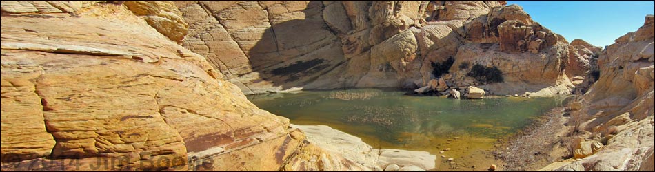
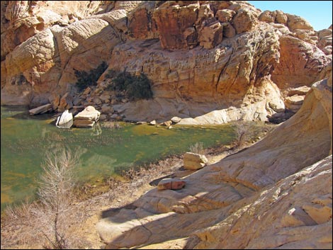
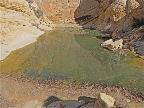
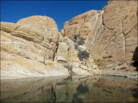
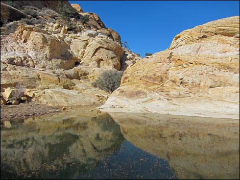
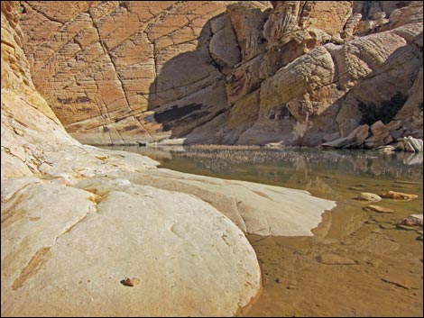
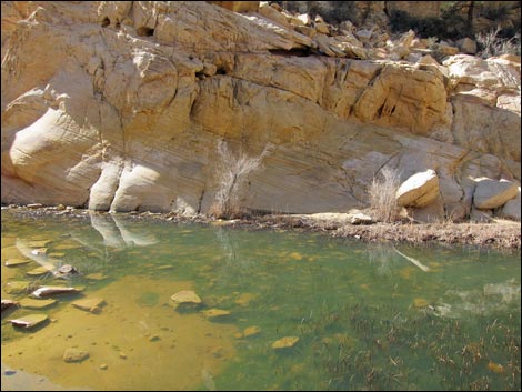
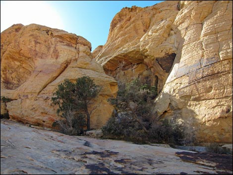
At the first opportunity beyond the gap, the trail leaves the wash (Wpt. 05) by a carsonite sign and turns right into a major side canyon, now heading southeast and uphill. The side canyon leads into the heart of the Calico Hills. The lower part of the canyon is wide and sandy, but higher up, the canyon narrows, and the trail runs on red and white sandstone slickrock. The route is not always obvious, but it works its way up the canyon following use-trails and traversing slick rock. The route is marked with cairns, and the trail crew has done a lot of work here to improve the trail: they even cut steps in solid sandstone rock and built stone stairs on the steeper parts. After climbing steeply for a fair ways and then crossing a long flat area with singleleaf pinyon pines (Wpt. 06), the trail eventually runs over sandstone and drops into Calico Tank (Wpt. 07), a large natural depression. The tank sometimes holds water, and there might be sedges, needlegrass, and cattails growing along the margin. |
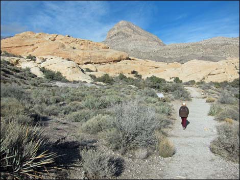
 Approaching Turtlehead Peak--Calico Tanks trail junction (view N) |
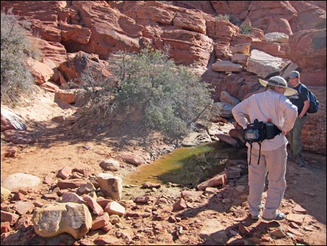
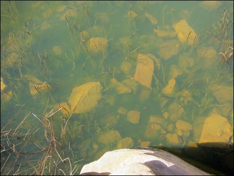
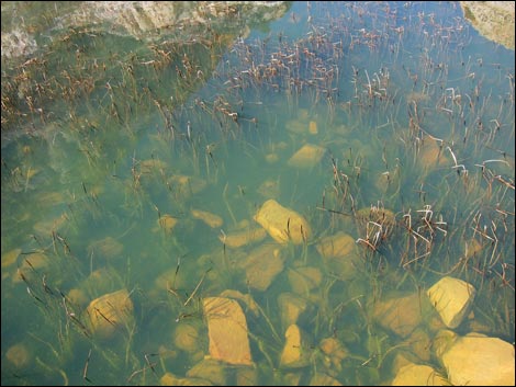
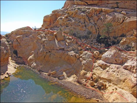
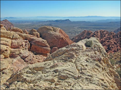
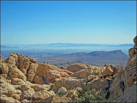
When there has been sufficient precipitation, the tank provides water for wildlife such as bighorn sheep. I have even seen relatively large fish in the pond. One fish looked like a 10-inch largemouth bass that someone brought up here and released. Lucky for the environment and the native insects and frogs, the ponds always dry out and the fish are eliminated. Look carefully in the water for fairy shrimp who have a life-strategy for thriving is places like this. The tank can be passed fairly easily along the south side, and hikers can scramble up to a saddle (Wpt. 08) with grand views down the cliffs to the east, out over Calico Basin, and across the Las Vegas Valley. There are various options for returning to the trailhead, but the safest is to follow your footprints back down the trail (photos of the return). |
 Sign missing: Calico Tanks Trail (right); Turtlehead Peak Trail (left) |
 Sign missing: Calico Tanks Trail (right); Turtlehead Peak Trail (left) |
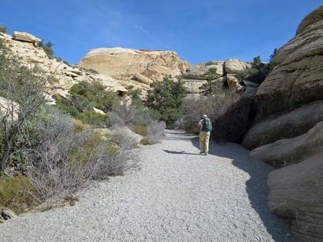
 Trail bends right to follow Sandstone Quarry Wash (view NE) |
 Hiker approaching sign for Agave Roasting Pit (view NE) |
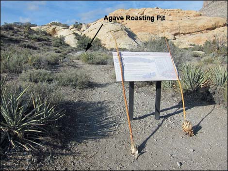 Info sign at agave roasting pit (view N) |
 Trail leaves old road and drops towards wash (view E) |
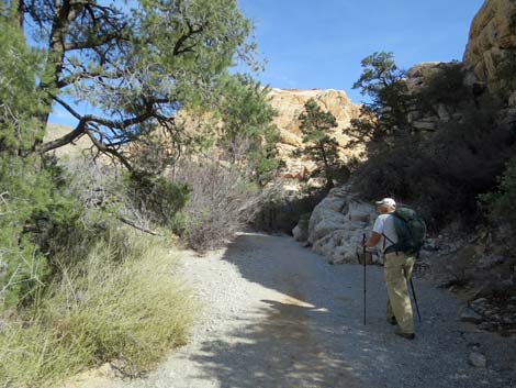
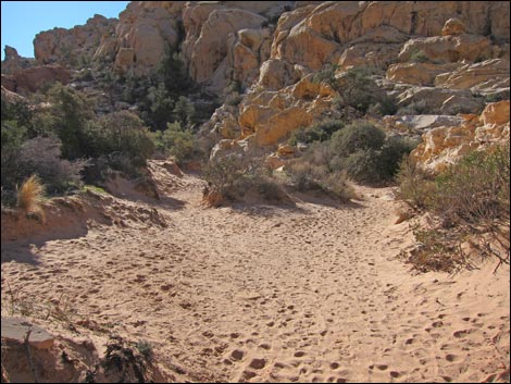
 Trail drops into wash; goes through gap (view NE) |
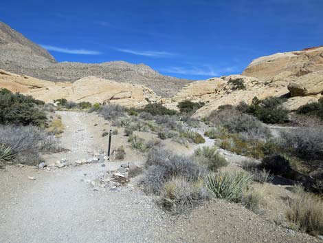
 Entering the gap (view E) |
 Trail marker when entering the gap (view E) |
 Oak trees in the sandstone gap |
 |
 |
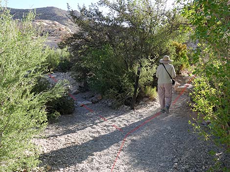 Trail leaves wash to the right |
 Route to Red Cap; don't go that way (stay right) |
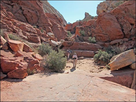
 Sandy valley bottom (view SE) |
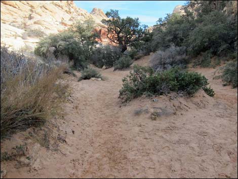 Sandy valley bottom narrows (view SE) |
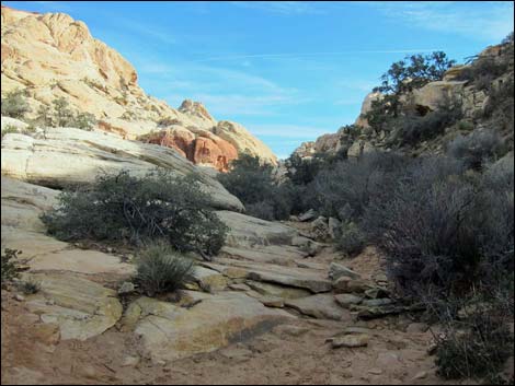 Sandy valley bottom leads to rocky valley bottom (view SE) |
 Hiking onto red sandstone slickrock (view SE) |
 |
 |
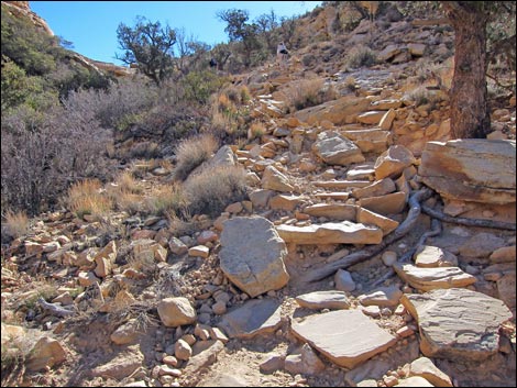
 Stairs carved into the rock face (view SE) |
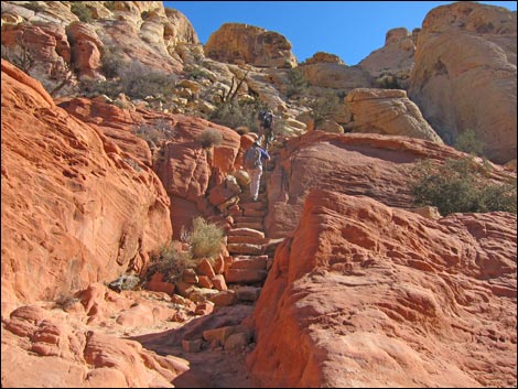 Stone stairs (view SE) |
 |
 |
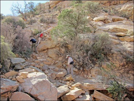 Trail goes onto steep, sandy soils with lots of rocks (view S) |
 Sandy trail (view SE) |
 |
 |
 |
 |
 Stone stairs (view SE) |
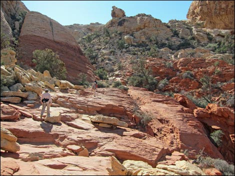
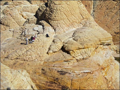
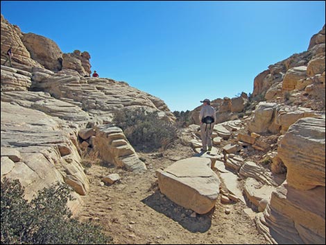 Hikers near a highpoint |
 Highpoint overlooking Calico Tank (view SE; route stays right) |
 Looking down while passing Calico Tank (view NE) |
 |
 |
 |
 |
 |
 |
 |
 |
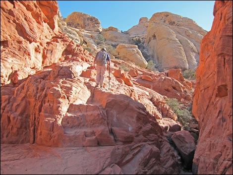
 Route across rocky hillside to saddle (view S) |
 Rocky hillside |
 Hikers out at the overlook (view E) |
 Overlook (view SE) |
 Hikers out at the overlook (view E) |
 Looking back at hikers above Calico Tank (view NW) |
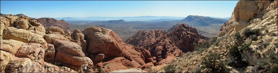
Table 1. Hiking Coordinates Based on GPS Data (NAD27; UTM Zone 11S). Download Hiking GPS Waypoints (*.gpx) file.
| Wpt. | Location | UTM Easting | UTM Northing | Elevation (ft) | Point-to-Point Distance (mi) | Cumulative Distance (mi) | Verified |
|---|---|---|---|---|---|---|---|
| 01 | Sandstone Quarry Trailhead | 639471 | 4002862 | 4,367 | 0.00 | 0.00 | Yes |
| 02 | Grand Circle Trail Junction | 639483 | 4002979 | 4,305 | 0.07 | 0.07 | GPS |
| 03 | Calico Tanks Trail Junction | 639461 | 4003002 | 4,311 | 0.02 | 0.09 | GPS |
| 04 | Turtlehead Peak Trail Junction | 639419 | 4003159 | 4,379 | 0.11 | 0.20 | GPS |
| 05 | Calico Tanks Canyon | 639636 | 4003359 | 4,405 | 0.20 | 0.40 | GPS |
| 06 | Flats with Pines | 640138 | 4003008 | 4,557 | 0.45 | 0.85 | GPS |
| 07 | Calico Tanks | 640557 | 4002755 | 4,732 | 0.31 | 1.16 | GPS |
| 08 | Saddle above Calico Tanks | 640599 | 4002718 | 4,752 | 0.05 | 1.21 | GPS |
| 01 | Sandstone Quarry Trailhead | 639471 | 4002862 | 4,367 | 1.21 | 2.42 | Yes |
Happy Hiking! All distances, elevations, and other facts are approximate.
![]() ; Last updated 240330
; Last updated 240330
| Hiking Around Red Rocks | Hiking Around Las Vegas | Glossary | Copyright, Conditions, Disclaimer | Home |