Hiking Around Las Vegas, Red Rock Canyon National Conservation Area
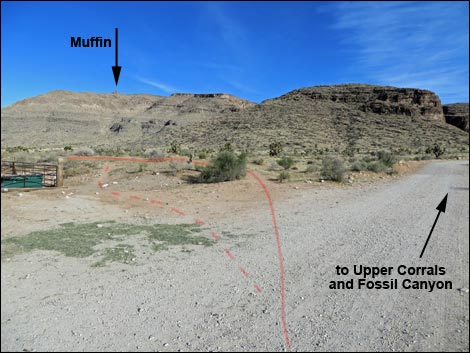
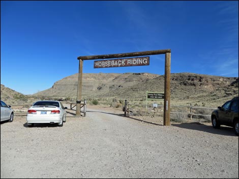 Cowboy Trail Rides Trailhead (view NE) |
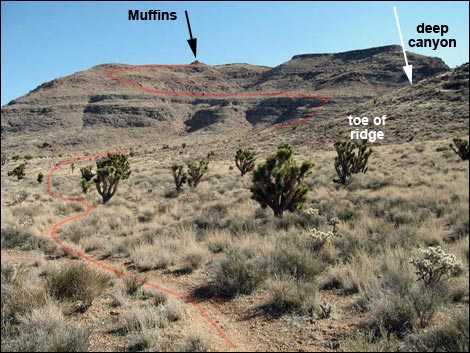
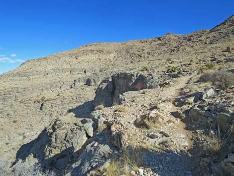
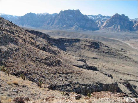
Overview This hike starts at the Cowboy Trail Rides parking and works up and across the northwest face of Blue Diamond Hill to the North Ridge, then turns south and climbs the ridge. At about 1.8 miles out, the trail passes the Muffin Rocks, which are Lower-Triassic-age Timpoweap Conglomerate rock. The Muffin Rocks make a nice destination, or at least a nice place to rest in the shade and gaze east over the Las Vegas Valley, or if you prefer, gaze west to the Sandstone Bluffs of Red Rock Canyon. From the Muffin Rocks, hikers can return over the same trail or continue south towards the summit of Blue Diamond Hill and take one of the several Blue Diamond Hill Bike Trails back down to the trailhead. Link to map |
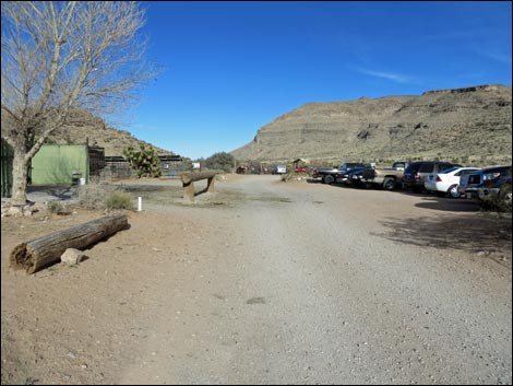 Cowboy Trail Rides lower parking and corrals (view NE) |
Watch Out Other than the standard warnings about hiking in the desert, ...this is a fairly safe hike, but there the trail runs along the top of some cliffs where a stumble would be fatal, and be careful climbing around on the muffin rocks. While hiking, please respect the land and the other people out there, and try to Leave No Trace of your passage. Also, even though this hike is short, be sure to bring what you need of the 10 Essentials. Getting to the Trailhead This hike is located in Red Rock Canyon National Conservation Area, about 30 minutes from town, but not on the Scenic Loop Road. Drive out West Charleston Blvd, past the entrance to the Scenic Loop Drive, to the Cowboy Trail Rides Trailhead on the left. Park here; this is the trailhead. |
 Cowboy Trail Rides lower corrals (view NE) |
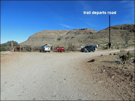
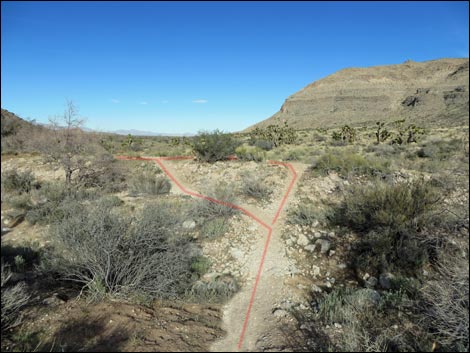
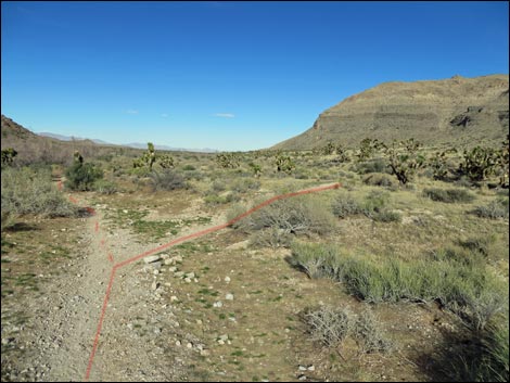
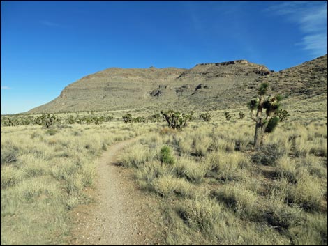
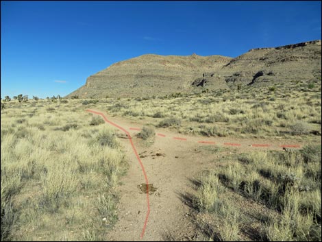
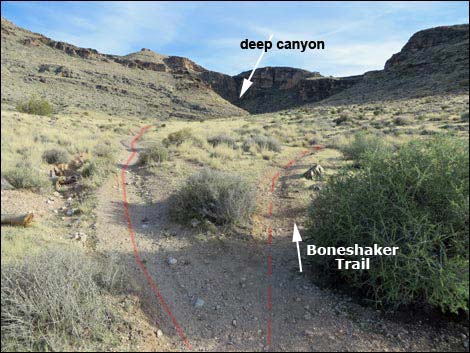
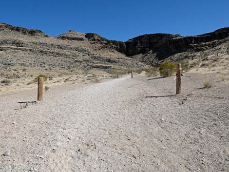
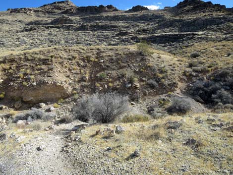
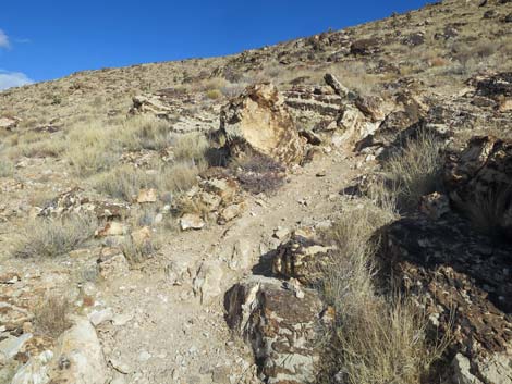
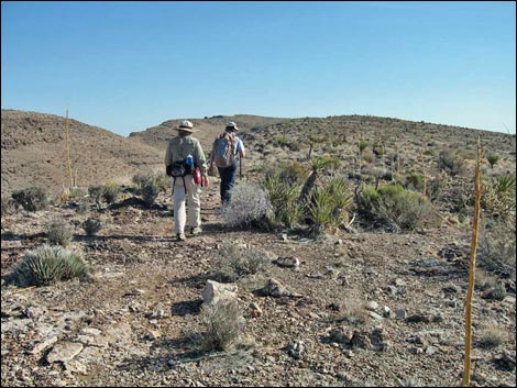
The Hike From the trailhead (Table 1, Waypoint 01), the hike runs northeast on the dirt road about 200 yards towards corrals ahead on the left. Just past the corrals, the trail departs the road to the left (Wpt. 30) aiming for the deep canyon left of the limestone ridge in the foreground. Hiking through this area, there are lots of Eastern Joshua Trees and many clumps of Big Galleta Bunchgrass with a few Silver Cholla mixed in. The trail intersects several trails on the desert flats (Wpt. 31, Wpt. 32, Wpt. 33) as it runs towards the deep canyon ahead. Trails seem to breed on the flats, so aim for the deep canyon on the left side of the ridge in the foreground. At a trail junction near the mouth of the canyon (Wpt. 34) and on the edge of a deep wash, the hike goes right and up the hill, while another trail goes down the wash. |
 Departing road behind lower corrals (view E) |
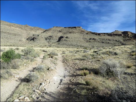
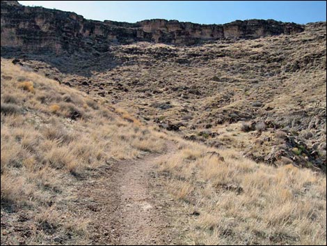
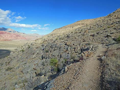
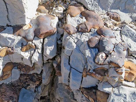
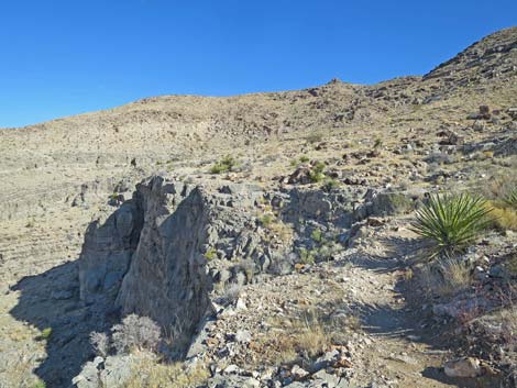
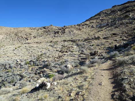
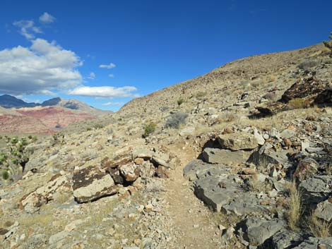
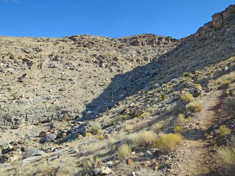
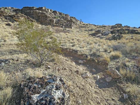
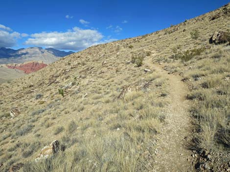
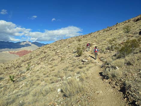
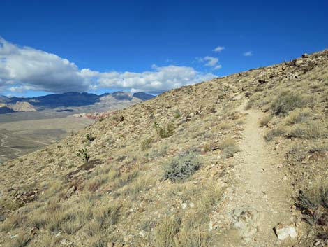
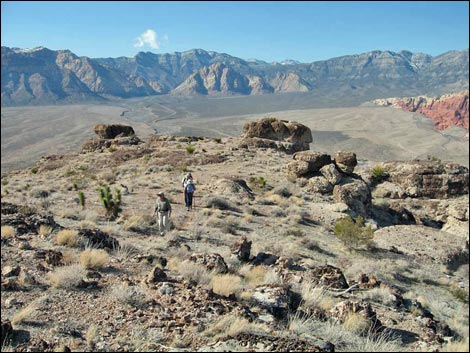
Across the deep wash, the trail climbs steeply as it switchbacks up the face of the hill (north side of the canyon) to yet another trail junction (Wpt. 35). Here, the Muffin Trail stays left and heads uphill, while the other trail turns south and runs slightly downhill before turning into the canyon. The Muffin Trail turns another switchback, and now heading northeast, climbs a bit more before running more or less on the contour. In this area, the hiking is easy, and the views are grand. To the west lie the Sandstone Bluffs of Red Rock Canyon, and to the north lie the limestone ridges of the La Madre Mountain Range. On these rocky slopes, which are limestone, cactus does well, evidenced by the number of cactus species here (including California Barrel Cactus, Engelmann's Hedgehog Cactus, Desert Spinystar, Beavertail Pricklypear, and Silver Cholla. Watch for gastropods, corals, and two types of sponge fossils in the rocks along the trail. The trail climbs gently along the hillside, then turns eastward and up somewhat steeply into a shallow canyon. From the back of the canyon, the trail climbs quite steeply before traversing out towards the North Ridge at a somewhat energetic pace. Passing two more switchbacks, the trail reaches the ridgeline (Wpt. 36) and turns back to the southeast along the top of the ridge. |
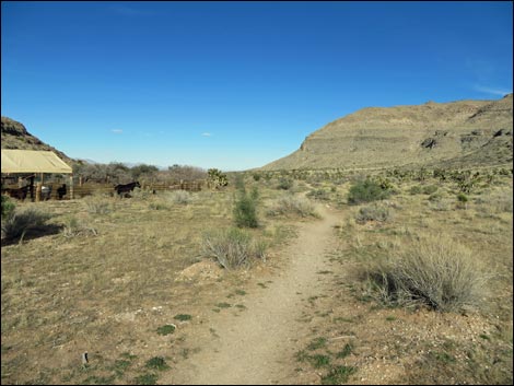 Trail runs past the lower corrals (view NE) |
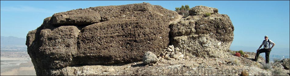
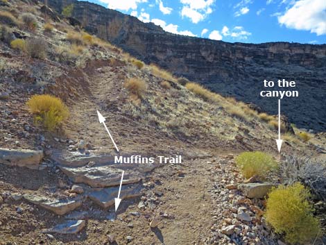
Shortly, the trail passes along the west side of the Muffin Rocks (Wpt. 37). This is a good place to stop and rest in the shade, enjoy the view, and eat lunch. When ready, hikers can return over the same trail or continue southeast and up towards the summit, then take one of several Blue Diamond Hill Bike Trails back down to the trailhead. Continuing south on the ridge, the trail is more faint than before, but it runs along the top of the ridge with nice views to the east over the Las Vegas Valley. Eventually the trail meets another major trail at a low point on the ridge (Wpt. 38). Hikers can turn down the canyon to the west and head back to the trailhead (this is the same canyon bypassed at the trail junction in the switchbacks; Wpt. 35) or they can continue following the maze of trails in the area that will eventually lead downhill to the trailhead. |
 Lots of trails - take either one here |
 Lots of trails - stay right |
 |
 |
 Trail on desert flats with Joshua Trees and bunchgrass (view NE) |
 Multiple trailing |
 Trail starting up towards deep canyon (view SE) |
 Hitching posts (view SE) |
 Muffin Trail crosses this wash, then stays right (view SE) |
 Starting up steep hillside (view SE) |
 First switchback heading up steep hillside (view NE) |
 Third switchback heading up steep hillside (view NE) |
 Fifth switchback heading up steep hillside (view NE) |
 Seventh switchback heading up steep hillside (view NE) |
 Past 7th switchback heading up steep hillside (view NE) |
 Trail junction; stay left (straight; view SE) |
 Ninth (last) switchback heading up steep hillside (view NE) |
 Trail winds steeply up the rocky hillside (view NE) |
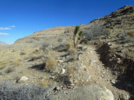
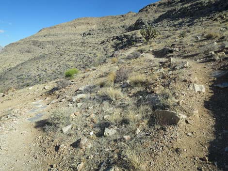
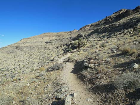
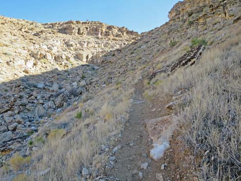
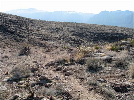
 Trail traverses gentle slopes (view N) |
 Trail traverses gentle slopes (view N) |
 Nice example of ocean-bottom sponge fossils |
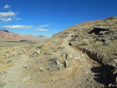
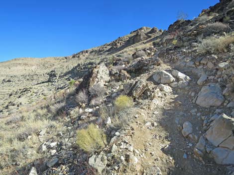
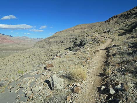
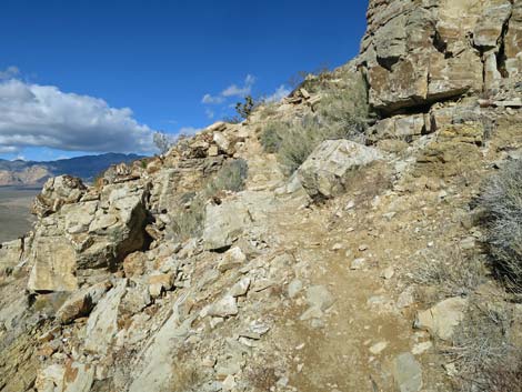
 Trail traverses gentle slopes above cliffs (view NE) |
 Trail traverses gentle slopes above cliffs (view E) |
 Trail traverses gentle slopes (view E) |
 Trail angles right into side canyon (view N) |
 Trail climbs somewhat steeply into side canyon (view E) |
 Trail climbs somewhat steeply into side canyon (view E) |
 Nice ocean-bottom fossils; perhaps algal mat |
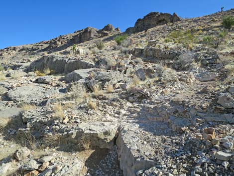
 Trail climbs aggressively out of the side canyon (view N) |
 Trail climbs aggressively (view N) |
 Nice spherical sponge with internal structure |
 Nice spherical sponge with internal structure |
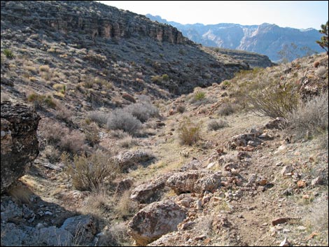
 Looking back down across side canyon to Red Rock cliffs (view W) |
 Approaching another set of switchbacks (view N) |
 Turning another switchback (view SE) |
 Trail traverses gentle slopes (view N) |
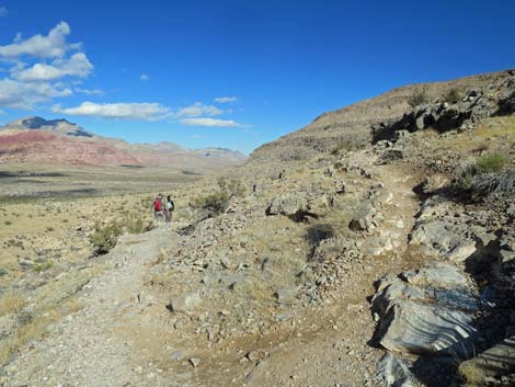
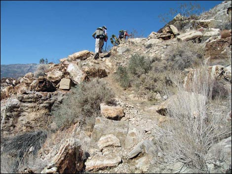
 Hikers on trail traversing gentle slopes (view N) |
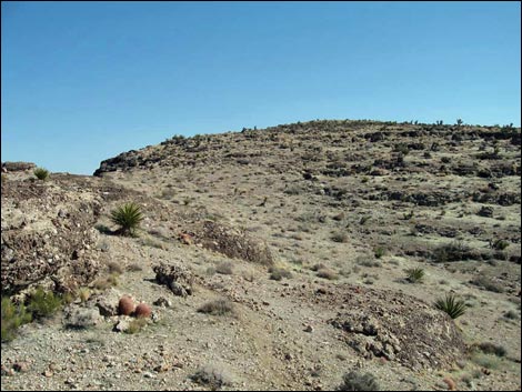
 Trail traverses gentle slopes, then turns up ridgeline (view N) |
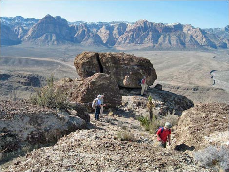
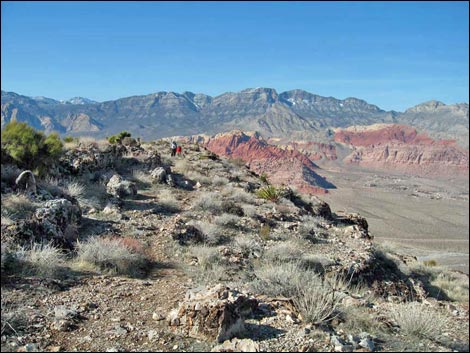
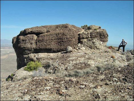 Hiker at the main Muffin Rock (view E) |
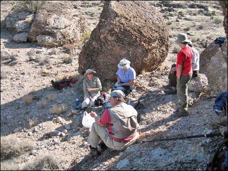 Lunch with the Muffins (view S) |
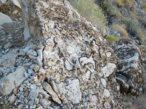
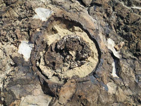
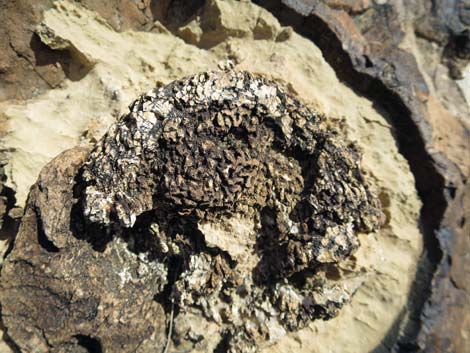
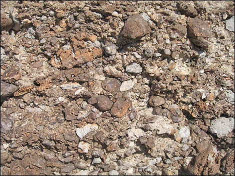 Triassic-age Timpoweap conglomerate rock |
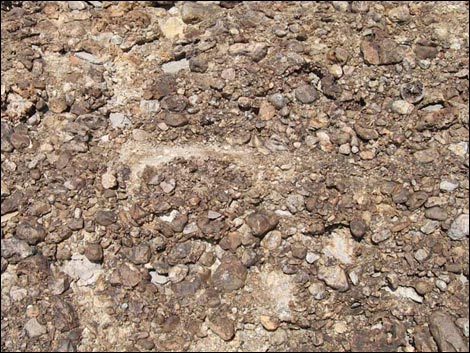 Triassic-age Timpoweap conglomerate rock |
 Looking back, hikers departing the Muffins (view NW) |
 Faint trail continues up the ridge (view SE) |
 Looking back, faint trail continues up the ridge (view NW) |
 Faint trail continues up the ridge (view SE) |
 Looking back, faint trail continues up the ridge (view NW) |
 A now well used trail drops into a low point on the ridge (view SW) |
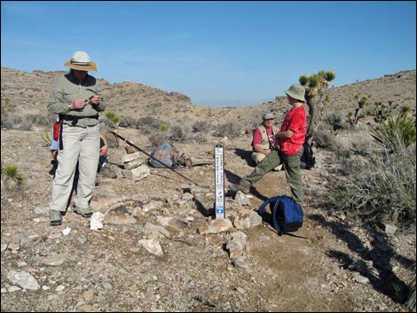 Hikers at trail junction: end of Muffin Trail (view NE) |
 Consider returning via the rocky canyon (view NW) |
Table 1. Hiking Coordinates and Distances based on GPS Data (NAD27; UTM Zone 11S). Download Hiking GPS Waypoints (*.gpx) file.
| Wpt. | Location | UTM Easting | UTM Northing | Elevation (ft) | Point-to-Point Distance (mi) | Cumulative Distance (mi) | Verified |
|---|---|---|---|---|---|---|---|
| 01 | Trailhead Parking | 641052 | 3998352 | 3,705 | 0.00 | 0.00 | GPS |
| 30 | Trail Departs Road | 641257 | 3998377 | 3,686 | 0.16 | 0.16 | GPS |
| 31 | Trail Junction | 641390 | 3998437 | 3,677 | 0.09 | 0.25 | GPS |
| 32 | Trail Junction | 641666 | 3998438 | 3,686 | 0.18 | 0.43 | GPS |
| 33 | Trail Junction | 641824 | 3998424 | 3,711 | 0.11 | 0.54 | GPS |
| 34 | Trail Junction | 641948 | 3998190 | 3,764 | 0.17 | 0.71 | GPS |
| 35 | Trail Junction | 642037 | 3998071 | 3,915 | 0.22 | 0.93 | GPS |
| 36 | North-most Point | 642669 | 3998579 | 4,413 | 0.72 | 1.65 | GPS |
| 37 | Muffin Rocks | 642793 | 3998417 | 4,526 | 0.16 | 1.81 | GPS |
| 38 | Trail Junction | 643572 | 3997502 | 4,739 | 0.80 | 2.61 | GPS |
Happy Hiking! All distances, elevations, and other facts are approximate.
![]() ; Last updated 240329
; Last updated 240329
| Blue Diamond Hill | Hiking Around Red Rocks | Hiking Around Las Vegas | Glossary | Copyright, Conditions, Disclaimer | Home |