Hiking Around Las Vegas, Mount Charleston Area, Kyle Canyon
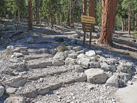 Cathedral Rock - South Loop Trailhead (view W) |
Overview This is a very strenuous, 9.7-mile round-trip hike that climbs about 3,400 vertical-feet from the Cathedral Rock Trailhead to the summit of Griffith Peak. The trail climbs the south side of Kyle Canyon to the crest, follows the Griffith Peak Trail along the crest for a few hundred yards, and then climbs a steep spur-trail to the summit. Views from the summit are among the best in southern Nevada, and there are some gnarled bristlecone pines (now mostly burned) and interesting fossil on the summit. An alternate route up Griffith Peak starts at the Griffith Peak Trailhead, but that trail is closed for now because of damage after the fire. Link to map. |
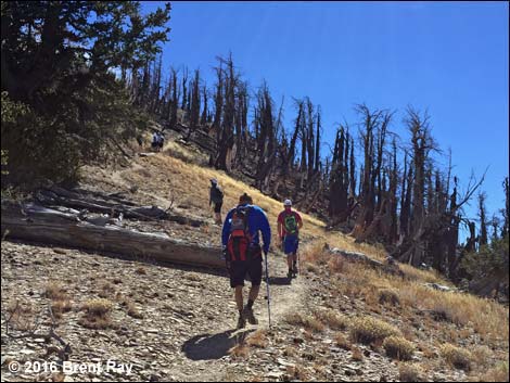
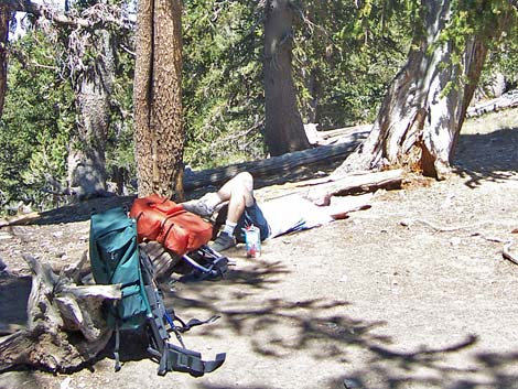 Resting atop South Loop Saddle (view W) |
Watch Out Other than the standard warnings about hiking in the desert, ...this is a pretty safe hike, but watch for ice in winter and early spring. The trail is strenuous, so take it easy at this elevation if you've just come up from the desert. There are places along the trail where a slip would prove hazardous, but nothing out of the ordinary. This trail would be a bit long and hard for young kids. While hiking, please respect the land and the other people out there, and try to Leave No Trace of your passage. Also, this is a long hike, so be sure to bring the 10 Essentials. This hike goes into the Mt. Charleston Wilderness Area, so pay particular attention to respecting the land. |
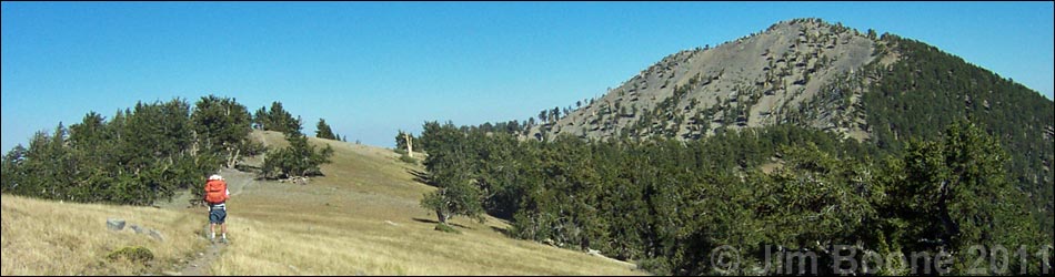
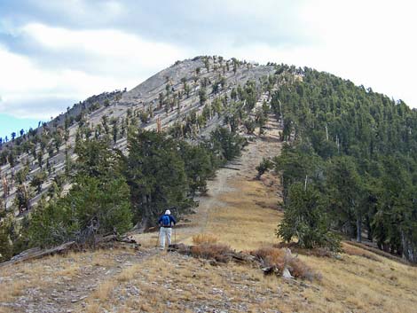
 Griffith Peak (view E from South Loop Saddle) |
Getting to the Trailhead This hike is located in Kyle Canyon up in the Spring Mountains National Recreation Area, about 1 hour northwest of Las Vegas. From town, drive out to the Spring Mountains Visitor Center, then continue up Kyle Canyon Road to the Cathedral Rock Trailhead. The Hike From the trailhead (Table 1; Waypoint 01), the trail runs up and left about 200 yards to a fork (Wpt. 02). At the fork, the Cathedral Rock Trail turns right, while the South Loop Trail continues straight. Both trails pass through a forest of ponderosa pines and white fir with an open understory of wax currents and a few other shrubs, plus some grasses, thistles, and a few forbs. In the trees, views are short but overlook the parking area and picnic area. |
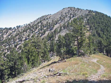
 Just east of the South Loop Saddle (view E; before fire) |
Past the picnic area, the trail runs steeply up the hillside as it runs generally southeast towards the base of the Echo Cliffs. After about 20-25 minutes, the trail joins an old road (Wpt. 03), which is followed up and across the avalanche chute that comes down from Griffith Peak. This is a nice area in the fall when the Quaking Aspen leaves are changing color. The trail passes a fork in the old road (Wpt. 04) to the right and runs very steeply up the east side of the avalanche chute below towering limestone cliffs. The trail crosses the avalanche chute (Wpt. 05) and switchbacks up the steep west side of the canyon to the top of the Echo Overlook (Wpt. 06). Echo Overlook is about halfway to the crest: only about 2 miles, 1.5 hours, and 1,500 feet to go. For details on this section of the hike, see the description of the Echo Overlook Trail. From Echo Overlook, the trail contours and switchbacks across the hillside to the west to another overlook, then turns south and begins a long series of switchbacks that lead another 2 miles to the crest of the ridge (Wpt. 07). For more details on this section of the hike, see the South Loop Trail. |
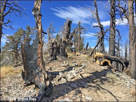
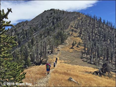 Just east of the South Loop Saddle (view E; after fire -- 10/2016) |
There is a trail junction at the crest (Wpt. 07). The trail to the southeast (Griffith Peak Trail) leads around the south side of Griffith Peak and down to the Griffith Peak Trailhead (about 5 miles out), and the trail to the northwest (South Loop Trail) leads to the summit of Mt. Charleston (about 4 miles out). From the trail junction (Wpt. 07), the route follows the Griffith Peak Trail to the east for about 5 minutes. The trail runs slightly downhill along the crest of the ridge. When the Griffith Peak Trail bends to the south and leaves the ridgetop (Wpt. 08), the route turns left onto a recently established trail junction (no sign). This new trail runs up the northwest side of Griffith Peak to the summit (Wpt. 09). Link to summit views. To get back to the trailhead, retrace your steps to the South Loop Trail, and follow it back down. On the way down, stay on the trail and don't cut the switchbacks. Cutting switchbacks damages the trail, damages the vegetation, and makes trail conditions worse for everyone. |
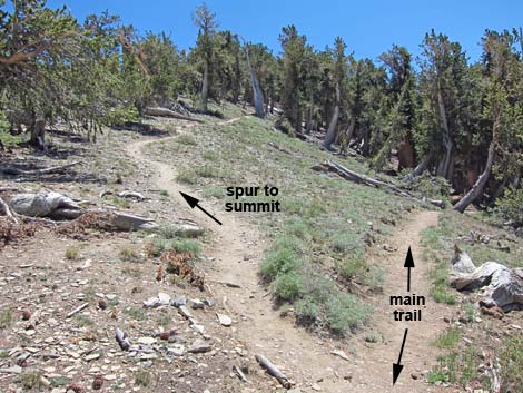 Trail junction; spur-trail to summit (left; view E) |
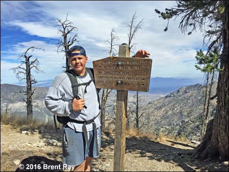 After fire -- October 2016 (sign at trail junction; view NE) |
 After fire -- October 2016 |
 After fire -- October 2016 |
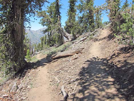 Switchback on Griffith Peak spur-trail (view NW) |
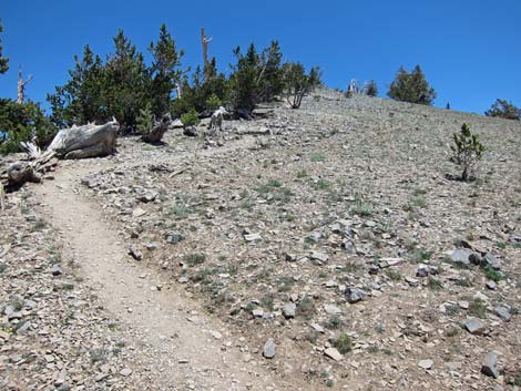 Final spur-trail to the summit (view E) |
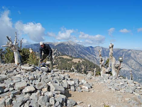 Hiker on the summit (view W) |
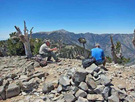 Hikers on the summit (view W) |
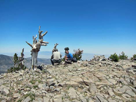 Hikers on the summit (view NE) [summit views] |
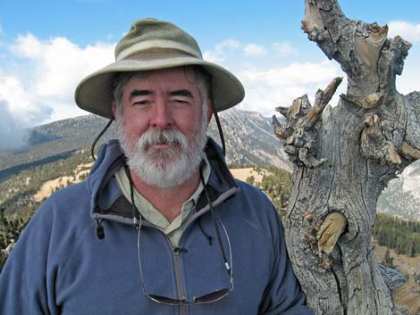 Happy hiker on the summit [summit views] |
Table 1. Hiking Coordinates Based on GPS Data (NAD27; UTM Zone 11S). Download Hiking GPS Waypoints (*.gpx) file.
| Wpt. | Location | UTM Easting | UTM Northing | Elevation (ft) | Point-to-Point Distance (mi) | Cumulative Distance (mi) | Verified |
|---|---|---|---|---|---|---|---|
| 01 | Cathedral Rock Trailhead | 621731 | 4013026 | 7,713 | 0.00 | 0.00 | GPS |
| 02 | Cathedral-South Loop Trail Junction | 621802 | 4012928 | 7,716 | 0.10 | 0.10 | GPS |
| 03 | Join Old Road | 622189 | 4012283 | 7,914 | 0.56 | 0.66 | GPS |
| 04 | Old Road Forks | 622517 | 4012134 | 8,186 | 0.35 | 1.01 | GPS |
| 05 | Avalanche Chute | 622283 | 4011678 | 8,585 | 0.35 | 1.36 | GPS |
| 06 | Echo Overlook | 622152 | 4011879 | 9,077 | 0.74 | 2.10 | GPS |
| 07 | Crest of the Ridge | 621303 | 4010816 | 10,741 | 2.22 | 4.32 | GPS |
| 08 | West Ridge | 621499 | 4010551 | 10,550 | 0.22 | 4.54 | GPS |
| 09 | Griffith Summit | 621752 | 4010381 | 11,060 | 0.31 | 4.85 | GPS |
| 01 | Cathedral Rock Trailhead | 621731 | 4013026 | 7,713 | 4.85 | 9.70 | GPS |
Happy Hiking! All distances, elevations, and other facts are approximate.
![]() ; Last updated 240329
; Last updated 240329
| Hiking Around Mt Charleston | Hiking Around Las Vegas | Glossary | Copyright, Conditions, Disclaimer | Home |