Hiking Around Las Vegas, Mount Charleston Area, Kyle Canyon
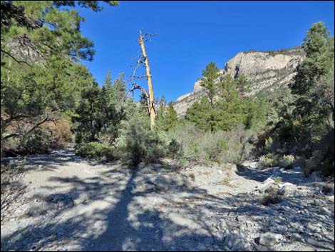
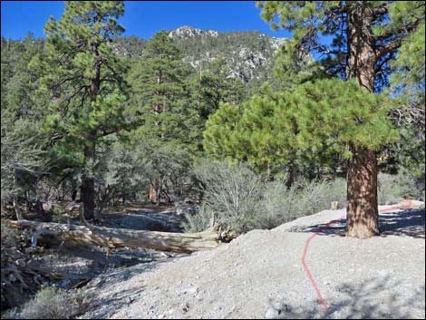
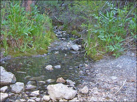
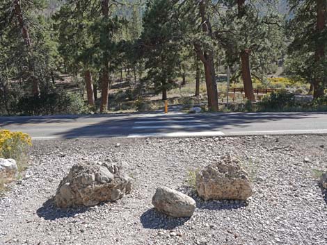
 Fletcher Canyon trailhead (view E from parking) |
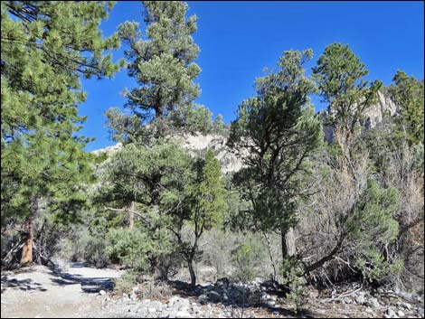
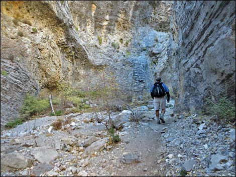
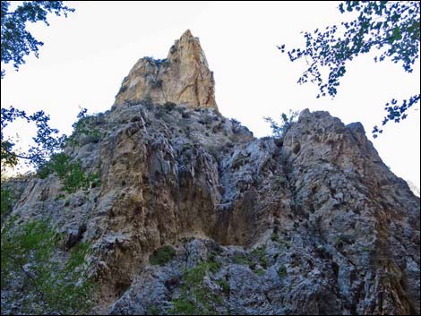
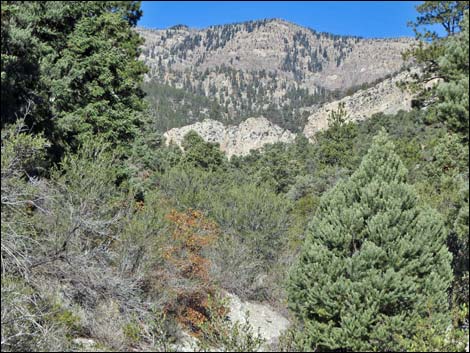
Overview This trail is a pleasant, 1.9-mile (one-way) hike on a trail in the Mt. Charleston Wilderness Area that generally runs at a moderate grade up a forested canyon to a spring, then runs steeply into a deep, narrow canyon with walls that are a few feet apart and about 200 feet high. The trail ends at a fork in the canyon where water has carved an interesting chute across the top of a boulder. Above the fork, water-polished boulders and pour-overs block both canyons, but both forks can be climbed to the mountain slopes above (the left fork is easier). The entire hike runs through a deep, heavily forested canyon that is surrounded by towering limestone cliffs. Water flows seasonally. Link to map or elevation profile. |
 Fletcher Canyon Trail passes the restroom (view E) |
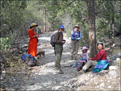
Watch Out Other than the standard warnings about hiking in the desert, ...stay out of the narrows if thunderstorms threaten to avoid potential flash floods. Many of the rocks in the bottom of the canyon are water-polished and quite slick, so watch your step (I almost took a header on one). If you want to drink the water, be sure to treat or filter it. Try to stay out of the stinging nettle that grows along the trail in moist areas. While hiking, please respect the land and the other people out there, and try to Leave No Trace of your passage. Also, this hike is moderately long, so bring what you need of the 10 Essentials. This trail runs into the Mt. Charleston Wilderness Area, so pay particular attention to respecting the land. |
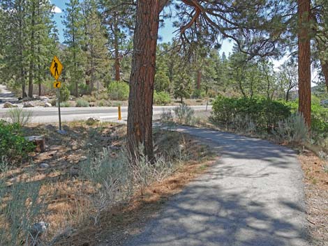
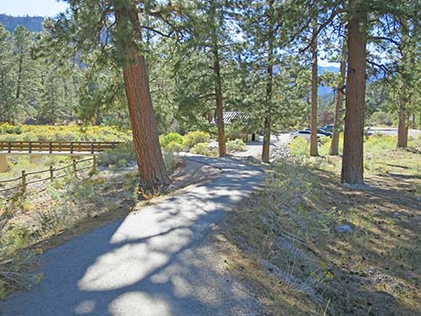
 Fletcher Canyon Trail merges onto paved Acastus Trail (view E) |
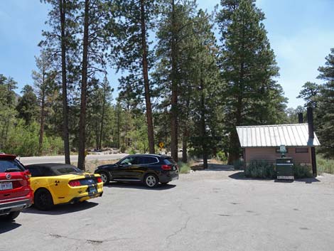
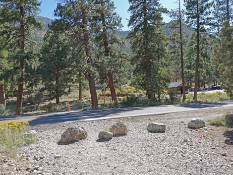
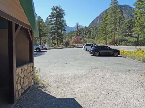
Getting to the Trailhead This hike is located in Kyle Canyon up in the Spring Mountains National Recreation Area, about 45 minutes northwest of Las Vegas. From town, drive out to the Spring Mountains Visitor Center, then continue up Kyle Canyon Road to the Fletcher Canyon Trailhead parking area on the left. |
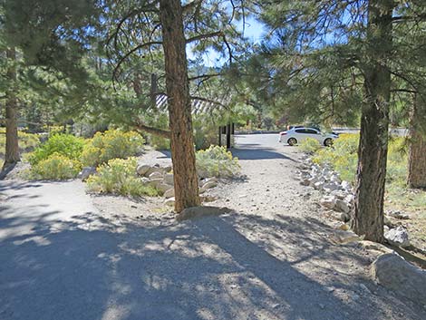
 Paved trail runs out to the Kyle Canyon Road (view NE) |
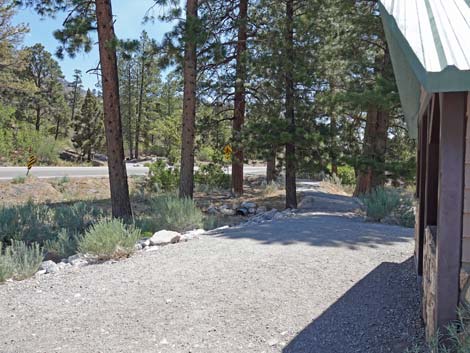
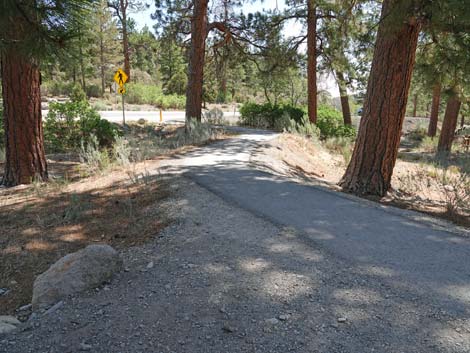
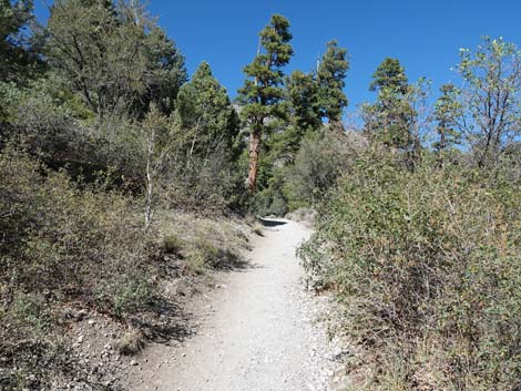
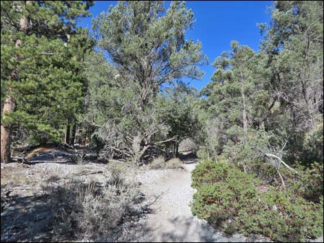
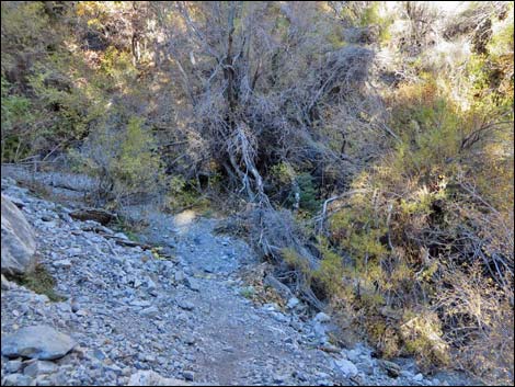
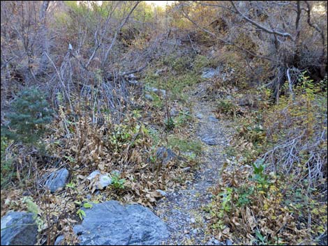
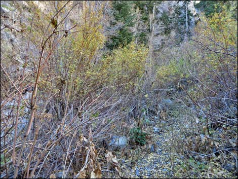
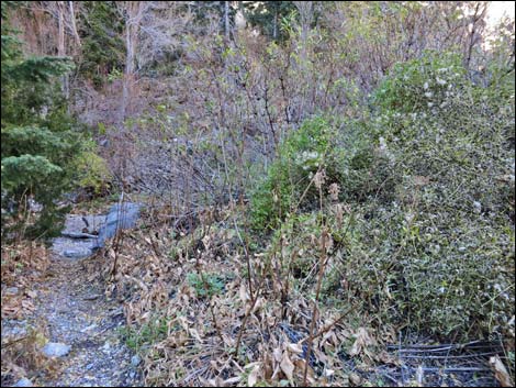
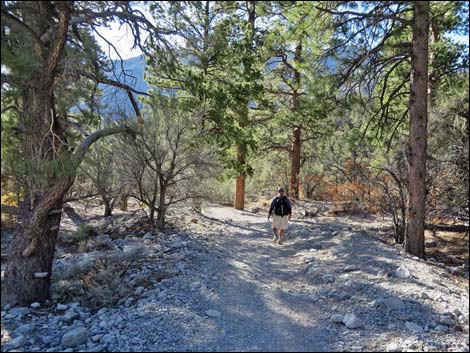
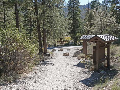
The Hike From the main Fletcher Canyon Trailhead parking area, the Fletcher Canyon Trail runs east past the toilets and out of the parking area. The trail stays left on a bit of the paved Acastus Trail, then quickly arrives at the edge of Kyle Canyon Road. Cross carefully to the other side where hikers will see a large Fletcher Canyon Trailhead sign (Table 1, Waypoint 01) and an information kiosk. The trail continues past the signs across the toe of a ridge that becomes south side of Fletcher Canyon. Initially, the trail runs through an open Ponderosa Pine forest with an understory of Ashy Silktassel and few other desert shrubs. About 0.14 miles out, the trail arrives at the edge of Fletcher Canyon Wash (Wpt. 02), turns west, and heads upstream along the south side of the wash, passing some interesting limestone conglomerate rocks near the turn. In this lower part of the canyon, the Ponderosa Pines give way to a mixed forest dominated by Singleleaf Pinyon with a dense understory of Mountain Mahogany, Pointleaf Manzanita, Ashy Silktassel, Gambel Oak, Big Sagebrush, and many other shrubs. |
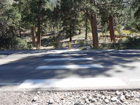
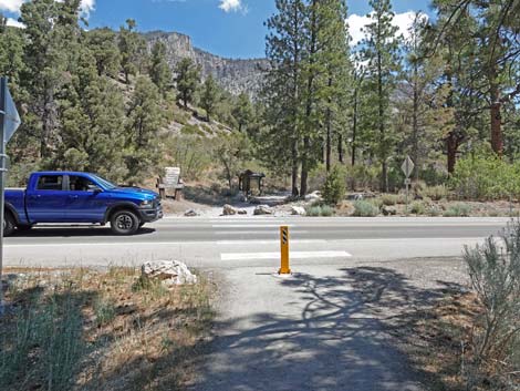 Use caution crossing Kyle Canyon Road (view N) |
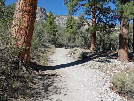
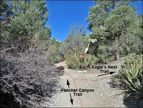
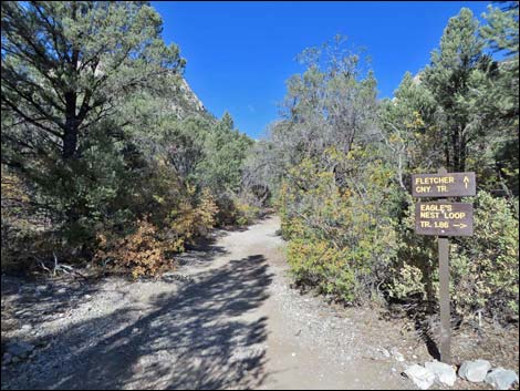
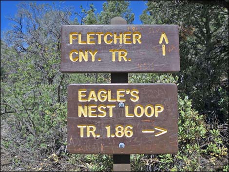
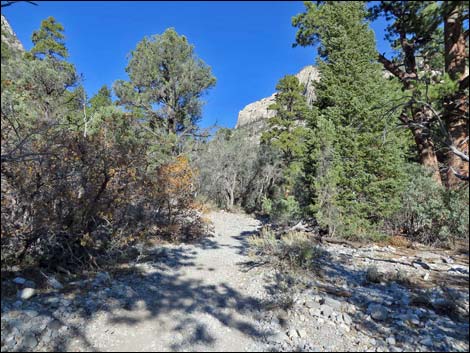
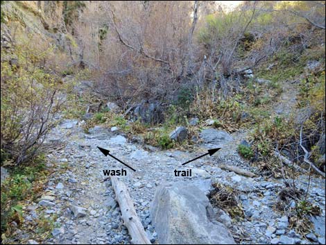
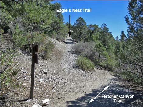
The trail runs along the south side of the wash, then crosses to the north side (Wpt. 03). At this point, hikers get a good view of the limestone cliffs high on the far side of the canyon. The end of the trail cuts through narrows in these cliffs, so from here hikers can get an idea of how far it is to the narrows. Through this part of the canyon, the understory stays dense, but the overstory changes from a Pinyon-Juniper Woodland to a Ponderosa Pine-White Fir forest mixed with Pinyon Pine. At about 0.37 miles out, the trail forks at a signed trail junction (Wpt. 04). The Eagle Nest Trail turns right, leaves the bottom of the wash, and steeply climbs the side of the canyon. The steep section seen here is the only steep part on the 2.75-mile loop trail. |
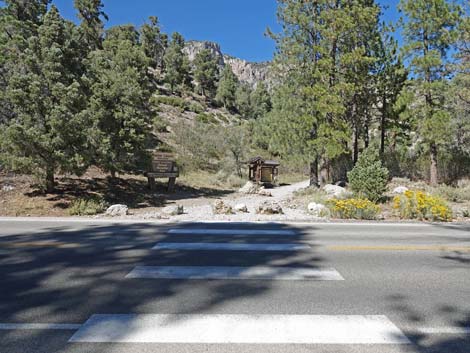 Fletcher Canyon Trail crosses Kyle Canyon Road (view N) |
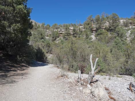
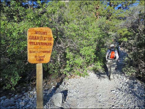
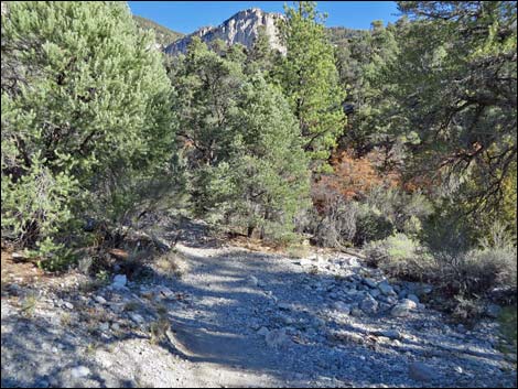
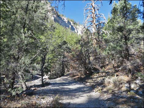
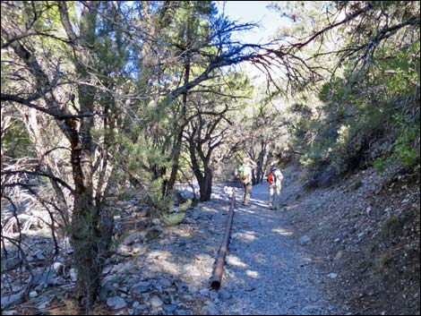
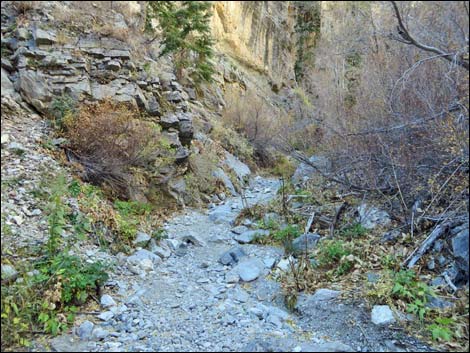
The Fletcher Canyon Trail continues northwest through the forest, and at about 0.59 miles out, crosses back to the south side of the wash (Wpt. 05). The trail then quickly passes a wooden sign (Wpt. 06) announcing entry into the Mt. Charleston Wilderness Area. At about 0.73 miles out, the trail crosses back onto the north side of the wash (Wpt. 07). The trail continues northwest at a moderate grade, and by 1.3 miles out, the limestone cliffs have narrowed noticeably, although it is not yet "narrows." Shortly, the canyon narrows a bit more and the trail crosses back to the south side of the wash (Wpt. 08). At this point, two metal pipes in the wash drip water from the seasonal spring that is a bit farther up the trail. |
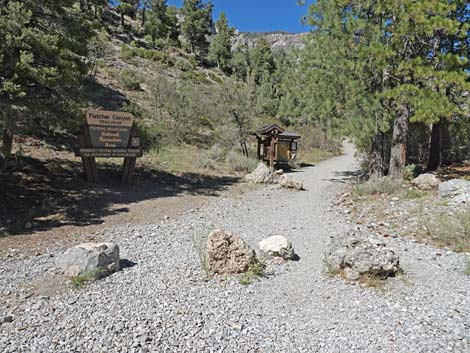 Dirt trail starts across the road (view N) |
From the twin pipes, the trail runs a few more yards along the stream to what appears to be a trail junction (Wpt. 09). Here, the stream flows down out of a thicket of shrub and trees. When the stream is dry, hikers can continue up the wash, otherwise, the main trail climbs steeply along the south wall of the canyon. In this area, the canyon has deep, moist soils with lots of vegetation, including Charleston Mountain Angelica (wild parsley), Blue Elderberry, Wax Current, Western Columbine, Stinging Nettle, and many other species. The area even smells like plants -- unusual for the desert. The spring attracts birds, so keep an eye out for Broad-tailed Hummingbirds, Canyon Wrens, Hermit Thrushes, Cassin's Finches, and other species here. |
 Fletcher Canyon Trailhead sign (view N) |
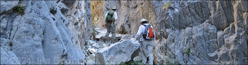
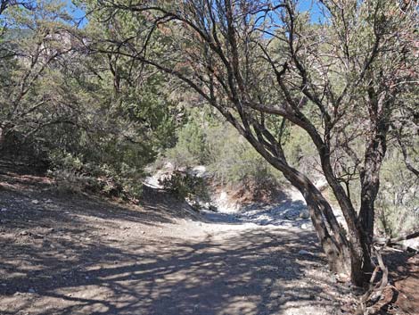
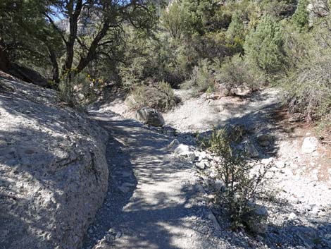
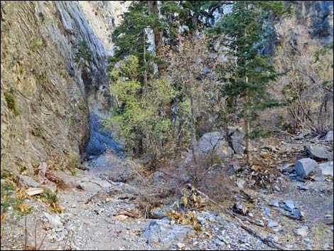
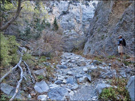
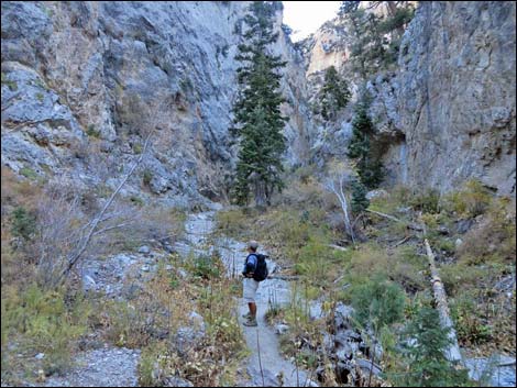
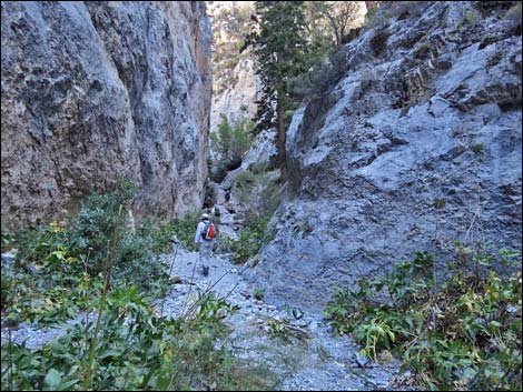
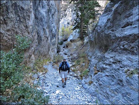
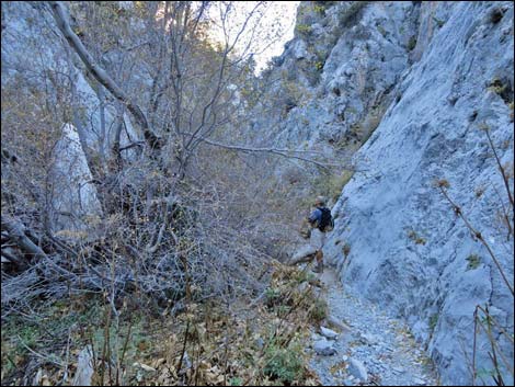
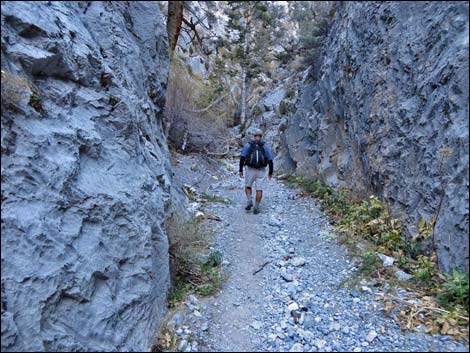
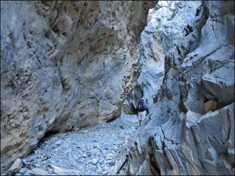
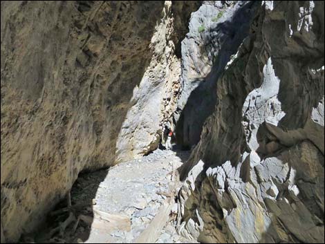
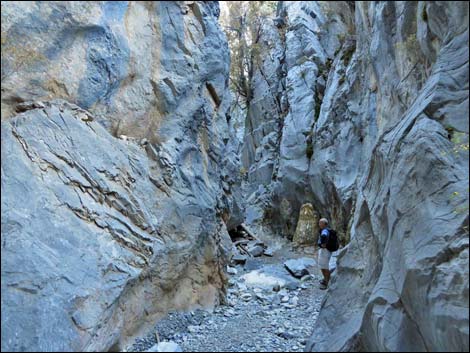
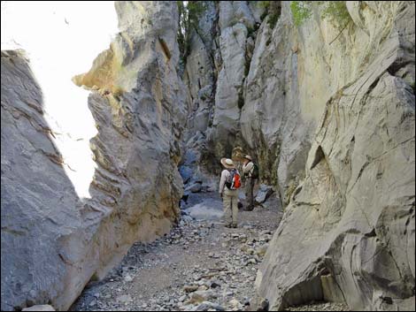
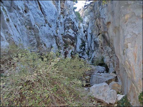
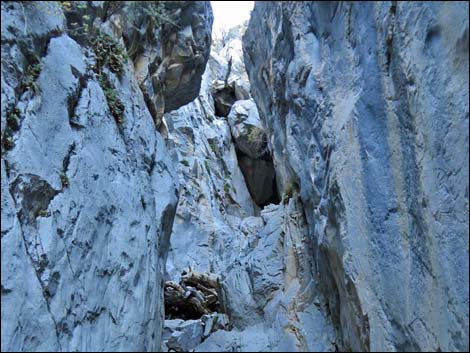
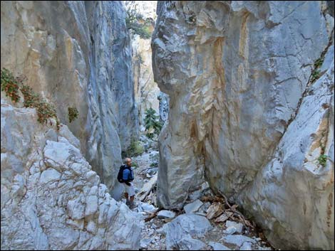
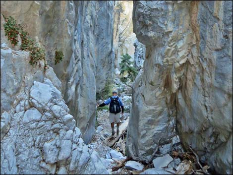
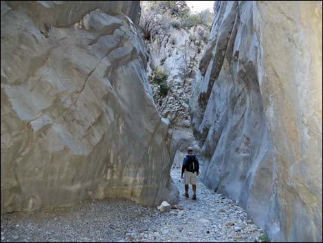
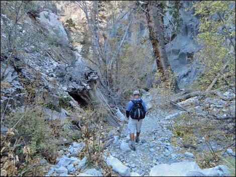
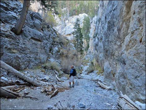
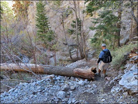
Continuing on the trail, the trail climbs quite steeply in three segments for much of the next 0.2 miles. Fortunately, the steep parts are interspersed by flat sections, plus the canyon is interesting so hikers can always stop and look at the rock walls (that is, take a short rest), so it isn't bad. At the top of the steep section, the trail drops into the wash at the entrance into the narrows, which is above the spring, so except during times of melting snow, water usually does not flow here. When dry, hikers can follow the wash here; otherwise, the trail crosses onto the far hillside to pass through an area of tall, dense vegetation (sometimes referred to as Hummingbird Hollow). Past the well-vegetated area, the canyon bends hard to the south, then bends equally hard back to the north, making a tight S-curve (Wpt. 11). Here, the walls of the canyon are quite narrow, and just above here, they close down to only a few feet wide. There may be a few boulders and logs to crawl over in this section, but they are easy to pass. Watch for Mt. Charleston Chipmunks scampering about the cliffs, a high-elevation species found only in the Spring Mountains. |
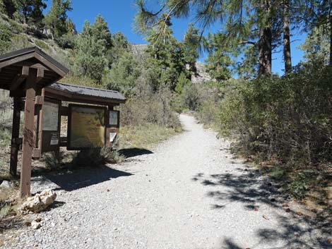 Approaching Fletcher Canyon trailhead information kiosk (view N) |
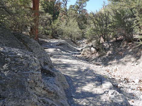
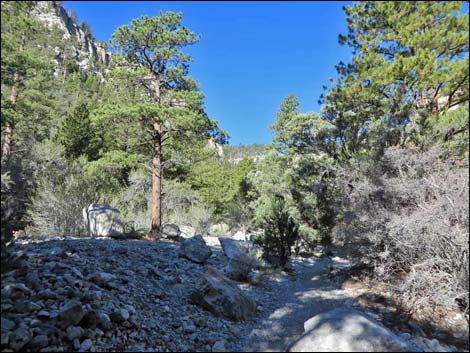
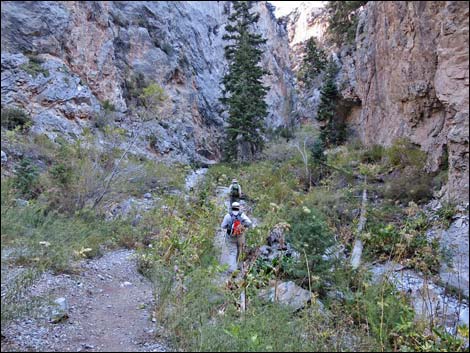
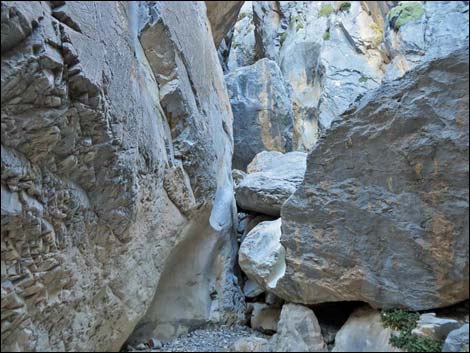
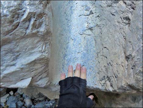
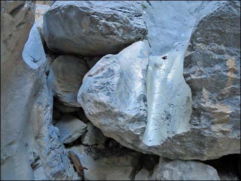
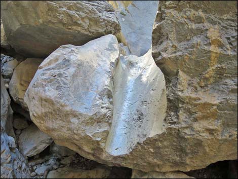
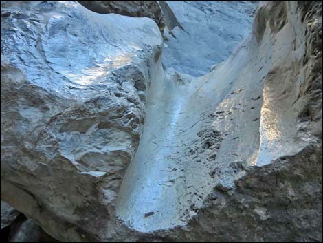
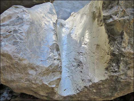
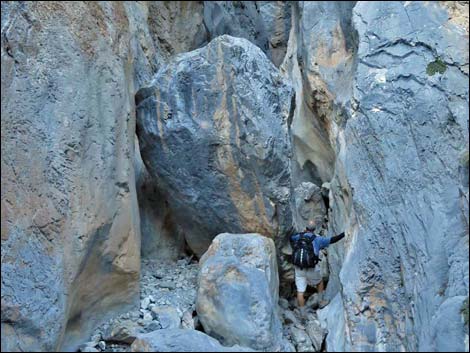
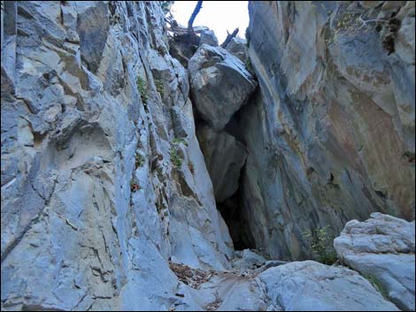
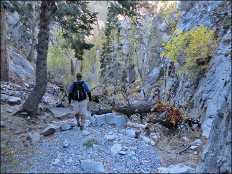
The upper canyon is forested with Ponderosa Pine and White Fir, a few Rocky Mountain Juniper, and Bristlecone Pine can be seen on the cliffs above the canyon. The understory includes Wild Rose, Wax Current, and other shrubs, plus more Western Columbine and Mat Rockspirea (a plant growing on the rock walls), but it is fairly open. After running up the narrow canyon for about 0.2 miles from the S-curve, a big boulder mostly blocks the canyon, and just above the boulder, the canyon forks (Wpt. 12). This point is about 1.9 miles out and the end of the official trail. This is also where a smooth water chute is carved in the top of a well-polished limestone boulder. |
 Fletcher Canyon Trailhead information kiosk (view N) |
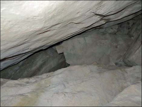
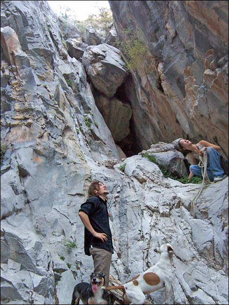
Continuing around the large boulder and scrambling up the canyon to the right (north), a pour-over capped by several boulders (Wpt. 13) blocks easy passage. This is probably what is referred to as Obstruction Rock. I crawled up under the rock and burrowed through a tunnel, but concluded that I would have to move a large rock that was blocking the exit hole. It also looks like the canyon wall could be climbed as moderate 5th class, but without a rope I didn't want to try it (at least not the unprotected downclimb). From the fork in the canyon, the left (west) fork can be passed by climbing over some 3rd-class water-polished boulders to get into a higher section of narrow canyon. These narrows quickly open into a wider canyon above the cliffs and a use-trail (Wpt. 14). I've not gone very far up the canyon, but it can be followed up to the North Loop Trail or to Fletcher Peak. After enjoying the cool of the canyon, return to the trailhead by retracing your footsteps back down the trail. |
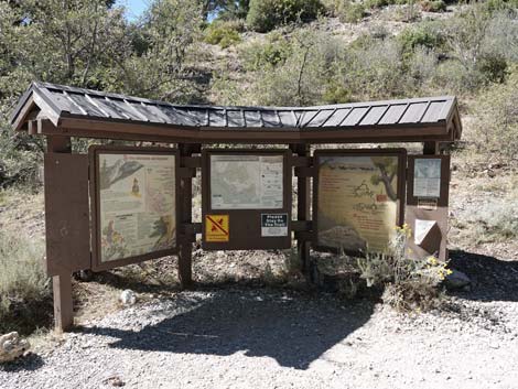
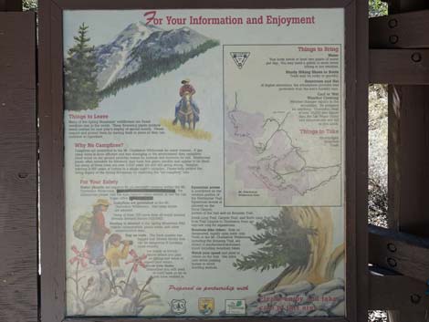 Left information kiosk panel (view W) |
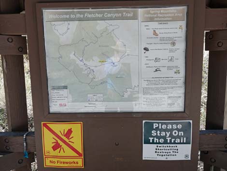 Middle information kiosk panel (view W) |
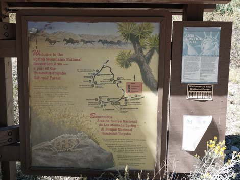 Left information kiosk panel (view W) |
 Trail starts heading north (view NNE) |
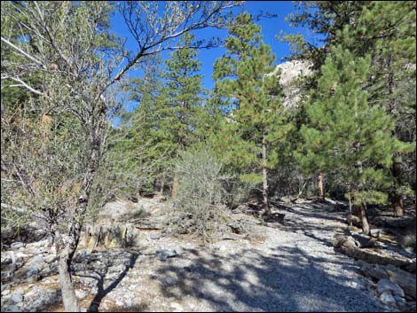
 Passing large ponderosa pine trees (view N) |
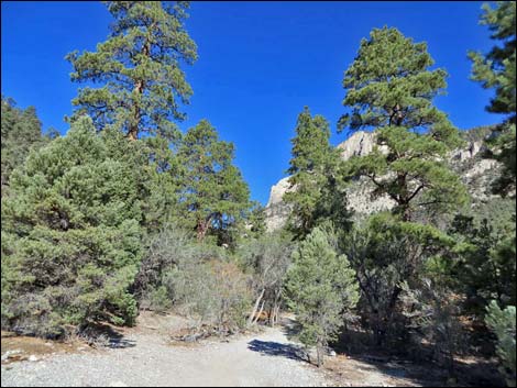
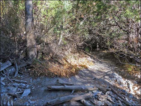
 Fletcher Canyon Trail begins to enter Fletcher Canyon (view N) |
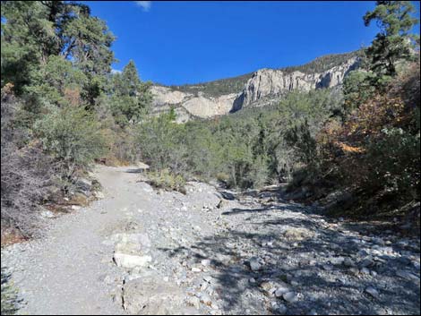
 Fletcher Canyon Trail arriving at Fletcher Wash (view N) |
 Fletcher Canyon Trail at first contact with Fletcher Wash (view N) |
 Fletcher Canyon Trail turns up along Fletcher Wash (view N) |
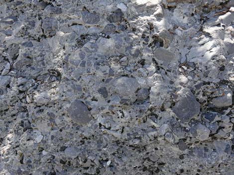 Conglomerate limestone at the edge of the wash (view SW) |
 Trail runs on south side of wash (view NW) |
 Trail crosses to north side of wash (view NW) |
 |
 |
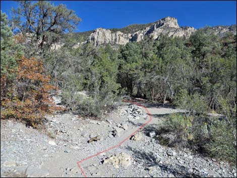
 Fletcher Canyon -- Eagle's Nest trail junction (view NW) |
 Fletcher Canyon -- Eagle's Nest trail junction (view NW) |
 Fletcher Canyon -- Eagle's Nest trail sign (view NW) |
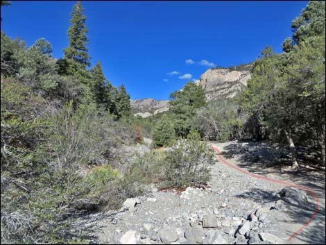
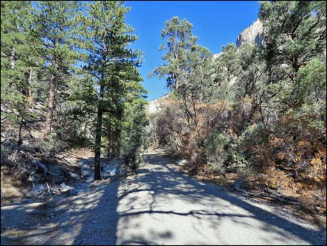
 Fletcher Canyon Trail continues up canyon bottom (view NW) |
 Trail crosses to south side of wash (view NW) |
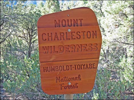
 Wilderness boundary sign (view NW) |
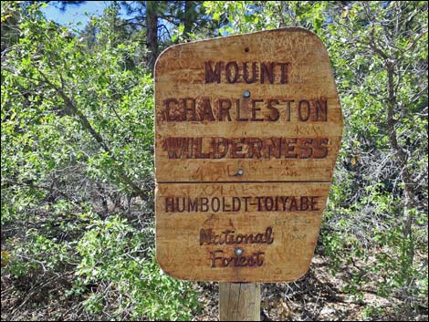
 Wilderness boundary sign when new (view SW; August 2009) |
 Wilderness boundary sign vandalized (view SW; September 2015) |
 |
 |
 |
 |
 |
 |
 |
 |
 |
 |
 Historic water pipe on trail (view NW) |
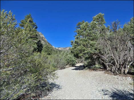
 Trail continues up canyon north of wash (view NW) |
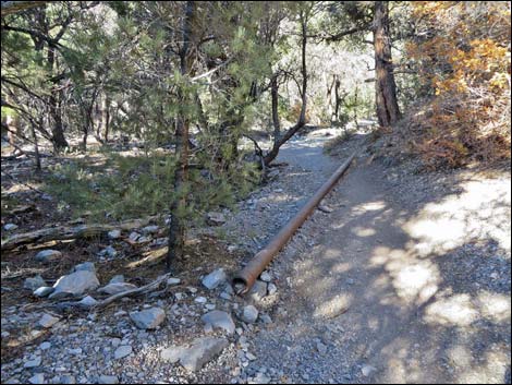 Historic water pipe across trail (view NW) |
 Trail continues up canyon (view NW) |
 Trail continues up canyon (view NW) |
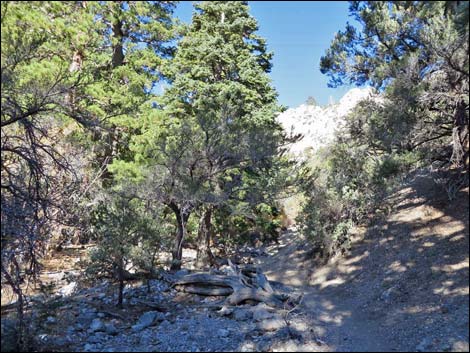
 Approaching wash crossing (view W) |
 Water across trail below Fletcher Spring (view W) |
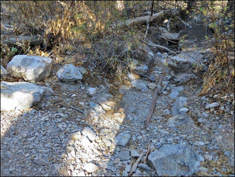 Wash crossing: dry in the fall; but pipe often drips (view NW) |
 Spur trail into thicket (view N) |
 Birder along short spur trail in the thicket (view NW) |
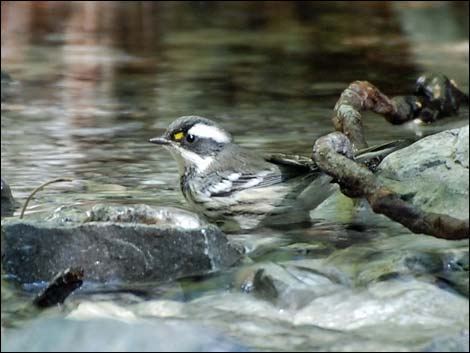 Black-throated Gray Warbler bathing in the spring |
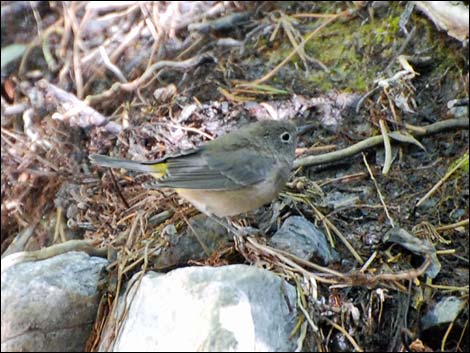 Virginia's Warblers at the spring |
 Apparent spur trail right is not a better way to go (view NW) |
 Trail abruptly begins to climb steeply (view W) |
 Trail drops back into wash (view W) |
 Hikers can follow wash when dry or use-trail (view W) |
 When dry, it is easier to walk up the wash (view SW) |
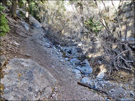
 When the wash is flowing, it is easier to walk up trail (view SW) |
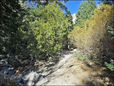
 Trail through "the meadow" (view SW) |
 Trail in "the meadow" returning to wash (view SW) |
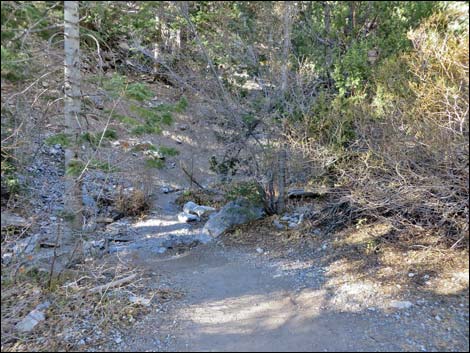
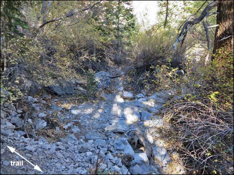
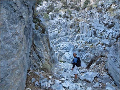
 Trail continues up wash into the narrows (view SW) |
 Hiker at the bend in the narrows (view W) |
 Tower above the bend in the narrows (view W) |
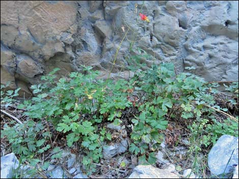
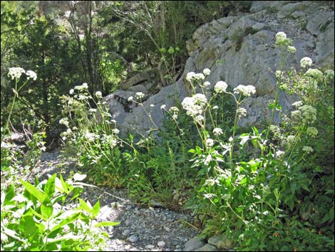 Charleston Mountain Angelica along the wash |
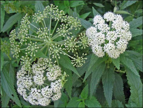 Charleston Mountain Angelica leaves and flowers |
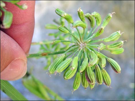 Charleston Mountain Angelica fruits |
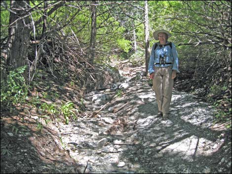
 Trail continues up the wash (view NW) |
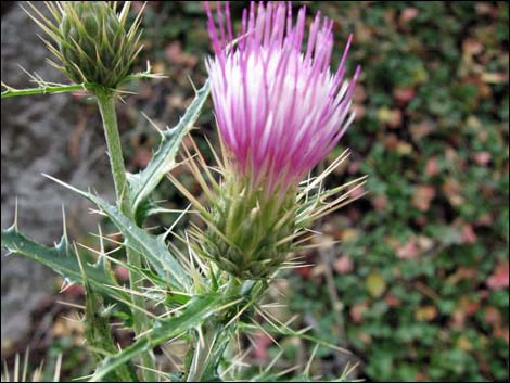 Arizona Thistle |
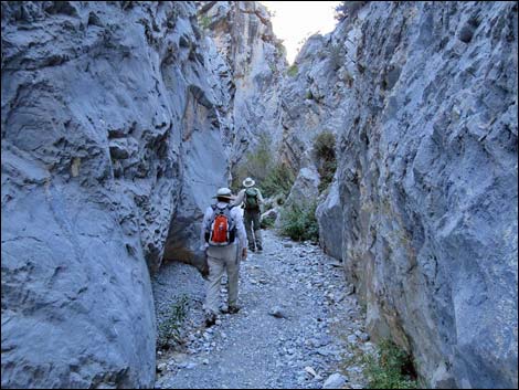
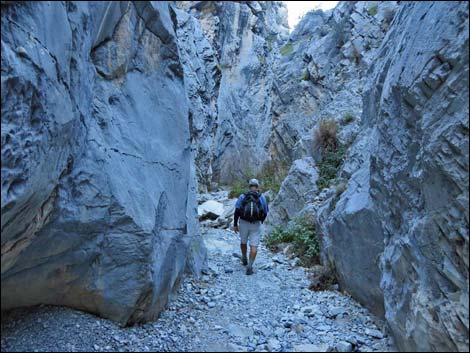
 Hikers in the wide spot in the narrows (view NE; late summer) |
 Hikers in the wide spot in the narrows (view NE; fall) |
 Hikers entering the second narrows (view NE) |
 Hiker entering the second narrows (view NE) |
 |
 |
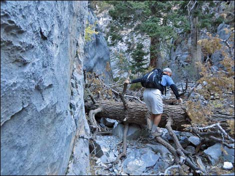 Hiker climbing over fallen tree (view N) |
 Western Columbine along the wash |
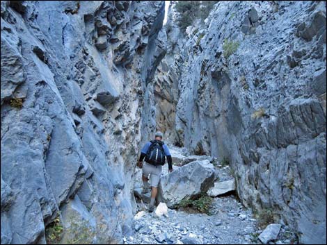
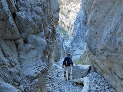
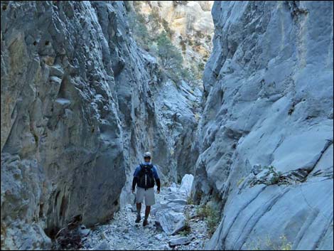
 Hikers in the second narrows (view NW) |
 Hiker in the second narrows (view NW) |
 |
 |
 Hiker in the second narrows (view NW; fall lighting) |
 Hikers in the second narrows (view NW; summer lighting) |
 Hiker in the second narrows (view NW; fall lighting) |
 Hiker in the second narrows (view NW; summer lighting) |
 Hiker in the second narrows (view NW; fall lighting) |
 Hiker in the second narrows (view NW; summer lighting) |
 Hiker in the second narrows (view NW; fall lighting) |
 Hikers in the second narrows (view NW; summer lighting) |
 The rock chute (view NE; winter color) |
 The rock chute (view NE; winter color) |
 The rock chute (view NE; winter color) |
 The rock chute (view NE; summer color) |
 The rock chute (view NE; winter color) |
 The rock chute (view NE; summer color) |
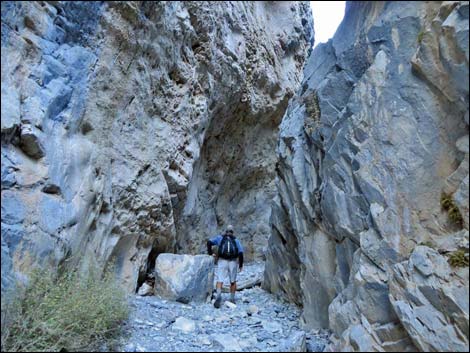
 Hiker beginning to exit narrows via side canyon (view W) |
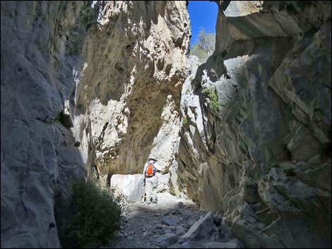
 Narrows continue steeply towards "the obstruction (view N) |
 Below "the obstruction (view N) |
 Under "the obstruction (view N) |
 "The obstruction (view straight up) |
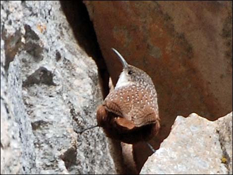 Canyon Wren up in the rocks |
 Hikers below the obstacle (view N) |
 On belay climbing the western fork (view W) |
The Descent
 |
 |
 |
 |
 |
 |
 Hiker descending narrows (view SE) |
 Odd plants grow on rock walls: Jaeger's Mousetail, Rosaceae |
 |
 |
 |
 |
 View out across Kyle Canyon (view SE) |
 Fletcher Canyon -- Eagle's Nest trail junction (view NW) |
 Returning to the trailhead kiosk information signs (view S) |
 Trailhead parking is visible across Kyle Canyon Road (view SW) |
 Fletcher Canyon Trail approaching Kyle Canyon Road (view S) |
 Fletcher Canyon Trail crosses Kyle Canyon Road (view S) |
 Fletcher Canyon Trail continues across Kyle Canyon Road (view SW) |
 Trail forks; Fletcher Canyon Trail stays right (view S) |
 Fletcher Canyon Trail returning to Fletcher Canyon Trailhead (view SW) |
 More to come ... |
Table 1. Hiking Coordinates Based on GPS Data (NAD27; UTM Zone 11S). Download Hiking GPS Waypoints (*.gpx) file.
| Wpt. | Location | UTM Easting | UTM Northing | Elevation (ft) | Point-to-Point Distance (mi) | Cumulative Distance (mi) | Verified |
|---|---|---|---|---|---|---|---|
| 01 | Trailhead | 624786 | 4013869 | 6,947 | 0.00 | 0.00 | GPS |
| 02 | Fletcher Canyon Wash | 624837 | 4014054 | 7,009 | 0.14 | 0.14 | GPS |
| 03 | Wash Crossing | 624764 | 4014142 | 7,053 | 0.08 | 0.22 | GPS |
| 04 | Trail Junction | 624609 | 4014302 | 7,062 | 0.15 | 0.37 | GPS |
| 05 | Wash Crossing | 624294 | 4014361 | 7,203 | 0.22 | 0.59 | GPS |
| 06 | Wilderness Boundary | 624275 | 4014364 | 7,210 | 0.02 | 0.61 | GPS |
| 07 | Wash Crossing | 624159 | 4014496 | 7,263 | 0.12 | 0.73 | GPS |
| 08 | Metal Pipes | 623326 | 4014991 | 7,503 | 0.67 | 1.40 | GPS |
| 09 | Spring | 623293 | 4015005 | 7,556 | 0.03 | 1.43 | GPS |
| 10 | Hummingbird Hollow | 623174 | 4015007 | 7,617 | 0.08 | 1.51 | GPS |
| 11 | S-Curve | 623034 | 4014960 | 7,645 | 0.10 | 1.61 | GPS |
| 12 | Canyon Forks | 622924 | 4015247 | 7,690 | 0.24 | 1.85 | GPS |
| 13 | Pour-Over | 622929 | 4015286 | 7,774 | 0.01 | 1.86 | GPS |
| 14 | Canyon above Cliffs | 622813 | 4015293 | 7,857 | . | . | GPS |
| 01 | Trailhead | 624786 | 4013869 | 6,947 | 1.86 | 3.72 | GPS |
Happy Hiking! All distances, elevations, and other facts are approximate.
![]() ; Last updated 240729
; Last updated 240729
| Hiking Around Mt Charleston | Hiking Around Las Vegas | Glossary | Copyright, Conditions, Disclaimer | Home |