Hiking Around Las Vegas, Mojave National Preserve
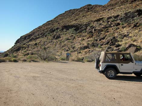
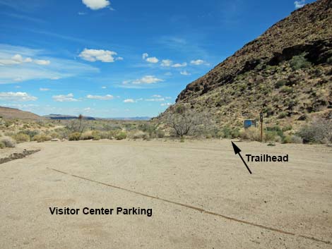 HITW Visitor Center Trailhead at Visitor Center parking (view SE) |
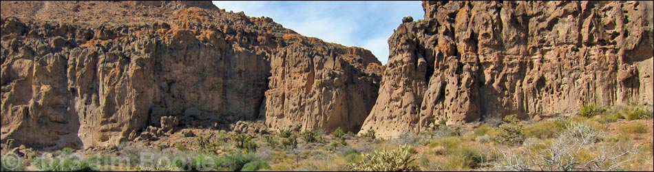
Overview The Hole-in-the-Wall Visitor Center Trailhead is located in the back of the Hole-in-the-Wall Visitor Center parking lot, which is located against volcanic cliffs in the southeast part of Mojave National Preserve. This trailhead is within walking distance of the Hole-in-the-Wall Campground. Hole-in-the-Wall Visitor Center Trailhead provides access to several trails, including Banshee Peak, Rings Trail (aka: Banshee Canyon, Ringbolts Trail), Rings Loop Trail, and the Nature Trail. Link to trailhead map. |
 Rings Loop Trail at HITW Visitor Center Trailhead (view SE) |
Getting to the Trailhead This hike is located in Mojave National Preserve, about 2 hours south of Las Vegas. From town, drive out to the Hole-in-the-Wall Visitor Center, which is about 85 miles from town. Pull into the Visitor Center parking lot and park as far from the Visitor Center at possible (Table 1, Site 1943). Park here; this is the trailhead. |
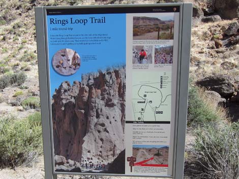 Information sign at Rings Loop Trail |
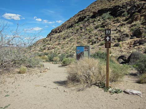
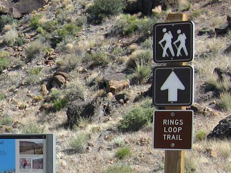 Direction sign for Rings Loop Trail |
 Returning to the trailhead (view SE) |
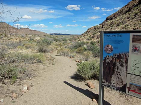 Starting down Rings Loop Trail |
 Departing the Visitor Center on the Picnic Area Road (view W) |
 More to come ... |
Table 1. Highway Coordinates (NAD27; UTM Zone 11S). Download Highway GPS Waypoints (*.gpx) file.
| Site | Location | Latitude (°N) | Longitude (°W) | UTM Easting | UTM Northing | Elevation (feet) | Verified |
|---|---|---|---|---|---|---|---|
| 1943 | Hole-in-the-Wall Visitor Center | 35.04206 | 115.39417 | 646470 | 3878689 | 4,245 | Yes |
Happy Hiking! All distances, elevations, and other facts are approximate.
![]() ; Last updated 240329
; Last updated 240329
| Hiking Around Mojave Preserve | Hiking Around Las Vegas | Glossary | Copyright, Conditions, Disclaimer | Home |