Hiking Around Las Vegas, Death Valley National Park, Death Valley Wilderness Area
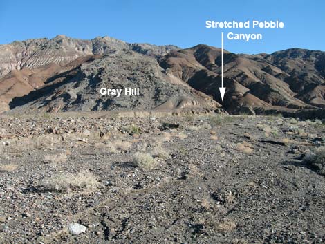 Canyon mouth adjacent to gray hill (view SE) |
Overview The hike into lower Stretched Pebble Canyon is a pleasant and geologically interesting, 3-mile round-trip hike in the Death Valley Wilderness Area. The route runs cross-country up the gently sloping bajada, with great views off into northern Death Valley and towards the Cottonwood Mountains all along the way, to the mouth of the canyon. The canyon is narrow from the mouth and stays narrow. From the mouth of the canyon up to whichever obstruction blocks your progress, the walls of the canyon are a wonderful study in sedimentary and metamorphic rocks. The "stretched pebbles," a structural geology term, are rocks and boulders that were squashed flat under the forces of heat and pressure, but not really changed. Stretched pebbles line the canyon walls everywhere, and they even provide footholds and handholds when climbing some of the easier pour-overs. Link to topographic map or elevation profile. |
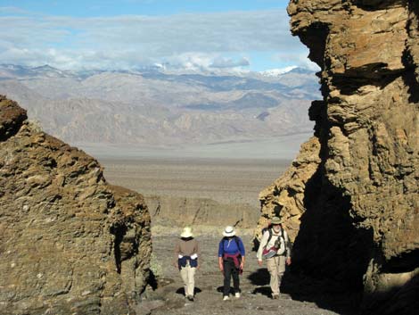
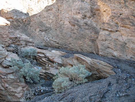
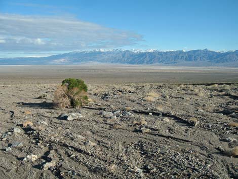 Looking back: grand view from the bajada (view N) |
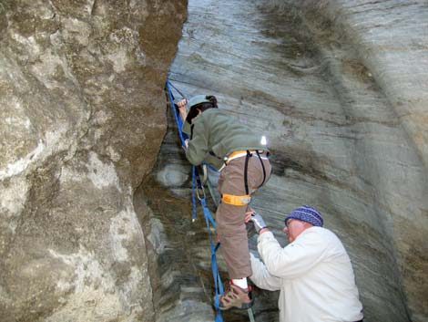
Watch Out Other than the standard warnings about hiking in the desert, ... hiking into the lower canyon is quite safe. Passing the first major obstruction and getting into the upper canyon requires good rock-climbing skills and a willingness to risk one's life on poor and crumbling rock. Climbing ropes are helpful in some spots, but not always. While hiking, please respect the land and the other people out there, and try to Leave No Trace of your passage. Also, this hike is in a wild and remote area, so be sure to bring the 10 Essentials. |
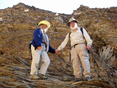
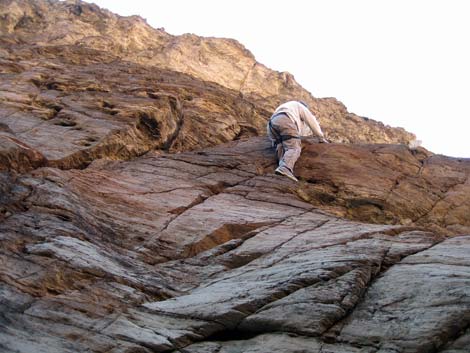
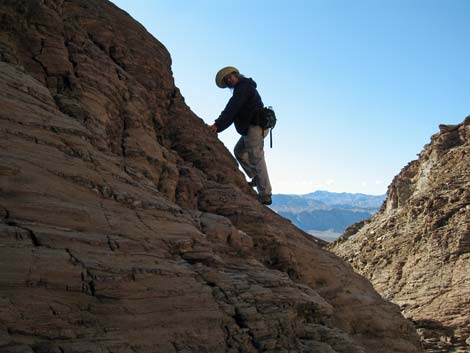
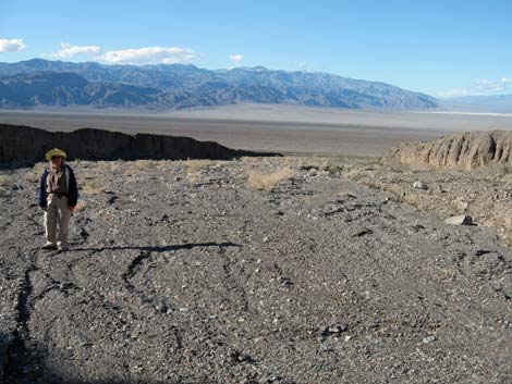 Looking back: hiker near top of bajada (view NW) |
Getting to the Trailhead This hike is located in Death Valley National Park, about 2-1/2 hours northwest of Las Vegas. From town, drive out to Death Valley. From the Furnace Creek Visitor Center (Table 1, Site 712), drive north and west on Highway 190 to Stovepipe Wells. From the Stovepipe Wells General Store, continue west for 3.3 miles and park on the side of the road (Site 984). Park here; this is the trailhead. |
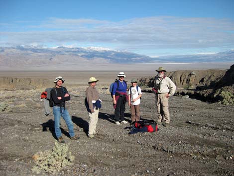 Looking back: hikers resting at top of bajada (view N) |
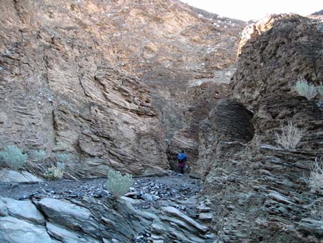
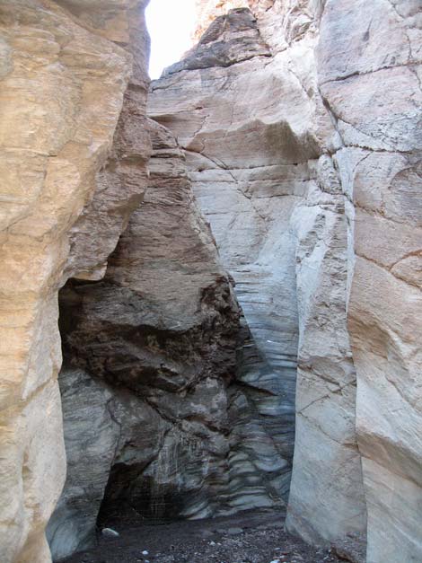
The Hike From the trailhead (Table 2, Waypoint 1), the route runs southeast towards the base of Tucki Mountain where an oddly-gray, pyramid-shaped hill lies against the brown mountain. Stretched Pebble Canyon is on the south (right) edge of this gray hill. Hiking up the bajada, one is inclined to wander too far to the south because the washes trend that way, but aim for the gray hill and get into a wash with a high south wall (Wpt. 2). The bajada is sparsely vegetated with creosote bush, some desert holly, and little else. One out-of-place pygmy cedar seems to be growing quite happily. In the canyon, the walls are so narrow and the flash floods so vigorous, that little but a few rock nettle and desert holly shrubs grow up there. |
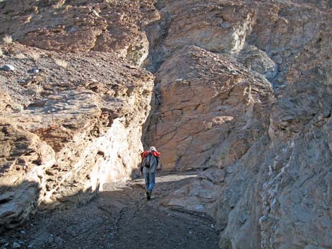
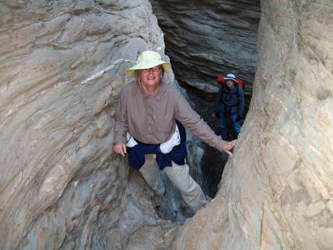
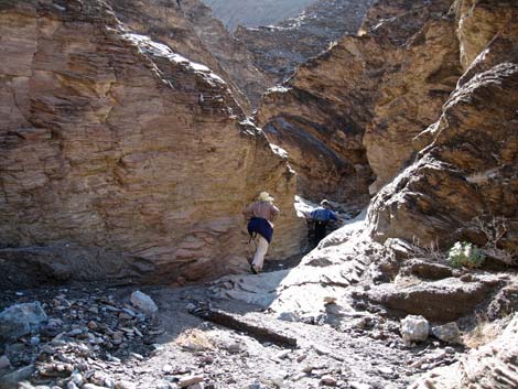
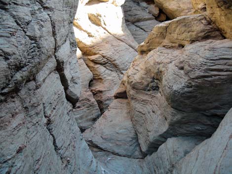
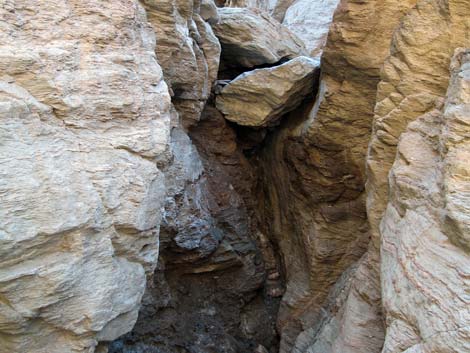
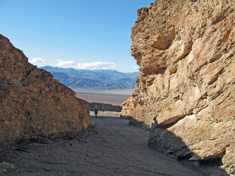
 Entrance to Stretched Pebble Canyon (view E) |
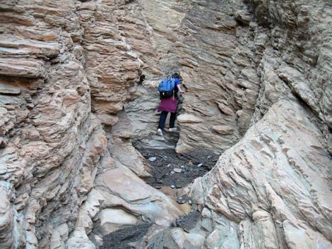
Continuing up the wash, the route runs into a slot in the side of the mountain at the top of the bajada (Wpt. 3). From there, the route is obvious as the canyon is narrow, and it is nearly impossible to escape the bottom of the canyon. That said, it isn't long before one encounters the first major obstruction: a large chockstone at the top of a pour-over (Wpt. 4). The geology is quite interesting, if a bit uncertain. It appears that during the late Precambrian (some half-billion years ago and before life really got started on earth), this area was a shallow, tropical sea, and limestone formed in the shallow waters. The climate cooled, however, and glaciers scoured some ancient mountains and pushed their moraine out into the sea, covering the limestone. Things warmed, and the seas came back, and more limestone covered the moraine. During the Jurassic, the age of dinosaurs, volcanoes were active in this area, and the heat and pressure of magma partially metamorphosed the limestone and glacial moraines. |
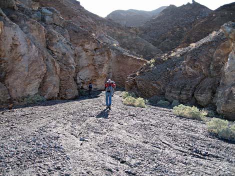 Hiker entering Stretched Pebble Canyon (view E) |
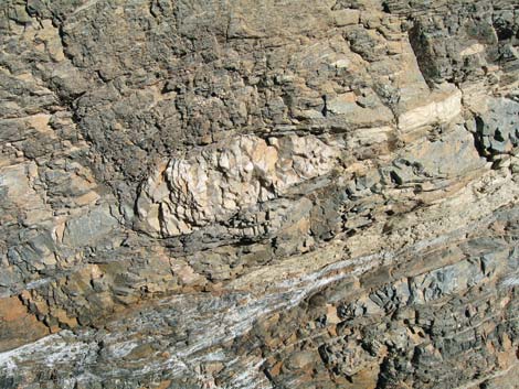
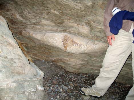
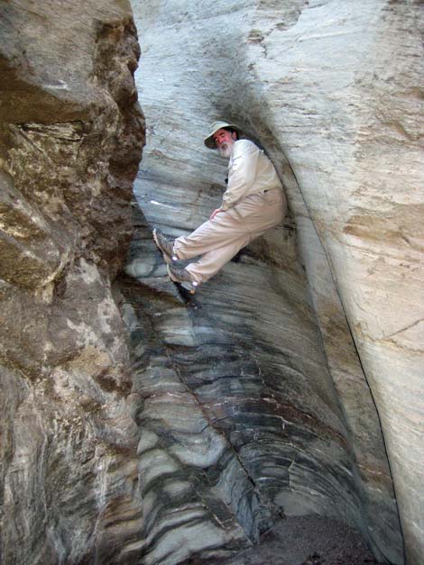
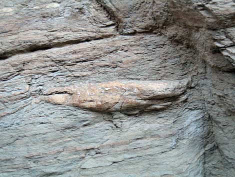
Later, faulting lifted the mountains and erosion cut the canyons, exposing what we see today: loose and shaley dolomite adjacent to highly compressed conglomerate rocks. Large boulders and smaller rocks in the glacial moraines were squashed into pancakes, resulting in what are called "stretched pebbles," although "squashed pebble" might be more appropriate here. Exposed along the water-polished canyon walls, they look like stretched rocks, but they are actually 3-dimensional, pancake shaped rocks. Enjoy the narrow canyon, scramble up the easier pour-overs, and marvel at the geology exposed here. When you get to a pour-over you don't want to climb, head back down to the trailhead knowing that you didn't miss much of importance higher up. [Note: reviewing this description some years later, there is confusion about the order of photos at the end of our hike regarding the 3rd and 4th difficult pour-overs.] |
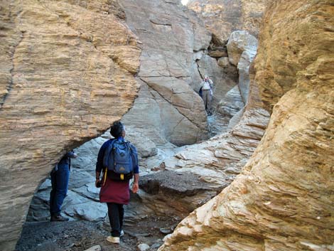
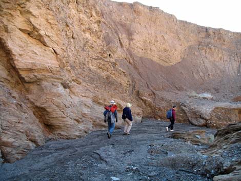
 Looking back at hikers passing entrance to Stretched Pebble Canyon |
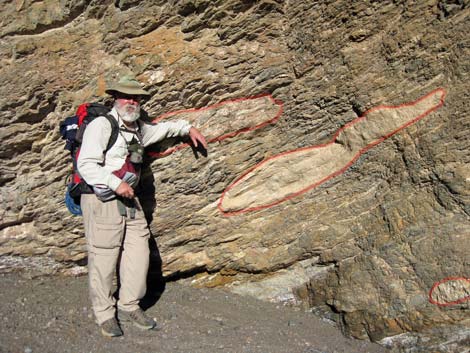 Leaning on one stretched pebble (red outline) among several |
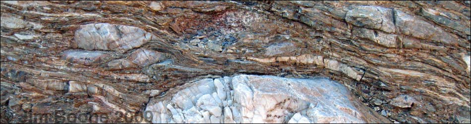
 Stretched pebbles in the canyon wall |
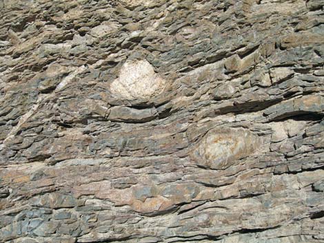 Stretched pebbles in the canyon wall |
 Stretched pebbles in the canyon wall |
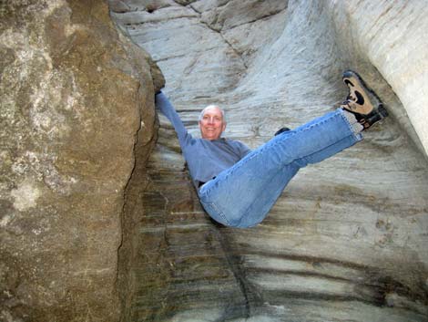
 Hiker in the canyon |
 |
 |
 Stretched pebbles line the walls lower in the canyon |
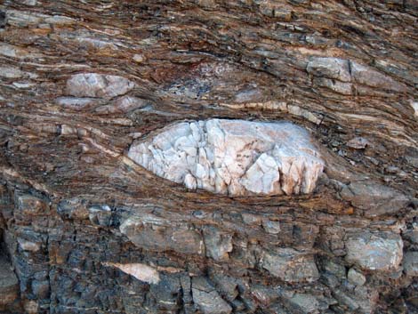
 Big stretched pebble in the canyon wall |
 |
 |
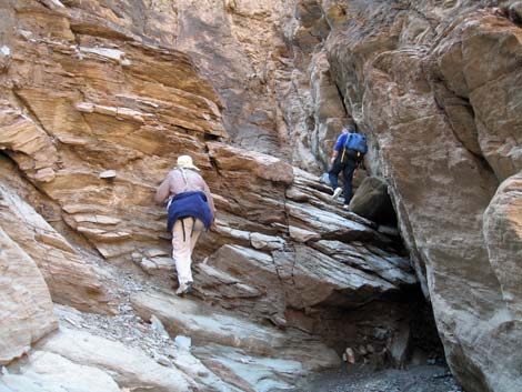
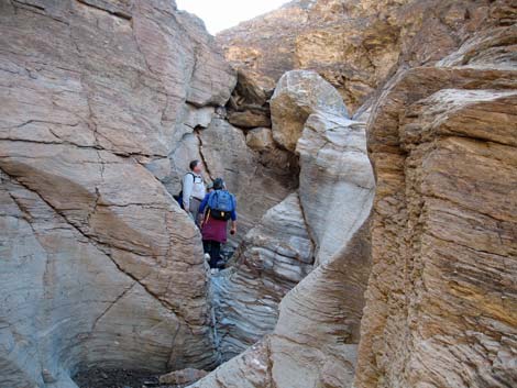 First difficult pour-over |
 Passing 1st pour-over -- not for the faint of heart! |
 |
 |
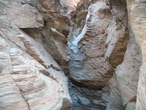
 Hikers scrambling up the canyon |
 Second difficult pour-over |
 Second difficult pour-over |
 Second difficult pour-over |
 |
 |
 Second difficult pour-over: we had some fun here |
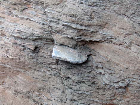 Nicely exposed stretched pebble |
 Hiker in the canyon |
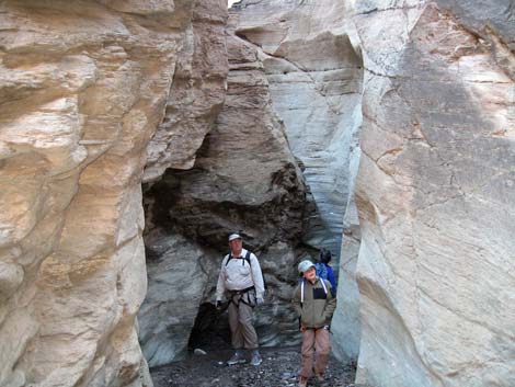
 3rd difficult pour-over |
 Passing the 3rd pour-over wasn't worth the risk |
 An even more difficult pour-over |
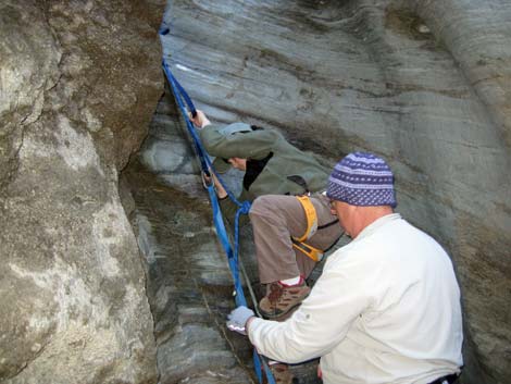
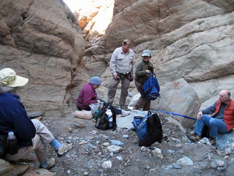 Crew readying for the descent |
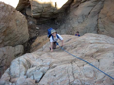
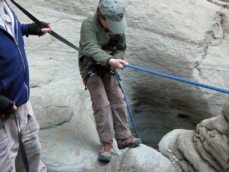 Young Ben on rappel |
 Stretched pebbles make good footholds |
 Hiker downclimbing |
 Hikers descending the wash |
 Hikers exiting Stretched Pebble Canyon onto the bajada |
Table 1. Highway Coordinates Based on GPS Data (NAD27; UTM Zone 11S). Download Highway GPS Waypoints (*.gpx) file.
| Site # | Location | Latitude (N) | Longitude (W) | Easting | Northing | Elevation (ft) | Verified |
|---|---|---|---|---|---|---|---|
| 0712 | Furnace Creek Visitor Center | 36.46159 | 116.86574 | 512030 | 4034954 | -186 | Yes |
| 0751 | Hwy 190 at Stovepipe Wells | 36.60654 | 117.14594 | 486948 | 4051034 | 0 | Yes |
| 0984 | Stretched Pebble Parking | 36.57240 | 117.18822 | 483159 | 4047254 | 451 | GPS |
Table 2. Hiking Coordinates Based on GPS Data (NAD27; UTM Zone 11S). Download Hiking GPS Waypoints (*.gpx) file.
| Wpt | Location | Easting | Northing | Elevation | Point-to-Point Distance (mi) | Cumulative Distance (mi) | Verified |
|---|---|---|---|---|---|---|---|
| 01 | Trailhead | 483159 | 4047254 | 451 | 0.00 | 0.00 | GPS |
| 02 | Wash | 484002 | 4046225 | 758 | 0.87 | 0.87 | GPS |
| 03 | Mouth of Canyon | 484254 | 4045866 | 889 | 0.28 | 1.15 | GPS |
| 04 | Obstruction | 484434 | 4045730 | 1,054 | 0.18 | 1.33 | GPS |
| 05 | Obstruction | 484557 | 4045652 | 1,152 | 0.12 | 1.45 | GPS |
| 01 | Trailhead | 483159 | 4047254 | 451 | 1.45 | 2.90 | GPS |
Happy Hiking! All distances, elevations, and other facts are approximate.
![]() ; Last updated 240324
; Last updated 240324
| Death Valley | Hiking Around Las Vegas | Glossary | Copyright, Conditions, Disclaimer | Home |