Hiking Around Las Vegas, Death Valley National Park
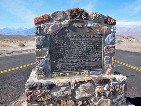 Monument on Highway 190 at turn off (view W) |
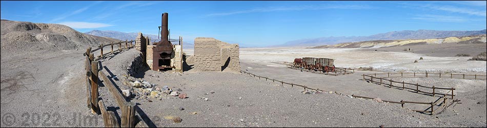
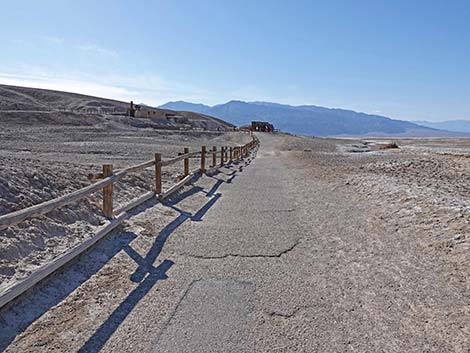
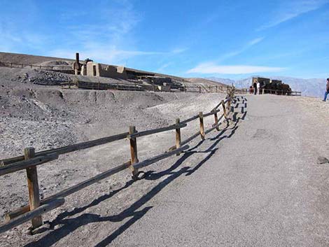
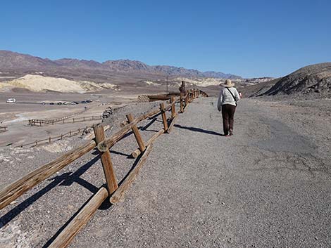
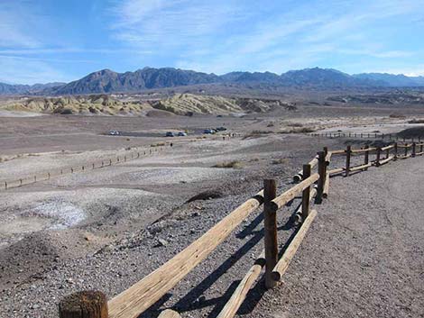
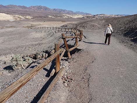
Overview The Harmony Borax Works Trail is a pleasant 0.4-mile loop that runs on pavement through the historic Harmony Borax Works area. Exhibits along the trail include a 20 Mule Team Borax wagon-train and the ruins of the old cottonball borate ore-boiling facility. Signs provide information about the site, the source of the ore out on the salt flats, and the men who worked and suffered here. Across the flats, a site with adobe ruins provide more information about life in the area. Although the trail is paved, parts are too steep to be considered fully accessible, although getting to the 20 Mule Team Borax wagon-train exhibit should be possible for most people. Link to map. |
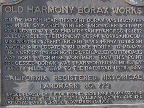 Text on monument |
Watch Out Other than the standard warnings about hiking in the desert, ...this is an entirely safe trail, but don't trip and fall off the pavement. While hiking, please respect the land and the other people out there, and try to Leave No Trace of your passage. This hike is short, so if you stay on the trail, you don't really need to bring the 10 Essentials. Be sure to stay on the trail and off of the exhibits. |
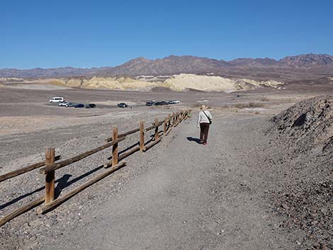
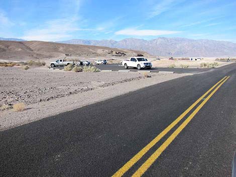 Harmony Borax Road approaching parking area (view W) |
Getting to the Trailhead This hike is located in Death Valley National Park, about 3.5 hours northwest of Las Vegas. From town, drive out to Death Valley. From the Furnace Creek Visitor Center (Table 1, Site 0712), drive north on Highway 190 for about 1.3 miles to Harmony Borax Road (Site 0534). Watch for signs to the Borax Works. Turn left (west) onto the paved Harmony Borax Road and drive out for about 0.2 miles to the parking lot access road (Site 0535) on the left. Turn left into the Harmony Borax Parking area (Site 1012). Park here; this is the trailhead. |
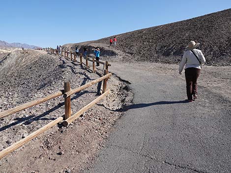
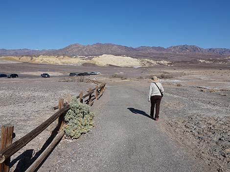
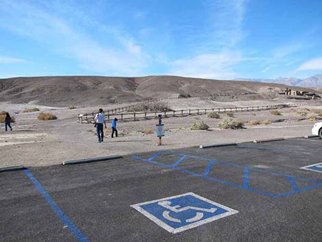 Trailhead parking area and start of the trail (view SW) |
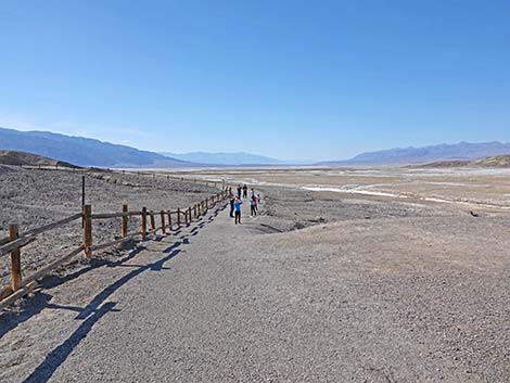
The Hike From the parking lot, the paved trail runs south a few yards to a trail junction. Here, the loop begins, and hikers can walk the loop in either direction. Staying right, the trail climbs at a gentle grade westward towards the 20 Mule Team Wagons that are parked along the trail. Read the signs and learn about the transport of goods across the desert before air conditioned motor vehicles. The cottonball borate ore-boiling facility sits just up the hillside from the wagon exhibit, so although the wagon exhibit dominates this area, be sure to look up and examine the ore-boiling facility from below. Continuing, the trail runs westward to a sign and an overlook with a view out across the saltflats in the distance to the west. Again, learn about the lives of the men who worked the salt mine. The trail cuts steeply up the hillside and bends back to the east, soon arriving at a point overlooking the borax plant site. Here, read the signs and learn about the borax process. |
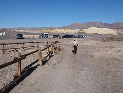
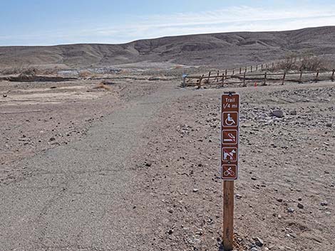 Trailhead sign and start of the trail (view S) |
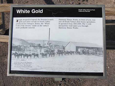
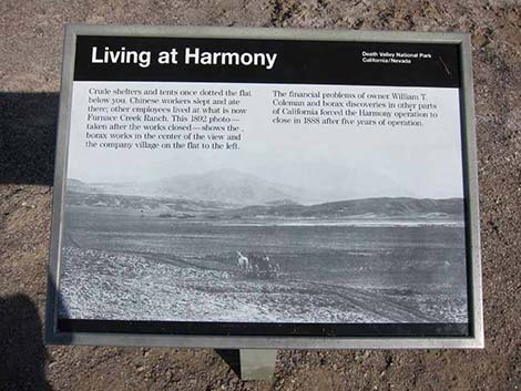
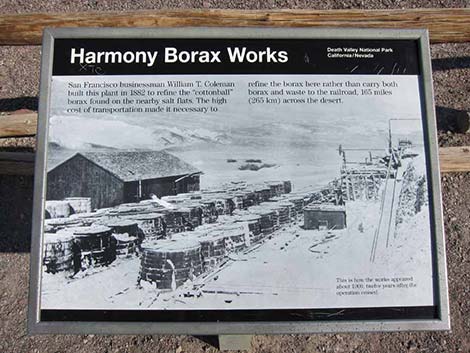
Before leaving, gaze again some 2+ miles out to the west and look for mounds of salt that were piled up by Chinese laborers. Contemplate the men who worked and suffered here, then return to the parking lot. From the official Death Valley website: Harmony Borax Works was the central feature in the opening of Death Valley and the subsequent popularity of the Furnace Creek area. The plant and associated townsite played an important role in Death Valley history. After borax was found near Furnace Creek Ranch (then called Greenland) in 1881, William T. Coleman built the Harmony plant and began to process ore in late 1883 or early 1884. When in full operation, the Harmony Borax Works employed 40 men and produced three tons of borax daily. During summer when temperatures were extreme, the water used for processing the borax was so hot that the suspended borax could not crystallize and the plant was shut down. Coleman moved his work force to the Amargosa Borax Plant near Tecopa, California, during summer. |
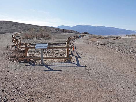 At the beginning, the trail forks: hikers can walk the loop either way |
Getting finished borax to market from the middle of Death Valley was difficult, and the Harmony operation became famous for using teams of 20 mules to pull two very large wagons of ore plus a third wagon of water. Two mule skinners hauled borax on the long overland route to the town of Mojave. The romantic image of the "20-mule team" persists to this day and has become the symbol of the borax industry in this country. The Harmony plant ceased operation in 1888 after only five years of production when Coleman’s financial empire collapsed. Acquired by Francis Marion Smith, Harmony never resumed the boiling of cottonball borate ore, and in time became part of the borax reserves of the Pacific Coast Borax Company and it successors. On December 31, 1974, the site was placed on the National Register of Historic Places. The Harmony Borax exhibit now includes the batch plant ruins, machinery, signs describing life and processes at the plant, and a set of historic 20-mule team wagons. Across the nearby flats, the remains of adobe buildings stand in quiet testament to the people how made a living here. Far out on the salt flats, "haystacks" remain from the day when the plant ceased operation and everyone walked away. |
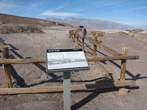 Information sign at start of the Harmony Borax trail (view W) |
 Sign: information about borax, or "white gold" |
 Staying right at the fork provides a gentle grade to the wagons |
 Paved trail leading to the exhibits (view W) |
 Sign: Living at Harmony |
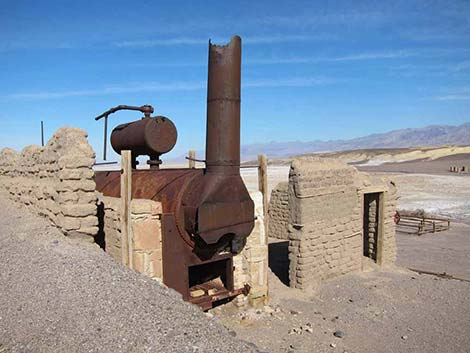
 Approaching the batch plant ruins |
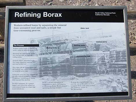 Sign: refining borax |
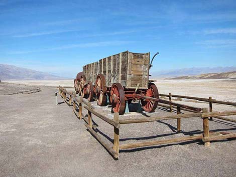
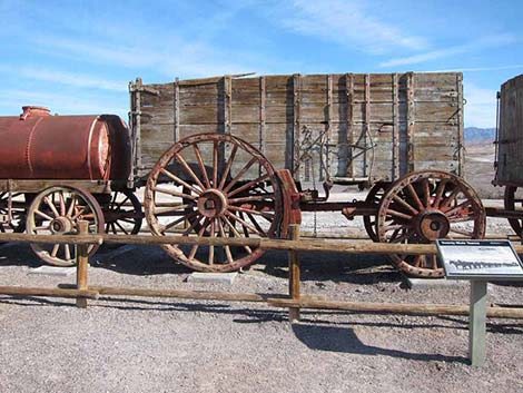
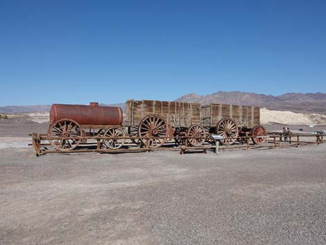
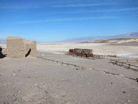
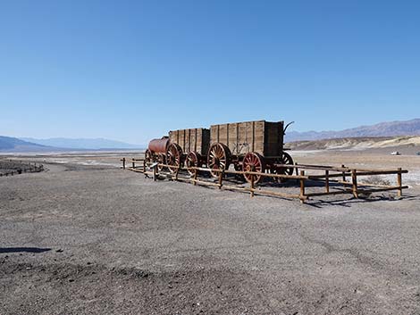 Approaching the Historic 20-mule team wagons |
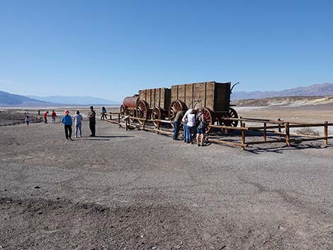 Historic 20-mule team wagons |
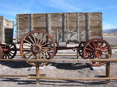
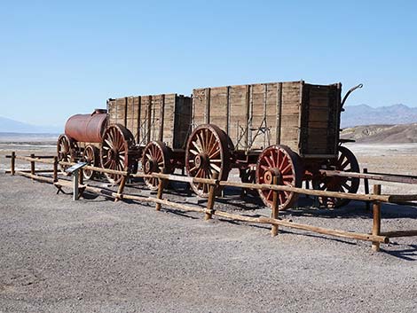 Historic 20-mule team wagons |
 Historic 20-mule team wagons |
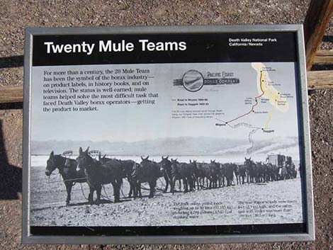 Sign: twenty-mule teams |
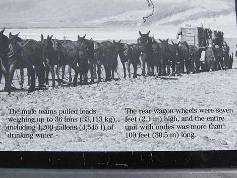 Sign details: twenty-mule teams |
 Historic 20-mule team wagons |
 Historic 20-mule team wagons |
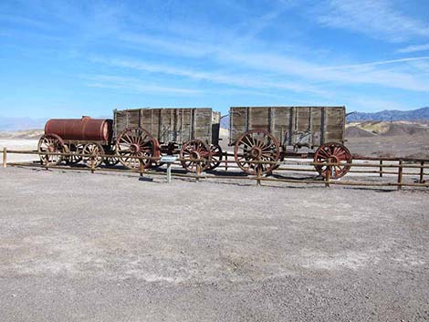 Historic 20-mule team wagons |
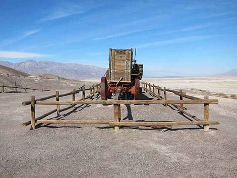
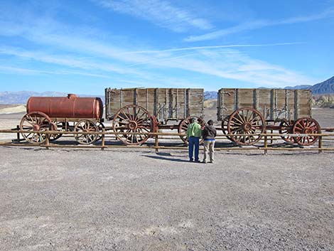
 Historic 20-mule team wagons: front wagon |
 Historic 20-mule team wagons: middle wagon |
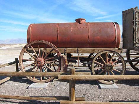 Historic 20-mule team wagons: water wagon |
 Departing from the Historic 20-mule team wagons area (view NE) |
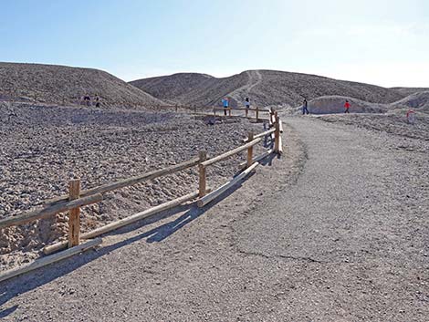
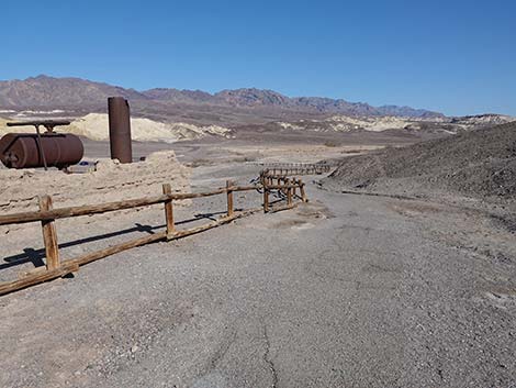
 Trail continues past the 20-mule team wagons (view NW) |
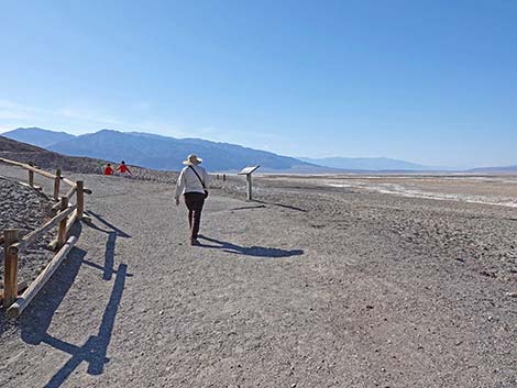 Hiker on trail approaching an information sign (view NW) |
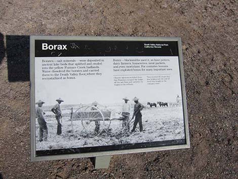 Sign: Borax |
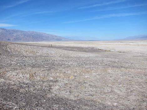 Overlook (view NW out towards the borax quarry area) |
 At the end of the loop, the trail climbs rather steeply (view S) |
 Trail turns back to the east (view SE) |
 Hiker approaching the borax works |
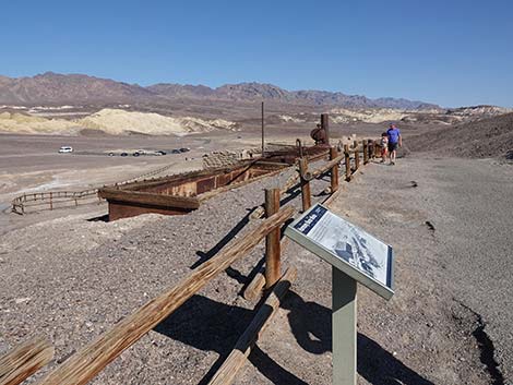 Sign: Harmony Borax Works |
 Sign: Harmony Borax Works |
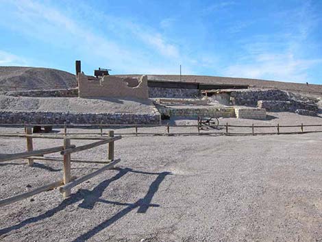
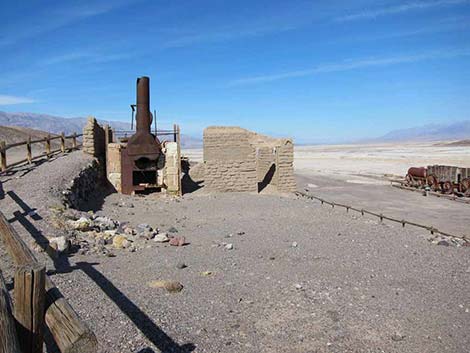
 Overlooking the batch plant (view NE) |
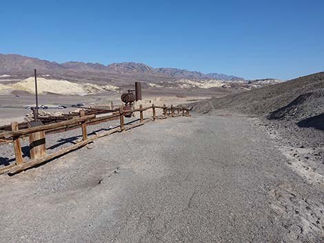 The trail runs above the batch plant (view SE) |
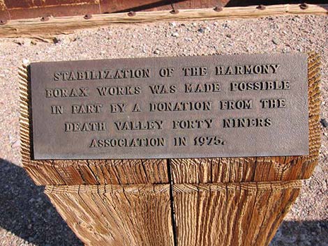 Thanks Death Valley Forty Niners! |
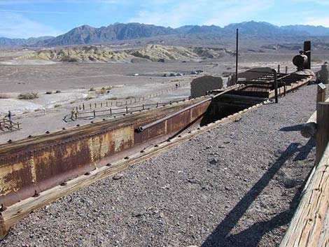
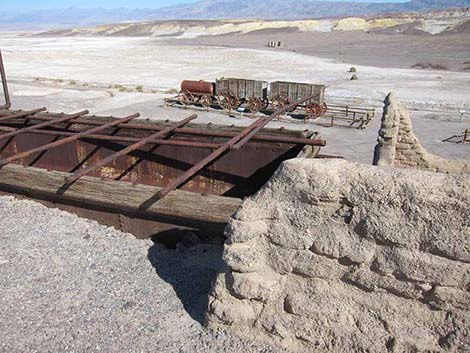
 Batch plant with wagons and adobe ruins in the background (view N) |
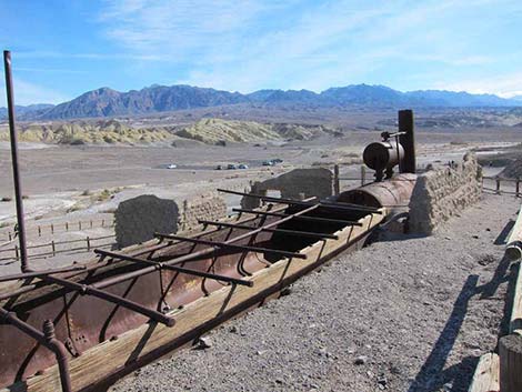 Batch plant (view NE) |
 Batch plant |
 The trail runs to the end of the Batch plant (view SE) |
 Batch plant |
 Looking back: departing the batch plant |
 Looking back: departing the batch plant |
 Trail starting towards the trailhead (view NE) |
 The trail runs down the hillside (view SE) |
 The trail runs down the hillside (view NE) |
 The trail runs down the hillside (view NE) |
 Hiker returning towards the start of the loop and trailhead (view NE) |
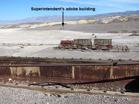
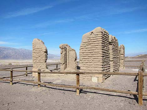
Harmony Borax Superintendent's Adobe Building
After visiting Harmony Borax Works, consider driving a few minutes out Mustard Canyon Road to see the Superintendent's Adobe Building. It is said that this is where the plant manager lived while the site was in operation, but this could have been an office while the manager lived at Furnace Creek with other white workers. The Chinese laborers are said to have lived on-site using canvas tents for shelter.
 Harmony Borax Works (view SW from Mustard Canyon Road) |
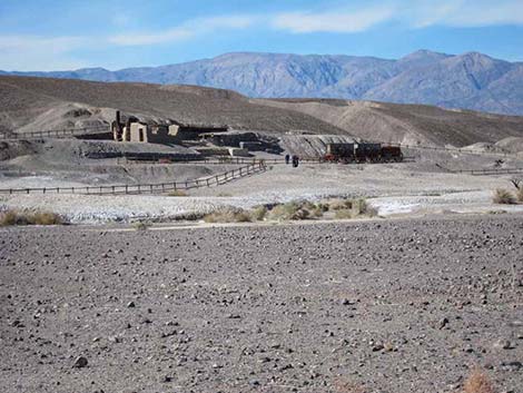 Harmony Borax Works (view SW from Mustard Canyon Road) |
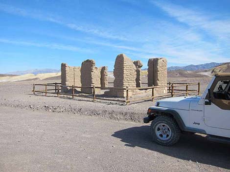 Superintendent's adobe building (view N from Mustard Canyon Road) |
 Superintendent's adobe building |
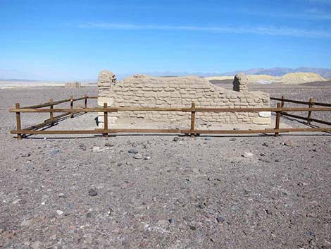
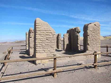 Superintendent's adobe building |
 Superintendent's adobe building |
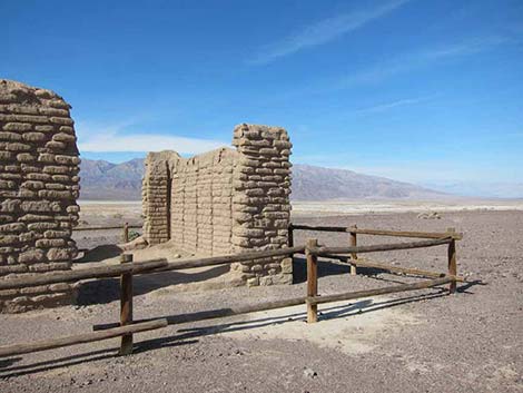 Superintendent's adobe building |
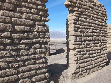 Superintendent's adobe building |
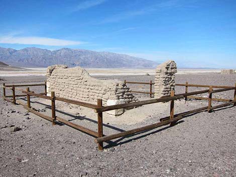 Adobe building |
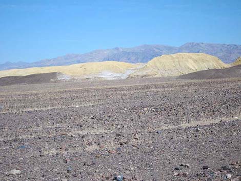 Mustard Canyon Hills (view N from Adobe Buildings area) |
Table 1. Highway Coordinates (NAD27; UTM Zone 11S). Download Highway GPS Waypoints (*.gpx) file.
| Site # | Location | Latitude (N) | Longitude (W) | Easting | Northing | Elevation (ft) | Verified |
| 0712 | Furnace Creek Visitor Center | 36.46159 | 116.86574 | 512030 | 4034954 | -186 | Yes |
| 0534 | Hwy 190 at Harmony Borax Rd | 36.48009 | 116.86866 | 511765 | 4037006 | -262 | GPS |
| 0535 | Harmony Rd @ Parking Access Rd | 36.48027 | 116.87184 | 511481 | 4037026 | -260 | GPS |
| 1012 | Harmony Borax Works Parking | 36.48009 | 116.87229 | 511440 | 4037005 | -260 | Yes |
Happy Hiking! All distances, elevations, and other facts are approximate.
![]() ; Last updated 240324
; Last updated 240324
| Death Valley | Hiking Around Las Vegas | Glossary | Copyright, Conditions, Disclaimer | Home |