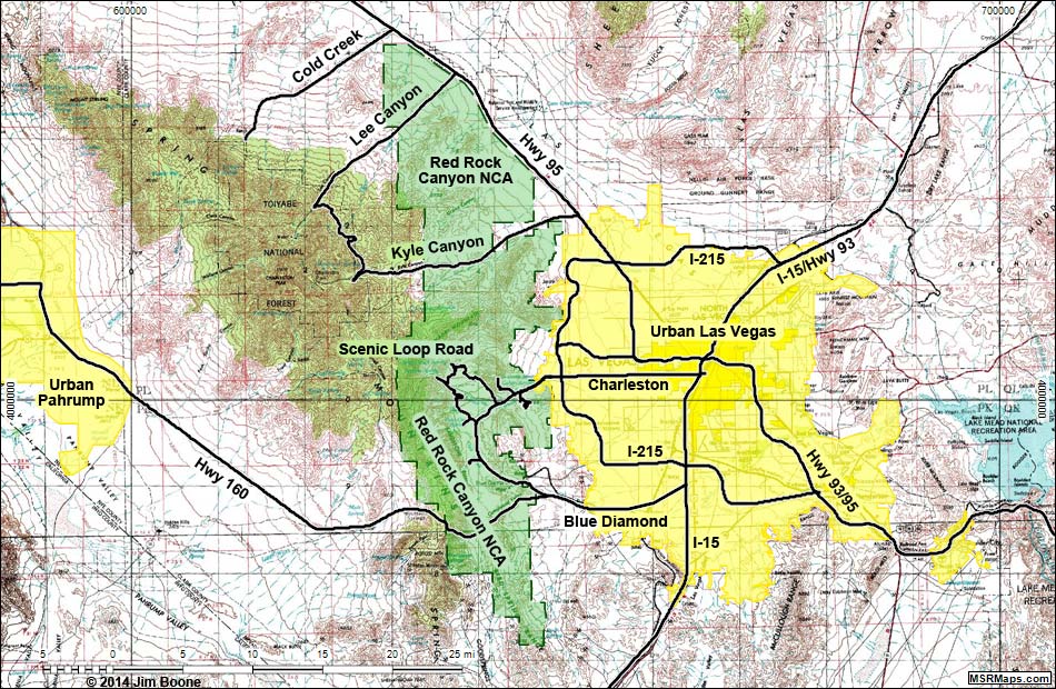
Note: Roads are black (solid = paved). Map based on USGS 15 minute topo map, which may have red grid lines and various numbers. North is at the top. Grid is UTM NAD27 CONUS. National Conservation Areas (boundaries dashed green, fill light green) based on BLM data. Urban areas (yellow) based on Google Earth (2/2014) image.
Happy hiking! All distances, elevations, and other facts are approximate.
![]() ; Last updated 140309
; Last updated 140309
| Red Rocks NCA | Hiking Around Las Vegas | Glossary | Copyright, Conditions, Disclaimer | Home |