Hiking Around Las Vegas, Zion National Park
 Highway 9 Bridge (view N) |
Overview The Pa'Rus Trail is well named: Pa'Rus is Paiute for “the river,” and the River Trail runs for 1.7-miles along the Virgin River between the Highway 9 Bridge and the Visitor Center, passing South Campground along the way. The is trail wide, almost entirely paved, gentle, and accessible, and the Park Service even permits bikes and dogs here. There are five footbridges along the trail, three over the Virgin River and two over side creeks. Small parts of the trail run through wooded areas, but most of it is open and provides great views up and down Zion Canyon. This trail makes for a pleasant way to end a day up in Zion Canyon: get off the shuttle bus, walk down the trail, soak your feet in the river, and walk back to the Visitor Center or campgrounds. The trail can be walked in either direction, but I've described it as running from north to south, down the canyon from the Pa'Rus shuttle bus stop to the Visitor Center. Link to map. |
 Trail in Pinyon-Juniper Woodland with oaks (view S) |
Watch Out Other than the standard warnings about hiking in the desert, ...this is a safe, well-maintained trail that is entirely suitable for kids and wheelchairs. Be careful playing along the river. While hiking, please respect the land and the other people out there, and try to Leave No Trace of your passage. Also, even though this is a short hike, be sure to bring what you need of the 10 Essentials. |
 Footbridge over the Virgin River (view SE) |
Getting to the Trailhead
This hike is located in Zion National Park, about 3 hours northwest of Las Vegas. From town, drive out to Zion National Park. During winter, drive north from the Visitor Center (Table 1, Site 863) on Highway 9 for 1.3 miles to Zion Canyon Road (Site 864). Turn left onto Zion Canyon Road and drive north for about 1/4 mile to the Pa'Rus parking area (Site 915), which is a wide spot in the road beyond the bus stop. Park here; this is the trailhead. When the shuttle buses are running, ride the shuttle bus from the Visitor Center (Site 863) or any other bus stop to the Canyon Junction (Pa'Rus Trailhead) bus stop (Site 915). Start here; this is the trailhead. |
 Trail along historic farm fields (view S) |
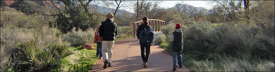
The Hike From the bus stop, the trailhead is about 30 yards down (south) the road, on the right (west) side of the road just upstream from the Highway 9 Bridge. The trailhead is marked with a large information sign. From the trailhead (Table 2, Waypoint 7), the paved trail leads southwest, over the side of the riverbank towards the Virgin River and under the Highway 9 Bridge. The trail runs on the east side of the river through a bit of Pinyon-Juniper Woodland with oak trees. Shortly (0.14 miles out), the trail crosses Pine Creek (Wpt. 8) on the first of five footbridges. Pine Creek comes down the side canyon from the east. Pine Canyon is capped by a feature called the Great Arch. The pleasant, if airy, Canyon Overlook Trail runs out to the edge of the cliffs atop the Great Arch. |
 Trail (view N) |
The trail continues south for 0.07 miles, then crosses to the west side of the Virgin River on the second bridge (Wpt. 9). There are some nice Cottonwood Trees along the river. The trail continues south along the west side of the river for about 0.16 miles to the next bridge (Wpt. 10), where it crosses back to the east side of the river. On the east side, the trail runs along the river for 0.39 miles in a large open area with great views. There are a few low shrubs, Soaptree Yucca (called Utah Yucca in the Park), saltbushes, and other things, but nothing that obstructs the view in any direction. This open area probably was cleared and farmed by the Mormon settlers who lived in the canyon long ago. |
 Trail in South Campground (view N) |
The trail crosses back onto the west side of the river (Wpt. 11) and runs through a bit of Two-needle Pinyon, Utah Juniper, and oak, then quickly gets back into an open area with lots of Arrowweed. A side trail cuts off the paved trail in here and runs up to the Park Cultural Museum. About 0.21 miles past the bridge, the trail crosses Oak Creek (Wpt. 12) on the fifth and last footbridge. Just beyond the bridge, the trail crosses a paved utility road; be careful of vehicle traffic. From the road crossing, the trail continues south for about 0.20 miles to the north edge of South Campground. The trail runs along and through the campground for 0.39 miles to the Visitor Center access road (Wpt. 14). Most of the trail along here runs between the river and the campground, but the end of this section runs through the campground. |
 Visitor Center Road at Pa'Rus Trail (view N towards the south edge of South Campground) |
From the end of the campground at the Visitor Center access road, the route crosses back to the east side of the river on the Visitor Center Road bridge and ends in the Visitor Center complex (Wpt. 15), which can be seen across the river. A use-trail continues south along the highway, probably leading down into the town of Springdale. From the Visitor Center, it is a short walk to Watchman Campground. |
Table 1. Highway Coordinates (NAD27; UTM Zone 12S). Note: These are UTM-Zone-12 coordinates.
Download Highway GPS Waypoints (*.gpx) file.
| Site | Location | Latitude (°N) | Longitude (°W) | UTM Easting | UTM Northing | Elevation (feet) | Verified |
|---|---|---|---|---|---|---|---|
| 0863 | Zion Visitor Center | 37.2000 | 112.9865 | 323702 | 4118706 | 3,940 | Yes |
| 0864 | Highway 9 at Zion Canyon Road | 37.2176 | 112.9736 | 324881 | 4120630 | 4,048 | Yes |
| 0915 | Pa'Rus Trailhead | 37.2181 | 112.9734 | 324907 | 4120685 | 4,064 | Yes |
Table 2. Hiking Coordinates Based on GPS Data (NAD27; UTM Zone 12S). Note: These are UTM-Zone-12 coordinates.
Download Hiking GPS Waypoints (*.gpx) file.
| Wpt. | Location | Time | Min | Cum Min | Easting | Northing | Elevation (ft) | Point-to-Point Distance (mi) | Cumulative Distance (mi) |
|---|---|---|---|---|---|---|---|---|---|
| 07 | Pa'Rus Trailhead, north end | 15:42 | 0:00 | 0:00 | 324907 | 4120685 | 4,064 | 0.00 | 0.00 |
| 08 | Bridge over Pine Creek | 15:47 | 0:05 | 0:05 | 324829 | 4120509 | 4,018 | 0.14 | 0.14 |
| 09 | 1st bridge over Virgin River | 15:49 | 0:02 | 0:07 | 324799 | 4120422 | 4,024 | 0.07 | 0.21 |
| 10 | 2nd bridge over Virgin River | 15:52 | 0:03 | 0:10 | 324692 | 4120228 | 4,007 | 0.16 | 0.37 |
| 11 | 3rd bridge over Virgin River | 16:02 | 0:10 | 0:20 | 324505 | 4119669 | 3,986 | 0.39 | 0.76 |
| 12 | Bridge over Oak Creek & road | 16:07 | 0:05 | 0:25 | 324392 | 4119383 | 3,973 | 0.21 | 0.97 |
| 13 | South Campground (north edge) | 16:12 | 0:05 | 0:30 | 324277 | 4119102 | 3,953 | 0.20 | 1.17 |
| 14 | South Campground (south edge) | 16:22 | 0:10 | 0:40 | 323750 | 4118903 | 3,943 | 0.39 | 1.56 |
| 15 | Visitor Center | 16:27 | 0:05 | 0:45 | 323726 | 4118724 | 3,896 | 0.14 | 1.70 |
Happy Hiking! All distances, elevations, and other facts are approximate.
![]() ; Last updated 240330
; Last updated 240330
| Hiking Around Zion National Park | Hiking Around Las Vegas | Glossary | Copyright, Conditions, Disclaimer | Home |