Hiking Around Las Vegas, Zion National Park
 Footbridge to trailhead (view S) |
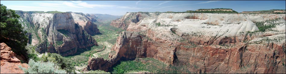
Overview This fairly long (7 miles round trip), strenuous trail runs from the bottom of Zion Canyon to Observation Point on the East Rim overlooking Zion Canyon. The trail is safe and paved most of the way, but many parts have precipitous drop-offs -- which among other things, make for awesome views. I read a description of this trail that says something to the extent that on this trail, you hike up, and up, and up, and when you think you are at the top, the trail keeps going up, and up, and up. I couldn't have said it better. The views from many parts of the trail and the overlook are breathtaking, especially the views straight down -- then again, maybe I was just out of breath. Link to map or elevation profile. |
 Observation Point Trail stays right (view S) |
Watch Out Other than the standard warnings about hiking in the desert, ...this is a safe trail, but there are many, many places, including at the end, where a false step could be your last. Be sure to bring enough water. While hiking, please respect the land and the other people out there, and try to Leave No Trace of your passage. Also, be sure to bring what you need of the 10 Essentials. |
 Paved trail low on the switchbacks (view S) |
Getting to the Trailhead
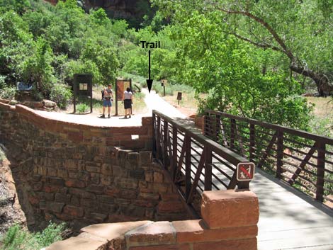
This hike is located in Zion National Park, about 3 hours northwest of Las Vegas. From town, drive out to Zion National Park. From the Visitor Center (Table 1, Site 863), drive (during winter) or ride the shuttle bus north on Highway 9 for about 1.3 miles to Zion Canyon Road (Site 864). Turn left onto Zion Canyon Road and drive north for about 4 miles to the Weeping Rock parking area (Site 392). Park here; this is the trailhead. |
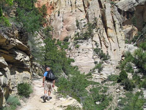
 Near the Hidden Canyon Trail junction (view S) |
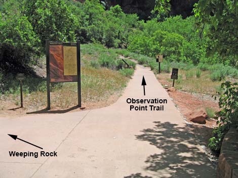
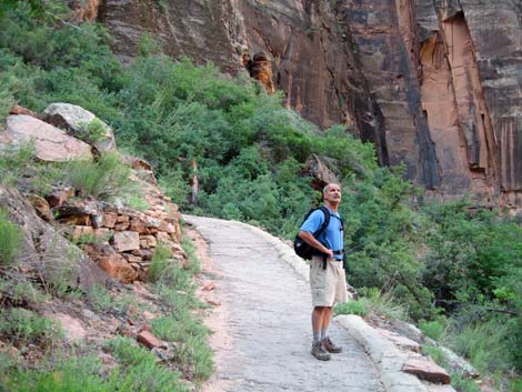
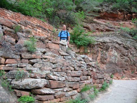
The Hike From the Weeping Rock parking area, the trail crosses a footbridge over Echo Creek to a trail junction with the Weeping Rock Trail (Table 2, Waypoint 1). The Observation Point Trail continues straight, while the Weeping Rock Trail turns left and runs up along the creek. The paved Observation Point Trail sweeps around to the left and begins to climb very steeply. Fortunately, the first minute or two of the trail are the steepest of the entire hike. There are other steep parts, but none as steep as this. |
 High on the switchback (view NE) |
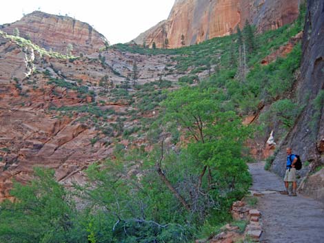
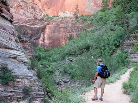
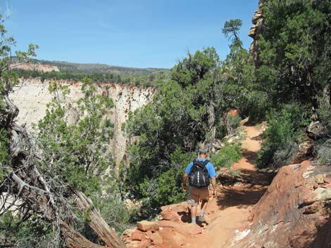
At the top of the steepest part, the trail begins switchbacking up the hillside and through the cliffs. Parts of the trail were blasted out of solid stone. The trail winds upward, and after about 0.6 miles, passes the junction with the Hidden Canyon Trail (Wpt. 2). The start of the trail is partly shaded by gambel oak trees, maple trees, ash trees, and higher up on the switchbacks, ponderosa pines and douglas fir contribute to the shade. The Observation Point Trail continues switchbacking up the hillside, then levels out and turns into Echo Canyon (Wpt. 3). At first Echo Canyon forms a deep, narrow gorge below the trail (look down for canyoneers), but the trail runs level, and the bottom of the canyon quickly rises to meet the trail. In this area, Utah juniper, single-leaf pinyon pine, and shrub live oak begin to appear along the trail, as do ceanothus, manzanita, and pricklypear. |
 Looking down the switchbacks (view SW) |
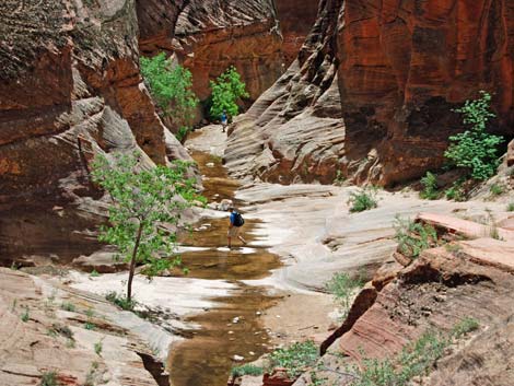
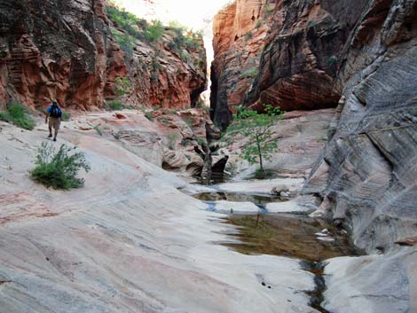
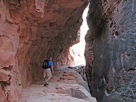
When the water is high, the next section can be a bit wet. The trail runs up the bottom of Echo Canyon, then cuts up onto the north side and passes through a narrow slot on another bit of trail blasted out of the canyon wall. The trail emerges on the other side of the slot and proceeds up what is now a wider and more open canyon. The trail wanders up the canyon staying higher and higher on the north side. When the East Rim Trail forks off (Wpt. 4) and drops back into the bottom of the canyon, the Observation Point Trail starts more aggressively climbing the hillside. |
 Starting into Echo Canyon (view W) |
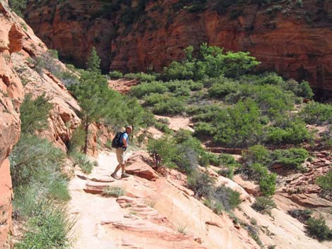
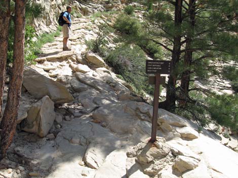
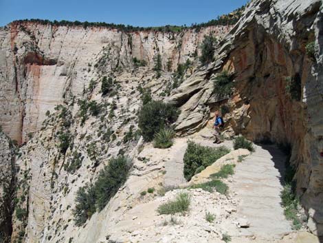
The trail climbs and climbs an open, rocky hillside with a few ponderosa pines for shade, while pricklypear, manzanita, and Utah yucca adorn the sunny hillside. From this hillside, the trail cuts out across the face of a cliff above Zion Canyon on three long and spectacular switchbacks blasted out of the white rock wall. The trail eventually reaches the rim (Wpt. 5), and the steep hiking is done. From this point forward, the trail is no longer paved. The trail runs north along the edge of the Zion Canyon rim until reaching the East Mesa Trail junction (Wpt 6). There was an old fire here, and the gambel oak, two-needle pinyon pine, sagebrush, and bitterbrush are growing back, but there is little shade. |
 Slickrock in Echo Canyon (view E) |
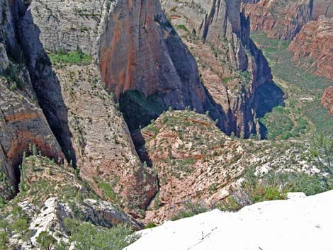
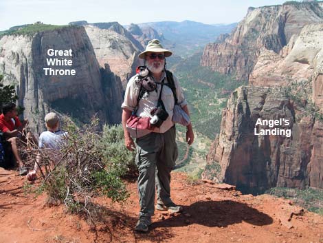
From the trail junction, the trail curves to the west and runs across red sand to Observation Point and the end of the trail (Wpt. 7). The summit is large flat area with shady trees such as pinyon pine, juniper, gambel oak, and many shrubs such as serviceberry, sagebrush, cliffrose, bunchgrasses, prickly pear, Utah yucca, and manzanita. Out at the point, sit, relax, eat lunch, and enjoy the view. From this perch, you can look down Zion Canyon with the Great White Throne on the left and Angel's Landing on the right. You can even see people on the Angel's Landing Trail and the buses in the bottom of the canyon. Looking around the corner to the north, you can see the top of the Zion Narrows disappearing into the distance. When ready, follow your tracks back do to the trailhead. |
 Approaching the Echo Canyon slot (view E) |
 Hiker in the Echo Canyon slot (view E) |
 Hiker in the sunny upper Echo Canyon (view E) |
 Observation Point Trail at East Rim Trail |
 Hiker climbing out the north size of Echo Canyon (view N) |
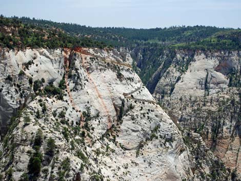
 Switchbacks carved into white sandstone (view N) |
 Meanders of Echo Canyon (view SW from above) |
 Hiker at the end of the paved trail atop the East Rim (view N) |
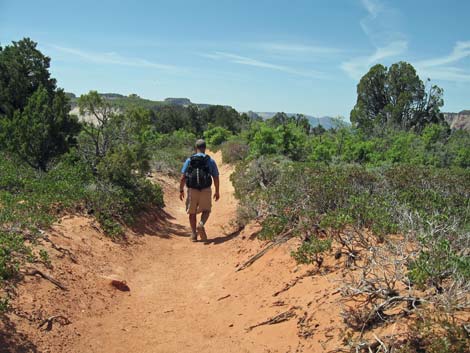 Hiker on sandy trail near Observation Point (view W) |
 Observation Point (view SW) |
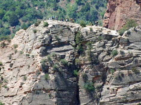 Humans atop Angel's Landing (view SW) |
 Trail carved in white sandstone (view S from Observation Point) |
Table 1. Highway Coordinates (NAD27; UTM Zone 12S). Note: UTM-Zone-12 coordinates.
Download Highway GPS Waypoints (*.gpx) file.
| Site # | Location | Latitude (°N) | Longitude (°W) | UTM Easting | UTM Northing | Elevation (feet) | Verified |
|---|---|---|---|---|---|---|---|
| 0392 | Weeping Rock parking area | 37.2706 | 112.9377 | 328194 | 4126447 | 4,348 | Yes |
| 0863 | Zion Visitor Center | 37.2000 | 112.9865 | 323702 | 4118706 | 3,940 | Yes |
| 0864 | Highway 9 at Zion Canyon Road | 37.2176 | 112.9736 | 324881 | 4120630 | 4,048 | Yes |
Table 2. Hiking Coordinates Based on GPS Data (NAD27; UTM Zone 12S). Note: UTM-Zone-12 coordinates.
Download Trail GPS Waypoints (*.gpx) file.
| Wpt. | Location | Easting | Northing | Elevation (ft) | Point-to-Point Distance (mi) | Cumulative Distance (mi) | Verified |
|---|---|---|---|---|---|---|---|
| 01 | Weeping Rock Trailhead | 328194 | 4126453 | 4,333 | 0.00 | 0.00 | GPS |
| 02 | Hidden Canyon Trail Junction | 328369 | 4126267 | 4,951 | 0.57 | 0.57 | GPS |
| 03 | Enter Echo Canyon | 328583 | 4126460 | 5,158 | 0.44 | 1.01 | GPS |
| 04 | East Rim Trail Junction | 329072 | 4126843 | 5,616 | 0.79 | 1.80 | GPS |
| 05 | Top of the Steep Trail | 328845 | 4127117 | 6,425 | 0.85 | 2.65 | GPS |
| 06 | East Mesa Trail Junction | 328380 | 4127607 | 6,491 | 0.46 | 3.11 | GPS |
| 07 | Observation Point | 328040 | 4127308 | 6,509 | 0.35 | 3.46 | GPS |
Happy Hiking! All distances, elevations, and other facts are approximate.
![]() ; Last updated 240330
; Last updated 240330
| Hiking Around Zion National Park | Hiking Around Las Vegas | Glossary | Copyright, Conditions, Disclaimer | Home |