Southern Nevada Wilderness Areas, Hiking the Wilderness Areas
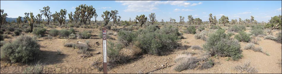
 Trailhead parking (view NE) |
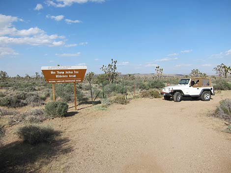
Overview This short, or perhaps long, route in the Wee Thump Joshua Tree Wilderness Area provides access to wild country from the edge of the paved Joshua Tree Highway (Highway 164) west of Searchlight, Nevada. From the trailhead, this "trail" runs for about 25 feet before it fades out and disappears into the wilds of the Wee Thump. In fact, in the true spirit of wilderness, there is no trail, no use-trail, and probably no boot-prints to follow. This is a place to stop along the highway, squeeze through the gate, and wander off into the wilderness. Except for wheelchairs, this route provides a portal into Wilderness for virtually any human. Never again will the nay-sayers be able to accuse the BLM of excluding everyone except the hiking elite from Wilderness. Link to map. |
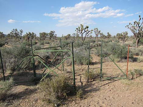 Gate (view N) |
Watch Out Other than the standard warnings about hiking in the desert, ... this is a fairly safe hike. There are many cactus and other things with sharp points, so be careful walking around. While hiking, please respect the land and the other people out there, and try to Leave No Trace of your passage. This hike goes into Wilderness, so pay particular attention to respecting the land. This hike runs off-trail where nobody will find you, so be sure to bring the 10 Essentials if you plan to get out of sight of the highway. Cell phones work from some parts of this wilderness area. |
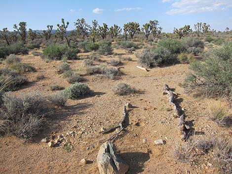 Start of the "trail" (outside wilderness; view N) |
Getting to the Trailhead This hike is located in the Wee Thump Joshua Tree Wilderness Area, about 1 hour south of Las Vegas, just west of Searchlight. From town, drive south on Highway 95 to Searchlight (Site 0927). In downtown Searchlight, turn right onto Joshua Tree Highway (Highway 164) and drive west for 11.1 miles to a pullout on the north side of the road (Site 1007). A short access road leads to a parking area by a large Wilderness Area sign. Alternatively, from town, drive south on Interstate-15, past Primm, to Nipton Road in California (Site 1008). Exit the Interstate and turn left onto Nipton Road. Drive east to the Nevada State Line, then continue east for another 7.5 miles to the pullout on the north side of the road (Site 1007). A short access road leads to a parking area by a large Wilderness Area sign. |
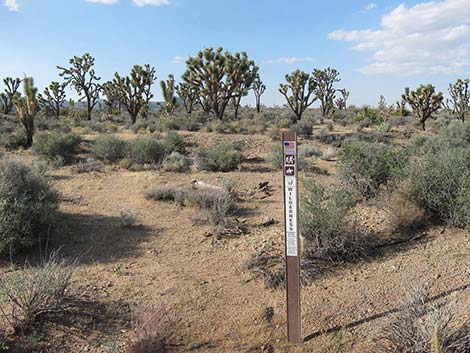 Wilderness boundary sign (view N) |
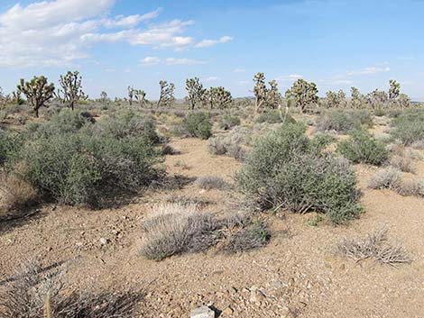
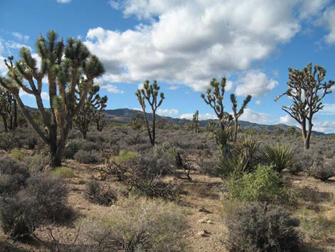
The Hike From the trailhead (Table 2, Waypoint 01), the trail squeezes through the gate and into the wilderness area. Almost as quickly, the trail fades away, and hikers are left to experience the grandeur of wilderness without any sign of human intrusion or development -- not even a trail disturbs this wilderness. Joking aside, this is a nice place to stop for a nice, relaxing walk-about in the desert. This hike lies in the Upper Sonoran Life Zones at the transition between the Mojave Desert Scrub and Pinyon-Juniper Woodland habitat types. The area is thick with blackbrush, buckhorn cholla cactus, pricklypear cactus, banana yucca, Joshua trees, and a single singleleaf pinyon pine, a collection of species that reflect a mix of lower- and higher-elevation species. Also watch for Woodhouse's Scrub-Jays, Black-tailed Jackrabbits, and Desert Cottontail. |
 Into the Wilderness (view NE) |
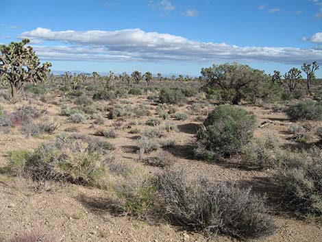 No formal trails in Wee Thump Joshua Tree Wilderness Area |
 No formal trails in Wee Thump Joshua Tree Wilderness Area |
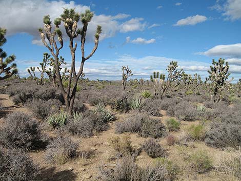 No formal trails in Wee Thump Joshua Tree Wilderness Area |
Table 1. Highway Coordinates Based on GPS Data (NAD27; UTM Zone 11S). Download Highway GPS Waypoints (*.gpx) file.
| Site | Location | UTM Easting | UTM Northing | Latitude (N) | Longitude (W) | Elevation (ft) |
|---|---|---|---|---|---|---|
| 0927 | Hwy 95 at Hwy 164, Searchlight | 688813 | 3926424 | 35.46519 | 114.91921 | 3,500 |
| 1007 | Spirit of Wilderness Trailhead Parking | 671865 | 3931555 | 35.51451 | 115.10480 | 4,545 |
| 1008 | I-15 at Nipton Rd | 640822 | 3926437 | 35.47327 | 115.44788 | 3,432 |
| 1351 | Spirit of Wilderness Trailhead Parking | 671916 | 3931605 | 35.51495 | 115.10423 | 4,567 |
Table 2. Hiking Coordinates Based on GPS Data (NAD27; UTM Zone 11S). Download Hiking GPS Waypoints (*.gpx) file.
| Wpt. | Location | UTM Easting | UTM Northing | Elevation (ft) | Point-to-Point Distance (mi) | Cumulative Distance (mi) |
|---|---|---|---|---|---|---|
| 01 | Trailhead | 671912 | 3931608 | 4,533 | 0.00 | 0.00 |
Happy Hiking! All distances, elevations, and other facts are approximate.
![]() ; Last updated 240330
; Last updated 240330
| Hiking Around Wilderness Areas | Hiking Around Las Vegas | Glossary | Copyright, Conditions, Disclaimer | Home |