Hiking Around Las Vegas, Red Rock Canyon National Conservation Area
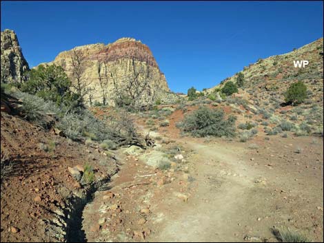
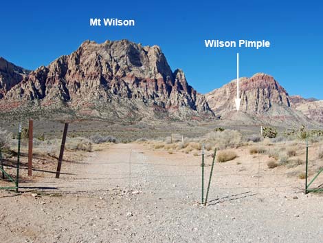 South Oak Creek Trailhead (view W) |
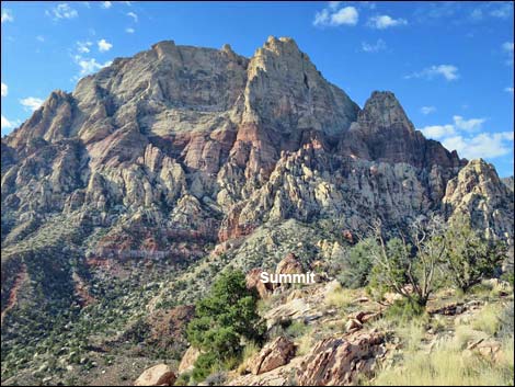
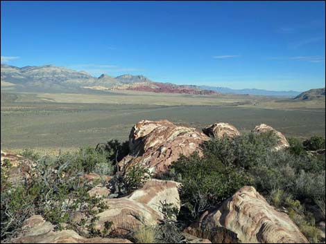
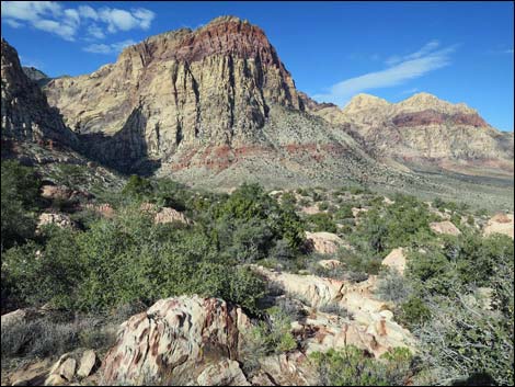
Overview Wilson Pimple Peak provides a surprisingly scenic view for such a low summit. This pleasant 4-mile hike crosses Red Rock Valley to the base of Mt. Wilson using the South Oak Creek Trail. Atop Wilson Saddle, the peak is reached using an old mining road and a steep use-trail. From the peak, grand views spread out below across the vast expanse of Red Rock Valley, and of course, the east face of Mt. Wilson, which towers above, feels very close and airy. Link to map. |
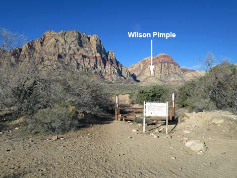 Trail sign and old gate before Oak Creek Wash (view W) |
Watch Out Other than the standard warnings about hiking in the desert, ...this is a fairly safe hike, even for kids, but mind the edge at the summit. While hiking, please respect the land and the other people out there, and try to Leave No Trace of your passage. Also, even though this hike is short, be sure to bring what you need of the 10 Essentials. Getting to the Trailhead This hike is located in Red Rock Canyon National Conservation Area, about 40 minutes from town, but not on the Scenic Loop Road. Drive out West Charleston Blvd, past the entrance to and exit from the Scenic Loop Road, to the South Oak Creek Trailhead. Park here; this is the trailhead. |
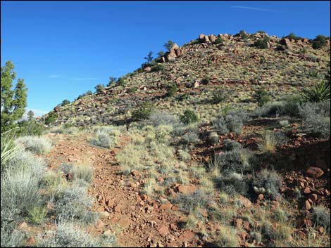
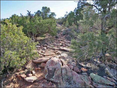
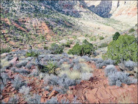
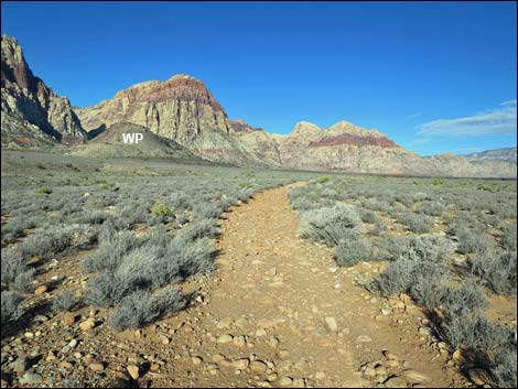 Rocky trail crosses desert flats (view NW) |
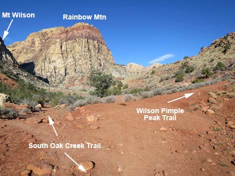
The Hike From the trailhead (Table 1, Waypoint 01), the South Oak Creek Trail runs west and down the old road towards the original Red Rock Campground. The trail runs straight to a trail sign and gate at the edge of Red Rock Wash (Wpt. 02). Following old roads (Wpts. 03, 04, 05), the South Oak Creek Trail runs north and then west, eventually running up a canyon along the base of Wilson Pimple and climbing onto Wilson Saddle (Wpt. 06). Atop Wilson Saddle (Wpt. 06), the South Oak Creek Trail continues over the other side, while the Wilson Pimple Peak Trail turns right following an old road towards the peak. The old road bends left and levels out somewhat as it contours up and across the hillside. After offering nice views into Oak Creek Canyon from the point of a hairpin turn, the road turns back and up along the side of the ridge. At the next bend in the road (Wpt. 20), this time to the left, Wilson Pimple Peak Trail (a use-trail) leaves the road and continues up along the side of the ridge. |
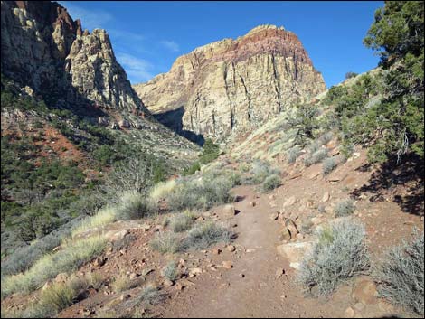
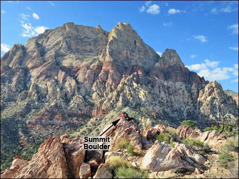
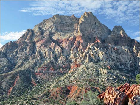
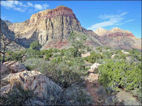
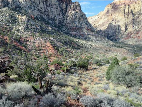
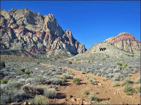 Wilson Pimple below the face of Mt. Wilson (view W) |
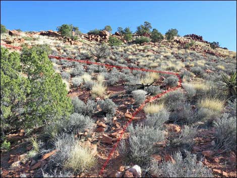
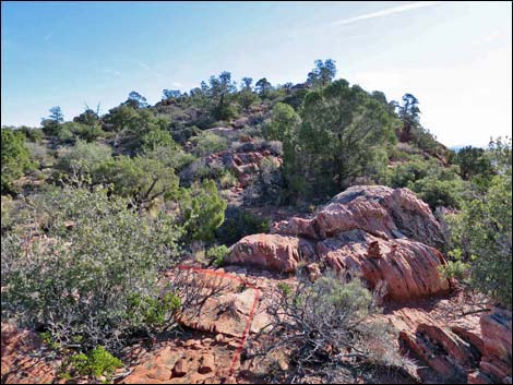
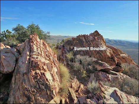
Wilson Pimple Peak Trail runs straight up the hillside, staying between the ridgeline on the right and the gully on the left. After passing under several Utah Junipers, the use-trail turns abruptly left to cut up and across the high, steep slope aiming for the rocky ridge on the skyline (Wpt. 21); watch for cairns. Over the ridge, rather than following the rocky ridgeline towards the summit, the use-trail runs northeast into an open, fairly flat, sandy area. Deep soils in this area and near the summit provide opportunity for lots of trees (pinyon, juniper, and oak) and robust shrubs (manzanita, goldenbush). About 60 yards out, the use-trail turns right towards the summit. Winding among the trees, shrubs, and boulders, Wilson Pimple Peak Trail arrives unceremoniously on the rocky summit (Wpt. 22). This is a good place to sit, relax, gaze up at Mt. Wilson, and enjoy the grand views spreading out below. |
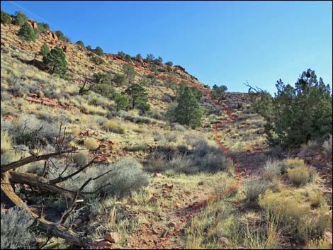
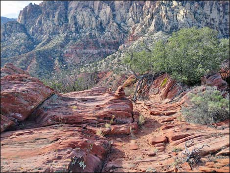
 Climbing towards Wilson Saddle (view NW) |
 Wilson Saddle (view NW) |
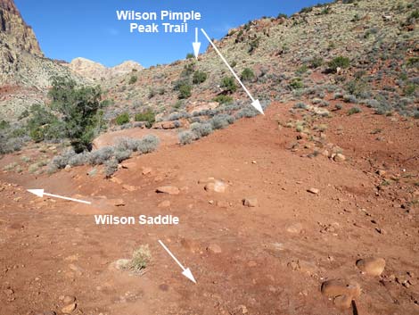 Wilson Pimple Peak Trail departing Loop Trail (view N) |
 Trail follows old road up across hillside (view NW) |
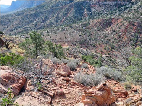
 Old road runs around a hairpin turn (view N) |
 Old road turns left; use-trail continues up slope (view E) |
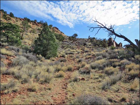 Use-trail continues up slope (view E) |
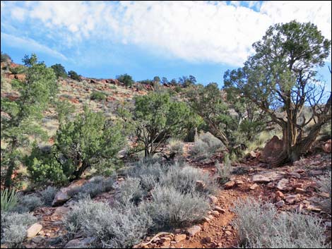 use-trail passes trees (view E) |
 Beyond the trees, the use-trail turns left (view E) |
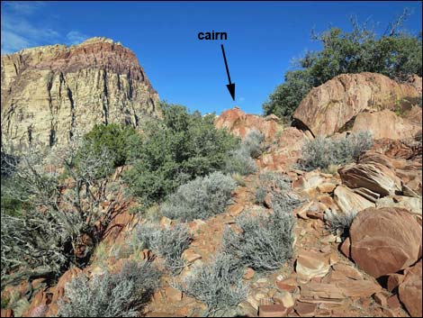 Use-trail cuts across steep slopes to skyline ridge (view NW) |
 Over ridge, trail runs on sandy flats (left in photo; view SE) |
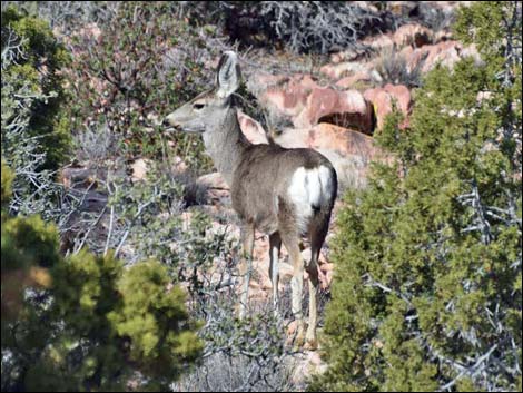 Mule deer near the summit |
 Trail winds among trees and rocks towards the summit (view SE) |
 Wilson Pimple Summit (view SE) |
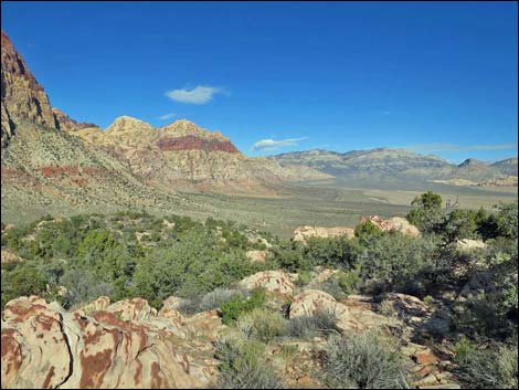
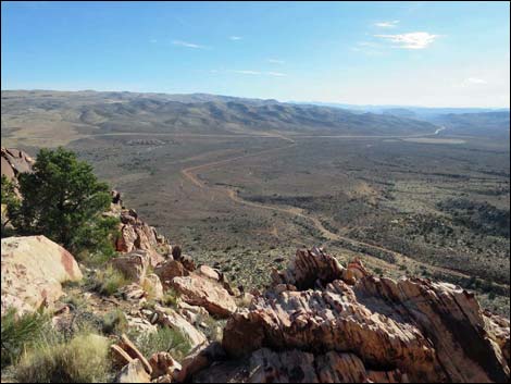
 Summit scenery (view SW) |
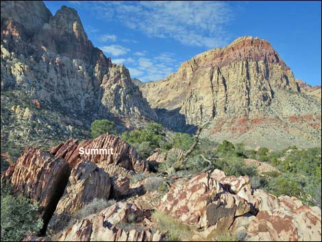 Summit scenery (view W) |
 Summit scenery (view SW) |
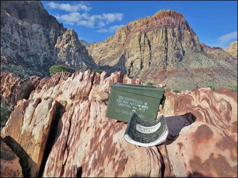 Summit register (view SW) |
 Summit scenery (view SW) |
 Summit scenery (view N) |
 Summit scenery (view NE) |
 Summit scenery (view NE) |
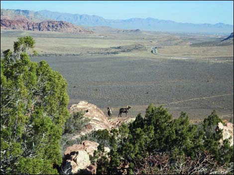
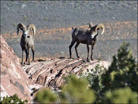 Bighorn sheep near the summit |
 Summit scenery (view SE) |
Descending Wilson Pimple Peak
 Starting down from the summit (view NW) |
 Use-trail winding among trees and rocks (view NW) |
 Cairn at edge of ridgeline (view SW) |
 Trail drops across high, steep slopes (view SW) |
 Trail descends through juniper trees (view NW) |
 Trail approaching the old road (view NW) |
Table 1. Hiking Coordinates and Distances based on GPS Data (NAD257; UTM Zone 11S). Download Hiking GPS Waypoints (*.gpx) file.
| Wpt. | Location | UTM Easting | UTM Northing | Elevation (ft) | Point-to-Point Distance (mi) | Cumulative Distance (mi) | Verified |
|---|---|---|---|---|---|---|---|
| 01 | South Oak Creek Trailhead | 639689 | 3994796 | 3,756 | 0.00 | 0.00 | GPS |
| 02 | Trail Sign and Gate | 639441 | 3994828 | 3,736 | 0.16 | 0.16 | GPS |
| 03 | Road Forks, Stay Left | 639284 | 3994936 | 3,742 | 0.13 | 0.29 | GPS |
| 04 | Road Forks, Stay Left | 638748 | 3995372 | 3,821 | 0.45 | 0.74 | GPS |
| 05 | Merge with Main Dirt Road | 638524 | 3995556 | 3,857 | 0.20 | 0.94 | GPS |
| 06 | Wilson Pimple Saddle | 637473 | 3995556 | 4,137 | 0.75 | 1.69 | GPS |
| 20 | Use-Trail Leaves Old Road | 637440 | 3995692 | 4,232 | 0.18 | 1.87 | GPS |
| 21 | Use-Trail at Ridgeline | 637510 | 3995737 | 4,366 | 0.09 | 1.96 | GPS |
| 22 | Wilson Pimple Peak | 637623 | 3995688 | 4,420 | 0.12 | 2.08 | GPS |
| 01 | South Oak Creek Trailhead | 639689 | 3994796 | 3,756 | 2.08 | 4.16 | GPS |
Happy Hiking! All distances, elevations, and other facts are approximate.
![]() ; Last updated 240330
; Last updated 240330
| Hiking Around Red Rocks | Hiking Around Las Vegas | Glossary | Copyright, Conditions, Disclaimer | Home |