Hiking Around Las Vegas, Red Rock Canyon National Conservation Area
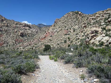
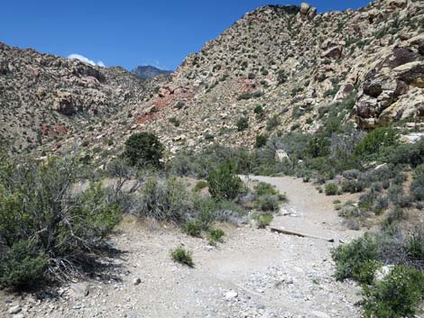
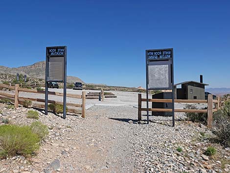
 White Rock Spring trailhead (view W) |
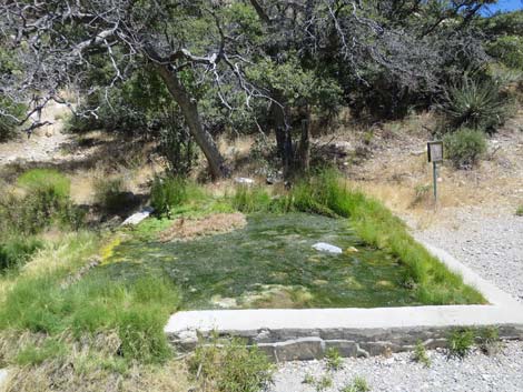
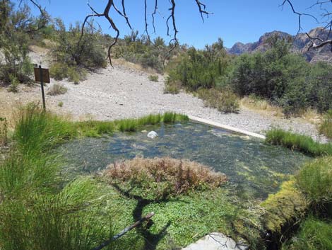
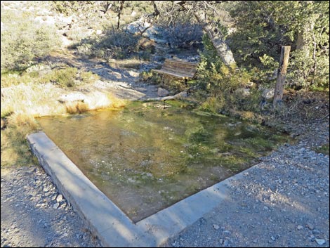
Overview The White Rock Spring Trail is a short (0.12-mile) trail runs down an old road to a spring with a small cement catch basin. The spring is a good place to find birds and other wildlife, and the short walk provides grand sweeping views of the White Rock Hills and the Red Rock (Wilson) Cliffs. The trail is too short for a destination hike, but it is a good place to take visitors for a short walk in the desert and a good place to watch birds. For visitors driving the Scenic Loop Road, this makes a nice place to stop, stretch your legs, and spend a few minutes walking in the high desert. The access road is, however, a bit rough, so plan to drive slowly. When quiet, this is one of my favorite places at Red Rock Canyon, and it proves that a nice hike doesn't have to be long and hard. Link to map. Link to BLM Georeference PDF map file. |
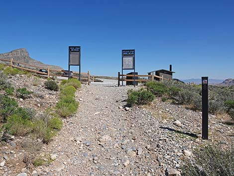
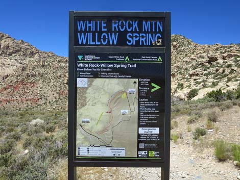 Trailhead sign (view W) |
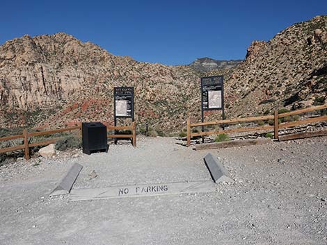
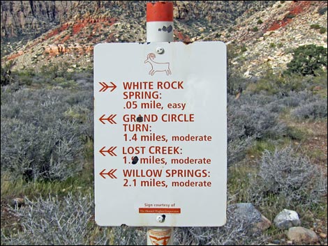
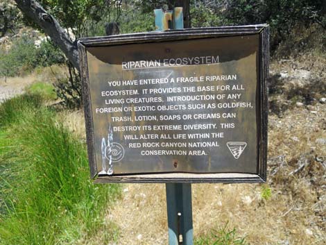
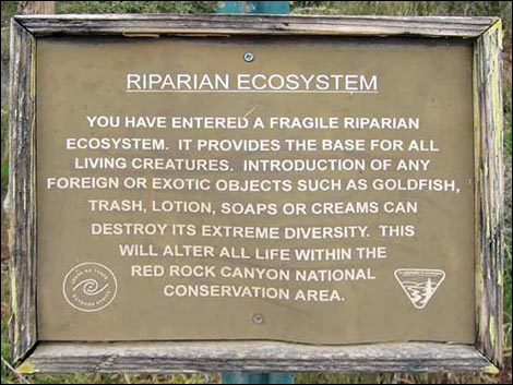
Watch Out Other than the standard warnings about hiking in the desert, ...this is a safe hike, but you probably shouldn't drink the water. Please don't contaminate the water, as it supports a fragile little ecosystem, and don't add goldfish, as they eat Red-spotted Toad eggs, dragonfly larvae, and damage the ecosystem. While hiking, please respect the land and the other people out there, and please try to Leave No Trace of your passage. Also, even though this hike is short, be sure to bring what you need of the 10 Essentials. Getting to the Trailhead This hike is located along the Scenic Loop Road in Red Rock Canyon National Conservation Area, about 45 minutes west of Las Vegas. From town, drive out to Red Rocks, pay the entrance fee, and drive about half-way around the Scenic Loop Road to White Rock Road. Drive up White Rock Road to the White Rock Trailhead. Park here; this is the trailhead. |
 White Rock Spring in the near distance (view NW from trailhead) |
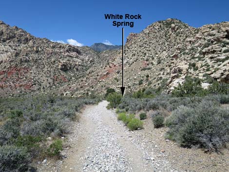
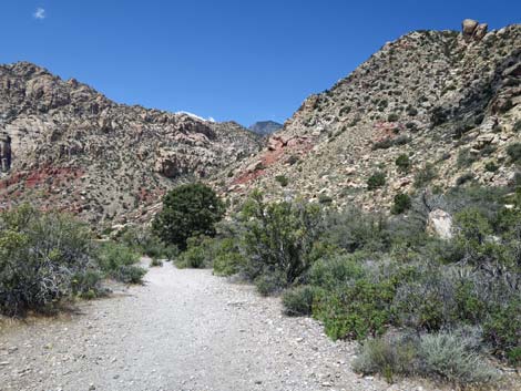
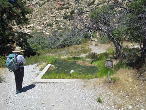
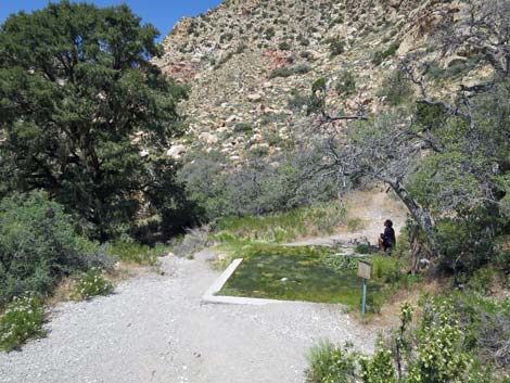
The Hike A sign on the west side of the parking area marks the White Rock Spring trailhead (another trail leads out from the northeast side of the parking area). From the trailhead, hikers can look northwest (left as you drove up the road) and down the hillside to see a large singleleaf pinyon pine near the rocky cliffs. This is your target. From the trailhead (Table 2, Waypoint 01), this short trail follows an old road for about 0.07 miles down the hillside to a trail junction (Wpt. 02). Here, the left fork is the White Rock Loop Trail that leads to the Willow Springs Picnic Area, and the right fork leads to White Rock Spring. After walking for about one more minute (0.05 miles), the trail ends at the cement catch basin (Wpt. 03). |
 Approaching White Rock Loop -- White Rock Spring trail junction |
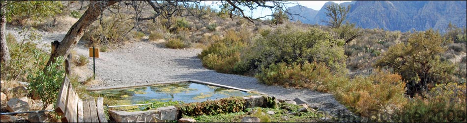
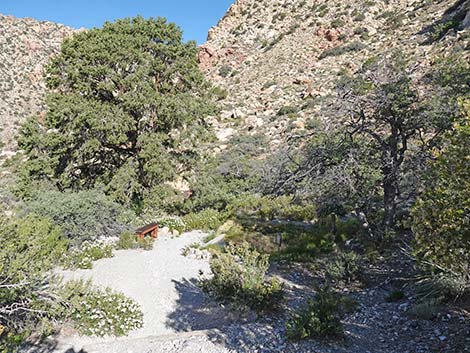
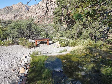
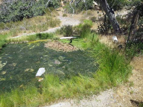
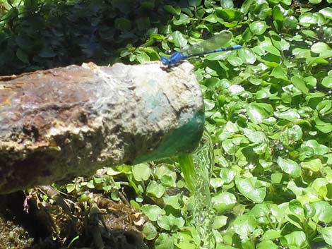
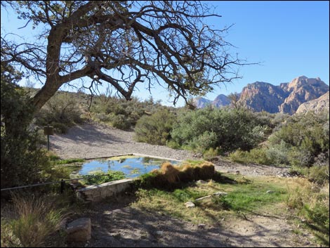
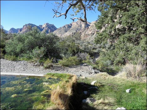
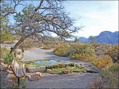
The shade of a shrub live oak tree provides a quiet place to sit, enjoy the grand solitude, and watch the wildlife come to the water. Don't overlook the colorful dragonflies and damselflies as they dart about catching tiny flying insects. The spring itself is up the hill from the catchment, but it is buried and can't be seen (follow the pipe northeast for about 40 feet until it disappears underground). The catchment provides year-round water for wildlife. Historically, native pacific treefrogs bred in the pond. Unfortunately however, people released goldfish into the pond, and the goldfish ate all of the frog eggs and tadpoles. With so many fish and so little space, the tads didn't have a chance. Goldfish also eat the native spring snails, making it hard for them to survive. Goldfish are pretty, but please don't release them into ponds in the desert; these ecosystems are delicate and easily damaged. |
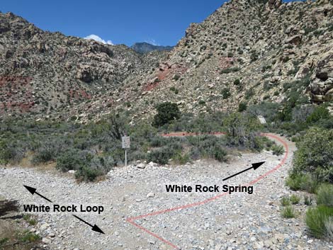 White Rock Loop -- White Rock Spring trail junction (view NW) |
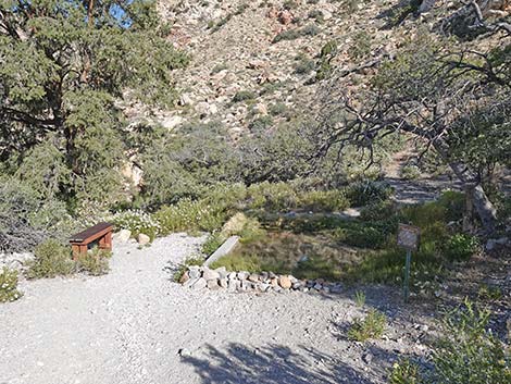
The BLM figured out a good way to maintain the spring and the wildlife it supports without the hazard of goldfish and other exotic tropical aquarium fish -- they poured sand into the catch basin to make the water fairly shallow. The shallow water allows birds and other predators to catch the fish, and being shallow, water likely gets too hot in the summer for non-native species to survive. While at the pond, sit quietly under the trees and watch for birds and bighorn sheep; and sometimes if you are lucky, bats will swoop in to drink late in the day. During summer, don't linger too late as the presence of humans discourages birds, bighorn sheep, and other wildlife from coming down to drink -- and life is hard enough for them without our interference. |
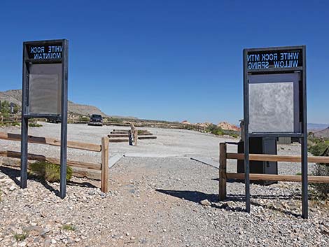
 Sign at White Rock Loop -- White Rock Spring trail (view W) |
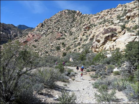 Hikers approaching White Rock Spring (view NW) |
 |
 |
 Wooden stairs approaching White Rock Spring (view NW) |
 White Rock Spring in morning shadows (view NW) |
 |
 |
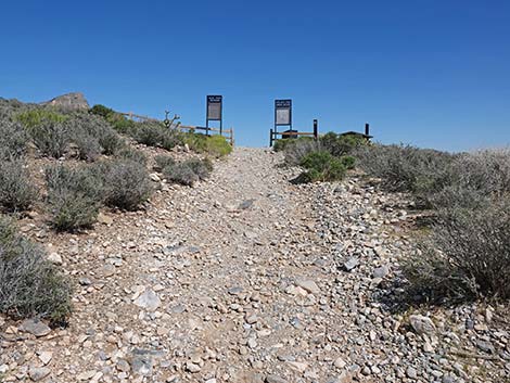
 Information sign - please respect the environment (view N) |
 Information sign - please respect the environment (view N) |
 |
 |
 |
 |
 White Rock Spring (view NW) |
 White Rock Spring (view SW) |
 White Rock Spring (view W from historic bench) |
 White Rock Spring (view S with historic bench) |
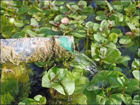 Water trickling from pipe that fills the cement pond (view S) |
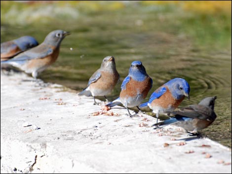 Western Bluebirds drinking at White Rock Spring (view NE) |
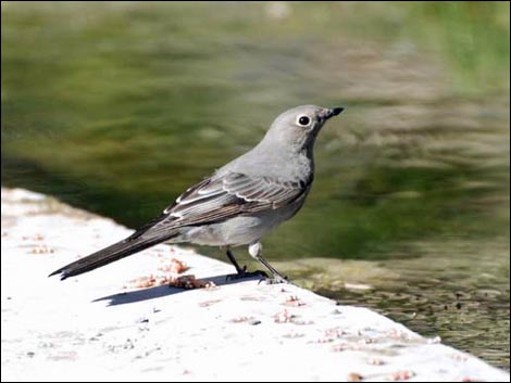 Townsend's Solitaire |
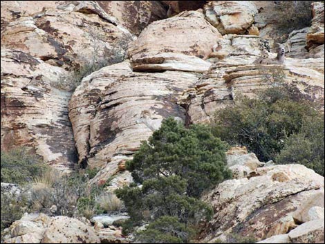 Bighorn Sheep ewe and lamb (view NW) |
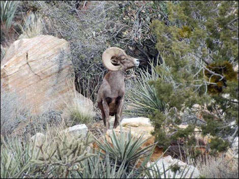 Bighorn Sheep ram (view NW) |
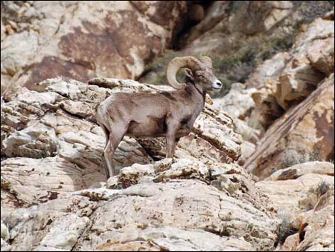 Bighorn Sheep ram (view NW) |
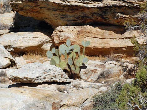 Pancake Pricklypear |
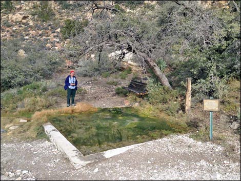 Birdwatcher at White Rock Spring (view N) |
 Thick winter ice on White Rock Spring; pipe continues to trickle |
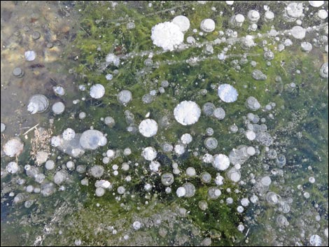 Bubbles frozen into thick ice on White Rock Spring |
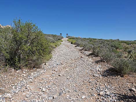
Returning to Upper White Rock Trailhead
 |
 |
 |
 |
 |
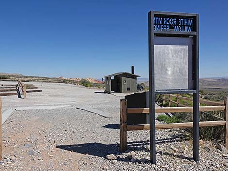 |
Table 2. Hiking Coordinates Based on GPS Data (NAD27; UTM Zone 11S). Download Hiking GPS Waypoints (*.gpx) file.
| Wpt. | Location | Easting | Northing | Elevation (ft) | Point-to-Point Distance (mi) | Cumulative Distance (mi) | Verified |
|---|---|---|---|---|---|---|---|
| 01 | Trailhead | 636979 | 4004051 | 4,875 | 0.00 | 0.00 | Yes |
| 02 | Trail junction | 636874 | 4004072 | 4,842 | 0.07 | 0.07 | GPS |
| 03 | Spring Catchment Basin | 636799 | 4004100 | 4,810 | 0.05 | 0.12 | GPS |
| 01 | Trailhead | 636979 | 4004051 | 4,875 | 0.12 | 0.24 | Yes |
Happy Hiking! All distances, elevations, and other facts are approximate.
![]() ; Last updated 240330
; Last updated 240330
| Hiking Around Red Rocks | Hiking Around Las Vegas | Glossary | Copyright, Conditions, Disclaimer | Home |