Hiking Around Las Vegas, Red Rocks National Conservation Area
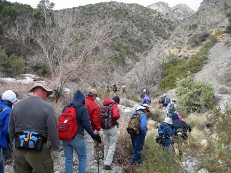
 Hikers on Rocky Gap Road |
Overview This 2.5-mile, relatively easy route starts at Willow Springs (4,575 ft) and follows Rocky Gap Road for 1.25 miles as it winds between the Rainbow Mountain Wilderness Area and La Madre Mountain Wilderness Area. The route then turns up a wet canyon into the La Madre Mountain Wilderness Area and follows the water for another 1.25 miles until a short waterfall in a narrow cleft blocks easy passage (5,542 ft). With a 4WD vehicle, it is possible to drive 1.1 miles farther up Rocky Gap Road. Flowing water and real waterfalls make this an interesting route for desert rats, and the views of two wilderness areas are spectacular. For botanists, the route is also interesting because it starts in the Mojave Desert Scrub and climbs into the Pinyon-Juniper Woodland with some wetlands plants. Link to map or elevation profile. |
 |
Watch Out Other than the standard warnings about hiking in the desert, ...this route is fairly safe, but it has some 2nd-class scrambling and there are places with a bit of exposure, so it might not be a good hike for young kids. Water is available in the creek, so hikers can bring a water filter rather than carry enough water for the entire hike. Watch for rocks slippery from mud and algae. While hiking, please respect the land and the other people out there, and try to Leave No Trace of your passage. Also, this is a fairly long hike, so be sure to bring the 10 Essentials. This route runs up into designated Wilderness, so please pay particular attention to respecting the land. |
 |
Getting to the Trailhead
This hike is located along the Scenic Loop Road in Red Rock Canyon National Conservation Area, about 1 hour west of Las Vegas. Drive out to Red Rocks, pay the fee, and then drive about half-way around the Scenic Loop Road to Willow Spring Road. Turn right and drive north 0.6 miles to the Willow Springs Trailhead. Park here; this is the trailhead. For hikers with high-clearance vehicles who want to shorten the hike, continue north on Rocky Gap Road to the La Madre Trailhead, or drive even farther in a 4WD vehicle. |
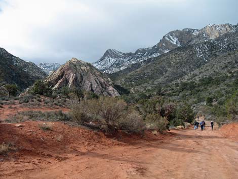 |
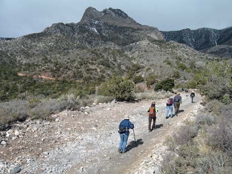
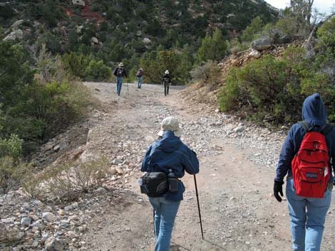
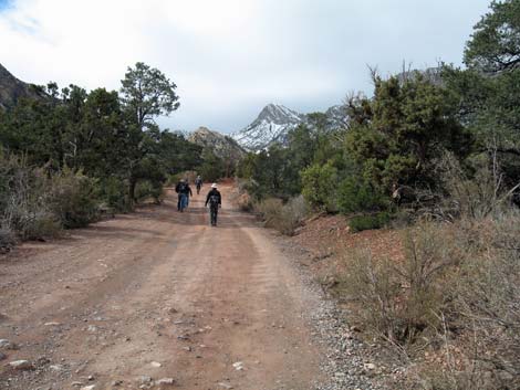
The Hike From Willow Springs Picnic Area (Table 1, Waypoint 01), the route follows the unpaved Rocky Gap Road northward along Red Rock Wash for about 0.5 miles where the road crosses Red Rock Wash (Wpt. 02). In a carefully driven 2WD vehicle, it is possible to drive to a small parking area just before the road drops into the wash. About 100 yards past the wash (Wpt. 03), the La Madre Spring and White Rock Loop trails branch off to the right by a large La Madre Wilderness Area sign. The route continues along Rocky Gap Road for another mile, passing the highpoint (Wpt. 04) and 4WD trailhead (Wpt. 05) along the way. |
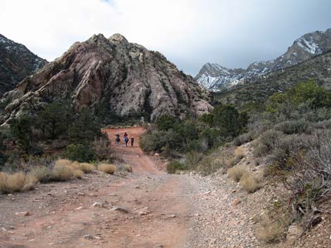 |
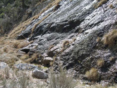
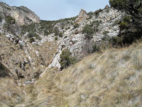
Although it is just an old road, Rocky Gap Road traverses some grand scenery along this route making the walk well worth the effort. There is an agave roasting pit with an information sign about prehistoric use of this area by humans (think about it -- people just like you and me lived here) along Red Rock Wash. Higher up, there are spectacular views down the canyon to the east between the White Rock Hills and La Madre Mountain. If the views whet your appetite, the La Madre Spring and White Rock Loop trails run through the valley. The road becomes quite high above the creek below, and views across the canyon towards the south (in the Rainbow Mountain Wilderness Area) reveal twisted and stained sandstone cliffs adorned by colorful lichens. |
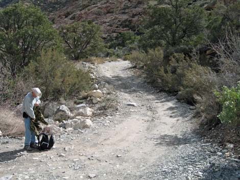
 Turning off Rocky Gap Road |
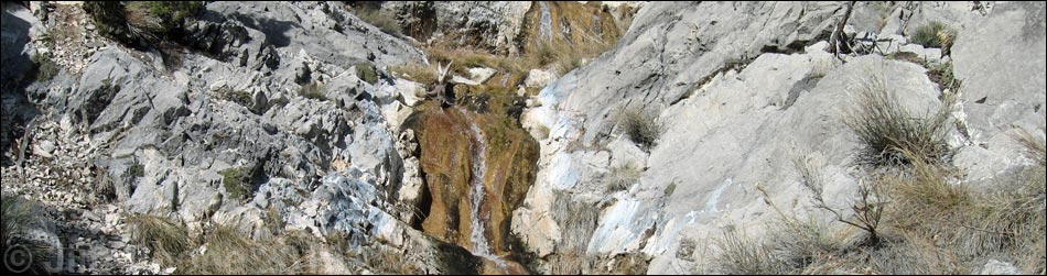
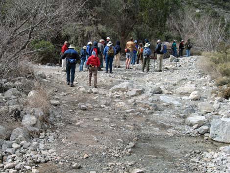
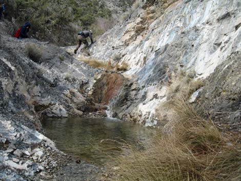
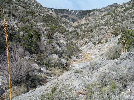
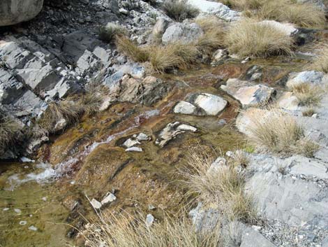
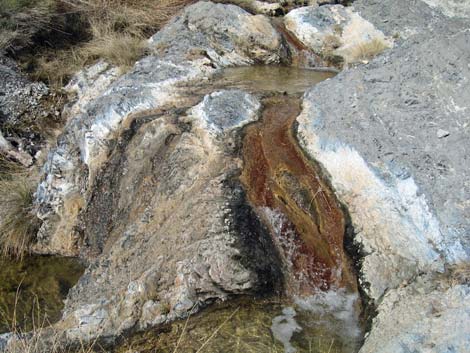
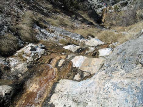
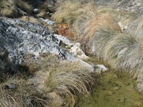
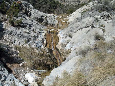
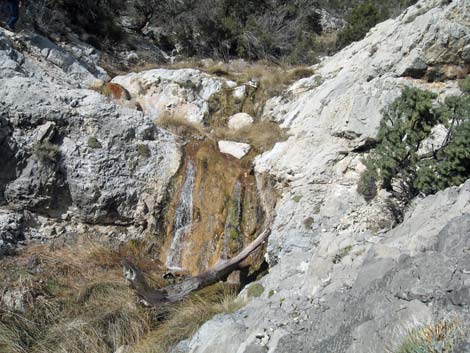
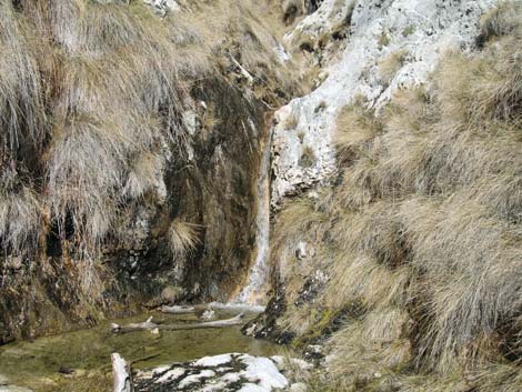
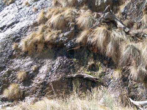
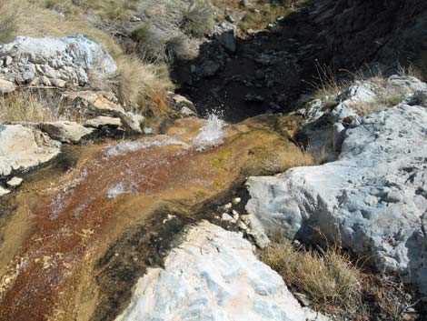
When a creek, which usually flows all year, crosses the road (Wpt. 06), the route leaves the road and follows the creek up (north) into Waterfall Canyon and the La Madre Mountains Wilderness Area. The La Madre Mountains are limestone, and as such the original rock was formed by piling horizontal layer upon horizontal layer of muck in the bottom of an ancient sea. Through tectonic forces, the surface of the earth (here limestone) fractured and was tilted upward to form the mountains we see today. The original limestone is very hard rock, but under the forces of erosion, it tends to come apart revealing the original layers. In the creekbed, these layers now create hundreds of little waterfalls (well, perhaps big riffles) and a few higher waterfalls. |
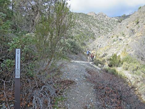 Entering the La Madre Mountain Wilderness Area |
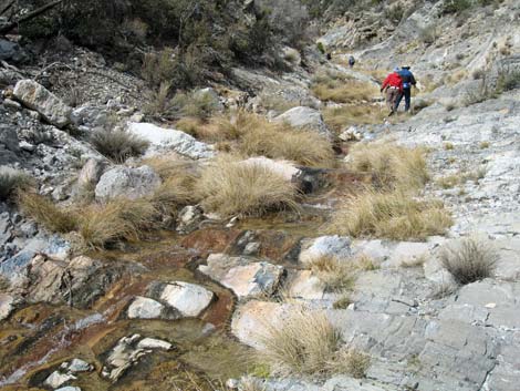
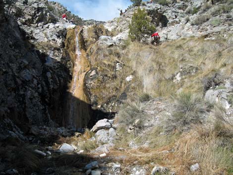
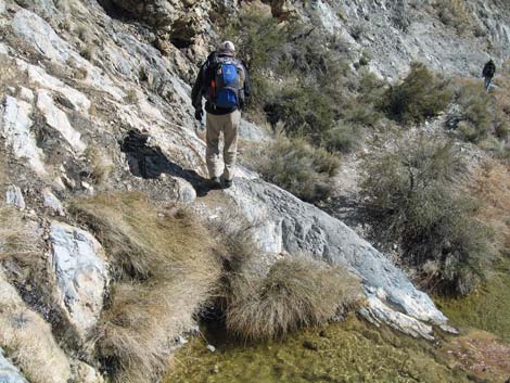
Hiking up Waterfall Canyon, there are bits of use-trail here and there mostly on the east side, but the hike generally is one little scramble-up after another while trying to keep your feet dry. There are, however, a few adventuresome scrambles and some exposed sections of use-trail. Eventually the creek runs up into a narrow cleft where water pours down through a slot that is too small to climb into. This point, about 2.5 miles from Willow Springs, is a good place to turn around and head back down. If you haven't had enough, a route can be found up the east wall to bypass the waterfall. Return to the top of the highest waterfall, then sit and relax for a while before heading back to the trailhead following your footprints down the canyon and the road. |
 |
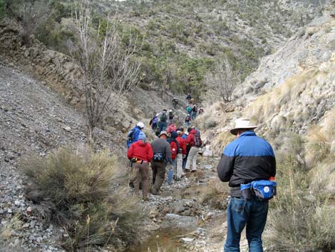 |
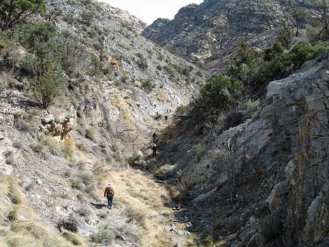
 Hikers low in the canyon |
 Hikers low in the canyon |
 |
 |
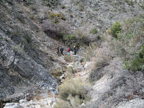
 Waterfall in the middle of the canyon |
 Hikers in the middle of the canyon |
 |
 |
 Pools in the canyon; no frogs |
 Hiker passing the highest waterfall |
 |
 |
 Last waterfall |
 Wet limestone |
 Wet limestone with grasses |
 Last waterfall and forested slopes above |
 Looking back down |
 Some steep rock to descend |
 Hikers descending the canyon |
 Back on Rocky Gap Road |
Table 1. Hiking Coordinates Based on GPS Data (NAD27; UTM Zone 11S). Download Hiking GPS Waypoints (*.gpx) file.
| Wpt. | Location | Easting | Northing | Elevation (ft) | Point-to-Point Distance (mi) | Cumulative Distance (mi) | Verified |
|---|---|---|---|---|---|---|---|
| 01 | Trailhead | 635111 | 4002657 | 4575 | 0.00 | 0.00 | Yes |
| 02 | Red Rock Wash | 634390 | 4003067 | 4741 | 0.43 | 0.43 | GPS |
| 03 | White Rock Trail | 634329 | 4003154 | 4849 | 0.20 | 0.63 | GPS |
| 04 | Highpoint on Road | 633657 | 4002868 | 5034 | 0.61 | 1.24 | GPS |
| 05 | 4WD Trailhead | 633454 | 4002568 | 5038 | 0.25 | 1.49 | GPS |
| 06 | Waterfall Creek | 633197 | 4002419 | 5084 | 0.19 | 1.68 | GPS |
| 07 | Last Waterfall | 632459 | 4002500 | 5542 | 0.58 | 2.26 | GPS |
Happy Hiking! All distances, elevations, and other facts are approximate.
![]() ; Last updated 240330
; Last updated 240330
| Hiking Around Red Rocks | Hiking Around Las Vegas | Glossary | Copyright, Conditions, Disclaimer | Home |