Hiking Around Las Vegas, Red Rock Canyon National Conservation Area, Calico Basin
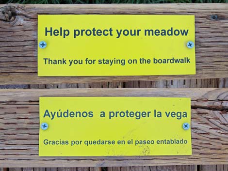 Signs on boardwalk - help protect your meadow! |
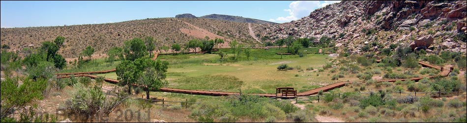
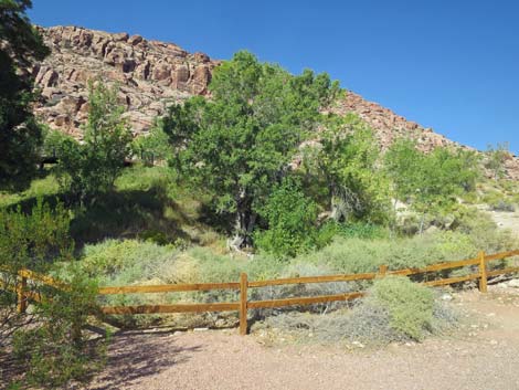
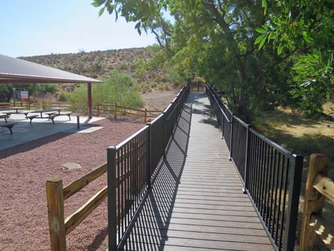
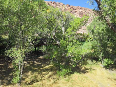
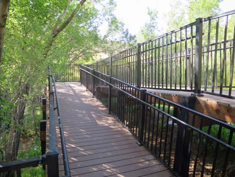
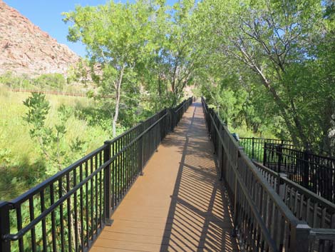
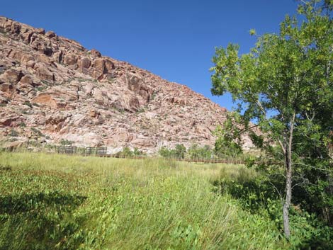
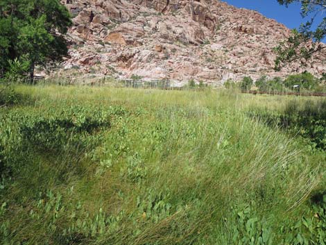
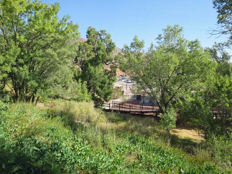
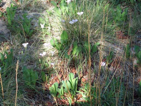
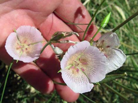
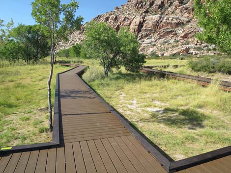
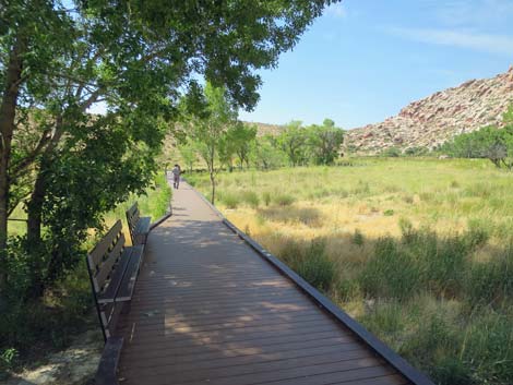
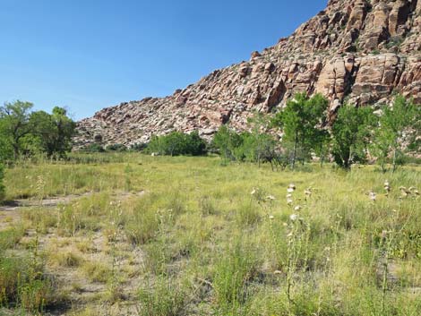
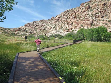
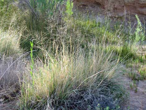
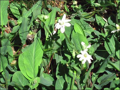
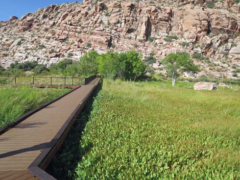
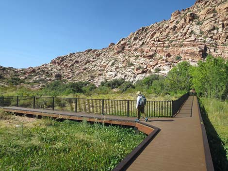
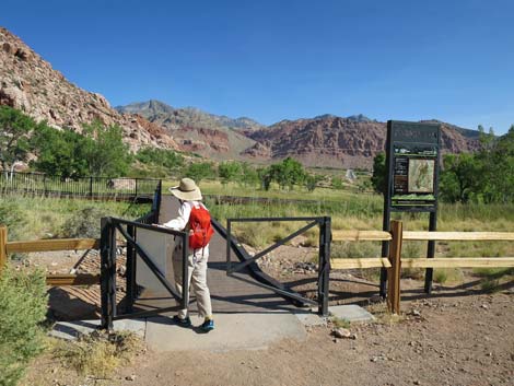
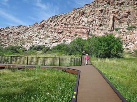
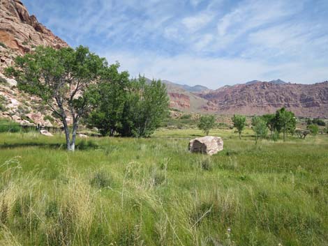
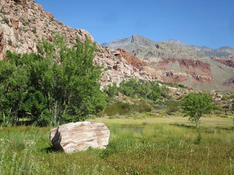
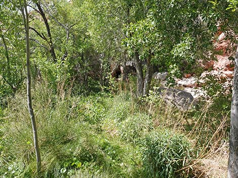
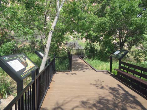
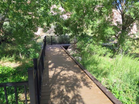
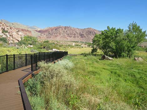
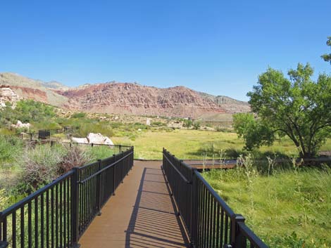
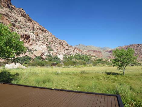
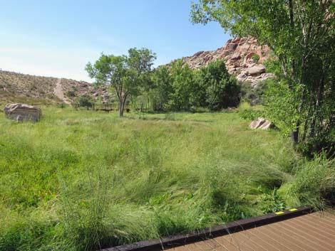
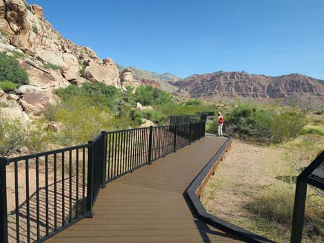
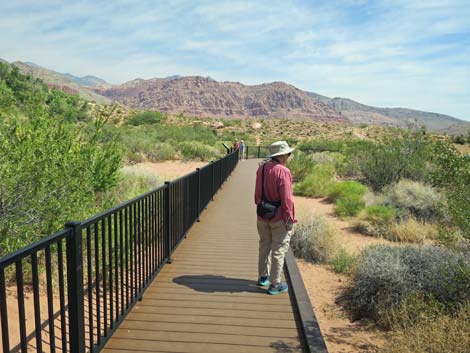
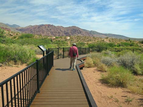
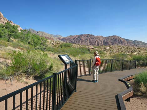
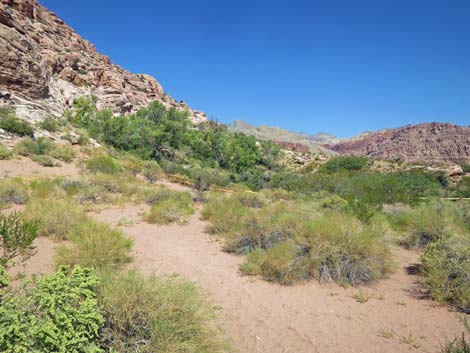
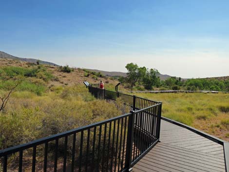
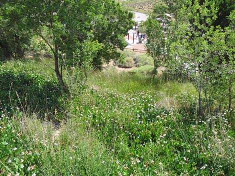
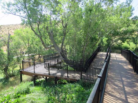
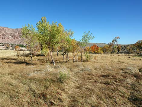
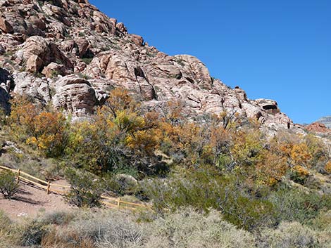
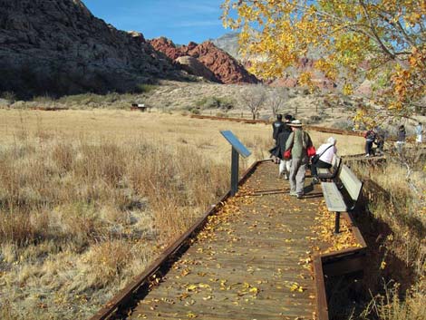
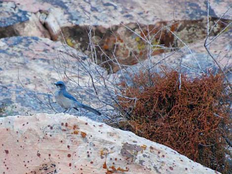
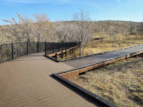
Overview Red Spring Boardwalk, or Calico Basin Boardwalk, is a delightful and fully accessible 1/2-mile hike in the Calico Basin area of Red Rock Canyon National Conservation Area. The boardwalk is not on the Scenic Loop Drive, so there is no charge to use the area. The boardwalk loop starts in a picnic area, switchbacks gently up a marshy hillside beneath towering Velvet Ash trees, and then makes a wide loop around an alkali meadow to Red Spring, which is at the far side of the meadow. Shaded benches provide pleasant places to sit, rest, and watch swallows and dragonflies flying over the meadow. An alkali meadow is a saturated or seasonally flooded area with somewhat salty water where only salt-tolerant plants can thrive. Here, Alkali Sacatone grass, Saltgrass, and Yerba Mansa are common, while the Alkali Mariposa Lily is rare. Because there is surface water here, this is a good place to watch birds and other creatures that come to drink. Link to map. |
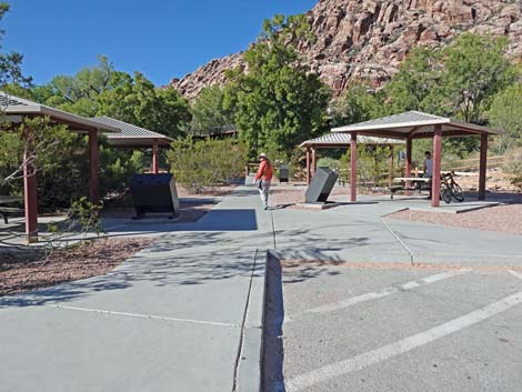
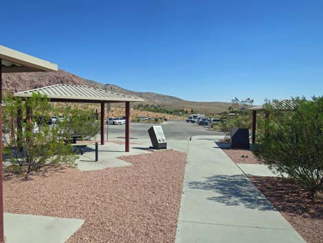
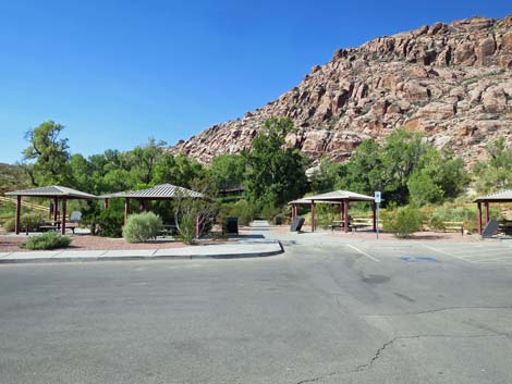 Red Spring picnic area and trailhead |
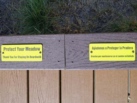
Watch Out Other than the standard warnings about hiking in the desert, ...this hike is fairly safe, even for kids. However, the boardwalk is elevated, so take care not to step off the side. While photographing a bird, I once backed up while looking through the camera and stepped off the boardwalk -- I fell into the mud with quite a thud, but I kept the camera clean! The meadow harbors the rare Alkali Mariposa Lily, so please stay on the boardwalk so as not to trample the delicate vegetation. While hiking, please respect the land and the other people out there, and please try to Leave No Trace of your passage. Also, even though this is a short hike, be sure to bring what you need of the 10 Essentials. |
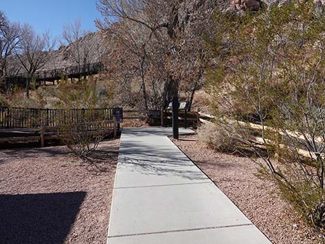
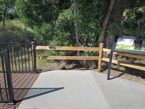
 Red Spring picnic area and cement trail to boardwalk |
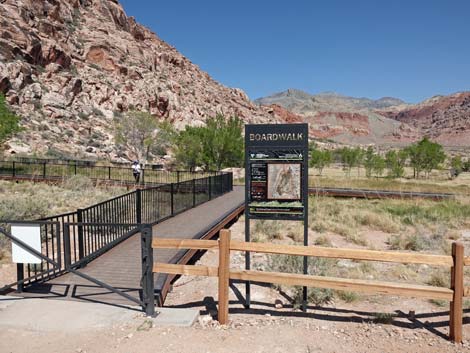
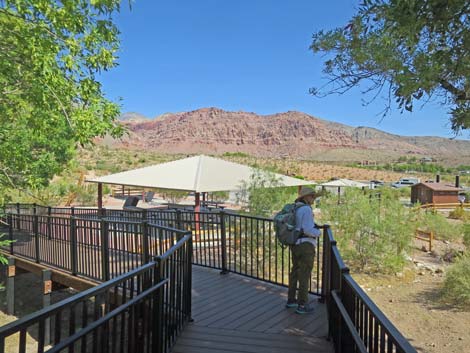
Getting to the Trailhead This hike is located in Red Rock Canyon National Conservation Area, about 30 minutes from downtown, but not in the Scenic Loop Road fee area. Drive out West Charleston Blvd, turn right onto Calico Basin Road, and then drive into the Red Spring Trailhead. Park here; this is the trailhead. The parking area closes at sunset, so don't stay too late and get locked in. |
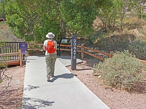
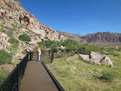
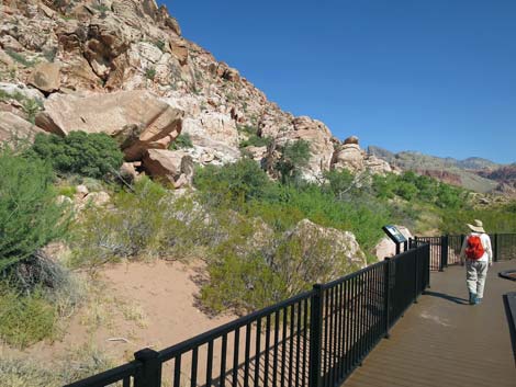
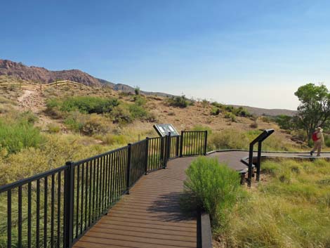
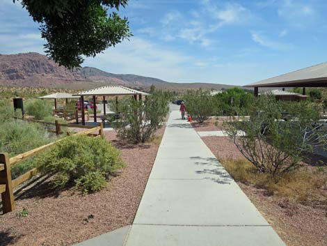
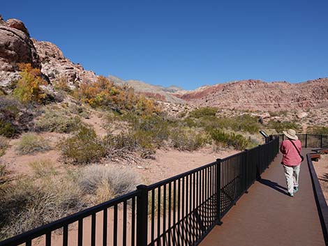
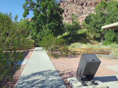 The concrete path leads through the picnic area (view W) |
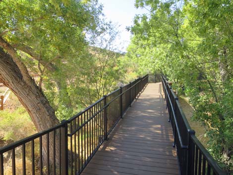
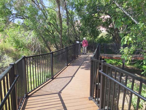
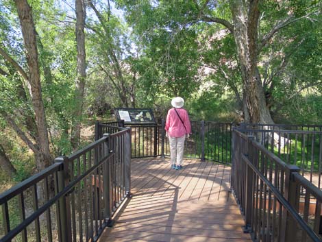
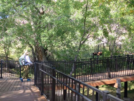
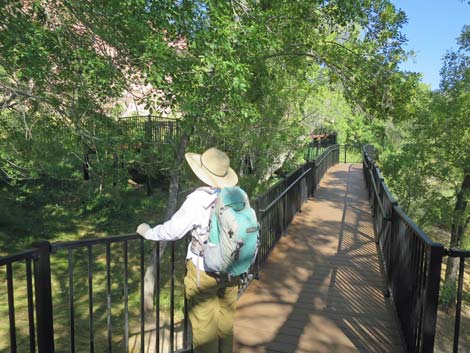
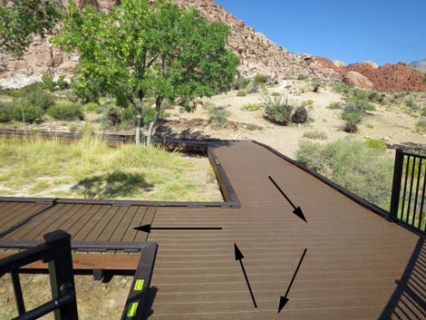
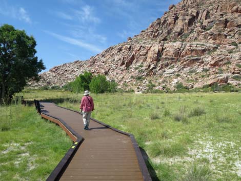
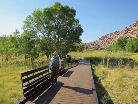
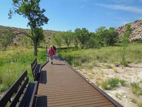
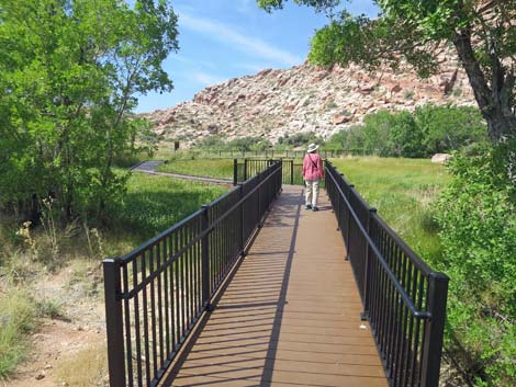
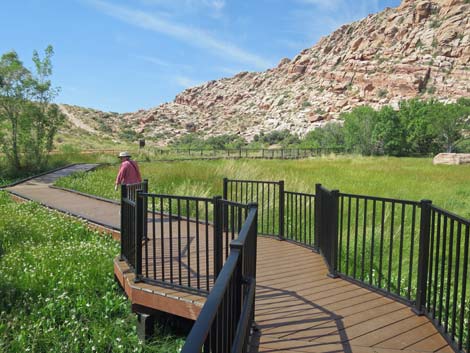
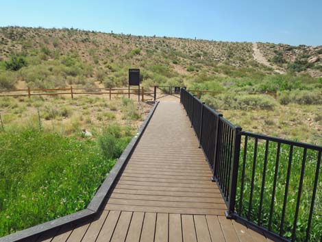
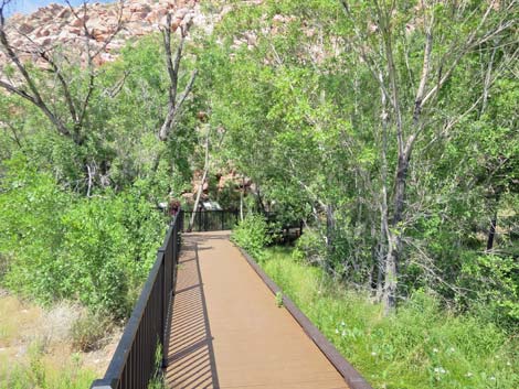
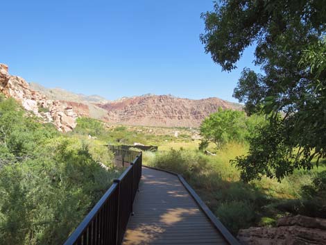
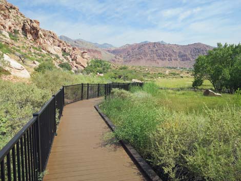
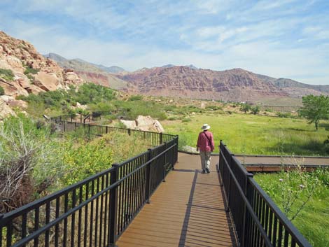
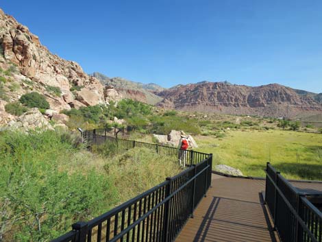
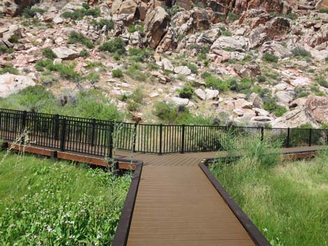
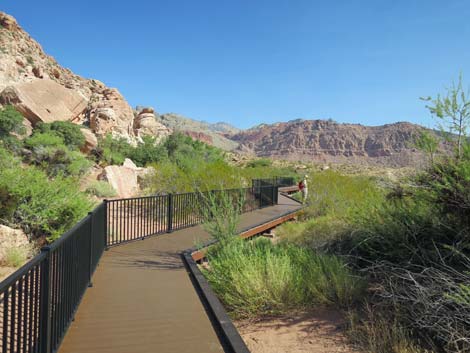
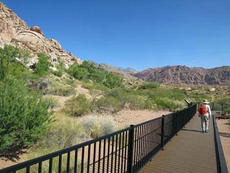
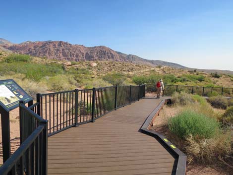
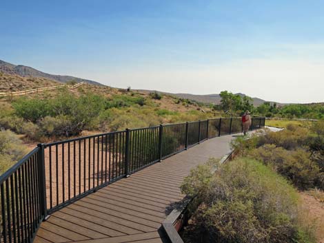
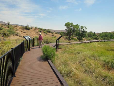
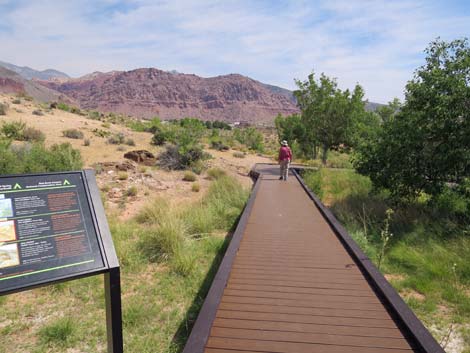
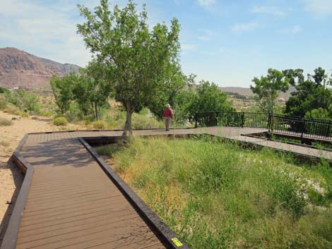
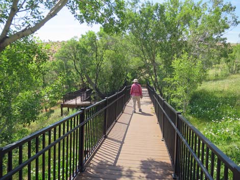
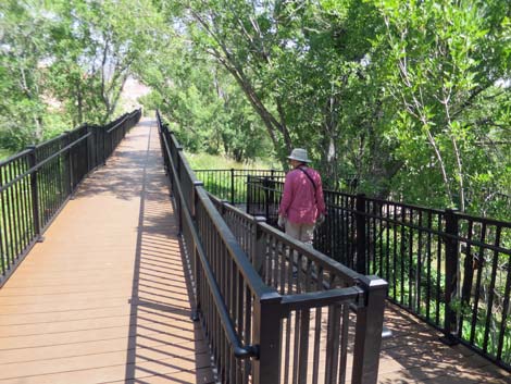
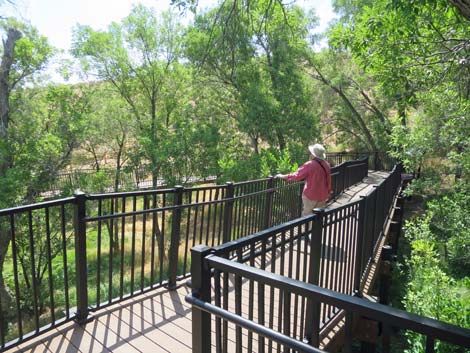
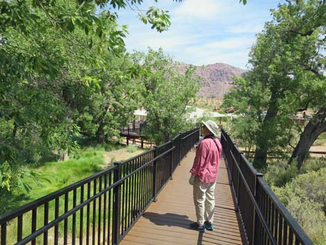
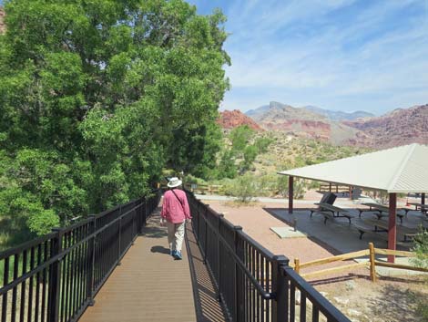
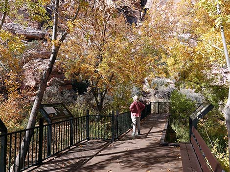
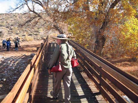
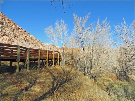
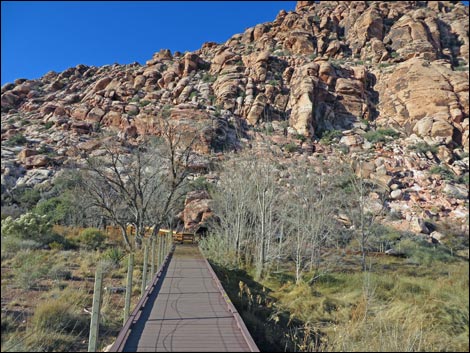
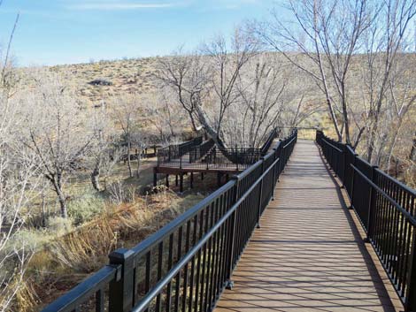
The Hike From the parking area, the concrete trail runs straight through the picnic area to the base of the boardwalk (Table 1, Waypoint 01). Beneath tall Velvet Ash trees, the boardwalk switchbacks up a marshy hillside to the edge of the alkali meadow with nice views out across the meadow and back down to the picnic area. This is a good place to stop and look for birds singing in the treetops. Atop the switchbacks, the trail forks to begin the loop around the meadow. Hikers can walk in either direction and enjoy the scenery, but the photos here were taken staying to the left at the fork. Red Spring is located under the Velvet Ash trees in the far corner of the meadow from the fork, so neither direction is shorter. Staying left, the boardwalk heads south along the edge of the meadow passing benches that invite people to sit peacefully in the sun or in the shade and watch violet-green swallows sallying back and forth across the meadow catching bugs. |
 Passing the picnic pavilion |
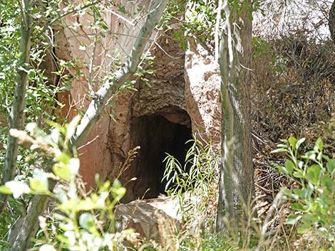
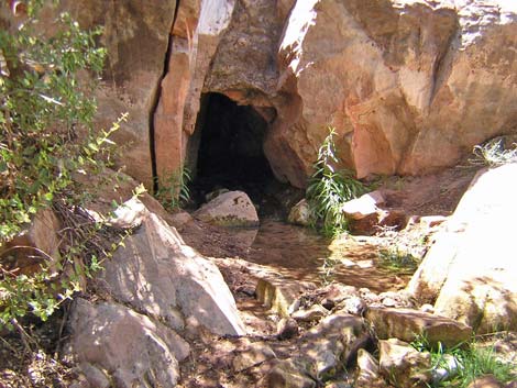
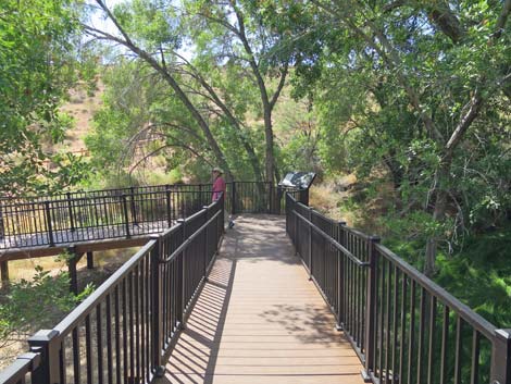
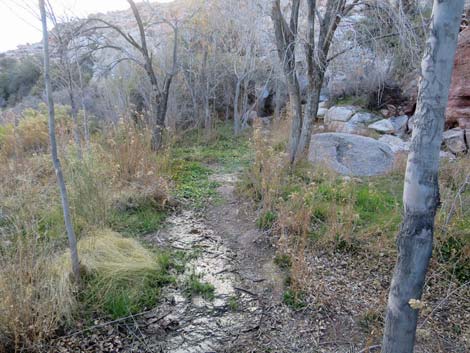
Continuing on the boardwalk, the trail begins to loop to the right and passes more old ash trees. Shortly, the trail passes a trail junction where are the boardwalk spur to the left exits the area to the south. A fairly popular trail climbs the steep hillside to an overlook. Continuing on the boardwalk, the trail heads due west to Red Spring (Wpt. 02). Shaded by tall ash trees, two benches invite hikers to sit and enjoy the cool spring environment. Lots of birds and flying insects make their home here among the lush vegetation. Rambunctious rock squirrels also live in this area, but for their own good, don't let them get your lunch. Before the boardwalk was installed, people congregated at the spring and trampled all of the riparian vegetation. Now however, the habitat is recovering, and it is hard to see where the spring comes out of a natural sandstone tunnel. While possibly frustrating to hikers, this is a good thing for the habitat and the wildlife that comes to drink from this precious resource. The increase in vegetation has improved the birding experience, and keep an eye out for foxes. |
 Tree and spring that attract birds |
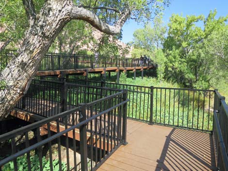
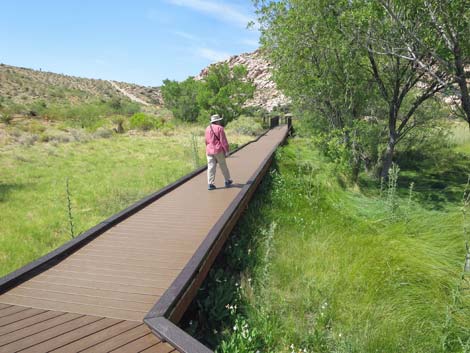
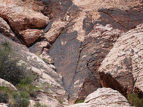
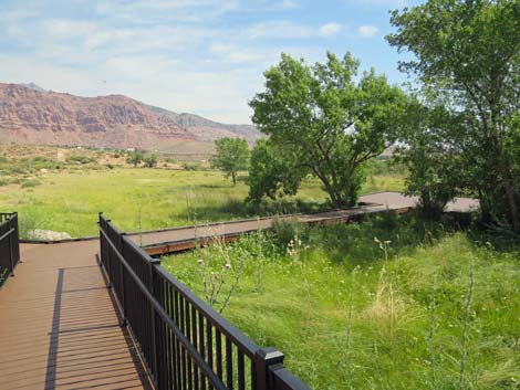
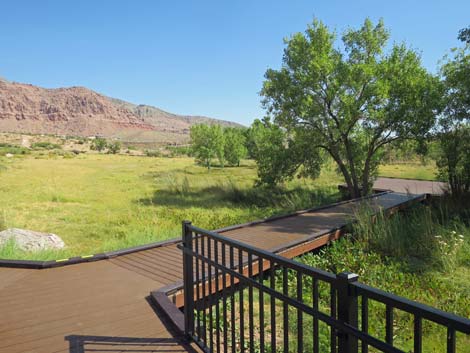
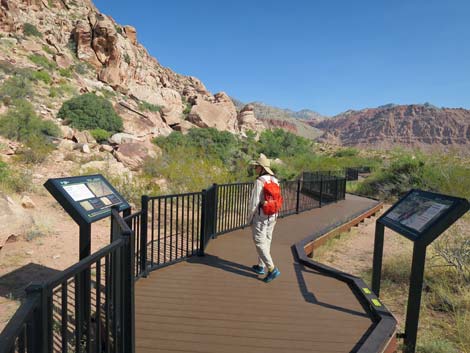
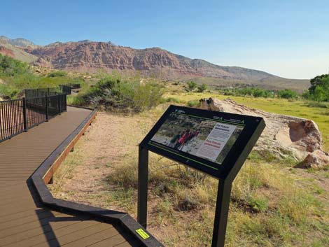
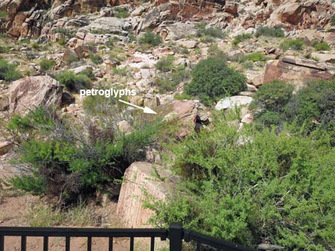
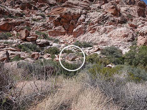
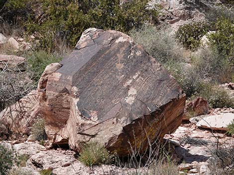
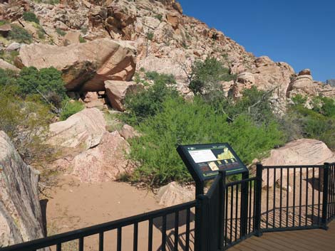
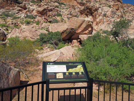
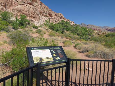
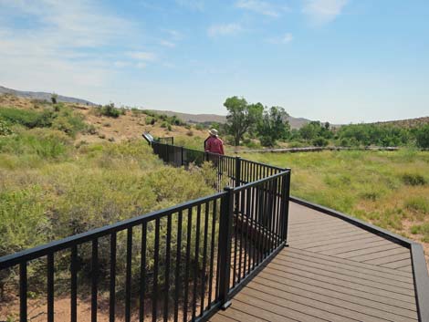
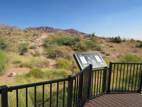
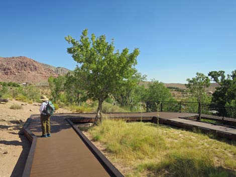
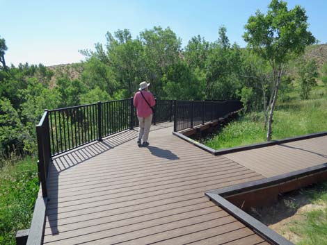
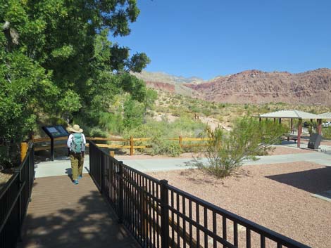
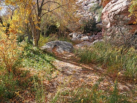
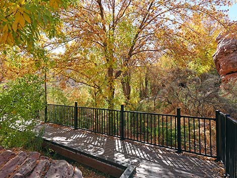
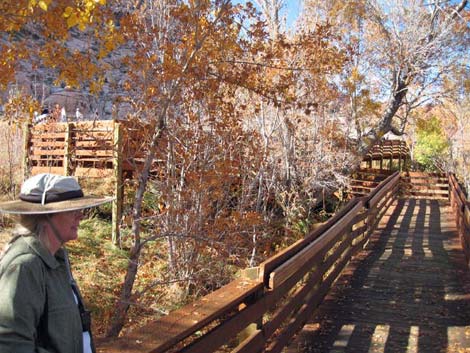
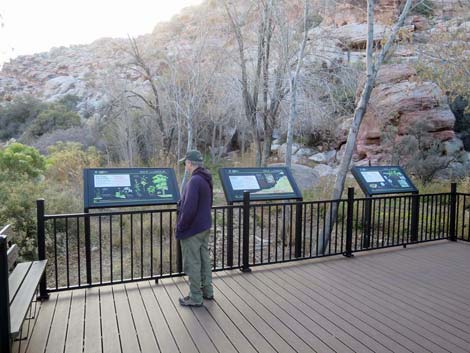
The boardwalk continues, now headed north out from under the trees with grand views across the meadow towards red-and-white sandstone crags in the distance and gray limestone ridges on the horizon. Shortly, the trail forks again and a spur to the right ends on a platform more in the middle of the meadow. Continuing straight, the trail arrives at an information sign (Wpt. 03) and petroglyphs on the left. The sign highlights one boulder, but look around for more petroglyphs including some at the base of the cliffs high above (although these are better seen from back in there Red Spring). The boardwalk continues north crossing sandy soils on the edge of the meadow. This is a fun area to look for tracks in the sand. Watch for coyote tracks, kangaroo rat tracks, quail tracks, lizard tracks, and if you're very lucky: snake tracks or desert tortoise tracks. |
 Alternate start of the Calico Basin Trail (view N) |
Past the sandy area, the boardwalk bends to the right again and begins looping east back towards the top of the switchbacks. Information signs in this area speak about Native Americans, plants, wildlife, and geology in the meadow area. The geology sign, however, does not speak about the Shinarump Conglomerate, an important marker of time in local geology (225 million years ago). These well-polished (often red) river gravels were laid down in braided rivers during a time after the ocean receded and before the sand dunes and dinosaurs arrived. Finally, the boardwalk loops back to close the loop at the top of the switchbacks and returns down to the picnic area and the trailhead (Wpt. 01) |
 Start of the boardwalk |
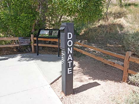 Donation box |
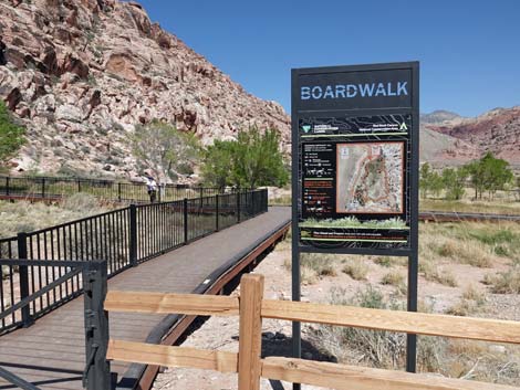
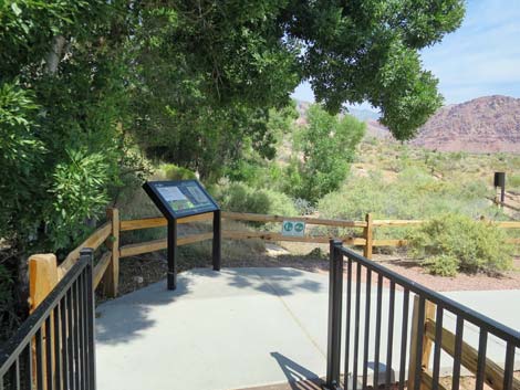
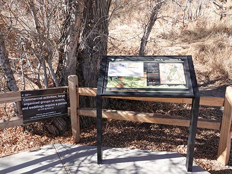 Information sign at the start of the boardwalk |
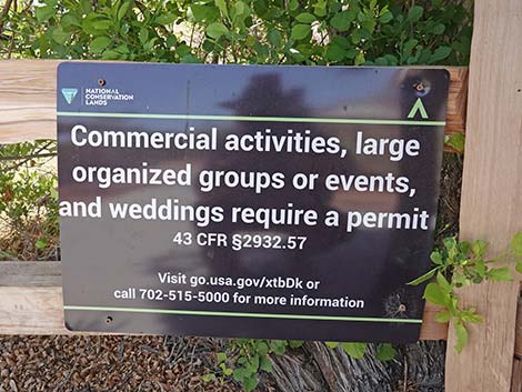 New sign to remind groups and commercial operators. |
 Somebody tore down the sign, but the rule still applies ... |
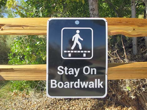 ... protect your meadow habitat by staying on the boardwalk |
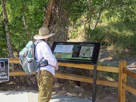 Information sign at the start of the boardwalk |
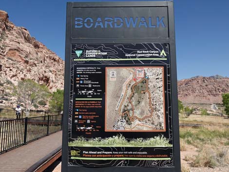
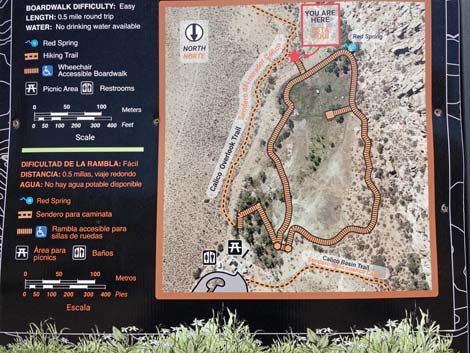
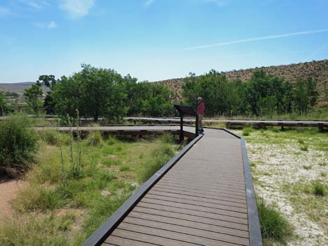
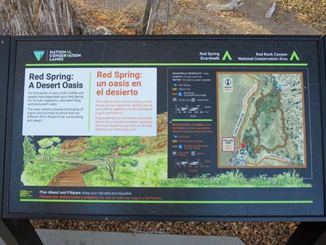 Information sign -- Red Spring: A Desert Oasis and map |
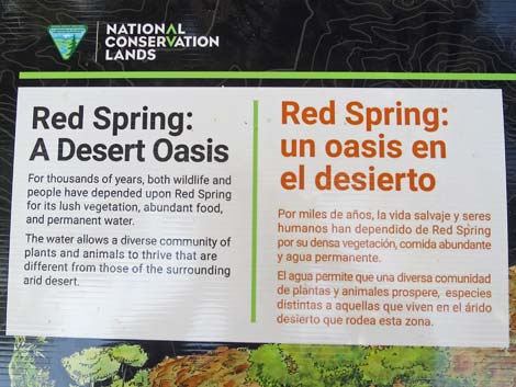 Information sign -- Red Spring: A Desert Oasis |
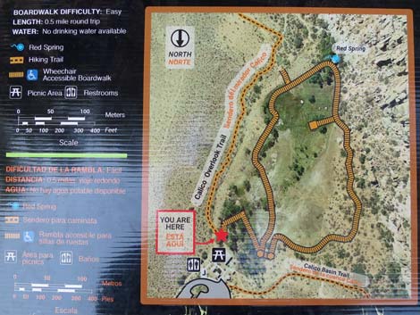 Information sign -- trail map |
 Start of the boardwalk adjacent to the picnic area (view S) |
 Ash trees provide lots of shade during summer (view S) |
 Velvet Ash trees and grassy meadow on the hillside (view W) |
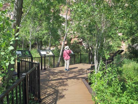
 Hiker on the boardwalk |
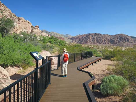
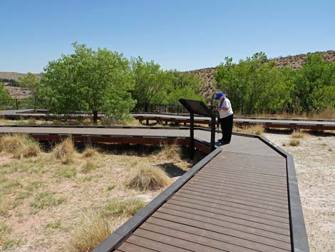
 Hiker at second interpretive sign |
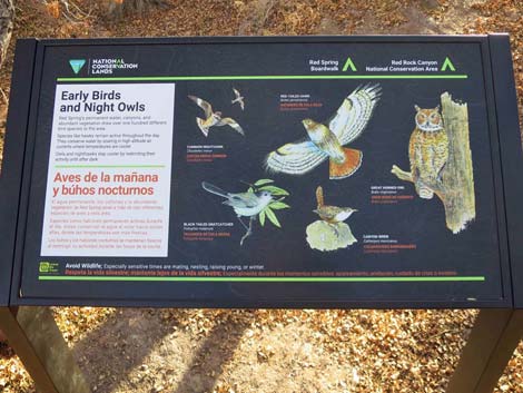 Interpretive sign: early birds and night owls |
 Hiker starting into the switchbacks (view SW) |
 First switchback (view NW) |
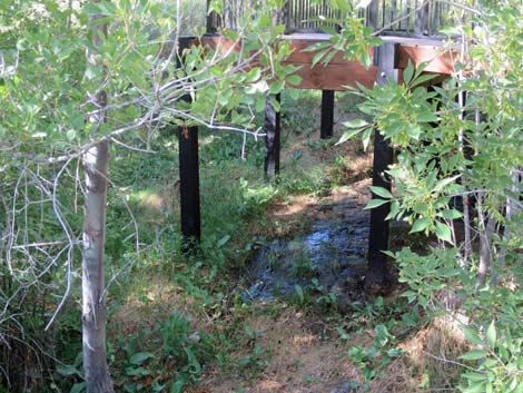 Marshy slope under the boardwalk (view SW) |
 Turning the next switchback (view NW) |
 Switching back (view SE) |
 Starting up the last switchback (view NW) |
 Cresting the hillside, the alkali meadow comes into view (view NW) |
 Alkali meadow during spring bloom (view NW) |
 Looking down the hillside towards the trailhead (view NE) |
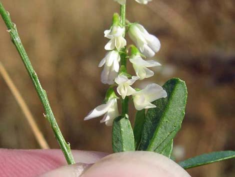
 Alkali Mariposa Lily (Calochortus striatus) |
 Our rare plant: Alkali Mariposa Lily (Calochortus striatus) |
 Alkali meadow (view SW) |
 Boardwalk forks to start the loop (view NW) |
 Staying left at the fork (view NW) |
 The boardwalk starts out into the alkali meadow (view SW) |
 Just a reminder -- protect your meadow vegetation! |
 Alkali meadow during early summer (view SW) |
 Benches in the sun (view SW) |
 Benches in the summer shade (view SW) |
 Tall Arizona Thistle in the meadow (view SW) |
 More benches in the sun (view SW) |
 Hiker on the boardwalk (view SW) |
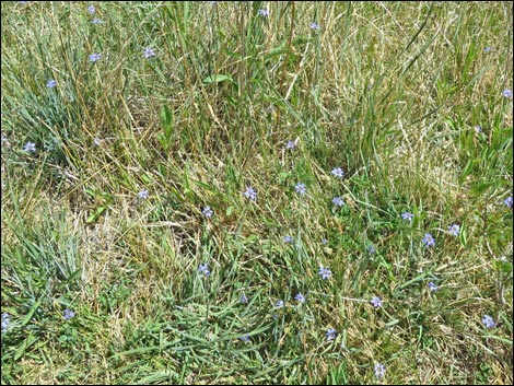 Watch for Western Blue-eyed Grass in the meadow |
 Hiker on the boardwalk (view SW) |
 Hiker on the boardwalk (view SW) |
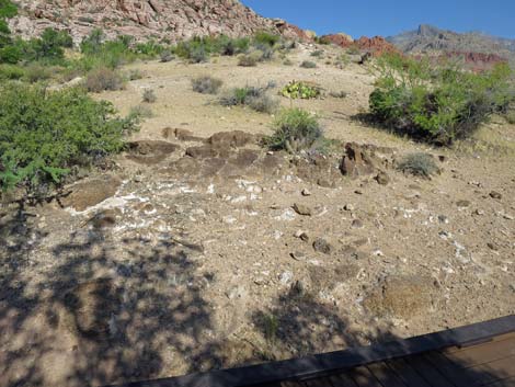
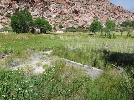 Concrete foundation of something old (view NE) |
 Alkali Sacaton Grass on the left; Yerba Mansa on the right (view SW) |
 Alkali Sacaton Grass with open seedheads |
 Yerba Mansa leaves and flowers |
 Lots of Yerba Mansa along the boardwalk in wetter areas |
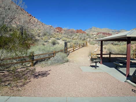
Spur to Boardwalk Exit onto Calico Overlook Trail
 Hiker turning onto spur trail (view SW) |
 Exit spur trail to Calico Overlook Trail (view S) |
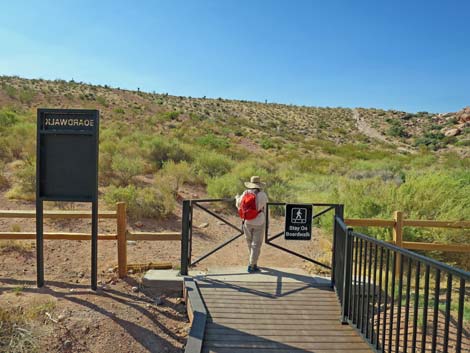 Trail sign and gate at the end of the spur trail (view S) |
 Hikers can enter the boardwalk here too (view N) |
 Trail sign (view N from outside the gate) |
 Trail sign (view N from outside the gate) |
 Trail sign (view N from outside the gate) |
 Trail sign (view N from outside the gate) |
Continuing on the Main Boardwalk
 Hiker continuing past the spur trail (view W) |
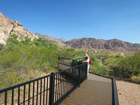
 Grand scenery across the alkali meadow (view N) |
 Grand scenery (view N) |
 Approaching Red Spring, proper (view SW) |
 Boardwalk at Red Spring (view W) |
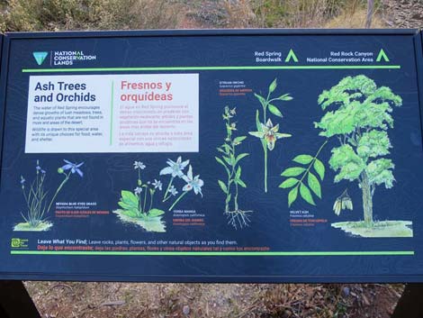 Information sign: Ash trees and orchids |
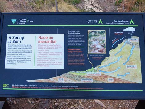 Information sign: A spring is born (geology) |
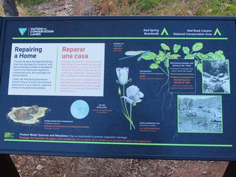 Information sign: Repairing a home (habitat restoration) |
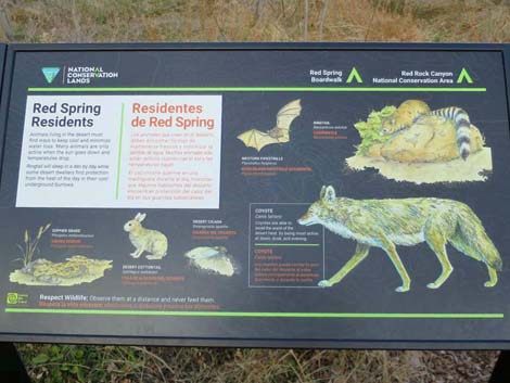 Information sign: Red Spring residents (mammals) |
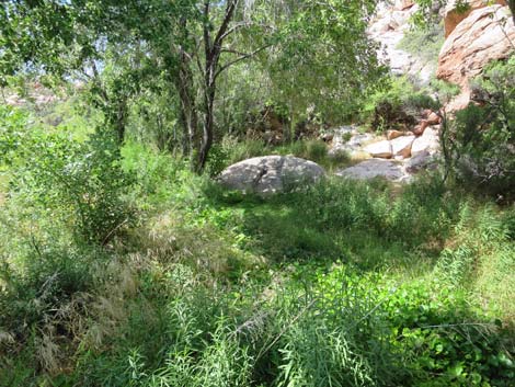 Riparian vegetation along the spring outflow steam (view SW) |
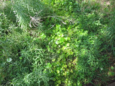 Water, mud, marsh plants, and flying insects (view down) |
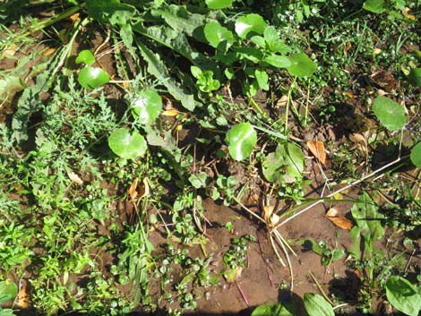 Water, mud, marsh plants, and flying insects (view down) |
 The spring emerges from a barely visible cave |
 The spring emerges from a barely visible cave |
 Red Spring emerges from a short tunnel - summer 2005 |
 Boardwalk, info signs, and benches at Red Spring (view NW) |
 Boardwalk passing Red Spring (view NW) |
 Boardwalk exiting Red Spring (view N) |
 The boardwalk runs north past Red Spring (view N) |
 Hard-to-see petroglyphs high on the hillside (view NW) |
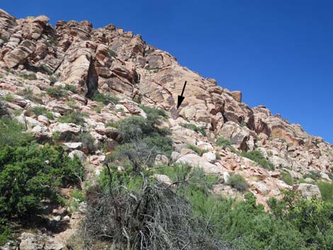 Petroglyphs high on the hillside (view NW) |
 Petroglyphs high on the hillside (view NW) |
 Continuing on the boardwalk (view N) |
 Boardwalk forks ahead (view N) |
 Hiker approaching spur trail to the right (view N) |
 Hiker continuing past the spur trail (view N) |
Spur Boardwalk to the Ceremonial Platform
 Spur trail to the right (view N) |
 Spur trail to the right (view NE) |
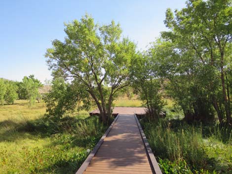 Spur trail to platform (view NE) |
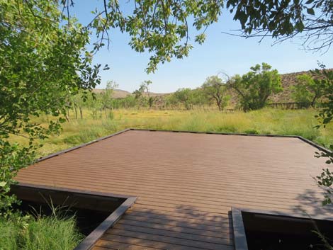 Platform at end of the spur trail (view NE) |
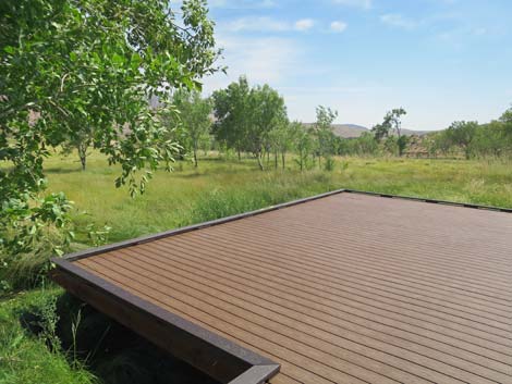 Platform (view NE across the alkali meadow) |
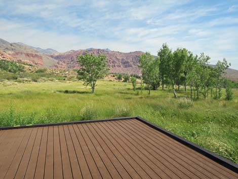 Platform (view N across the alkali meadow) |
 Platform (view NW across the alkali meadow) |
 Platform (view SW across the alkali meadow to Red Spring) |
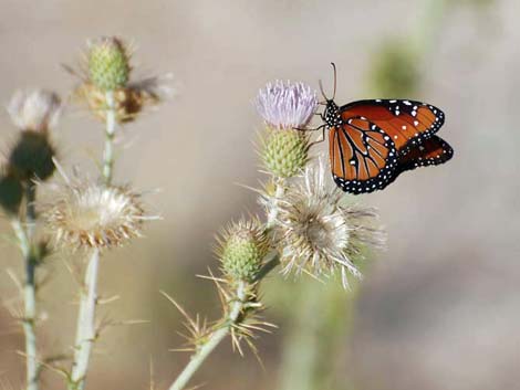 Butterfly on thistle |
 Returning to the main boardwalk trail (view W) |
Continuing on the Main Boardwalk Trail
Hiker continuing past the spur trail (view N) |
 Hiker continuing on the main boardwalk (view N) |
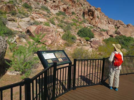
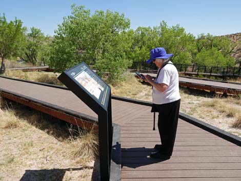
 Hiker at two interpretive signs (view N) |
 Interpretive sign on the right (view N) |
 Interpretive sign on the right (view E) |
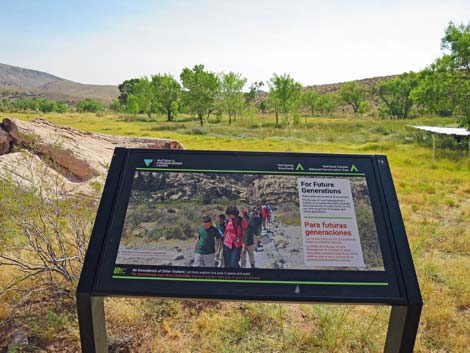
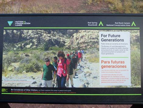 Interpretive sign: Protecting areas for future generations |
 Hiker at interpretive sign on the left (view N) |
 Interpretive sign on the left (view W) |
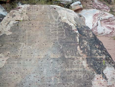
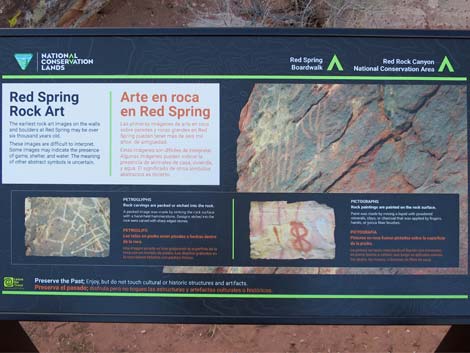 Interpretive sign: Red Spring Rock Art (petroglyphs) |
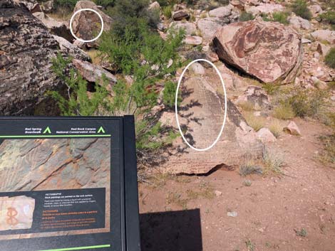 Petroglyphs on sandstone boulders (view W) |
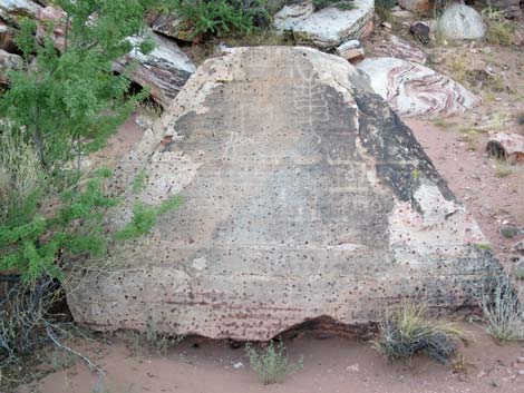 Petroglyphs on sandstone boulder (view W) |
 Petroglyphs on sandstone boulder (close-up view W) |
 More petroglyphs on sandstone boulder to the right (view NW) |
 A different view of petroglyphs on sandstone boulder (view W) |
 Another sandstone boulder with petroglyphs (view W) |
 Another sandstone boulder with petroglyphs (zoom; view W) |
 Hiker continuing past the petroglyphs (view N) |
 Hiker continuing past the petroglyphs (view N) |
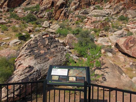
 Hiker approaching another interpretive sign (view N) |
 Hiker at another interpretive sign (view N) |
 Interpretive sign (view NW) |
 Interpretive sign (view W) |
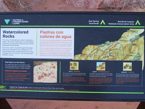 Interpretive sign: Water-colored Rocks (view W) |
 What is she pointing at? |
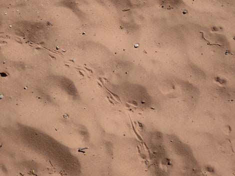 Fresh Kangaroo Rat tracks! |
 Now what did she find? |
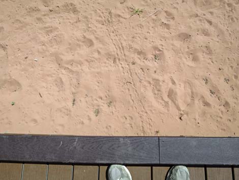 Desert Tortoise tracks! |
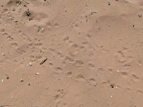 Desert Tortoise and Kangaroo Rat tracks! |
 Bushes and sand-dune habitat (view NE) |
 Hiker continuing on the boardwalk (view N) |
 Hiker approaching another interpretive sign (view NE) |
 Hiker at the next interpretive sign (view NE) |
 Interpretive sign (view NW) |
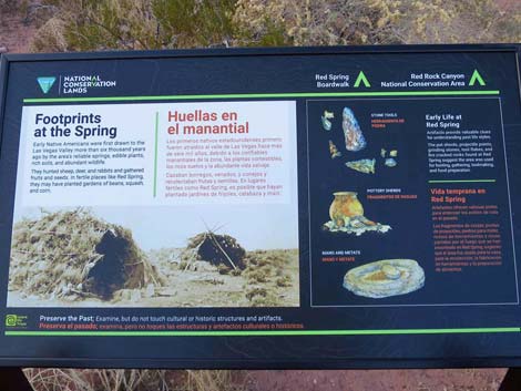 Interpretive sign: Footprints at the spring (archaeology) |
 Ash Spring on the hillside with Velvet Ash trees (view NW) |
 Hiker continuing on the boardwalk (view NE) |
 The boardwalk begins to loop back towards the fork (view NE) |
 Hiker on the boardwalk (view NE) |
 Hiker continuing on the boardwalk (view NE) |
 Hiker at the next set of interpretive signs (view NE) |
 Interpretive sign (view NE) |
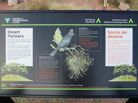 Interpretive sign: Desert partners (birds and plants) |
 Interpretive sign (view S) |
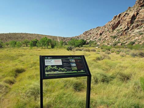
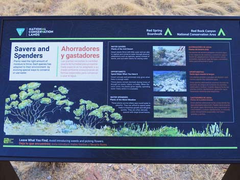 Interpretive sign: Savers and spenders (plant ecology) |
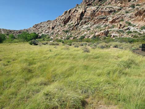 Broad, open salt-grass meadow (view SW) |
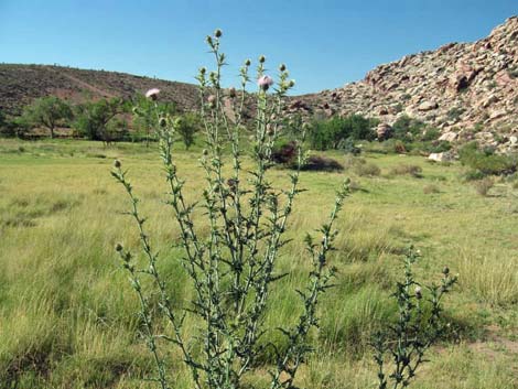 Mojave Thistle in the alkali meadow (view S) |
 Hiker continuing on the boardwalk (view NE) |
 Approaching hiker at the last interpretive sign (view E) |
 Hiker at the last interpretive sign (view E) |
 Hiker at the last interpretive sign (view E) |
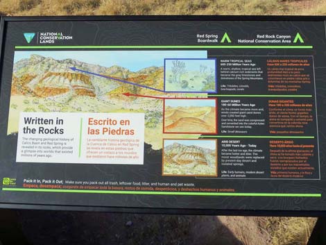 Interpretive sign: Written in the rocks (geology) |
 Hiker past the last sign on the trail (view N) |
 Hiker approaching the fork in the trail (view NE) |
 Nondescript rock outcrop? We need an interpretive sign here! |
 Shinarump Conglomerate - an important marker in local geology |
 Hiker returning to the fork in the trail (view NE) |
 Starting back down the switchbacks (view SE) |
 Nice view down the damp-soil hillside (view NE) |
 Hiker heading back down the ramp (view SE) |
 Then boardwalk switchbacks down the slope (view S) |
 Hiker in the switchbacks (view N) |
 Hiker continuing down the boardwalk (view S) |
 Hiker continuing down the boardwalk (view S) |
 Stopping to listen to birds singing in the trees (view N) |
 Hiker approaching the picnic area (view NE) |
 Hiker approaching the end of the boardwalk (view NW) |
 End of the boardwalk (view NW) |
 End of the boardwalk (view NW) |
 Starting back through the picnic area (view NE) |
 Returning through the picnic area to the parking lot (view NE) |
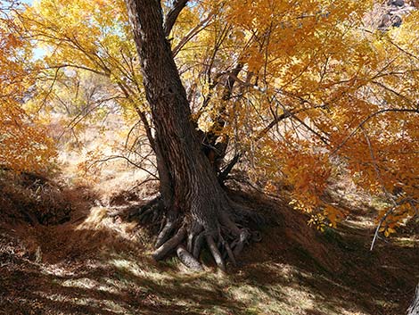
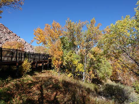
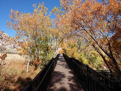
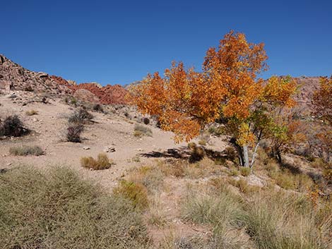
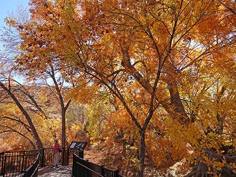
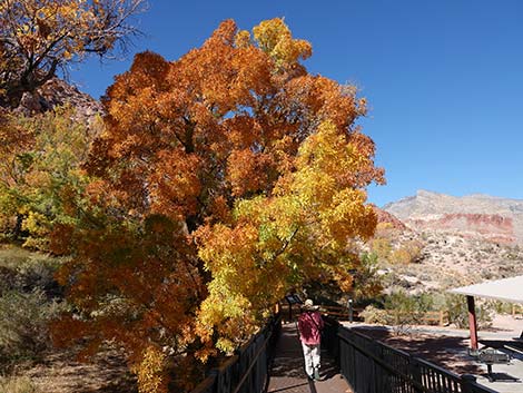
Fall Colors at Red Spring
 |
 |
 |
 |
 |
 |
 |
 |
 |
 |
 |
 |
 |
 |
 |
 |
 |
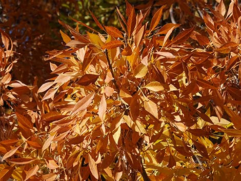 |
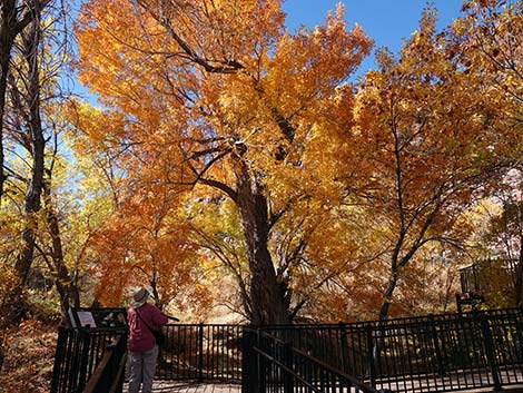
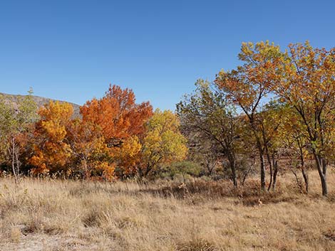
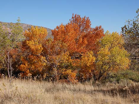
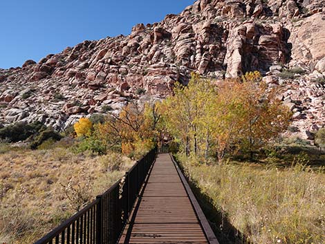
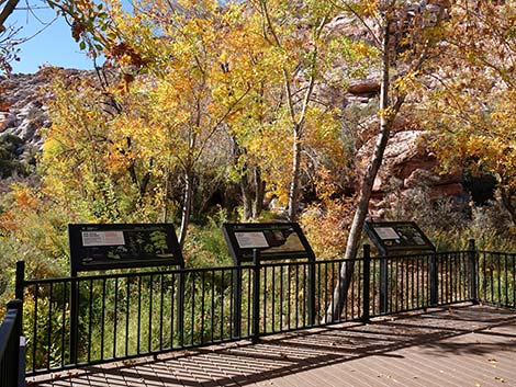
 Fall colors at Red Spring (view S) |
 Fall colors at Red Spring (view NW) |
 Fall colors in the Red Spring meadow (view N) |
 The birds can't hide behind tree leaves! |
Winter at Red Spring
 Red Spring Boardwalk during winter |
 Red Spring Boardwalk during winter |
 Red Spring Boardwalk during winter |
 Red Spring Boardwalk during winter |
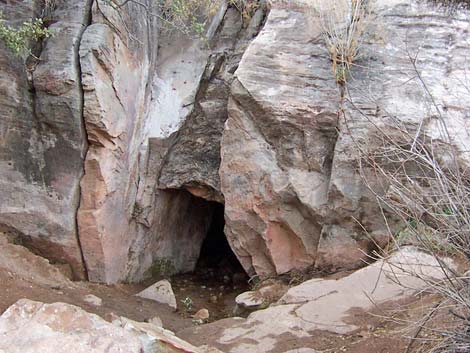 Red Spring emerges from a short tunnel - winter 2002 |
 Red Spring Boardwalk during winter |
 Red Spring Boardwalk during winter |
 Don't overlook winter-blooming flowers |
Table 1. Hiking Coordinates Based on GPS Data (NAD27; UTM Zone 11S). Download Hiking GPS Waypoints (*.gpx) file.
| Wpt. | Location | Easting | Northing | Elevation (ft) | Point-to-Point Distance (mi) | Cumulative Distance (mi) | Verified |
|---|---|---|---|---|---|---|---|
| 01 | Red Spring Trailhead | 642280 | 4001130 | 3,600 | 0.00 | 0.00 | GPS |
| 02 | Red Spring | 642181 | 4000923 | 3,735 | 0.16 | 0.16 | GPS |
| 03 | Petroglyphs | 642148 | 4001018 | 3,714 | 0.07 | 0.23 | GPS |
| 01 | Red Spring Trailhead | 642280 | 4001130 | 3,600 | 0.23 | 0.46 | GPS |
Happy Hiking! All distances, elevations, and other facts are approximate.
![]() ; Last updated 240330
; Last updated 240330
| Hiking Around Red Rocks | Hiking Around Las Vegas | Glossary | Copyright, Conditions, Disclaimer | Home |