Hiking Around Las Vegas, Red Rock Canyon National Conservation Area
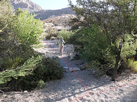
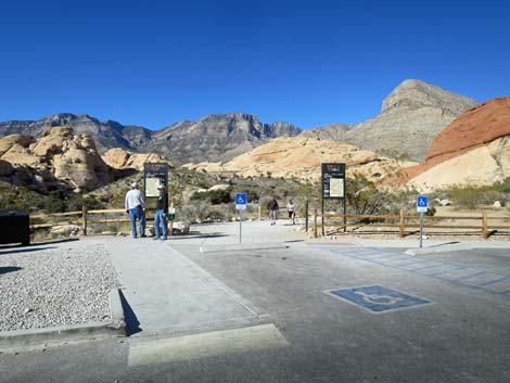 Sandstone Quarry Trailhead (view N) |
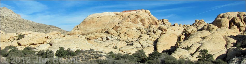
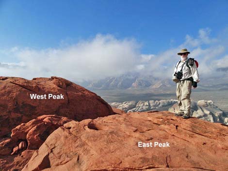
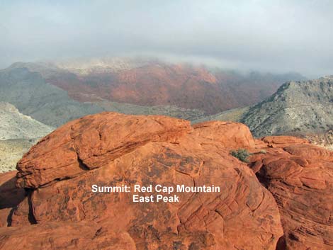
Overview Red Cap Mountain (sometimes referred to as "Little Turtlehead Peak" or "Turtlehead Junior") is the highest point in the Calico Hills. The summit, at 4,938 ft, is composed of two peaks separated by a deep and wide chasm. Views from the two peaks are virtually identical, and although the west peak is a few feet higher, the east peak is easier and safer to climb, so except for bragging rights, there is little value in risking the true summit. The 1.1-mile route up the east peak is a steep and strenuous 3rd-class scramble that follows washes, clefts, and sandstone slickrock up and across the west face of the mountain, then circles onto the summit from the south. Summit views are great, if airy, spreading out over Red Rock Canyon, Calico Basin, and the Las Vegas Valley. Most of Red Cap Mountain is composed of white sandstone, but the summit bears a cap of red sandstone, hence the name: Red Cap. |
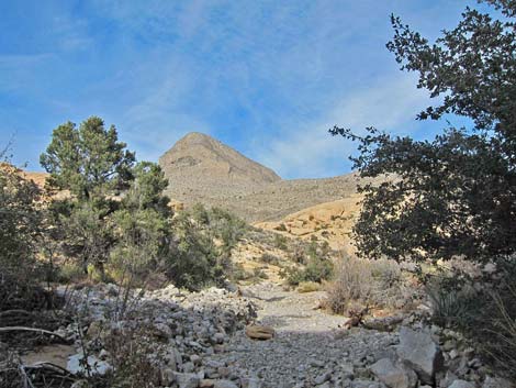
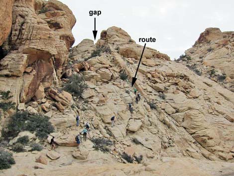
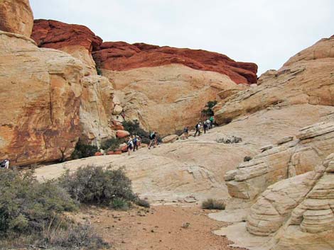
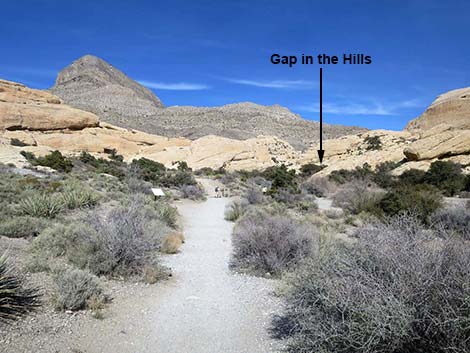 Calico Tanks Trail runs through gap (view NE) |
Link to map. Watch Out Other than the standard warnings about hiking in the desert, ...this is a steep and strenuous hike requiring some 3rd-class scrambling over and around boulders and up slickrock terraces. The route also requires some route-finding skills. Be extra careful when high enough to fall and hurt yourself. While hiking, please respect the land and the other people out there, and please try to Leave No Trace of your passage. Also, even though this is a short hike, be sure to bring what you need of the 10 Essentials. |
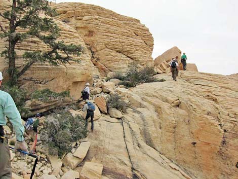
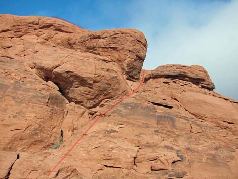
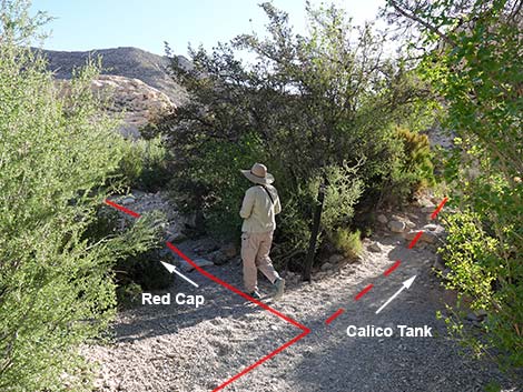 Trail junction: departing Calico Tank Trail (view NE) |
Getting to the Trailhead This hike is located along the Scenic Loop Road in Red Rock Canyon National Conservation Area, about 45 minutes west of Las Vegas. Drive out to Red Rocks, pay the entrance fee, and drive up the Scenic Loop Road for about 3 miles to the Sandstone Quarry Trailhead. Park here; this is the trailhead. |
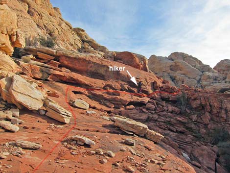
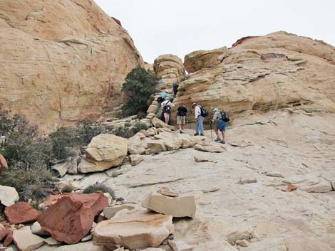
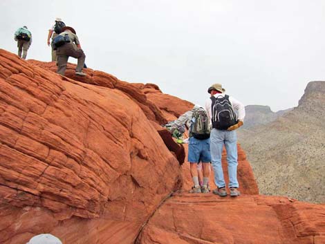
 Trail junction: hiker departing Calico Tank Trail (view NE) |
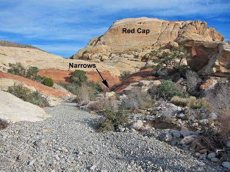
The Hike From the trailhead (Table 1, Waypoint 01) at the north end of the parking lot, the hike follows the Calico Tanks Trail, which runs on the old road that leads into the historic quarry area. The trail passes a signed Grand Circle Trail junction (Wpt. 02) on the left and continues towards a trail sign (Wpt. 03) on the far side of the quarry area. Still following the Calico Tanks Trail, the route runs north and passes a trail junction (Wpt. 04) where the Turtlehead Peak Trail forks off to the left. Now running northeast, the trail passes an agave roasting pit on the left, drops back into the wash, and follows the wash upstream through a narrow spot between sandstone cliffs crowded with shrub live oak trees. Just beyond the narrows (Wpt. 05), the Calico Tanks Trail turns right (no sign) to run up Calico Tanks Canyon, but the Red Cap route stays left in the main wash. |
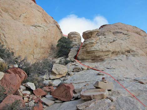
 Wash departing Calico Tanks Trail (view NE) |
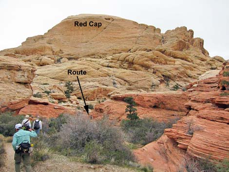
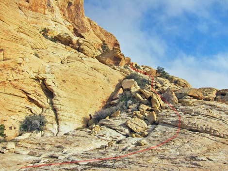
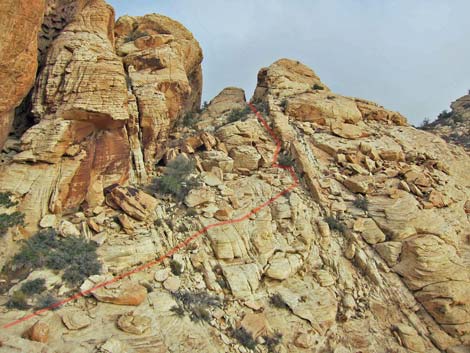
Staying left, the route continues up the wash for 3-4 more minutes. The main wash passes a large side wash (looks like a gravel road merging from the left) and continues through short red sandstone narrows. Shortly beyond the narrows, the main wash turns hard to the left (Wpt. 06), and a minor wash continues straight ahead (east). The route leaves the main wash (Wpt. 06) and follows the side wash ahead and then to the right, where the walking is easier on slickrock across the gully. The route traverses sandstone slabs to a minor saddle, which give a nice view of the cleft through the cliffs that is key to the rest of this route. Hiking across red slickrock, the route climbs towards a chute (Wpt. 07) behind an enormous semi-attached boulder. Using 3rd-class techniques, the route ascends to the top of the chute (Wpt. 08), which gets hikers above the red sandstone cliffs and onto white sandstone. |
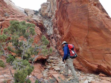
 Red sandstone narrows in main wash (view E) |
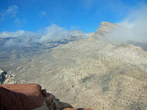
Continuing in the same direction, the route follows the trace of the chute through a gap (Wpt. 09), then traverses sloping ledges below steep rock faces following a line of shrub live oaks out to a relatively large singleleaf pinyon pine tree (Wpt. 10) below an even larger boulder perched on the hillside. Turning steeply upward at the pine, the route continues in the same general direction, staying as high under the cliffs as reasonably possible. The route climbs to another relatively large pine, traverses in the same general direction on ledges past yet another tall pine, and eventually runs up onto a broad ledge. Cliffs force the route to descend a bit into the head of a broad gully, but then the route climbs back and left through a chute (avoiding large boulders) to finally reach the crest of the ridge (Wpt. 11) where hikers get their first view down the east side of the Calico Hills. |
 Main wash bends left; route goes straight (view E) |
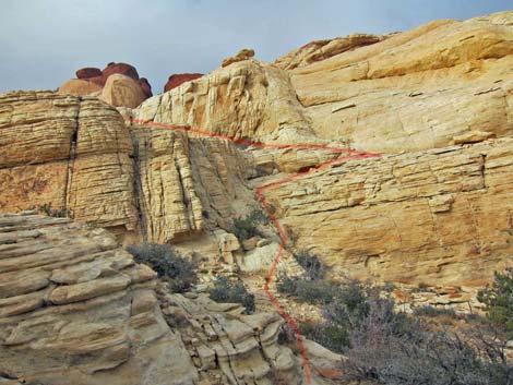
Turning north and zigzagging up and past a small pine, the route bends left onto a broad, sandy ledge area (Wpt. 12). In this sandy area, the route turns east, climbs through another steep cleft to the right of the last large pinyon, and regains the crest of the Calico Hills at a rather airy point (Wpt. 13). Turning north again, the route runs up the ridge line, working around little cliffs and crevices (look around the corner to the right just below the summit) onto the east summit (Wpt. 14). The east summit is separated from the main summit by a deep cleft. A number of routes lead back to the trailhead, but the easiest is to follow your footprints back down the slickrock. |
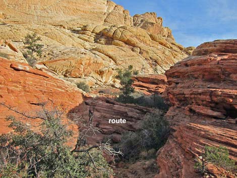 Route departing main wash (view E) |
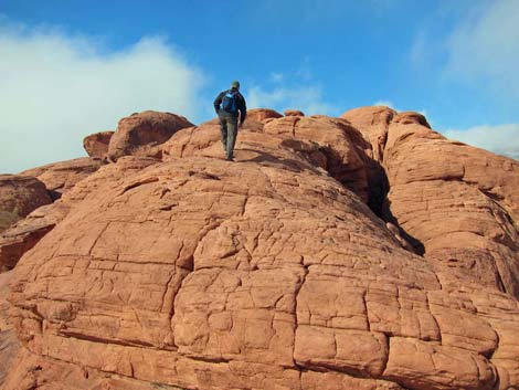
 Route on slickrock above gully (view SE) |
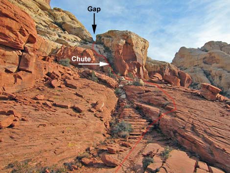 Route through chute and gap (view SE) |
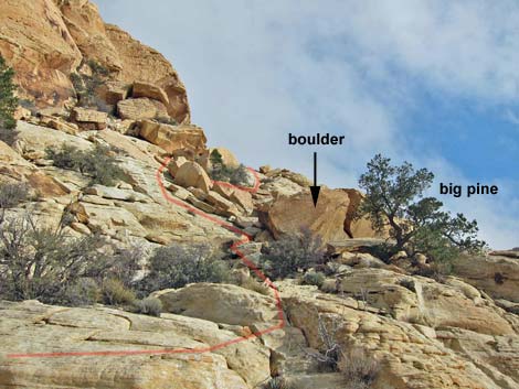
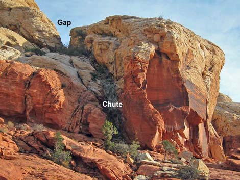 Approaching chute behind enormous boulder (view SE) |
 Entering chute behind enormous boulder (view SE) |
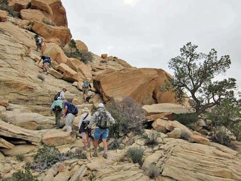
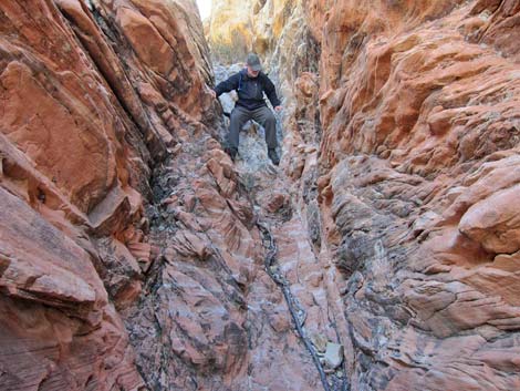
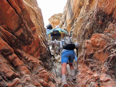 Hikers in 3rd-class chute (view SE) |
 Sandstone ramp along line of shrubs |
 Sandstone ramp leads to big singleleaf pine tree |
 Route past big pine by bigger boulder |
 Hikers passing big pine and bigger boulder |
 Next big pine |
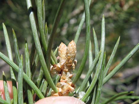 Needles of a singleleaf pine tree |
 Ledges and pine at head of steep gully |
 Hikers passing pine at head of steep gully |
 Route beyond broad ledge to the crest (view E) |
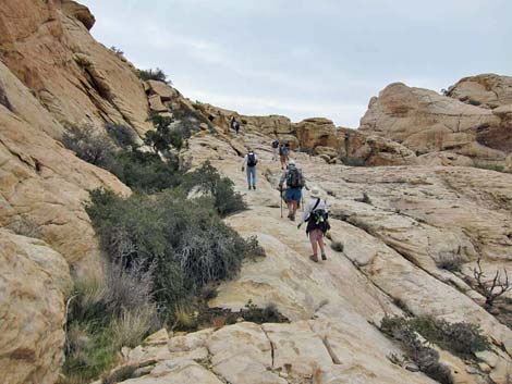
 Hikers beyond broad ledge approaching the crest (view E) |
 Route leading north from crest of the Calico Hills |
 Hikers on route leading north from crest of the Calico Hills |
 Broad sandy ledges (view N) |
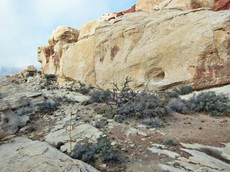
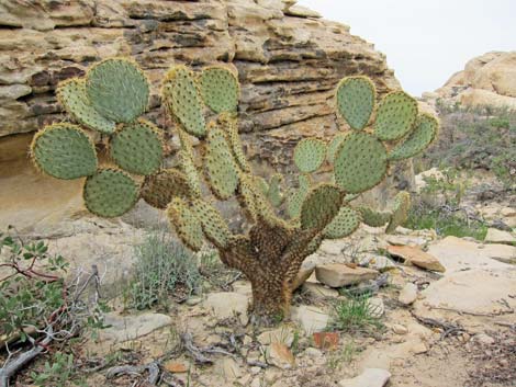 Watch for uncommon pancake cactus along the route |
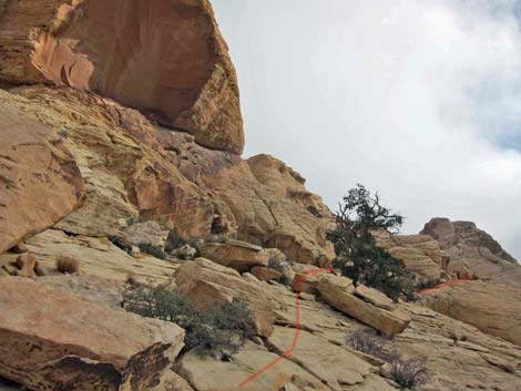
 Route to cleft above broad, sandy ledge (view E) |
 Hiker approaching cleft above broad, sandy ledge (view E) |
 Route through cleft above broad, sandy ledge (view E) |
 Hikers in cleft above broad, sandy ledge (view E) |
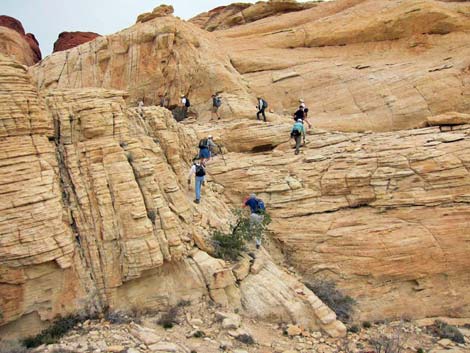
 Route towards airy ridgeline (not so bad as this looks; view E) |
 Hikers on easy 3rd-class scramble towards airy ridgeline (view E) |
 Hikers on airy ridgeline (view NE) |
 Hiker on final ridgeline (stay right below summit; view N) |
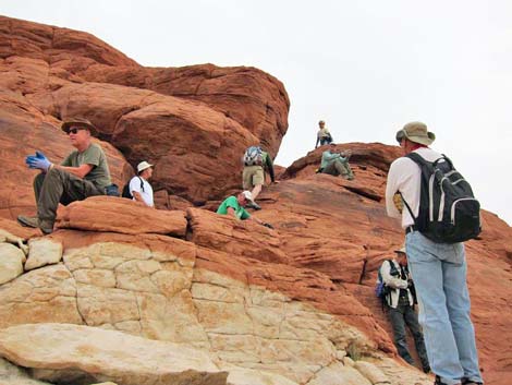
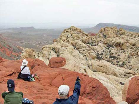 Hikers on east summit (view SE towards Calico Basin and Las Vegas) |
 View north towards La Madre Range |
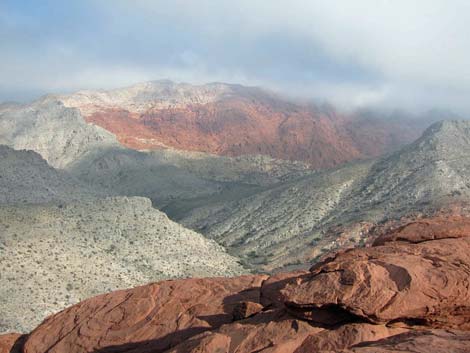 View east towards Gray Cap Peak |
 View north towards Turtlehead Peak |
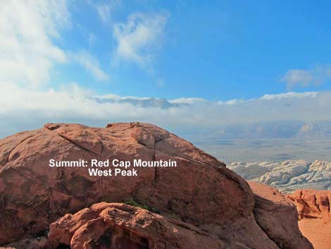 View west across West Peak to the Red Rock Cliffs |
 View from West Peak east across East Peak |
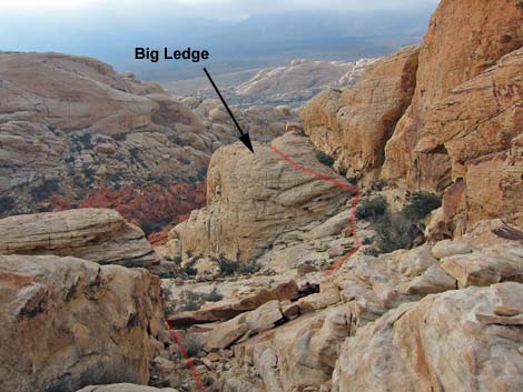 Descending the route, remember to cross over the big ledge |
 Hiker descending the last chute |
Table 2. Hiking Coordinates Based on GPS Data (NAD27; UTM Zone 11S). Download Hiking GPS Waypoints (*.gpx) file.
| Wpt. | Location | UTM Easting | UTM Northing | Elevation (ft) | Point-to-Point Distance (mi) | Cumulative Distance (mi) | Verified |
|---|---|---|---|---|---|---|---|
| 01 | Sandstone Quarry Trailhead | 639468 | 4002876 | 4,367 | 0.00 | 0.00 | Yes |
| 02 | Grand Circle Trail Junction | 639483 | 4002979 | 4,305 | 0.07 | 0.07 | GPS |
| 03 | Calico Tanks Trail Junction | 639461 | 4003002 | 4,311 | 0.02 | 0.09 | GPS |
| 04 | Turtlehead Peak Trail Junction | 639419 | 4003159 | 4,379 | 0.11 | 0.20 | GPS |
| 05 | Calico Tanks Canyon | 639636 | 4003359 | 4,405 | 0.20 | 0.40 | GPS |
| 06 | Wide Spot in Wash | 639797 | 4003422 | 4,385 | 0.12 | 0.52 | GPS |
| 07 | Base of Cleft | 639894 | 4003334 | 4,436 | 0.10 | 0.62 | GPS |
| 08 | Top of Cleft | 639904 | 4003331 | 4,466 | 0.02 | 0.64 | GPS |
| 09 | Broad Sandstone Ramps | 639928 | 4003300 | 4,499 | 0.02 | 0.66 | GPS |
| 10 | Small Pine Tree | 639995 | 4003239 | 4,580 | 0.07 | 0.73 | GPS |
| 11 | Crest of Calico Hills | 640244 | 4003198 | 4,785 | 0.19 | 0.92 | GPS |
| 12 | Sandy Area | 640186 | 4003238 | 4,808 | 0.06 | 0.98 | GPS |
| 13 | Cleft in the Rocks | 640206 | 4003261 | 4,828 | 0.03 | 1.01 | GPS |
| 14 | Red Cap, East Summit | 640168 | 4003307 | 4,944 | 0.07 | 1.08 | GPS |
| 01 | Sandstone Quarry Trailhead | 639468 | 4002876 | 4,367 | 1.08 | 2.16 | Yes |
Happy Hiking! All distances, elevations, and other facts are approximate.
![]() ; Last updated 240330
; Last updated 240330
| Hiking Around Red Rocks | Hiking Around Las Vegas | Glossary | Copyright, Conditions, Disclaimer | Home |