Hiking Around Las Vegas, Red Rock Canyon National Conservation Area
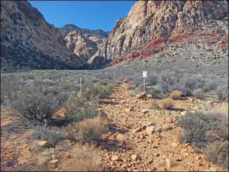
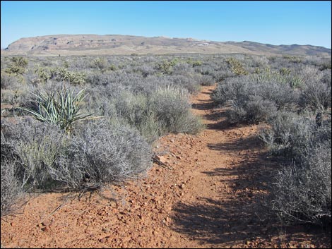
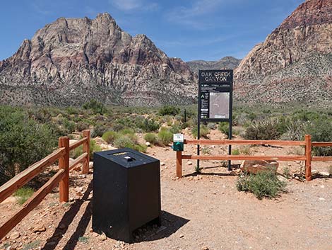 Oak Creek Canyon Trailhead (view SW) |
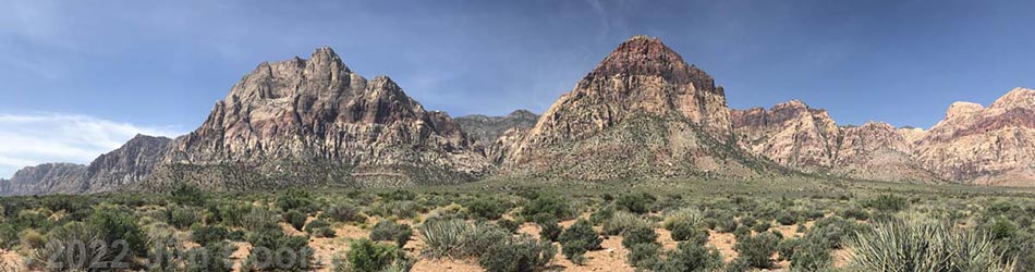
Overview This is a great hike that makes for a good, easy, 3.2-mile loop through the open desert below Rainbow Mountain. The hike starts and ends at the Oak Creek Canyon parking area, running along the base of Rainbow Mountain using the Oak Creek Canyon, Knoll, and Arnight trails. The elevation gain is only about 250 ft, but most of this is in one 0.2-mile section near the top of the loop. This is a loop, so it can be hiked in either direction, but it is described here as running southwest on Oak Creek Canyon trail, north on the Knoll trail, and southeast on the Arnight trail. Link to map. |
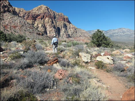
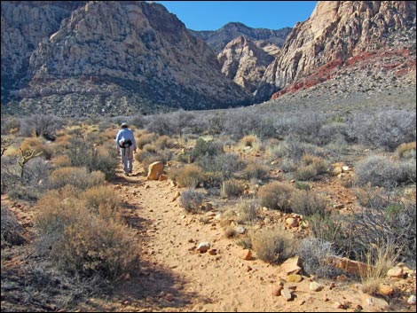 Hiker on Oak Creek Canyon Trail (view SW) |
Watch Out Other than the standard warnings about hiking in the desert, ...this hike is safe and easy, but the trail is rocky. The walking is easy, but watch your step and don't twist an ankle. Watching your step, however, is difficult because the Wilson Cliffs, and Mt. Wilson and Rainbow Mountain in particular, just seem to get taller, more vertical, and more spectacular the closer you get to the cliffs, and you will want to watch the scenery rather than your feet. While hiking, please respect the land and the other people out there, and try to Leave No Trace of your passage. Also, even though this is a short hike, be sure to bring what you need of the 10 Essentials. |
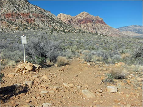
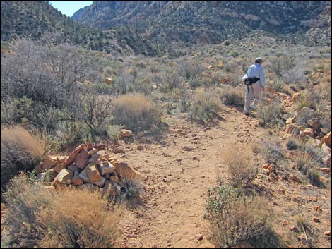 Oak Creek Canyon Trail at Middle Oak Creek Trail (view SW) |
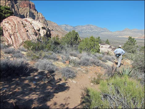
Getting to the Trailhead This hike is located along the Scenic Loop Road in Red Rock Canyon National Conservation Area, about 1 hour west of Las Vegas. Drive out to Red Rocks, pay the fee, and then drive most of the way around the Scenic Loop Road to Oak Creek Canyon Road. Turn right and drive to the end of the road and the Oak Creek Canyon Trailhead. The Hike From the Oak Creek Canyon Trailhead (Table 2, Waypoint 01), the Oak Creek Canyon Trail runs southwest on an old road that runs more-or-less directly towards the mouth of Oak Creek Canyon as it climbs at a gentle grade. The trail is well defined, but trails and use-trails without signs (e.g., Wpt. 02) branch off and head out into the desert, so be sure to continue hiking southwest on the wide trail towards Oak Creek Canyon. After about 0.81 miles, the Oak Creek Canyon Trail intersects the Knoll Trail (Wpt. 03). For details on this section of the route, see the description of the Oak Creek Canyon Trail. |
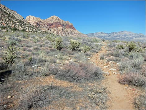
 Oak Creek Canyon Trail at Knoll Trail (view SW) |
From the intersection, the route turns north on the Knoll Trail. This segment of the loop runs north winding among boulders and shrubs, and passing little washes, but staying more-or-less on the contour. After about 0.46 miles, the trail crosses a low ridge (Wpt. 04) with nice views in all directions. This is a good place to stop for a picnic lunch. From the little ridge, the trail runs north and climbs the bajada (this is the only "steep" section of trail). After about 0.47 miles, the trail reaches the edge of Juniper Wash (Wpt. 05), which is the highest point on the Knoll Trail. The trail seems to end on the edge of the wash, but the trail drops into the wash and crosses to the other side where stone stairs lead out the other side. |
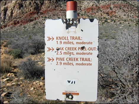 Trail sign (view W) |
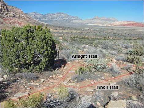
After crossing the wash, the trail heads slightly downhill for about 0.19 miles to a T-intersection (Wpt. 06) in front of a strikingly beautiful sandstone boulder with juniper trees all around. There is no sign here, but the Knoll Trail goes northeast (right) and down the hill. After another 0.13 miles, the trail reaches a T-intersection with the Arnight Trail (Wpt. 07). This is the end of the Knoll Trail, which was about 1.25 miles long, and the total distance to here is about 2.06 miles. For details on the section of the trail, see the description of the Knoll Trail. Turning southeast (right) onto the Arnight Trail, the trail starts down across the bajada. After about 20 minutes, the loop crosses Juniper Wash again. There was a small wildfire on edge of the wash in 2002; it has been interesting watching the site recover over the years. The trail continues southeastward across the gently sloping bajada for 1.15 miles. Close to the Oak Creek Canyon Trailhead, the trail becomes sandy and easy to walk on, a nice way to end the loop (Wpt. 01). For details on the section of the loop, see the description of the Arnight-Southbound Trail. |
 Start of Knoll Trail (view N) |
 Knoll Trail (view N) |
 Hiker on of Knoll Trail near Juniper Wash (view N) |
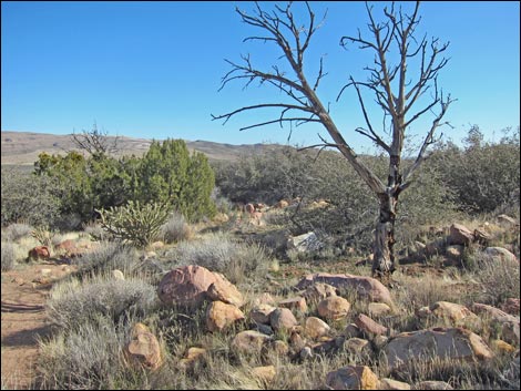
 Hiker passing colorful boulder along Knoll Trail (view NE) |
 Knoll-Arnight trail junction (view NE) |
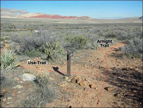 Arnight Trail at use-trail (view E) |
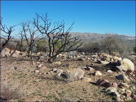 Wildfire at Juniper Wash (view E; December 2002) |
 Wildfire at Juniper Wash (view E; February 2013) |
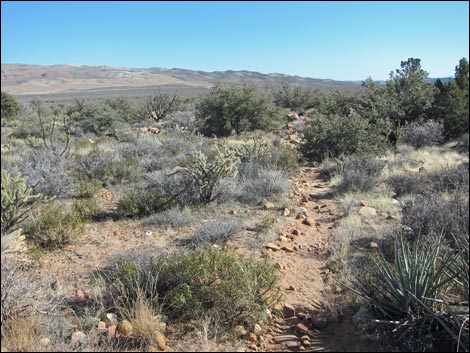 Arnight Trail in shrubby area (view SE) |
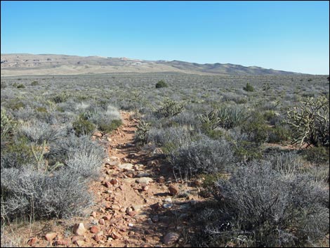 Arnight Trail in rocky area (view SE) |
 Arnight Trail with nice, smooth sand (view SE) |
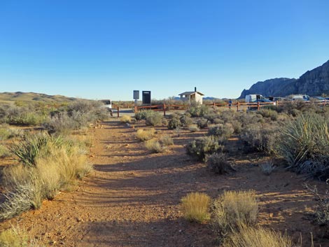 Arnight Trail approaching Oak Creek Canyon Trailhead (view S) |
Table 2. Hiking Coordinates Based on GPS Data (NAD27; UTM Zone 11S). Download Hiking GPS Waypoints (*.gpx) file.
| Wpt. | Location | UTM Easting | UTM Northing | Elevation (ft) | Point-to-Point Distance (mi) | Cumulative Distance (mi) | Verified |
|---|---|---|---|---|---|---|---|
| 01 | Oak Creek Canyon Trailhead | 638116 | 3997128 | 3,910 | 0.00 | 0.00 | Yes |
| 02 | Middle Oak Creek Trail | 637340 | 3996372 | 4,020 | 0.69 | 0.69 | GPS |
| 03 | Knoll-Oak Creek trail junction | 637160 | 3996332 | 4,104 | 0.12 | 0.81 | GPS |
| 04 | Low ridge | 637163 | 3997016 | 4,062 | 0.46 | 1.27 | GPS |
| 05 | Juniper Canyon Wash | 636748 | 3997543 | 4,171 | 0.47 | 1.74 | GPS |
| 06 | T-intersection | 636648 | 3997793 | 4,181 | 0.19 | 1.93 | GPS |
| 07 | Arnight Trail junction | 636701 | 3997956 | 4,138 | 0.13 | 2.06 | GPS |
| 01 | Oak Creek Canyon Trailhead | 638116 | 3997128 | 3,910 | 1.15 | 3.21 | Yes |
Happy Hiking! All distances, elevations, and other facts are approximate.
![]() ; Last updated 240330
; Last updated 240330
| Hiking Around Red Rocks | Hiking Around Las Vegas | Glossary | Copyright, Conditions, Disclaimer | Home |