Hiking Around Las Vegas, Red Rock Canyon National Conservation Area
 Lone Grapevine Rd at Mud Spring #2 trailhead parking (view SW) |
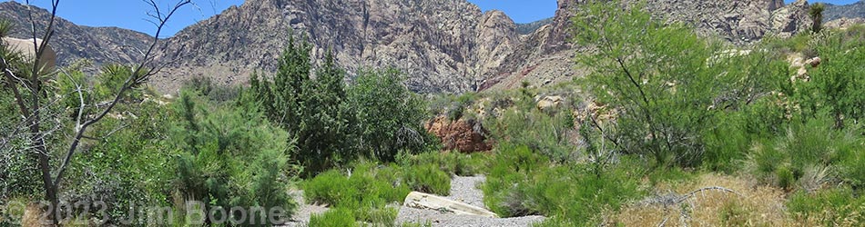
Overview This short route runs about 800 feet up a wash to a spring with velvet ash trees, desert willow trees, cattails, and other wetland vegetation. The spring is located in the desert flats below the Red Rock Escarpment, west of Blue Diamond (south end of the Red Rock Cliffs). Access is from Highway 160 using Black Velvet Road and Lone Grapevine Road, both of which should be suitable in a carefully driven sedan. This is a quiet place to stop, relax, "smell the roses," and listen to the songs of frogs and birds. The spring stopped flowing sometime before 2023, but the wash still supports a verdant wash-bottom flora. Link to map. |
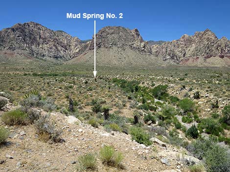 Mud Spring #2 (view W from trailhead) |
Watch Out Other than the standard warnings about hiking in the desert, ...this hike is short and safe with no unusual hazards. Without a high-clearance vehicle, be sure to drive carefully. While hiking, please respect the land and the other people out there, and try to Leave No Trace of your passage. Also, even though this hike is short, be sure to bring what you need of the 10 Essentials. |
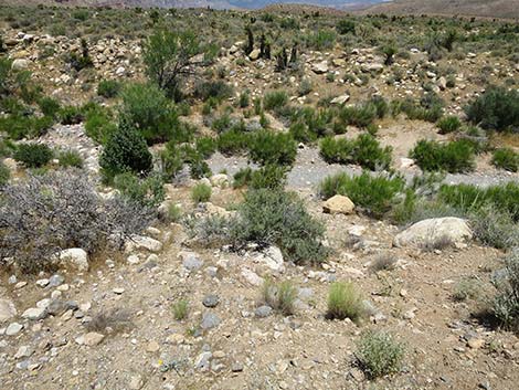
 Mud Spring Trailhead (view NW) |
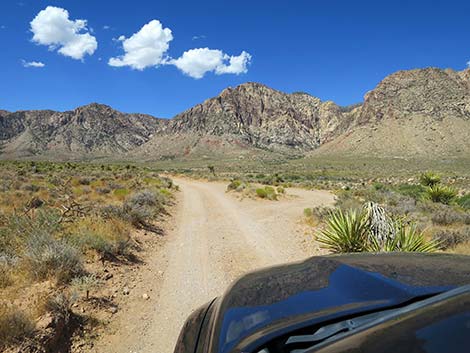
Getting to the Trailhead This hike is located in Red Rock Canyon NCA, but not in the Scenic Loop Road fee area. From the Red Rock Visitor Center area, drive west then south on West Charleston Blvd (Hwy 159) past Blue Diamond Town to Highway 160. Turn right onto Highway 160 and drive west for 4.7 miles to the paved Late Night Trailhead on the right. From the end of the paved parking area, follow Black Velvet Road for 1.3 miles to either of two roads to the left. These roads are two forks of Lone Grapevine Road. Follow Lone Grapevine Road west for 0.5 miles to a 2-3 car parking area (Site 1084) on the right at the edge of a bluff overlooking the wash. Park here; this is the trailhead. |
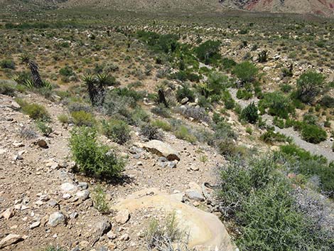
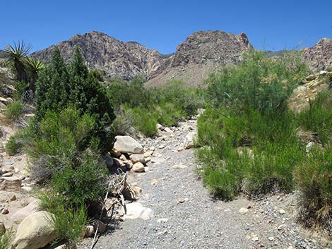
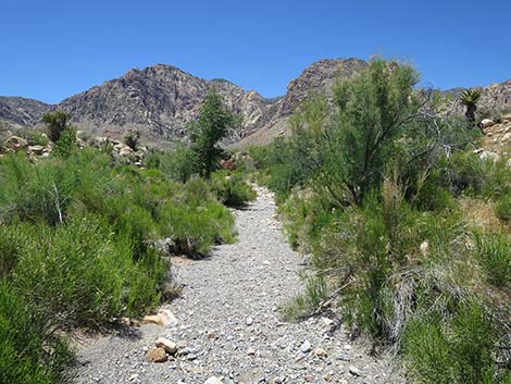
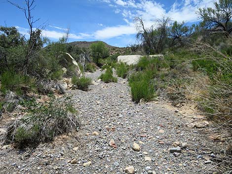
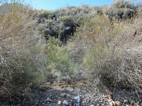
 Use-trail drops steeply into Mud Spring Wash (view N) |
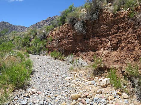
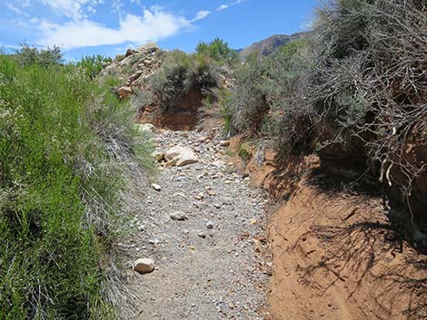
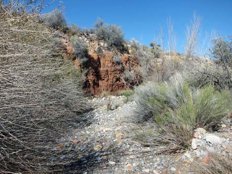
The Hike From the trailhead (Table 2, Waypoint 01), the route runs down off the bluff on a steep use-trail that drops into the wash. The use-trail fades in the wash. During cooler months, water used to flow past this point. Following the wash upstream, the sides of the wash steepen, and then the route passes a red mud-cliff on the right. At the base of the cliff, notice a hard layer of white rock. This layer is impermeable to water, and hikers may see water seeping out of the red mud at this point. Impermeable rock layers like this usually are the cause of springs at Red Rocks, and at this point, the process is more visible than elsewhere. |
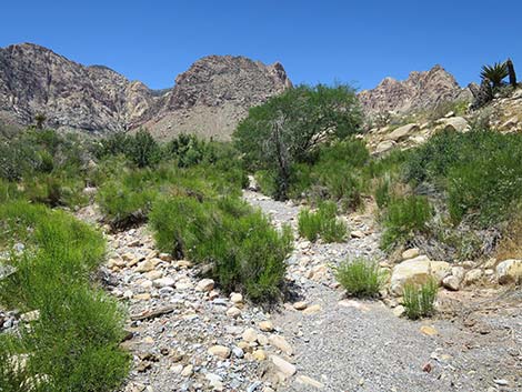
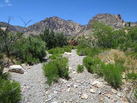
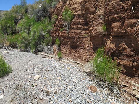
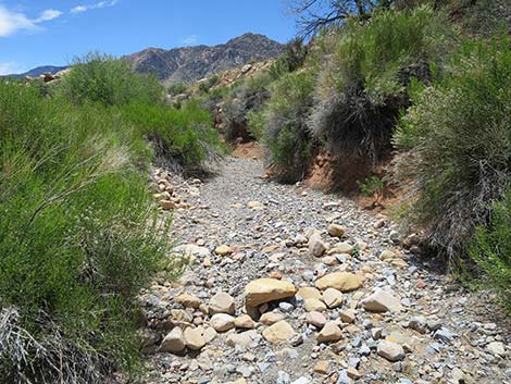
 Mud Spring Wash (view W) |
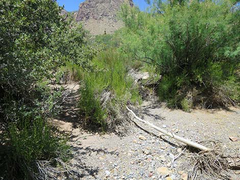
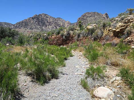
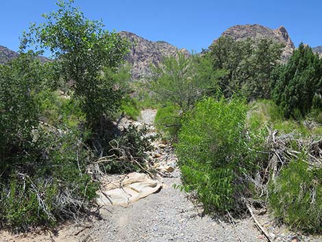
Continuing a few steps past the red mud cliff, the wash bends to the left. At the base of the brushy cliff to the right, notice another layer of white stone. This is where the main Mud Spring No. 2 emerged (Wpt. 03), but the water and delicate riparian vegetation are gone. Even so, many riparian shrubs and trees remain, including lots of Mulefat, a couple of Gooding's Willow, and several Velvet Ash. Continuing up the wash, the riparian vegetation ends (Wpt. 04) a minute or two upstream from the spring. When ready to head back, follow your footprints back down the wash to the trailhead, or consider making a loop by hiking southwest from the wash to the road, then walk back on the road to the trailhead. While in the area, consider visiting nearby springs such as Lone Grapevine Spring or Wooden Fence Spring. |
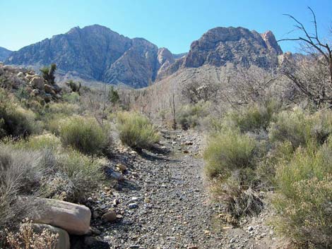
 The route follows Mud Spring Wash uphill (view W) |
 The route follows Mud Spring Wash uphill (view W) |
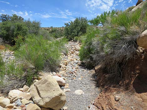
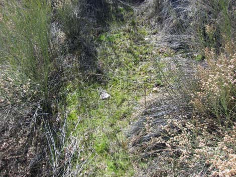
 Lots of summer vegetation in Mud Spring Wash (view W) |
 Lots of summer vegetation in Mud Spring Wash (view W) |
 Approaching the red cliff (view W) |
 Approaching Mud Spring #2 (view W) |
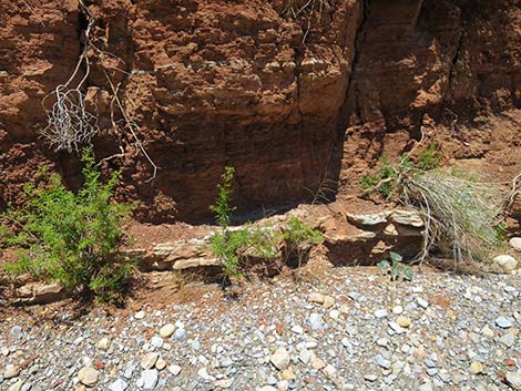 First part of Mud Spring #2; now dry (view N) |
 Approaching second part of Mud Spring #2 (view W) |
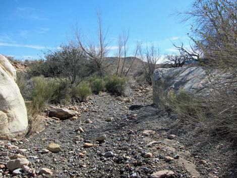
 Main part of Mud Spring #2; now dry (view W) |
 Main part of Mud Spring #2; now dry (view W) |
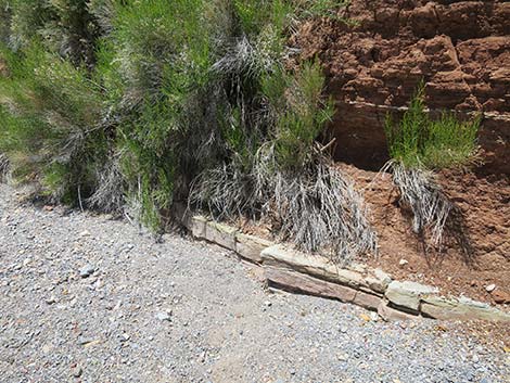
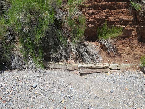
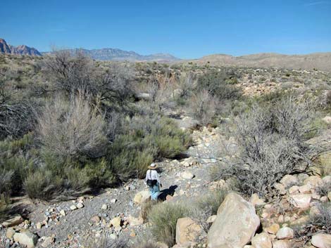
 Continuing up Mud Spring Wash past the spring (view S) |
 Mud Spring Wash past the spring (view W) |
 Mud Spring Wash past the spring (view W) |
 Mud Spring Wash past the spring (view W) |
 Mud Spring Wash past the spring (view S) |
 More to come ... |
Mud Spring #2 in 2011, only 10 years into our Mega-drought
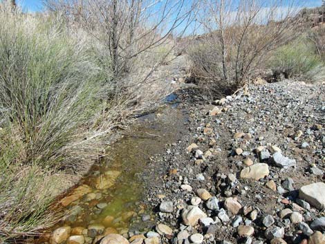
 Wash below spring with water (view W) |
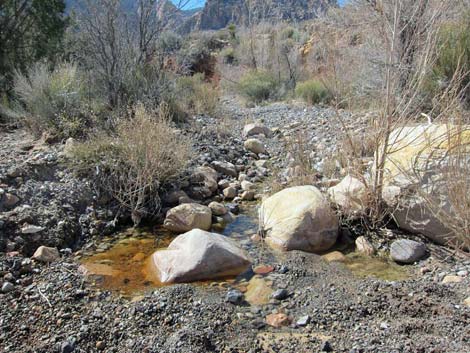 Water in the wash (view W) |
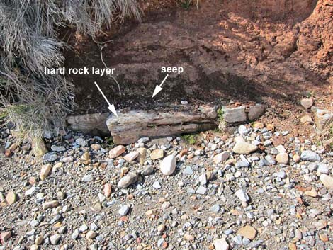 Seep at base of red mud cliff (view N) |
 Mud Spring No. 2 (view W) |
 Looking back: red cliff (view NE); the spring is to the left |
 Water trickling down the wash (view S) |
 Hiker in the wash above the spring (view N) |
 Mud Spring No. 2 (view W from wash) |
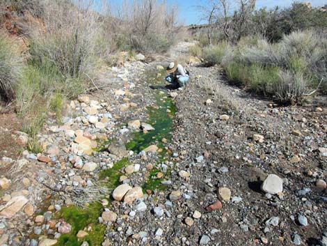 Looking for tadpoles (view E) |
 Pool of water in the wash (view E) |
Table 2. Hiking Coordinates and Distances based on GPS Data (NAD27; UTM Zone 11S). Download Hiking GPS Waypoints (*.gpx) file.
| Wpt. | Location | Easting | Northing | Elevation (ft) | Point-to-Point Distance (mi) | Cumulative Distance (mi) | Verified |
|---|---|---|---|---|---|---|---|
| 01 | Trailhead | 640524 | 3987781 | 3,796 | 0.00 | 0.00 | GPS |
| 02 | Wash | 640453 | 3987811 | 3,792 | 0.07 | 0.07 | GPS |
| 03 | Mud Spring No. 2 | 640340 | 3987790 | 3,796 | 0.08 | 0.15 | GPS |
| 04 | End of Riparian Vegetation | 640320 | 3987727 | 3,809 | 0.05 | 0.20 | GPS |
| 01 | Trailhead | 640524 | 3987781 | 3,796 | 0.25 | 0.40 | GPS |
Happy Hiking! All distances, elevations, and other facts are approximate.
![]() ; Last updated 230715
; Last updated 230715
| Hiking Around Red Rocks | Hiking Around Las Vegas | Glossary | Copyright, Conditions, Disclaimer | Home |