Hiking Around Las Vegas, Red Rock Canyon National Conservation Area
 |
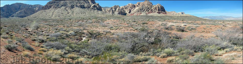
Overview This short, 1.1 mile round-trip, use-trail runs out across the open desert, passes two wet areas, and continues to a spring with honey mesquite, velvet ash trees, desert willow trees, and other desert wetland vegetation. The spring is located in the flats below the Red Rock Escarpment, west of Blue Diamond (south end of the Red Rock Cliffs). Access is from Highway 160 using Black Velvet Road, which should be suitable in a carefully driven sedan to at least near the trailhead. This is a quiet place to stop, relax, "smell the roses," and listen to the bird songs. Link to map. |
 |
Watch Out Other than the standard warnings about hiking in the desert, ...this hike is short and safe with no unusual hazards. Without a high-clearance vehicle, be sure to drive carefully. While hiking, please respect the land and the other people out there, and try to Leave No Trace of your passage. Also, even though this hike is short, be sure to bring what you need of the 10 Essentials. |
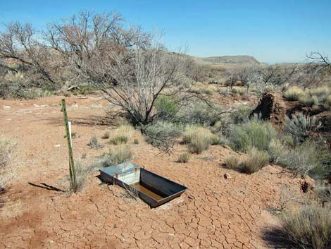
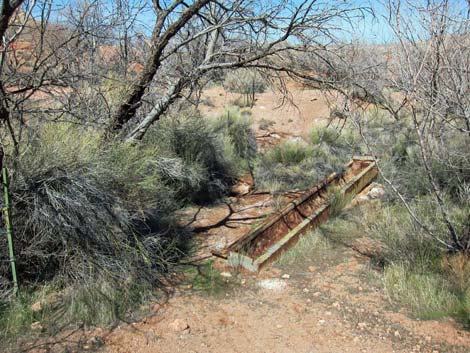
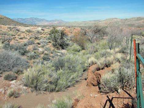
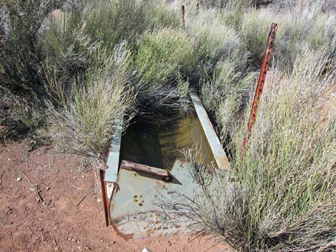 Old metal watering trough; Wpt. 03 (view NW) |
Getting to the Trailhead This hike is located in Red Rock Canyon NCA, but not in the Scenic Loop Road fee area. From the Red Rock Visitor Center area, drive west then south on West Charleston Blvd (Hwy 159) past Blue Diamond Town to Highway 160. Turn right onto Highway 160 and drive west for 4.7 miles to the paved Late Night Trailhead on the right. From the end of the paved parking area, follow Black Velvet Road to the Black Velvet Trailhead. Park here; this is the trailhead. |
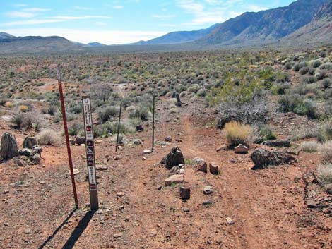
 Trail junction to the left; Wpt. 04 (view E) |
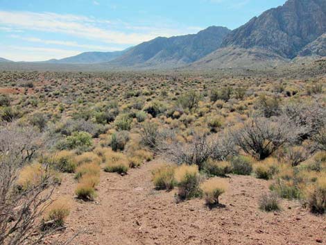
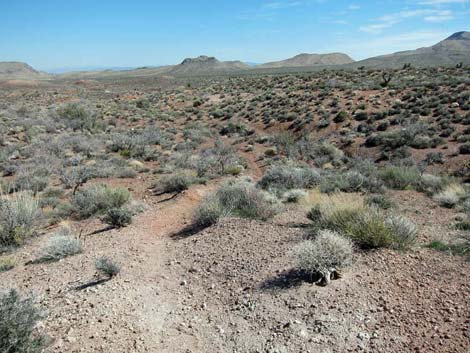
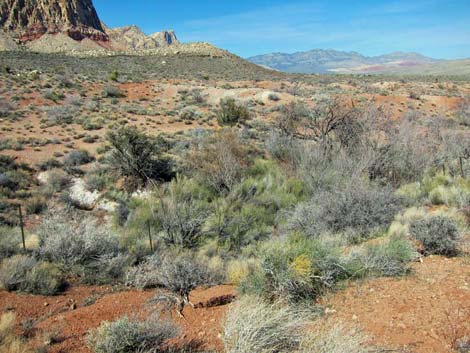
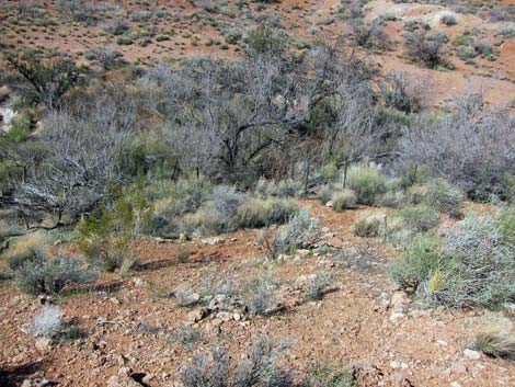
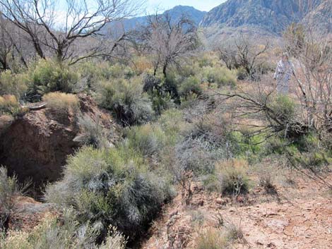
The Hike From the trailhead (Table 2, Waypoint 01), the route runs south on an old road. From the edge of the parking area, the trees at the spring are plainly visible slightly to the east of due south at a distance of only 0.25 miles. Hiking straight towards the spring, however, is a mistake because the soft soils between here and there are cut by deep, steep-sided rills. At about 75 yards out, at a point where hikers would want to hike straight towards the spring, the old road bends to the right and runs southwest across a hillside. Seeps along this section of the old road result in a muddy trail during cooler months. The moisture, however, attracts birds and other wildlife. |
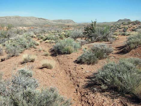 |
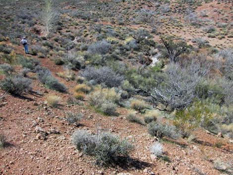
At about 0.22 miles out, the old road fades in a wet, brushy area where a creek (Wpt. 02) flows during cooler months. Just across the muddy creek, an old metal watering trough (Wpt. 03) still hold water for birds and other wildlife. Continuing south only about 60 feet past the trough, a trail junction to the left (Wpt. 04) leads almost due east towards the spring. Hiking east and down the hillside, the barbed-wire fence encircling the spring area soon comes into view. At a convenient spot along the trail (Wpt. 05), the lowest strand of wire on the fence is high enough to easily duck under. Inside the fence, a guzzler provides water for birds and other wildlife. For hikers and birders, it probably is just a well to stay outside the fence and walk the perimeter. |
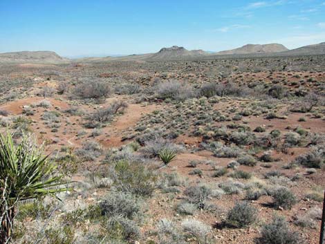 |
Just below the spring and outside the fence, an old, dry, metal watering trough provides silent testament to the history of cattle ranching in this area. For birders in particular, the hillside on the south edge of the fence provides a nice overview of the trees and shrubs, giving birders a good vantage while not spooking the birds. When ready to head back, follow your footprints back to the trailhead, but while out in this area, consider visiting other springs in the area, such as Mud Spring No. 2, Lone Grapevine Spring, and Wooden Fence Spring. |
 Guzzler inside the fence (view E) |
 Overview of the spring area (view NE) |
 Overview of the spring area (view N) |
 Overview of the spring area (view NW) |
 Old, dry trough outside the fence (view N) |
 The spring is up this deep gully (view SW) |
 Southwest corner of the fence (view NE) |
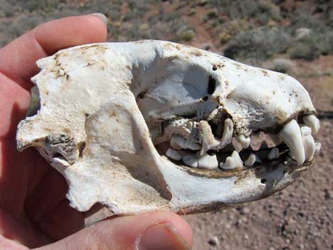 Watch for wildlife: American Badger live here |
Table 2. Hiking Coordinates and Distances based on GPS Data (NAD27; UTM Zone 11S). Download Hiking GPS Waypoints (*.gpx) file.
| Wpt. | Location | Easting | Northing | Elevation (ft) | Point-to-Point Distance (mi) | Cumulative Distance (mi) | Verified |
|---|---|---|---|---|---|---|---|
| 01 | Trailhead | 639822 | 3988616 | 3,862 | 0.00 | 0.00 | GPS |
| 02 | Muddy Wash | 639640 | 3988354 | 3,881 | 0.22 | 0.22 | GPS |
| 03 | Water Trough | 639633 | 3988341 | 3,881 | 0.03 | 0.25 | GPS |
| 04 | Trail Junction | 639631 | 3988322 | 3,889 | 0.01 | 0.26 | GPS |
| 05 | Fence | 639861 | 3988276 | 3,860 | 0.17 | 0.43 | GPS |
| 06 | Mud Spring No. 1 | 639862 | 3988223 | 3,848 | 0.02 | 0.45 | GPS |
| 01 | Trailhead | 639822 | 3988616 | 3,862 | 0.63 | 1.08 | GPS |
Happy Hiking! All distances, elevations, and other facts are approximate.
![]() ; Last updated 240330
; Last updated 240330
| Hiking Around Red Rocks | Hiking Around Las Vegas | Glossary | Copyright, Conditions, Disclaimer | Home |