Hiking Around Las Vegas, Red Rock Canyon National Conservation Area
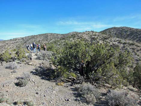
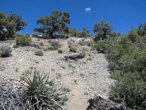
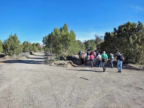 Hikers departing trailhead (view N) |
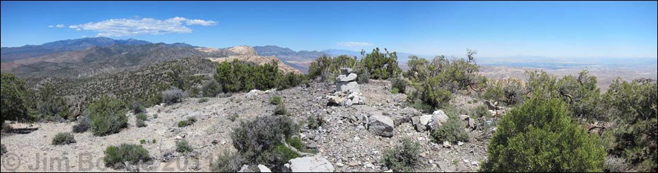
Overview This fairly strenuous, 5-mile round-trip hike is located on the west side of the Red Rock Canyon escarpment. Access is from Highway 160 near the town of Mountain Springs. The hike starts near the edge of the Rainbow Mountain Wilderness Area and heads east to the crest of the Spring Mountains Range, entirely within the Pinyon-Juniper Woodland zone. Following the crest north to a fork in the use-trail, the route continues north following the crest of the ridge to the summit. Views from everywhere along the are grand and include the La Madre Range to the north, Las Vegas and every mountain range to the east, to Mt. Potosi in the south. From the summit, the 360-degree view one of the best in all of the Red Rock region -- truly spectacular. Link to route map or elevation profile. |
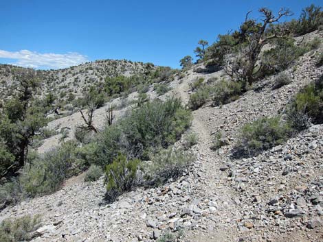
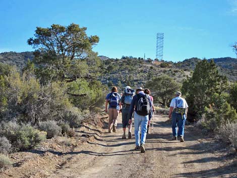 Steep road runs up to telecom tower (view NE) |
Watch Out Other than the standard warnings about hiking in the desert, ...this hike is fairly safe with no unusual hazards. Along the crest, there are places to fall off, but hikers would have to try extra hard to do so. While hiking, please respect the land and the other people out there, and try to Leave No Trace of your passage. Also, this hike is in a remote area, so be sure to bring the 10 Essentials. This route is in designated Wilderness, so please pay particular attention to respecting the land. |
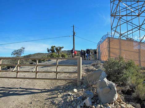 Hikers at telecom tower (view NE) |
Getting to the Trailhead This hike is located in Red Rock Canyon NCA, but over on the west side of the sandstone escarpment. From the Red Rock Visitor Center area, drive west then south on West Charleston Blvd (Hwy 159) past Blue Diamond Town to Highway 160. Turn right onto Highway 160 and drive west 9.5 miles to the Mountain Springs Trailhead, which is just before the town of Mountain Springs. |
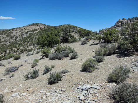
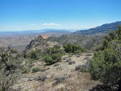
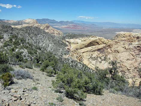
 Hikers on crest of the range (view N; Wpt. 04) |
The Hike From the trailhead (Table 2, Waypoint 01), the route runs north following the right of two parallel dirt roads. The dirt road climbs steeply towards a communications tower in the distance, passing one road intersection (Wpt. 02; stay straight) along the way. Just before the communications facility, a gate blocks the road, so technically hikers could drive to this point and park on the side of the road. From the communications facility (Wpt. 03), the route follows the dirt road eastward along the ridgeline. Just past the communications facility, the route enters the Rainbow Mountain Wilderness Area, and people have worked to convert the old road to a trail. Vegetation on the west side of the mountains is a fairly dense forest of singleleaf pinyon pine and Utah juniper with a variety of shrub species including blackbrush, banana yucca, mormon tea, sagebrush, turpentinebroom, narrowleaf goldenbush, silver cholla, and Utah agave. |
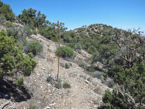
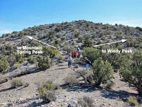 Fork in use-trail (view NE; Wpt. 05) |
The old road, and eventually an obvious use-trail, leads up and east towards the crest of the Spring Mountains Range (Wpt. 04). The use-trail reaches the crest at a flat spot on the ridge, and for the first time, hikers can look over the ridge and down to the sandstone escarpment and Cottonwood Valley. When hiking back down to the trailhead, this spot is not obvious, so take a good look at the area and notice the cairn before turning north and continuing along the ridgeline. Following the crest of the Spring Mountains north, the route climbs towards a highpoint. Before getting there, many cairns announce a trail junction (Wpt. 05). The route to Mountain Spring Peak continues north and across the west-facing slope, while the route to Windy Peak turns southeast and up the hillside. Hiking up and across the hillside, the use-trail climbs back onto the crest of the range (Wpt. 20). From there, the route more-or-less follows the ridgeline north to the summit (Wpt. 27). |
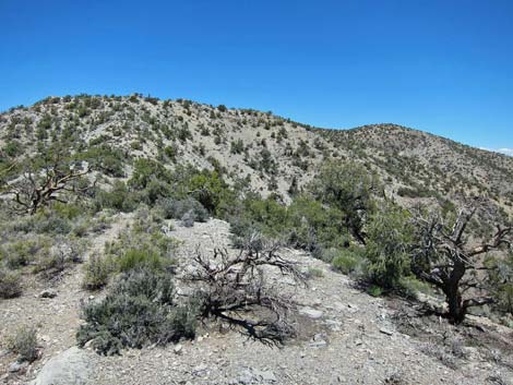
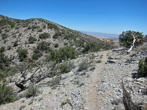
 Trail to Mountain Spring Peak climbs across hillside (view NE) |
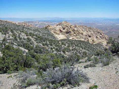
Where the route runs across broad, flat ridgetops, the use-trail becomes quite faint as hikers spread out. However, on all steeper slopes and on all side slopes, the use-trail generally is clear and obvious. The use-trail cuts across sideslopes to avoid the peaklets along the way, and there is a spot or two where hikers could miss the use-trail, continuing up the ridgeline and over the peaklet, but this would be little more than an inconvenience. In the summit area, vegetation includes singleleaf pinyon pine, Utah juniper, goldenbush, and blackbrush, but little shade. Views from the summit are perhaps the best in all of the Red Rock Region and include mountain ranges in Nevada, Utah, Arizona, and California. Even the view of Las Vegas is grand. When satiated with the view, continue north to Little Zion (The Park) or follow your footprints back to the crest of the range (Wpt. 04) and down to the trailhead (Wpt. 01). |
 |
 |
 |
 |
 |
 |
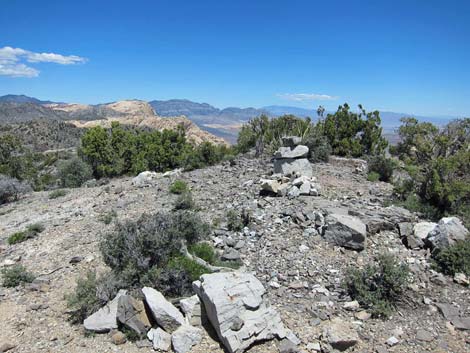 Summit cairn |
 Las Vegas (view NE) |
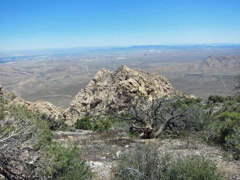 Las Vegas (view E) |
 Mountains in Arizona (view SE) |
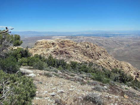
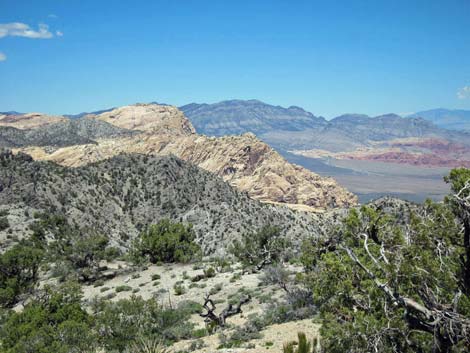 The Escarpment and La Madre Mt (view N) |
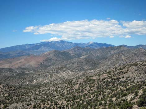 Mt. Charleston (view NW) |
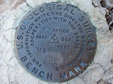 Summit Benchmark |
 Keystone Thrust (view north) |
Table 2. Hiking Coordinates and Distances based on GPS Data (NAD27; UTM Zone 11S). Download Hiking GPS Waypoints (*.gpx) file.
| Wpt. | Location | UTM Easting | UTM Northing | Elevation (ft) | Point-to-Point Distance (mi) | Cumulative Distance (mi) | Verified |
|---|---|---|---|---|---|---|---|
| 01 | Trailhead | 635267 | 3986363 | 5,470 | 0.00 | 0.00 | GPS |
| 02 | Fork in Road | 635394 | 3986528 | 5,524 | 0.19 | 0.19 | GPS |
| 03 | Telecom Tower | 635559 | 3986773 | 5,652 | 0.20 | 0.39 | GPS |
| 04 | Crest of the Range | 636370 | 3986956 | 6,012 | 0.67 | 1.06 | GPS |
| 05 | Trail Junction | 636623 | 3987573 | 6,246 | 0.47 | 1.53 | GPS |
| 20 | Ridgeline | 636679 | 3987782 | 6,353 | 0.14 | 1.67 | GPS |
| 21 | Start Up Slope | 636574 | 3987969 | 6,398 | 0.14 | 1.81 | GPS |
| 22 | Ridgeline | 636529 | 3988007 | 6,453 | 0.05 | 1.86 | GPS |
| 23 | Use-trail Leaves Ridge | 636583 | 3988418 | 6,520 | 0.28 | 2.14 | GPS |
| 24 | Use-trail Regains Ridge | 636554 | 3988496 | 6,532 | 0.06 | 2.20 | GPS |
| 25 | Use-trail Leaves Ridge | 636576 | 3988609 | 6,566 | 0.08 | 2.28 | GPS |
| 26 | Use-trail Regains Ridge | 636638 | 3988718 | 6,579 | 0.08 | 2.36 | GPS |
| 27 | Mountain Spring Peak Summit | 636800 | 3988804 | 6,639 | 0.12 | 2.48 | GPS |
| 04 | Crest of the Range | 636370 | 3986956 | 6,012 | 1.42 | 3.90 | GPS |
| 01 | Trailhead | 635267 | 3986363 | 5,470 | 1.06 | 4.96 | GPS |
Happy Hiking! All distances, elevations, and other facts are approximate.
![]() ; Last updated 240330
; Last updated 240330
| Hiking Around Red Rocks | Hiking Around Las Vegas | Glossary | Copyright, Conditions, Disclaimer | Home |