Hiking Around Las Vegas, Red Rock Canyon National Conservation Area
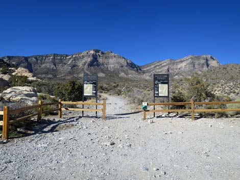 Trailhead sign (view north) |
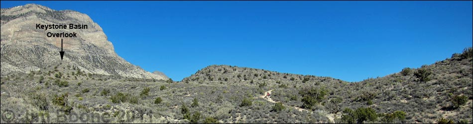
Overview This short, but moderately strenuous hike runs out the well-marked Keystone Thrust Fault Trail for about 0.6 miles, then follows an old road until it ends. Continuing on a use-trail, the route climbs to a rocky limestone crag overlooking Keystone Basin. For such a little peak, the summit provides surprisingly grand views out over the entire Red Rocks area. Link to map. |
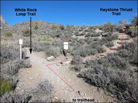 White Rock -- Keystone trail junction (view N) |
Watch Out Other than the standard warnings about hiking in the desert, ... this is a pretty safe hike, but if the earthquake fault starts thrusting, you should make a run for it. Be careful on the overlook where a fall could be quite painful. While hiking, please respect the land and the other people out there, and try to Leave No Trace of your passage. Also, even though this hike is short, be sure to bring what you need of the 10 Essentials. |
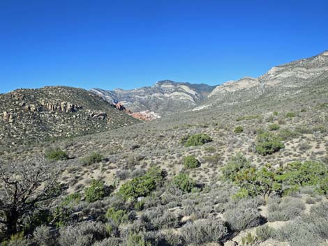
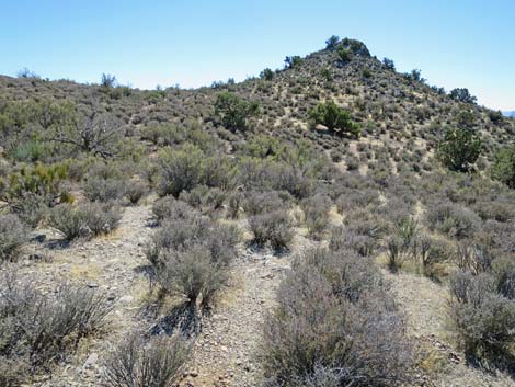
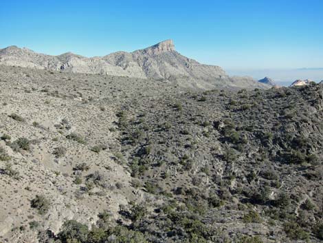
 Trail running towards Hogback Ridge (view NE) |
Getting to the Trailhead This hike is located along the Scenic Loop Road in Red Rock Canyon National Conservation Area, about 45 minutes west of Las Vegas. From town, drive out to Red Rocks, pay the entrance fee, and drive about half-way around the Scenic Loop Road to White Rock Road. Drive up White Rock Road to the White Rock Trailhead. Park here; this is the trailhead. |
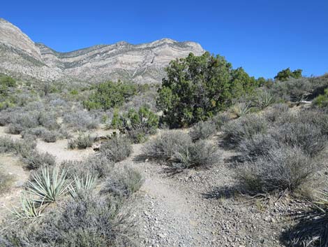
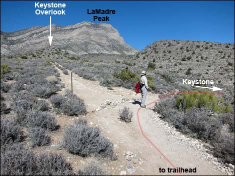 Trail junction to Keystone Thrust; stay left (view N) |
The Hike A sign on the northeast side of the parking area marks the Keystone Thrust trailhead. This is also a trailhead for the White Rock Loop Trail. Note that other trails lead out from the west side of the parking area. Along the trail, notice to diversity of shrub species and scattered pinyon pine and juniper trees. This area is located at the interface between the Mojave Desert Scrub habitat type and the Pinyon-Juniper Woodland habitat type. Watch for lots of Banana Yucca, Blackbrush, and Stansbury Cliffrose (typical Mojave Desert Scrub species), plus scattered Single-leaf Pinyon Pine, and Utah Juniper (typical Pinyon-Juniper Woodland species). |
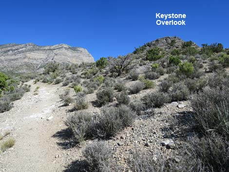
 Old road runs towards Keystone Overlook (view N) |
From the trailhead (Table 2, Waypoint 01), the Keystone Thrust Fault Trail runs north up an old road. The trail passes an agave roasting pit on the left. An information sign explains that native peoples used this area as a kitchen, cooking foods such as Utah Agave hearts, desert tortoise, chuckwalla, bighorn sheep, and other tasty items by heating stones in a fire, then cooking the food with the hot rocks. About 130 yards from the trailhead, the trail crosses the major wash (Wpt. 02) that comes down from the White Rock Hills. At a trail junction (Wpt. 03) about 100 yards past the wash, the Keystone Thrust Fault Trail turns right and climbs out of the wash to the east. Watch for trail signs and a few wooden stairs leading up the hillside. The White Rock Loop Trail continues north from the trail junction. |
 |
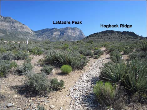
The Keystone Thrust Fault Trail runs northeast towards Hogback Ridge until it hits an old road (Wpt. 04) that comes up from the south. The trail turns and follows the old road northward along the steep west side of Hogback Ridge. Following the road north, the trail shortly passes another well-preserved agave roasting pit (Wpt. 05) off to the right (east). Beyond the agave roasting pit, the old road winds around, curves to the east, and climbs onto the ridge at the north end of Hogback Ridge. A few yards farther, the Keystone Thrust Fault Trail leaves the old road (Wpt. 06), turns right, and runs east and down into Keystone Basin. A metal T-post sign with an arrow placard marks the trail junction: the old road continues north up the ridge, while the Keystone Thrust Fault Trail turns right and runs down the hillside. |
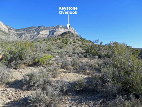 |
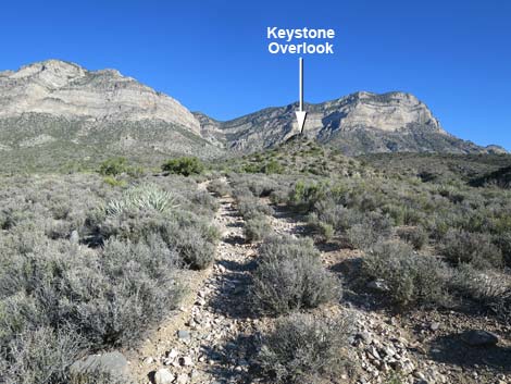
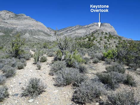
Following the old road (Wpt. 06) up the ridge, the route runs north. The road eventually ends (Wpt. 11) just west of the rocky summit of Keystone Overlook. Continuing north on a well-defined use-trail for about 250 feet past the end of the road, the route crosses a shallow wash at a good place to turn right and begin climbing towards the rocky knob that looms above. Following a use-trail onto the ridgeline, the path degenerates into a network of use-trails where hikers made multiple trails all heading for the summit. Regardless of the path chosen, all of the use-trails lead upward and cross onto the more gentle slopes of the east-facing side before reaching the summit (Wpt. 12). |
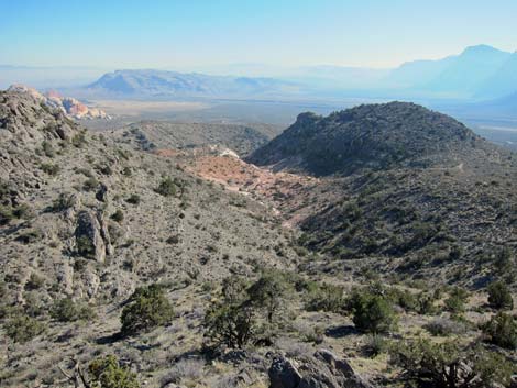
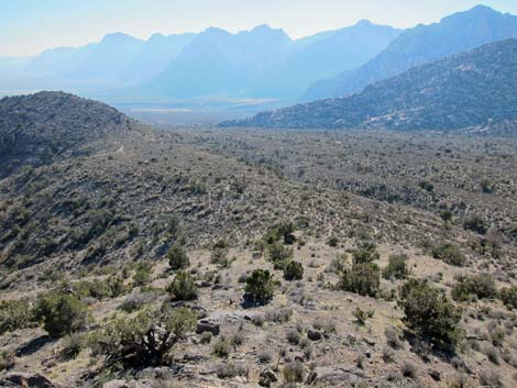
 Grand view out over the hillsides (view W) |
The summit is a rocky limestone crag with steep drop-offs to the south and west and surprisingly grand views in all directions. To the south is, of course, Keystone Basin with an interesting view of the Keystone Thrust Fault area. Also to the south are Blue Diamond Hill and Cottonwood Valley. To the east in afternoon light is an amazing view of Turtlehead Peak. To the north, the ashen face of La Madre Ridge thrusts over the landscape. To the west are White Rock Peak and the Red Rocks Cliffs. Enjoy the area, contemplate the forces the produced the current terrain, and then return to the trailhead by following your footprints in the dust back to the trailhead. A 3rd-class scrambling route down the southwest corner of the summit knob provides a bit of a loop. On the way back down, consider making a bit of a loop at the end of the trail by staying on the old road when the trail cuts off (Wpt. 04) to the right. |
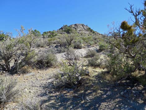
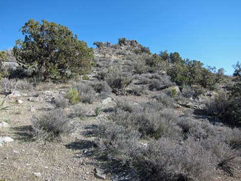
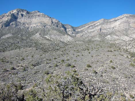
 Nearing Keystone Overlook (view N) |
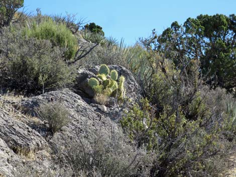 Pancake Cactus on the hillside |
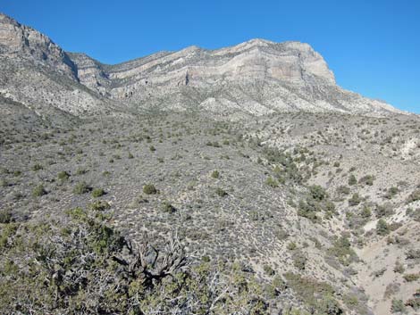
 Passing below Keystone Overlook (view NE) |
 Trail continues past Keystone Overlook (view N) |
 The route leaves trail and heads back towards ridgeline (SE) |
 Approaching the summit (view SE) |
 Summit (view S over Keystone Basin) |
 Summit (view E towards Turtlehead Peak) |
 Summit (view SW towards Wilson Cliffs) |
 Summit (view N towards La Madre Ridge; La Padre Peak) |
 Summit (view NE towards La Madre Ridge; La Madre Peak) |
 More to come ... |
Table 2. Hiking Coordinates Based on GPS Data (NAD27; UTM Zone 11S). Download Hiking GPS Waypoints (*.gpx) file.
| Wpt. | Location | Easting | Northing | Elevation (ft) | Point-to-Point Distance (mi) | Cumulative Distance (mi) | Verified |
|---|---|---|---|---|---|---|---|
| 01 | White Rock Trailhead | 637004 | 4004066 | 4,871 | 0.00 | 0.00 | Yes |
| 02 | White Rock Wash | 636961 | 4004167 | 4,915 | 0.07 | 0.07 | Yes |
| 03 | White Rock - Keystone Jct | 636952 | 4004271 | 4,956 | 0.07 | 0.15 | Yes |
| 04 | Old Road Jct | 637054 | 4004383 | 5,009 | 0.10 | 0.25 | GPS |
| 05 | Agave Roasting Pit | 637047 | 4004599 | 5,094 | 0.16 | 0.41 | Yes |
| 06 | Trail Jct | 637222 | 4004908 | 5,247 | 0.25 | 0.66 | Yes |
| 11 | End of Old Road | 637176 | 4005243 | 5,362 | 0.22 | 0.88 | GPS |
| 12 | Keystone Basin Overlook Summit | 637241 | 4005266 | 5,456 | 0.11 | 0.99 | GPS |
Happy Hiking! All distances, elevations, and other facts are approximate.
![]() ; Last updated 240330
; Last updated 240330
| Hiking Around Red Rocks | Hiking Around Las Vegas | Glossary | Copyright, Conditions, Disclaimer | Home |