Hiking Around Las Vegas, Red Rock Canyon National Conservation Area
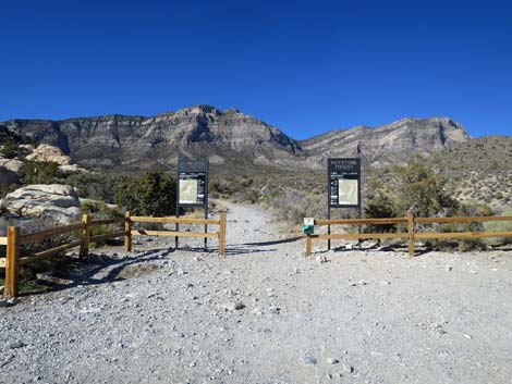 Keystone Thrust trailhead sign (view NW) |
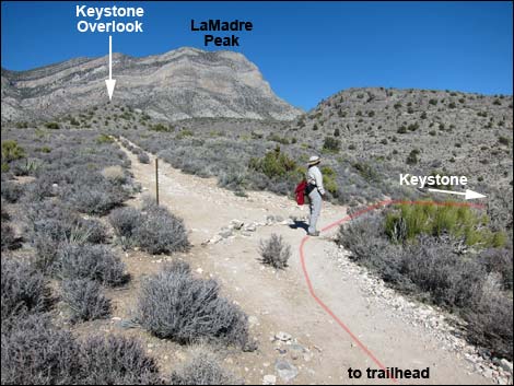
Overview The Keystone Loop Trail is a moderately strenuous hike that runs out the well-marked Keystone Thrust Trail for 0.8 miles to a place where hikers can touch the Keystone Thrust earthquake fault. This fault is interesting because older limestone rocks (gray) were pushed up and over younger sandstone rocks (red). Visitors can see thrust faults in other places around Red Rocks, but this is a good place to actually touch one. From the Keystone Thrust Fault, and after contemplating the forces that once broke the surface of the earth and pushed big blocks of stone about, hikers can continue south an interesting canyon to make either a 2-mile (short loop) or 3-miles loop (long loop) circling around the hills and back to the trailhead. Link to map. |
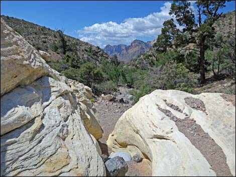
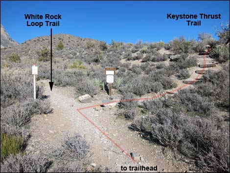 White Rock -- Keystone trail junction (view N) |
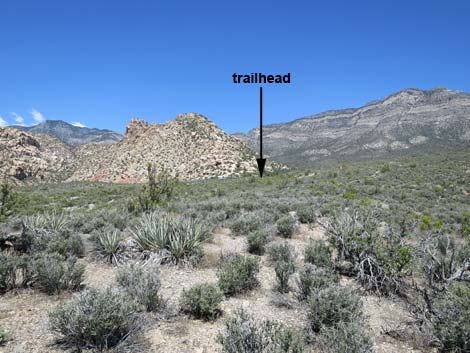
Watch Out Other than the standard warnings about hiking in the desert, ... this is a pretty safe hike, but if the earthquake fault starts thrusting, be sure to make a run for it. While hiking, please respect the land and the other people out there, and try to Leave No Trace of your passage. Also, even though this hike is short, be sure to bring what you need of the 10 Essentials. Getting to the Trailhead This hike is located along Scenic Loop Road in Red Rock Canyon National Conservation Area, about 45 minutes west of Las Vegas. From town, drive out to Red Rocks, pay the entrance fee, and drive about half-way around the Scenic Loop Road to White Rock Road. Drive up White Rock Road to the White Rock Trailhead. Park here; this is the trailhead. |
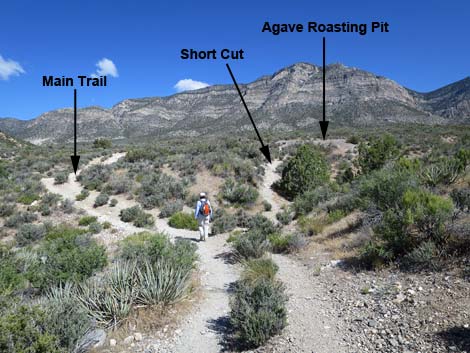 Hiker approaching second agave roasting pit (view N) |
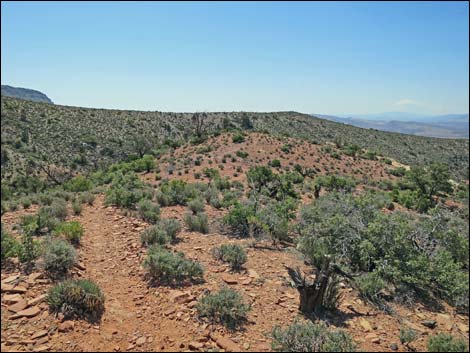
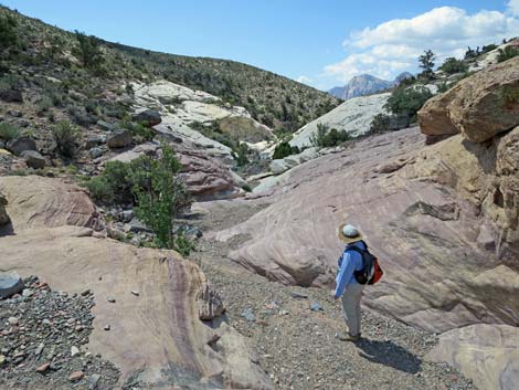
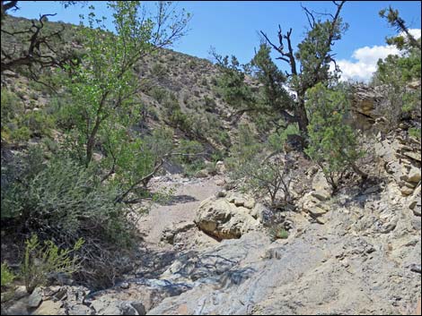
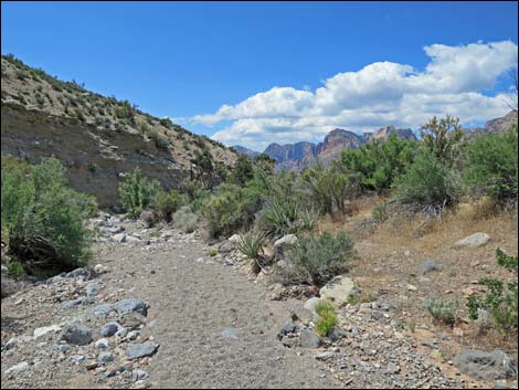
The Hike From the trailhead (Table 1, Waypoint 01), the Keystone Thrust Trail runs north up an old road. About 130 yards from the trailhead, the trail crosses White Rock Wash (Wpt. 02). At a trail junction (Wpt. 03) about 100 yards past White Rock Wash, the Keystone Thrust Trail turns right and climbs the low hillside to the east. The trail runs northeast until it hits an old road (Wpt. 04) that comes up from the south. The trail turns and follows the old road northward past another agave roasting pit (Wpt. 05). The old road winds around, climbs onto a ridgeline, and hits another trail junction (Wpt. 06). The Keystone Thrust Trail turns right and runs down into Keystone Basin (Wpt. 07), which is the end of the official trail. Now following use-trails, Keystone Loop Trail bends north, passes stone cabins build recently by hikers, and crosses the wash. Bending back to the south, the trail follows along below the trace of Keystone Fault (Wpt. 08) and runs out to a promontory (Wpt. 09) with nice views south across the Red Rock region. For details of getting to this point, see the Keystone Thrust Trail. |
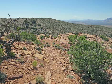
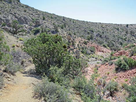
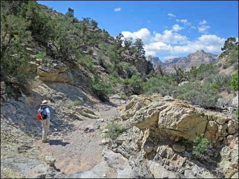
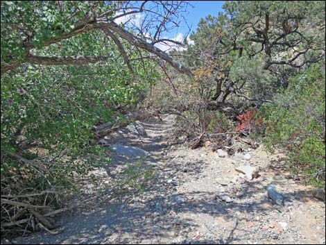
 Keystone Trail leaves old road (view NE) |
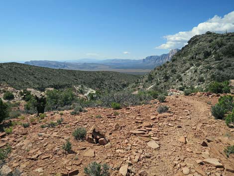
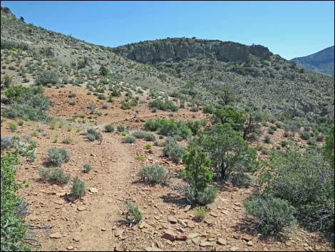
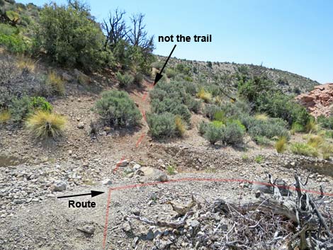
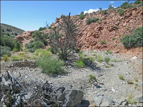
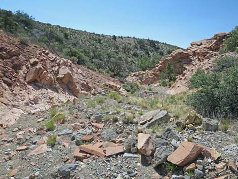
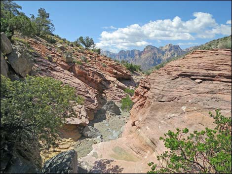
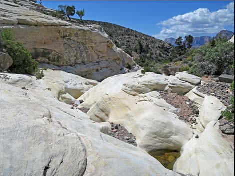
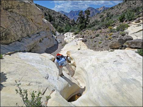
From the promontory (Wpt. 09), the Keystone Loop turns left and follows along the top of the cliffs before descending to another little promontory. After taking in the view from the final promontory, the trail turns northeast and begins a descent into the next canyon. On the way down, hikers will notice a trail climbing steeply up the slope on the other side of the canyon -- this is not the trail for the Keystone Loop. When the trail hits the bottom of the wash (Wpt. 10), the Keystone Loop Trail turns right and heads downstream. For the next 0.6 miles, the route just follows the canyon down. Along the way, hikers will pass several sandstone slickrock pour-overs, one vertical pour-over (Wpt. 10) that looks much worse from above than it really is, scamper under the branches of canyon live oak and pinyon pine trees, find Paleozoic fossils, and get some nice views up and down the canyon. |
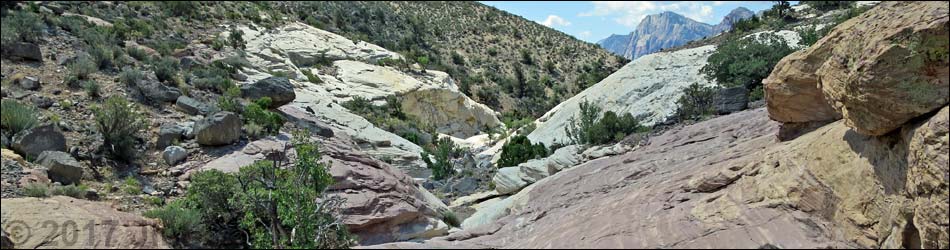
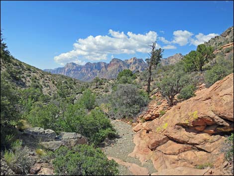
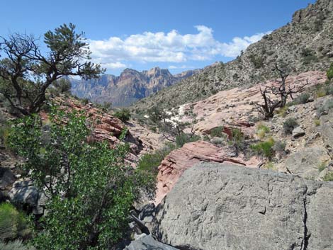
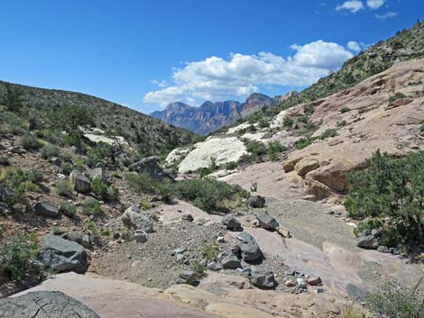
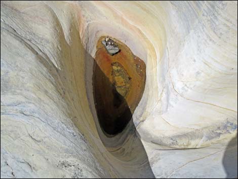
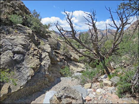
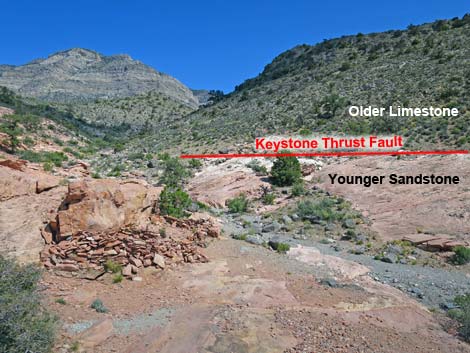 Looking towards Keystone Fault (view NE) |
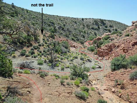
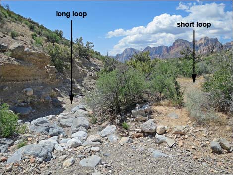
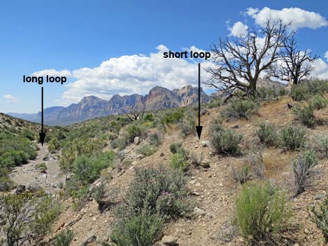
After hiking down the canyon for about 0.6 miles, a use-trail (Wpt. 12) forks right out of the wash and climbs onto the bank above the wash. For hikers desiring the "short loop," stay right onto the use-trail, which eventually runs out, but hikers can use this as a way to start looping back towards the trailhead (Wpt. 01). Keep in mind that the trailhead lies to the northwest, and hiking west at all will lead hikers to White Rock Road. For hikers who desire to hike the Long loop (or those who miss the short-loop turnoff), the wash continues another 0.15 miles to the Scenic Loop Road. Hikers still wanting to do the short loop can turn up the wash to the west that merges into the main wash on the upstream side of the road. After starting up this side wash, hikers can turn left to head west to White Rock Road. Continuing down the wash, hikers parallel the Scenic Loop Road for about 0.4 miles. In another 0.1 miles, the wash intersects the Grand Circle Trail. Joining this trail, hikers turn right and follow the trail back to the Scenic Loop Road. From there, hikers walk back up White Rock Road to the trailhead (Wpt. 01). |
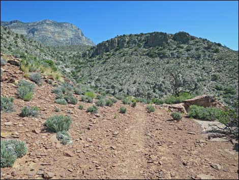
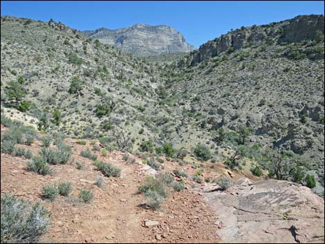
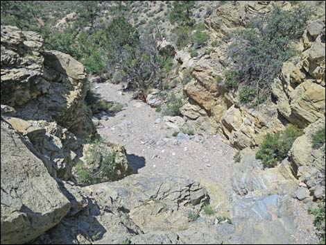
 Keystone Canyon Overlook (view S) |
 Departing the first promontory (view E) |
 Trail runs out a broad ridge (view SE) |
 Approaching the second promontory (view SE) |
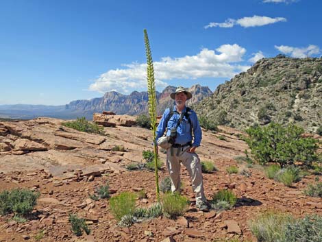 Blooming Utah Agave at Second Promontory (view S) |
 Departing the second promontory (view NE) |
 Starting into the next canyon (view NE |
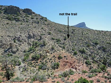 Looking across the canyon, that is not the trail (view E) |
 Descending towards the wash (view E) |
 Approaching the wash; turn downstream (view SE) |
 Wash; turn downstream (view SE) |
 The route runs down the wash (view S) |
 |
 |
 |
 |
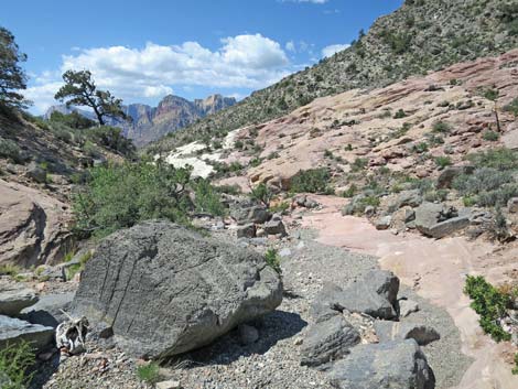 dark limestone boulder in the wash (view SW) |
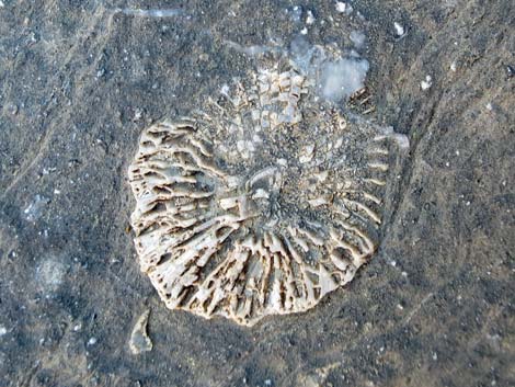 Crinoid fossil in dark limestone boulder |
 |
 |
 Sandstone slickrock (view SW) |
 Anybody home? |
 No tadpoles. |
 Sandstone slickrock ends (view SW) |
 |
 |
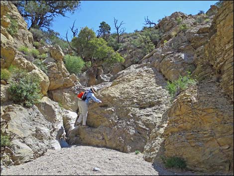
 Dodging under oak branches |
 Dodging under dead pine branches |
 Atop scary looking pour-over |
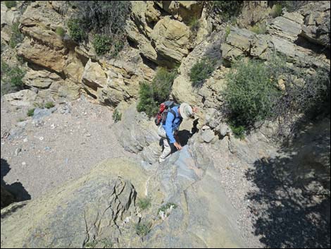 Jim down climbing |
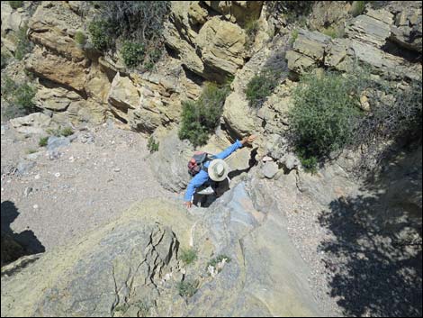 Jim down climbing |
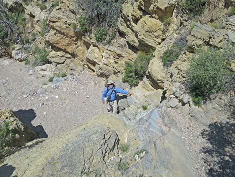 Jim down |
 Liz down climbing - not really so bad |
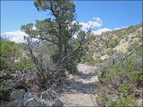 Pine tree along the wash offers some shade (view SW) |
 Two tall pinyon pines down the wash (view SW) |
 Nearing the short-loop turnoff (view SW) |
 Short-loop turnoff (view SW) |
 Short loop parallels wash for about 300 yards (view SW) |
 Short loop: turning back towards trailhead (view NW) |
 Short loop: trailhead at the base of White Rock Hills (view NW) |
Table 1. Hiking Coordinates Based on GPS Data (NAD27; UTM Zone 11S). Download Hiking GPS Waypoints (*.gpx) file.
| Wpt. | Location | UTM Easting | UTM Northing | Elevation (ft) | Point-to-Point Distance (mi) | Cumulative Distance (mi) |
|---|---|---|---|---|---|---|
| 01 | White Rock Trailhead | 637006 | 4004064 | 4,871 | 0.00 | 0.00 |
| 02 | White Rock Wash | 636961 | 4004167 | 4,915 | 0.07 | 0.07 |
| 03 | White Rock - Keystone Jct | 636953 | 4004268 | 4,956 | 0.07 | 0.14 |
| 04 | Old Road Jct | 637055 | 4004381 | 5,009 | 0.11 | 0.25 |
| 05 | Agave Roasting Pit | 637046 | 4004597 | 5,094 | 0.16 | 0.41 |
| 06 | Trail Junction | 637223 | 4004909 | 5,247 | 0.25 | 0.66 |
| 07 | Keystone Fault Overlook | 637383 | 4004874 | 5,135 | 0.12 | 0.78 |
| 08 | Keystone Thrust Fault | 637426 | 4004919 | 5,101 | 0.06 | 0.84 |
| 09 | Keystone Canyon Overlook | 637488 | 4004807 | 5,125 | 0.09 | 0.93 |
| 10 | Wash | 637649 | 4004819 | 5,025 | 0.19 | 1.12 |
| 11 | Wash at Pour-Over | 637522 | 4004307 | 4,804 | 0.42 | 1.54 |
| 12 | Long-Short Loops Split | 637427 | 4004031 | 4,740 | 0.21 | 1.75 |
| 01 | White Rock Trailhead | 637006 | 4004064 | 4,871 | 0.43 | 2.18 |
| . | . | . | . | . | . | . |
| 12 | Long-Short Loops Split | 637427 | 4004031 | 4,740 | 0.00 | 1.75 |
| 13 | Grand Circle Trail Junction | 637559 | 4003071 | 4,548 | 0.68 | 2.43 |
| 01 | White Rock Trailhead | 637006 | 4004064 | 4,871 | 0.67 | 3.10 |
Happy Hiking! All distances, elevations, and other facts are approximate.
![]() ; Last updated 240330
; Last updated 240330
| Hiking Around Red Rocks | Hiking Around Las Vegas | Glossary | Copyright, Conditions, Disclaimer | Home |