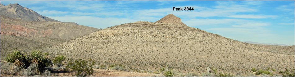
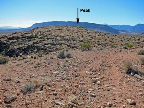
Peak 3844 East Loop Trail
Hiking Around Las Vegas, Red Rock Canyon NCA
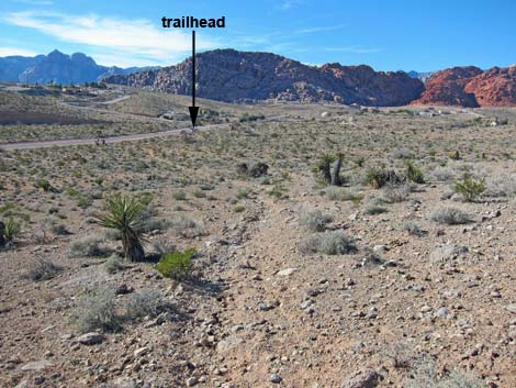
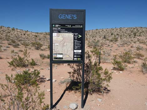 Genes Main Trailhead |
Overview This 3-mile loop starts along Calico Basin Road, shortly before the residential area, and uses interconnected use-trails that crisscross the desert to make a loop. Hikers need to pay attention to the many trail junctions. This hike runs east and then north along the east side of Peak 3844, circles around the north edge, and then turns south and climbs onto the summit. The hike descends off the north side of the peak and runs southwest back to the trailhead. This is a surprisingly pleasant hike with grand scenery, a nice craggy peak, and even solitude -- all on an easy hike starting only minutes from town. |
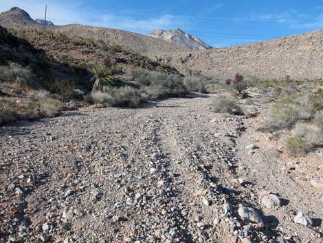
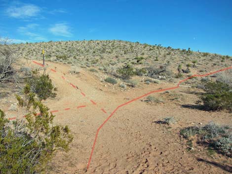 Hike does not go up past the sign (view NE) |
Watch Out Other than the standard warnings about hiking in the desert, ...this hike is fairly safe, but the peak is craggy, so always be extra careful near edges where you could fall and hurt yourself. While hiking, please respect the land and the other people out there, and try to Leave No Trace of your passage. Also, even though this is a short hike, be sure to bring what you need of the 10 Essentials. |
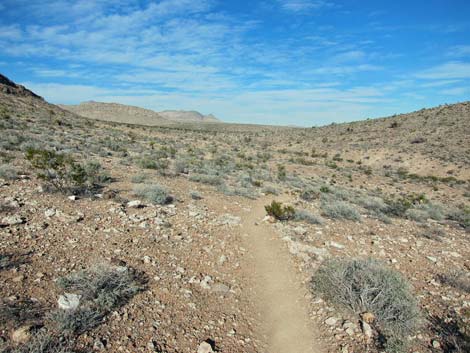
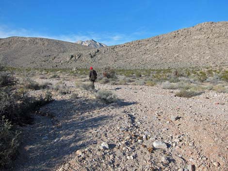
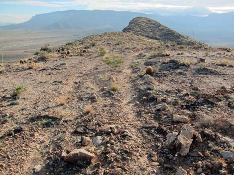
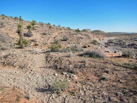 Hike continues parallel to Calico Wash (view E) |
Getting to the Trailhead This hike is located in Red Rock Canyon National Conservation Area, about 25 minutes from town, but not on the Scenic Loop Road. Drive out West Charleston Blvd, turn right onto Calico Basin Road, then drive north 0.4 miles to Genes Trailhead. Pull well off the road and park here; this is the trailhead. Watch for vehicles on the road. |
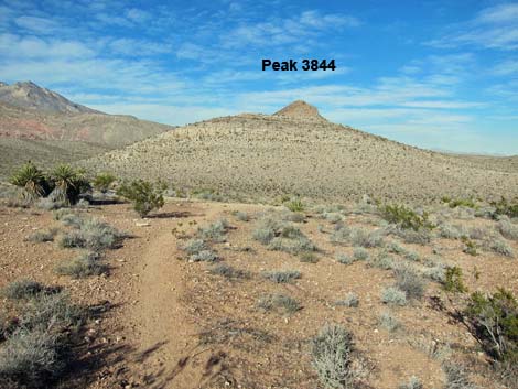 Head-on view of Peak 3844 (view NE) |
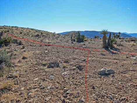
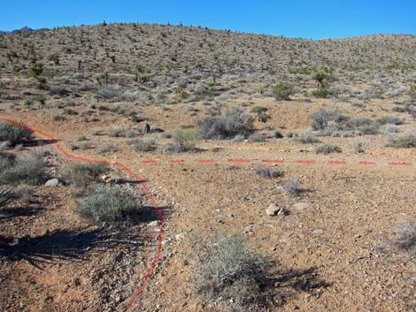
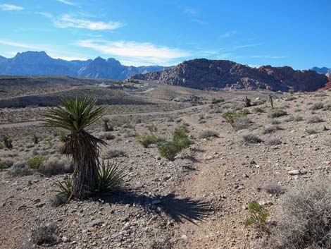
The Hike Because there are so many interconnected use-trails in this area, trails established by hikers, bikers, horseback riders, and even vehicles for various purposes, the route description sounds convoluted and confusing. In reality it is simple: always staying on well-defined use-trails or old roads, this hike runs north along the east side of Peak 3844, turns west to catch the north toe of the summit ridge, runs south to the peak, then cut down and north before curving back to the trailhead. From the trailhead (Table 1, Waypoint 01), a use-trail leads east along the edge of Calico Wash for about 30 yards to a trail junction (Wpt. 02). A wide use-trail (wide enough to be a road) forks left and runs uphill past an "Area Closed to Motorized Vehicles" sign. This hike, however, continues east on a narrow use-trail that stays parallel to Calico Wash; it does not turn up the hill past the sign. |
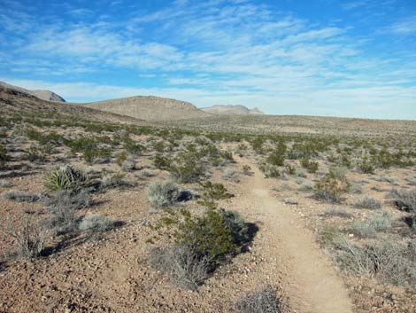
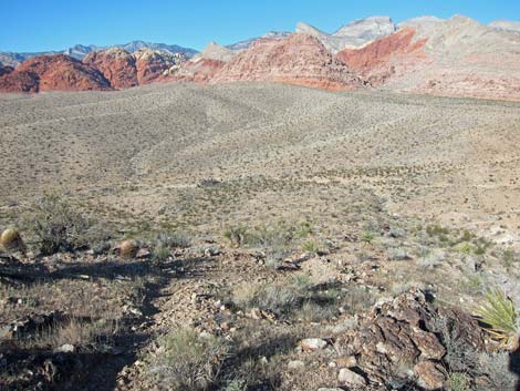
 Grand scenery (view N) |
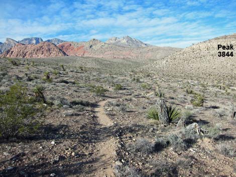
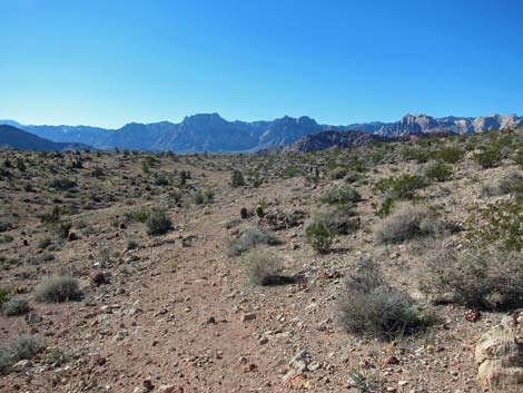
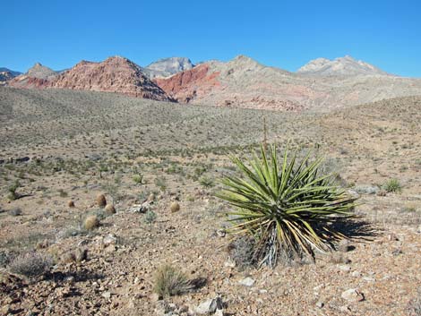
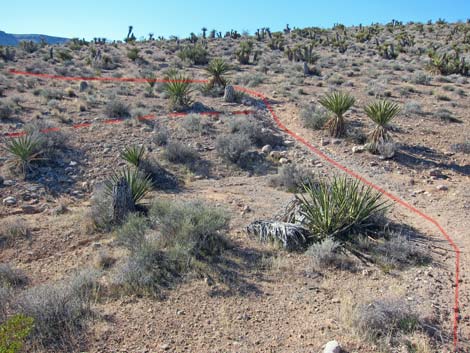
The use-trail runs east and climbs gently onto a low ridge, then swings to the north as it curves along the other side of the ridge. This section gives nice head-on views of Peak 3844 as it towers over the local scene. Through this area, the vegetation is sparse, but typical Mojave Desert Scrub, with a diverse assemblage of shrubs such as Creosote Bush and White Bursage, Mojave Yucca, Spiny Menodora, Nevada Jointfir, Indigo Bush, and several other species. The use-trail eventually runs down and crosses the wash that comes from the west side of Peak 3844. The use-trail turns northeast and soon merges with a faint use-trail (Wpt. 50) that comes in from the left. The use-trail continues to traverse gentle slopes beneath the south side of the Peak 3844. The use-trail runs through a low saddle, then continues along the east side of the Peak 3844 ridge, now heading more directly north. |
 Faint trail merges from the left (view NE) |
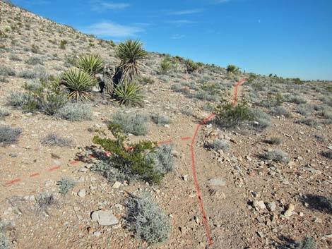
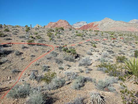
The use-trail passes another faint use-trail that cuts off to the left (Wpt. 51) and soon arrives at the edge of a deep gully (Wpt. 52). A faint use-trail turns left here, but the hike turns right, cuts down and across the gully, and descends towards the main wash below. Before reaching the wash, the use-trail turns north again, now running along the edge of the wash. The use-trail drops into the wash (Wpt. 53) when forced off the hillside by rocky outcrops. In the wash, the use-trail continues north along the base of the ridge, passing yet another faint use-trail (Wpt. 54) that cuts back hard to the left. In this area, the wash is thick with catclaw acacia, a species common in washes that often is infested with mistletoe, a staple food of Phainopepla. |
 Peak 3844 towers above the landscape (view N) |
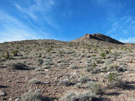
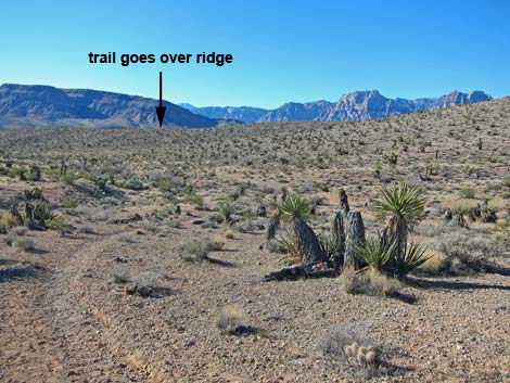
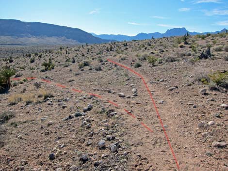
The use-trail passes under powerlines and soon merges with the powerline road (Wpt. 55). Following the road westward, the hike quickly encounters a fork in the road (Wpt. 56). Turning up the hillside on the left road, the hike starts up the hill heading south. The first few yards are a bit steep, but eventually the old road winds gently up the hillside. Two forks in the road are passed, always staying to the left (straight) on the ridgeline (Wpt. 41). Near the top of the ridge, the Red Rock cliffs come into view, as does the summit of Peak 3844. The old road eventually gains the top of the ridge and merges with a use-trail (Wpt. 12) coming from the right. |
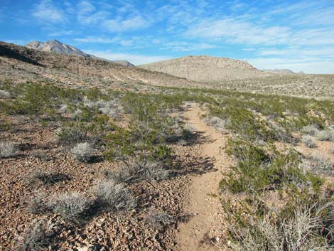
 Gentle trail running towards saddle (view NE) |
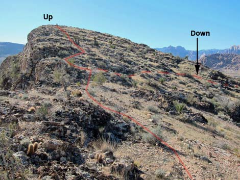
Following the old road south, the hike runs out onto a broad, flat highpoint (Wpt. 13) where vehicles stopped. I can image that this would have been a nice place to park and watch the lights of town at night. From the far south end of the old road (Wpt. 14), a use-trail continues along the ridge heading for the summit. Stunted Engelmann's Hedgehog Cactus and Utah agave are thick along the ridgeline. At the base of the summit block (Wpt. 15), the use-trail splits. A spur trail continues to the summit (Wpt. 16), but the loop turns right and starts down the steep north side of the peak. |
 Gentle trail beyond saddle (view N) |
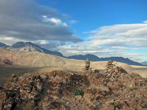
Continuing to the summit (Wpt. 16), the faint use-trail is hard to follow because of so much bedrock, but the route is obvious. Atop the summit, the views are grand for such a low peak. The 360-view includes the Red Rock Cliffs, the Calico Hills, the La Madre Range, the Las Vegas Range, Virgin Peak, the Muddy Mountains, peaks in Gold Butte, Wilson Mountain over in Arizona, the North McCullough range, perhaps the New York Mountains, the South McCullough ranges, and of course, Blue Diamond Hill. Departing the summit, the hike backtracks to base of the summit block (Wpt. 15), then turns left and heads west and northwest down the north side of the peak. Notice here the difference in vegetation from the more sunny south and west-facing slopes. Even desert almond grows here, a species usually restricted to washes. |
 |
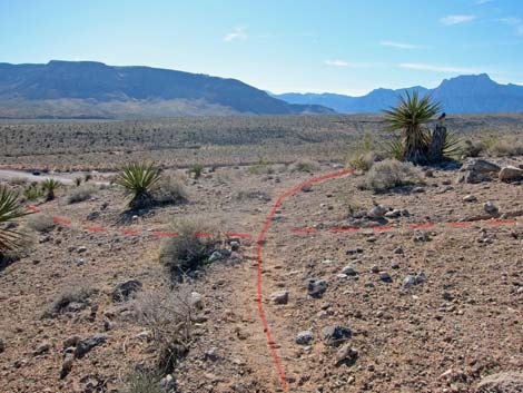
Descending to the northwest, the use-trail crosses a wash and intersects a use-trail running along the hillside (Wpt. 08). Turning left, the hike runs downhill and quickly merges with a use-trail coming in from the right (Wpt. 07) and continues to the southwest. The use-trail passes a junction (Wpt. 06) with a faint trail to the left, runs up over a ridge (with a view down to the trailhead), and then descends towards a gully. At a fork in the use-trail (Wpt. 05), the hike stays left and descends to the trailhead (Wpt. 01). |
 Faint trail forks left (view N) |
 Trail turns hard right at gully (view N) |
 Trail cuts down and across gully (view E) |
 Trail runs along edge of wash (view N) |
 Trail forced into wash by rocky outcrops (view N) |
 Trail in wash approaching powerlines (view N) |
 Trail merges onto powerline road (view NW) |
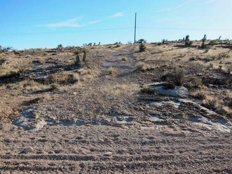 Powerline road rocks; hike goes up hill (view S) |
 Beyond steep part, old road levels out (view SW) |
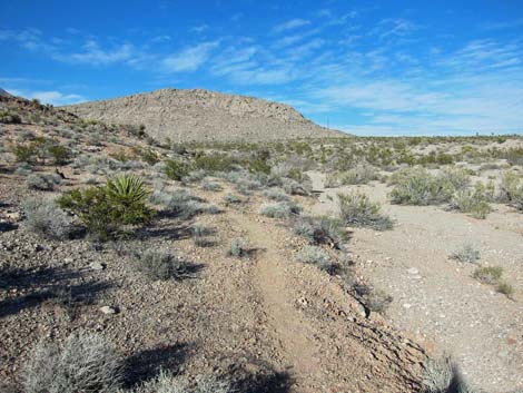
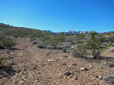
 Peak 3844 in the distance (view S) |
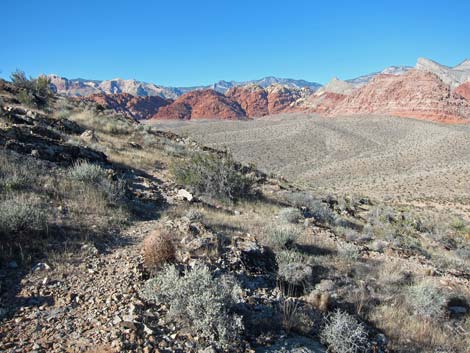
 Red Rock cliffs in the distance (view W) |
 Trail joins old road from the right (view S) |
 Trail follows old road up ridgeline (view S) |
 Broad, flat parking area at end of old road (view E) |
 Beyond old road, trail continues towards peak (view S) |
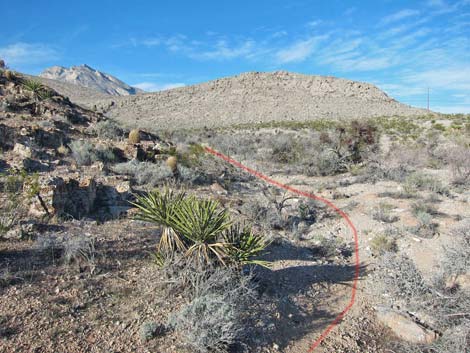
 Trail forks at base of summit block (view W) |
 Summit (view NE) |
 Descending the steep and rocky north side of the peak (view NW) |
 Descending the steep north side of the peak (view NW) |
 Descending the nice, north side of the peak (view NW) |
 Intersecting a trail across the wash (view NW) |
 The way back (view SW) |
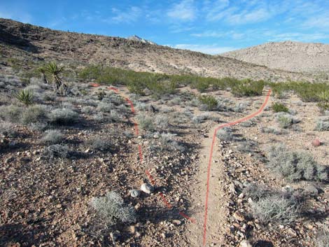
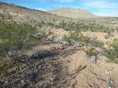
 Merging with a trail (triangle intersection) |
 Faint trail to the left (view SW) |
 |
 |
 Crest of ridge before descending towards trailhead (view W) |
 Descending towards trailhead (view W) |
Table 1. Hiking Coordinates and Distances based on GPS Data (NAD27; UTM Zone 11S). Download Calico East Area Waypoints (*.gpx) file. File includes all Calico East Area Hiking Waypoints.
| Wpt. | Location | UTM Easting | UTM Northing | Elevation (ft) | Point-to-Point Distance (mi) | Cumulative Distance (mi) | Verified |
|---|---|---|---|---|---|---|---|
| 01 | Trailhead, Main | 643610 | 4001122 | 3,465 | 0.00 | 0.00 | Yes |
| 02 | Trail Junction | 643632 | 4001137 | 3,489 | 0.02 | 0.02 | Yes |
| 50 | Trail Junction | 644036 | 4001419 | 3,513 | 0.45 | 0.47 | GPS |
| 51 | Trail Junction | 644492 | 4002208 | 3,558 | 0.65 | 1.12 | GPS |
| 52 | Trail Junction | 644504 | 4002272 | 3,560 | 0.04 | 1.16 | GPS |
| 53 | Trail Drops into Wash | 644549 | 4002398 | 3,557 | 0.09 | 1.25 | GPS |
| 54 | Trail Junction | 644506 | 4002525 | 3,575 | 0.09 | 1.34 | GPS |
| 55 | Trail Joins Powerline Road | 644470 | 4002612 | 3,586 | 0.06 | 1.40 | GPS |
| 56 | Old Roads Junction | 644431 | 4002621 | 3,586 | 0.03 | 1.43 | GPS |
| 41 | Trail Junction | 644279 | 4002521 | 3,694 | 0.14 | 1.57 | GPS |
| 12 | Trail Junction | 644158 | 4002148 | 3,734 | 0.29 | 1.86 | Yes |
| 13 | View Point | 644252 | 4002024 | 3,778 | 0.11 | 1.97 | Yes |
| 14 | End of Old Road | 644243 | 4001993 | 3,778 | 0.02 | 1.99 | Yes |
| 15 | Trail Junction | 644190 | 4001819 | 3,769 | 0.11 | 2.10 | Yes |
| 16 | Summit (Peak 3844) | 644161 | 4001755 | 3,816 | 0.06 | 2.16 | Yes |
| 15 | Trail Junction | 644190 | 4001819 | 3,769 | 0.05 | 2.21 | Yes |
| 08 | Trail Junction | 643890 | 4002028 | 3,588 | 0.27 | 2.48 | Yes |
| 07 | Trail Junction | 643850 | 4001930 | 3,566 | 0.08 | 2.56 | Yes |
| 06 | Trail Junction | 643736 | 4001599 | 3,542 | 0.23 | 2.79 | Yes |
| 05 | Trail Junction | 643613 | 4001437 | 3,568 | 0.14 | 2.93 | Yes |
| 04 | Trail Junction | 643640 | 4001235 | 3,521 | 0.14 | 3.07 | Yes |
| 03 | Trail Junction | 643642 | 4001178 | 3,504 | 0.04 | 3.11 | Yes |
| 02 | Trail Junction | 643632 | 4001137 | 3,489 | 0.03 | 3.14 | Yes |
| 01 | Trailhead, Main | 643610 | 4001122 | 3,465 | 0.02 | 3.16 | Yes |
Happy Hiking! All distances, elevations, and other facts are approximate.
![]() ; Last updated 240329
; Last updated 240329
| Hiking Around Red Rocks | Hiking Around Las Vegas | Glossary | Copyright, Conditions, Disclaimer | Home |