Hiking Around Las Vegas, Red Rock Canyon National Conservation Area
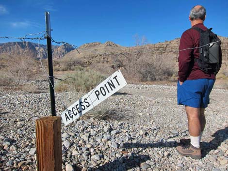
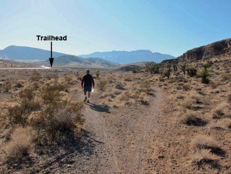
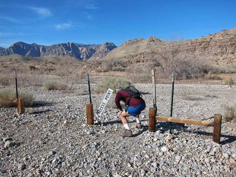 Negotiating the Access Point (view W) |
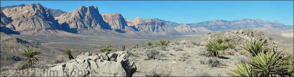
The White Cross Trailhead is closed. Access this trail from Blue Diamond. Overview The Ridgeline Loop Trail is a moderate 4.7-mile hike that climbs onto ridges that lie between Highway 160 and Blue Diamond town, runs westward to a rocky promontory overlooking Cottonwood Valley and the Red Rock Escarpment, loops back towards Blue Diamond (close enough to stop for a soda), and then runs back through a gap in the ridge to the trailhead. Because a plethora of mountain bike trails crisscross the area, various longer looping options are possible. Also because of the plethora of mountain bike trails, getting started on the right trail is a bit confusing. Using GPS waypoints will help, but hikers should be able to "feel their way along" and get there soon enough. Link to trail map. |
 |
Watch Out Other than the standard warnings about hiking in the desert, ... this hike is fairly safe with no unusual hazards. Pulling in and out of the trailhead parking is another matter. Watch the highway traffic carefully as most vehicles going downhill will be traveling in excess of 70 mph. When ready to leave, chill-out for a moment, let the traffic clear, and then pull out safely. This trail is accessed from the "White Cross" trailhead; consider carefully what that means. While hiking, please respect the land and the other people out there, and try to Leave No Trace of your passage. Also, be sure to bring what you need of the 10 Essentials. |
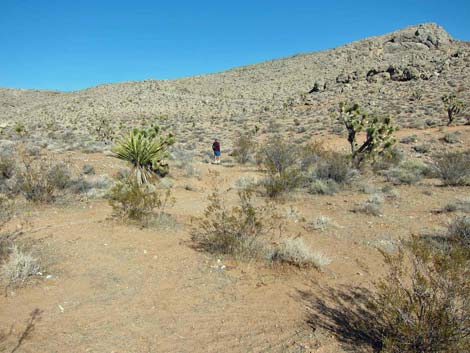
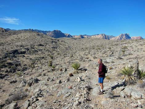
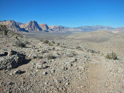
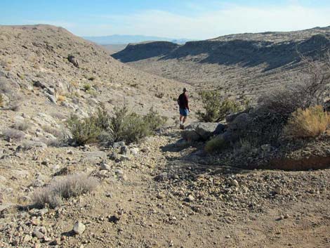
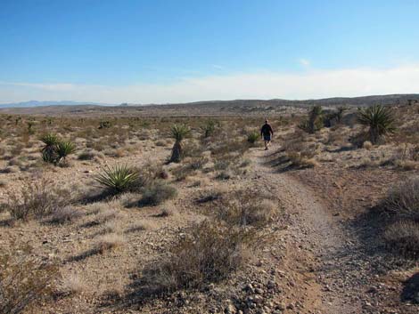
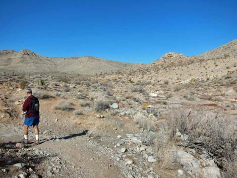 Leaving the main wash (view W) |
Getting to the Trailhead This hike is located in Red Rock Canyon NCA, but not in the Scenic Loop Road fee area. From the Red Rock Visitor Center area, drive west then south on West Charleston Blvd (Hwy 159) to Blue Diamond Town. Turn right into Blue Diamond and find a legal place to park. The access trail starts from the southeast edge of town and runs up the deep valley between the mountains. |
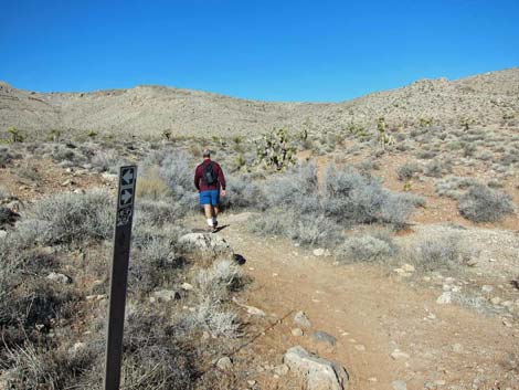
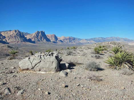
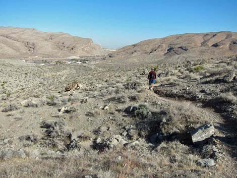
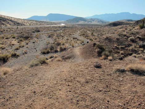
 Stay left on faint trail, not on "old road" (view N) |
The Hike From the trailhead (Table 1, Waypoint 01) at the end of the short spur road, multiple trails run down into the wash and converge at the Access Point (Wpt. 02), a gap in the highway fence. At about 50-ft out, hikers can duck through the smooth-wire fence. From what I've seen, mountain bikers just lift their bikes over the fence and skip the Access Point. Past the Access Point, the poorly-defined trail crosses Cottonwood Wash and intersects a well-defined trail running along the far side of the wash (this trail is clearly visible from the parking area). Although confused by multiple trailing, the first goal is to cross the wash, skirt around the end of the cliff to the left, and hike up along a side wash running northwest. |
 Stay left on the faint trail (view NW) |
Heading left on the trail across Cottonwood Wash, the trail runs along the base of a low cliff for a few yards and then turns right up a side wash to the west. At this point, trails seem to be going in all directions, but the loop trail runs west and away from the main wash at this point. Shortly, the trail forks (Wpt. 03) and the loop route continues northwest along, then crossing, the side wash (this is only about 100 yards from the trailhead). About 150 yards farther, the loop trail passes a trail junction (Wpt. 04) on the right. A few steps farther yet, the loop trail turns right at another trail junction (Wpt. 05) and runs due north. After only 25 yards, there is another fork in the trail (Wpt. 06). The obvious trail, which almost looks like an old road starting up and right across the hillside, is the wrong way. Staying to the left on the narrower trail, the loop trail runs across flattish country along the base of the hills. After all of this confusion, we are only 300 yards from the trailhead! |
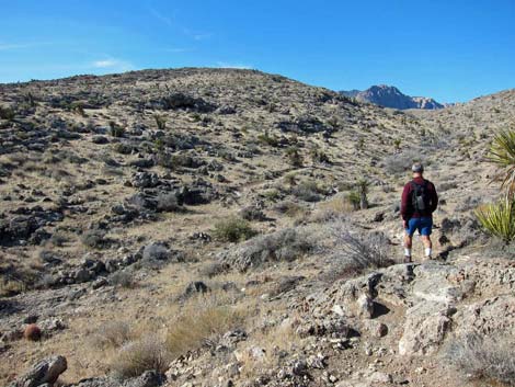
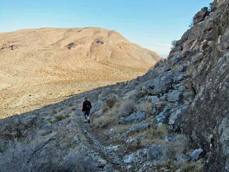
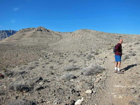 On the ridge, multiple-trail problems are left behind |
The trail eventually begins to climb the hillside, and from here on, the problem of multiple-trailing is left behind. As with most bike trails, the grade is gentle as the trail climbs to hear the ridgeline (Wpt. 07). In what might seem unusual to hikers, bike trails often skip high points, and this trail never quite gets to the top of the ridge, but it does provide tantalizing views of the tops of the Red Rock Escarpment far to the west. Running near the top of the ridge and heading west, the trail drops into and cross a gully, which from the perspective on the ridge (Wpt. 07), is ahead and down to the left. Crossing the gully (Wpt. 08), the trail switchbacks up the far side and eventually touches the next ridgeline (Wpt. 09), providing great views back down to Highway 160 and point southeast. |
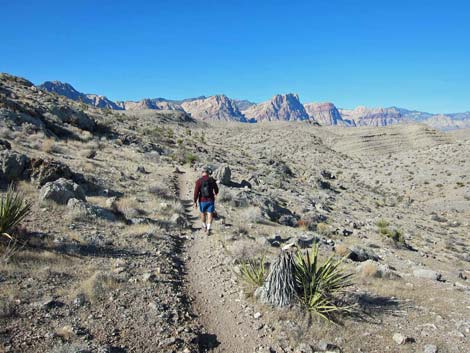
 Trail never quite climbs to the ridgeline (view NW) |
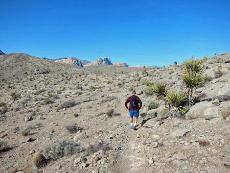
Continuing westward, the trail eventually climbs high and provides great views of the Red Rock Escarpment, with nice views of Blue Diamond and the gypsum quarry in a few places, and even the Las Vegas urban area in the distance. About half-way out the length of the ridge (Wpt. 10), a faint side trail branches off to the left. This trail becomes more obvious as it gains the top of the ridge and continues west to the far end of the ridge. However, continuing on the obvious "main trail" at this point, the loop trail drops off the ridgeline to the north and crosses the head of a canyon on a side-ridge. At the far end of the side-ridge (Wpt. 11), a short spur ridge (0.1 miles; no trail) leads to a rocky knob and a great lunch break area (Wpt. 12). |
 Getting ready to cross to the next ridge (view W) |
Back on the loop trail (Wpt. 11), the trail begins winding down the hillside into the canyon that forms the north side of the main Ridgeline ridge. From this view, an obvious trail sweeps down the side of the opposite ridge. This obvious trail is one choice, but at a T-intersection obscured by a rocky outcrop (Wpt. 13), a right turn provides an alternate with a bit of shade, at least during winter. Staying to the right, the loop trail winds along the rocky hillside, eventually touching limestone cliffs before turning steeply downhill as if to slide into Blue Diamond Town (Wpt. 14). Staying to the right at all trail junctions (back into the multiple-trailing zone), the loop trail eventually bends back to the south and runs through a gap in the hills leading towards Highway 160. On a bluff overlooking Cottonwood Wash (Wpt. 16), the trail turns southwest, and the trailhead eventually comes into view. Again, many trails are possible, but hikers can drop into Cottonwood Wash (Wpt. 17) and find their way back to the trailhead (Wpt. 01). |
 Dropping into the gully (view W) |
 Hiking on the second ridge (view NW) |
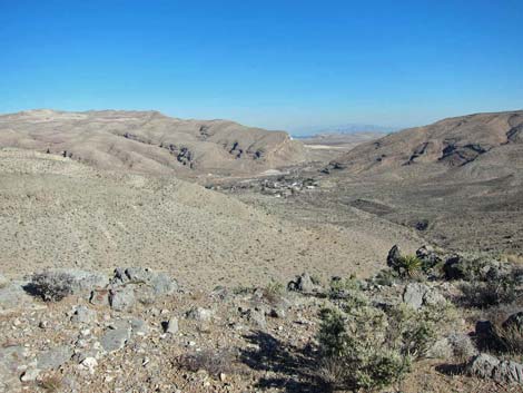 View into Blue Diamond Town; Las Vegas in the distance (view NE) |
 Starting down off the ridgeline, beginning to loop back (view NW) |
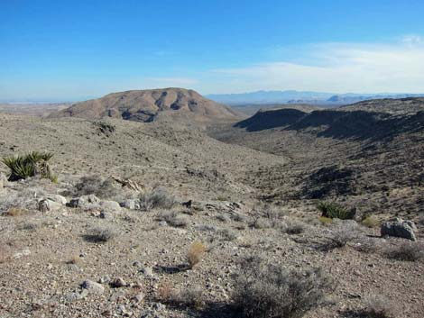 Canyon just north of the main ridge (view E) |
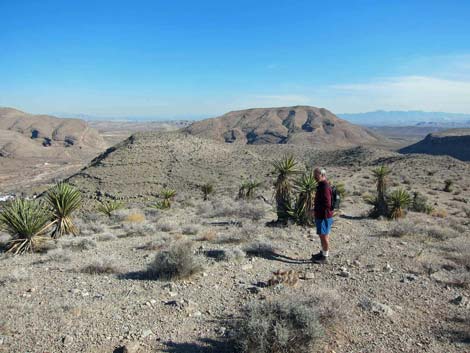
 From the trail, look towards lunch-break knob (view NW) |
 Starting down and back to the east (view E) |
 Trail intersection to the shady-side trail (view E) |
 Nearing Blue Diamond Town (view NE) |
 Catching some winter shade (view E) |
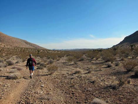 Hiking south through gap towards Highway 160 (view SE) |
 Flats before Cottonwood Wash and Highway 160 (view S) |
 Multiple trails all going the same place (view SW) |
 Dropping into Cottonwood Wash near the trailhead (view SW) |
Table 2. Hiking Coordinates and Distances based on GPS Data (NAD27; UTM Zone 11S). Download Hiking GPS Waypoints (*.gpx) file.
| Wpt. | Location | UTM Easting | UTM Northing | Elevation (ft) | Point-to-Point Distance (mi) | Cumulative Distance (mi) | Verified |
|---|---|---|---|---|---|---|---|
| 01 | Trailhead | 644288 | 3988337 | 3,484 | 0.00 | 0.00 | GPS |
| 02 | Access Point | 644277 | 3988352 | 3,484 | 0.01 | 0.01 | GPS |
| 03 | Fork in Trail | 644189 | 3988341 | 3,498 | 0.06 | 0.07 | GPS |
| 04 | Fork in Trail | 644077 | 3988408 | 3,512 | 0.09 | 0.16 | GPS |
| 05 | Fork in Trail | 644059 | 3988410 | 3,514 | 0.01 | 0.17 | GPS |
| 06 | Fork in Trail | 644061 | 3988429 | 3,508 | 0.02 | 0.19 | GPS |
| 07 | Near Ridgetop | 644014 | 3989020 | 3,755 | 0.63 | 0.82 | GPS |
| 08 | Cross Gully | 643851 | 3989058 | 3,724 | 0.11 | 0.93 | GPS |
| 09 | Overlook to SW | 643749 | 3988932 | 3,784 | 0.19 | 1.12 | GPS |
| 10 | Fork in Trail | 642668 | 3989463 | 4,054 | 0.95 | 2.07 | GPS |
| 11 | Spur to Knob | 642708 | 3989770 | 4,000 | 0.27 | 2.34 | GPS |
| 12 | Knob | 642659 | 3989921 | 3,957 | 0.10 | 2.44 | GPS |
| 11 | Spur to Knob | 642708 | 3989770 | 4,000 | 0.10 | 2.54 | GPS |
| 13 | Fork in Trail | 642754 | 3989646 | 3,877 | 0.16 | 2.70 | GPS |
| 14 | Fork in Trail | 644072 | 3989354 | 3,540 | 1.20 | 3.90 | GPS |
| 15 | Fork in Trail | 644250 | 3989246 | 3,521 | 0.04 | 3.94 | GPS |
| 16 | Fork in Trail | 644534 | 3988734 | 3,467 | 0.37 | 4.31 | GPS |
| 17 | Fork in Trail | 644449 | 3988638 | 3,481 | 0.09 | 4.40 | GPS |
| 18 | Fork in Trail | 644258 | 3988431 | 3,484 | 0.18 | 4.58 | GPS |
| 19 | Fork in Trail | 644252 | 3988403 | 3,484 | 0.02 | 4.60 | GPS |
| 02 | Access Point | 644277 | 3988352 | 3,484 | 0.04 | 4.64 | GPS |
| 01 | Trailhead | 644288 | 3988337 | 3,484 | 0.01 | 4.65 | GPS |
Happy Hiking! All distances, elevations, and other facts are approximate.
![]() ; Last updated 240330
; Last updated 240330
| Hiking Around Red Rocks | Hiking Around Las Vegas | Glossary | Copyright, Conditions, Disclaimer | Home |