Hiking Around Las Vegas, Red Rock Canyon NCA, Blue Diamond Hill
 Bike rider on First Finger Trail (view northwest) |
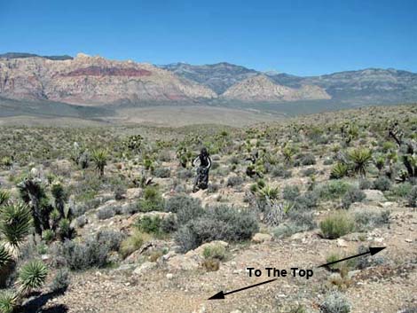
Overview The To-The-Top Trail is one of the longer Blue Diamond Hill Bike Trails. This trail begins at the end of the Jeep Trail Connector and climbs for 2.11 miles through two canyons and up a long ridge to the Viewpoint at the crest of Blue Diamond Hill. This is a great hike on generally gentle grades that rewards hikers with a grand panorama of the mountains in one direction and sweeping views of the entire Las Vegas valley in the other. Flora and Fauna This is Mojave Desert Scrub country with lots of cactus, birds, and lizards. See the Blue Diamond Hill Bike Trail Overview for details. Link to trail map. |
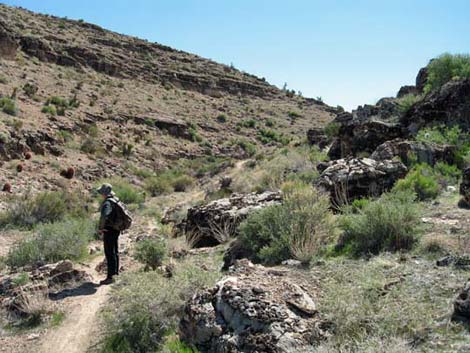 Hiker in upper Cave Canyon (view southeast) |
Watch Out Other than the standard warnings about hiking in the desert, ...this is a pretty safe hike. The Blue Diamond Hill Trails were designed for mountain bikes, so the grades are generally easy, but watch for bikers careening down the trail. Falls from the Viewpoint and other points along the crest of the hill would hurt. While hiking, please respect the land and the other people out there, and try to Leave No Trace of your passage. Also, even though this hike is short, be sure to bring what you need of the 10 Essentials. |
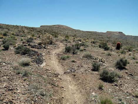
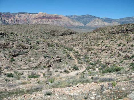 Looking down Cave Canyon (view northwest) |
Getting to the Trailhead This hike is located in Red Rock Canyon National Conservation Area, about 30 minutes from town, but not on the Scenic Loop Road. Drive out West Charleston Blvd, past the entrance to the Scenic Loop Drive, to the Cowboy Trail Rides Trailhead on the left. Park here; this is the trailhead. The Hike This trail begins at the end of the Jeep Trail connector (Wpt. 11) and runs northwest for a few yards to a junction with the First Finger Trail (Wpt. 10), and then continues a few yards farther to the junction with the south end of the Second Finger Trail (Wpt. 12). |
 The last ridge (view southeast) |
The trail then starts down across a hillside into the bottom of upper Cave Canyon and a T-intersection trail junction (Wpt 13). The north end of the Second Finger Trail goes left and up the hillside, and the To-The-Top Trail turns right and goes up the canyon. Heading southeast and up the canyon, the trail crosses the wash and ascends a few short switchbacks before continuing up canyon. The trail eventually turns north, contours over a low ridge, and drops into the next little canyon. Crossing that canyon, the trail continues contouring north to a junction with the Bone Shaker Trail (Wpt. 14). |
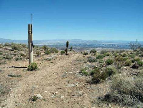 Near the Viewpoint (view east) |
The Bone Shaker continues to the northwest, while the To-The-Top Trail makes a U-turn and heads up the gentle ridge to the southeast. Somewhat unexpectedly, the trail passes a fenced radio facility (Wpt. 15), then continues upward on an old road. Near the crest of the ridge, the old road bends south (Wpt. 16) to run along the ridge to the gypsum mine, and the trail continues east towards the rim. A few yards past the road, the To-The-Top Trail passes a trail junction (Wpt. 17) with the Ridge Ride and Three Amigos trails, which run northwest along the ridge, and continues out to the Viewpoint. |
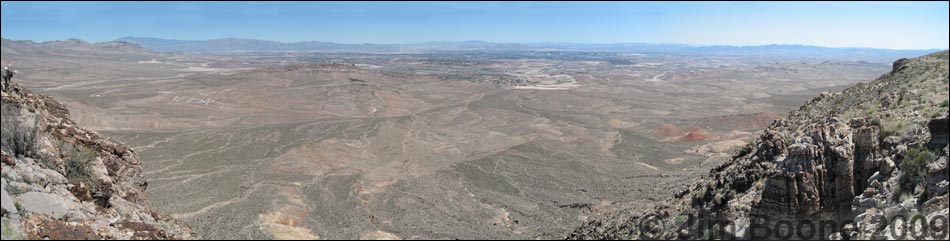
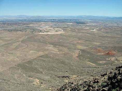 Downtown Las Vegas (view east from the Viewpoint) |
The Viewpoint is a place to rest, relax for a bit, eat lunch, and look out over Las Vegas. The city is a long way off, but the contrast is striking and reminds hikers of how different is the natural world and why we like it out here. From the end of the Viewpoint, walk back to the trailhead the way you came, make a loop by hiking back down another trail, or continue on one of the other Blue Diamond Hill Bike Trails. |
Table 2. Hiking Coordinates Based on GPS Data (NAD27; UTM Zone 11S). Download Hiking GPS Waypoints (*.gpx) file.
| Wpt. | Location | Easting | Northing | Elevation (ft) | Point-to-Point Distance (mi) | Cumulative Distance (mi) | Verified |
|---|---|---|---|---|---|---|---|
| 10 | First Finger Trail Junction | 643064 | 3996217 | 4,538 | 0.03 | 0.03 | GPS |
| 11 | Jeep Trail Junction | 643087 | 3996172 | 4,539 | 0.00 | 0.00 | GPS |
| 12 | Second Finger Trail Junction (south) | 643022 | 3996302 | 4,526 | 0.06 | 0.09 | GPS |
| 13 | Second Finger Trail Junction (north) | 643067 | 3996507 | 4,474 | 0.13 | 0.22 | GPS |
| 14 | Bone Shaker Trail Junction | 643221 | 3996877 | 4,654 | 1.14 | 1.36 | GPS |
| 15 | Fenced Radio Facility | 643826 | 3996752 | 4,819 | 0.41 | 1.77 | GPS |
| 16 | Road to the Mine Junction | 644265 | 3996849 | 4,906 | 0.32 | 2.09 | GPS |
| 17 | Ridge Ride Trail Junction | 644278 | 3996858 | 4,916 | 0.01 | 2.10 | GPS |
| 18 | Viewpoint | 644307 | 3996870 | 4,910 | 0.01 | 2.11 | GPS |
| 19 | Summit | 644211 | 3996944 | 4,937 | 0.10 | . | GPS |
Happy Hiking! All distances, elevations, and other facts are approximate.
![]() ; Last updated 240329
; Last updated 240329
| Hiking Around Red Rocks | Hiking Around Las Vegas | Glossary | Copyright, Conditions, Disclaimer | Home |