Hiking Around Las Vegas, Red Rock Canyon NCA, Blue Diamond Hill
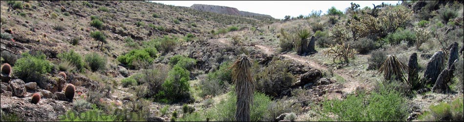
 First Finger Trail (right) at Fossil Trail (left; view N) |
Overview The First Finger Trail is one of the Blue Diamond Hill Bike Trails. This trail is 1.3 miles long, but it starts at least 2.28 miles from the trailhead, so a round trip doing this trail and returning to the trailhead is some 6.2 miles total. First Finger Trail gently contours down and out to the tip of the first ridge east of Fossil Canyon, then turns and climbs gently back to the base of the ridge. This trail starts near the end of the Fossil Trail and ends near the beginning of the To-The-Top Trail. Flora and Fauna This is Mojave Desert Scrub country with lots of cactus, birds, and lizards. See the Blue Diamond Hill Bike Trail Overview for details. Link to trail map. |
 |
Watch Out Other than the standard warnings about hiking in the desert, ...this is a pretty safe hike. The Blue Diamond Hill Trails were designed for mountain bikes, so the grades are generally easy, but watch for bikers careening down the trail. While hiking, please respect the land and the other people out there, and try to Leave No Trace of your passage. Also, even though this hike is short, be sure to bring what you need of the 10 Essentials. |
 |
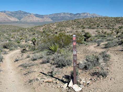
Getting to the Trailhead This hike is located in Red Rock Canyon National Conservation Area, about 30 minutes from town, but not on the Scenic Loop Road. Drive out West Charleston Blvd, past the entrance to the Scenic Loop Drive, to the Cowboy Trail Rides Trailhead on the left. Park here; this is the trailhead. The Hike From the trailhead, the most direct way to start the First Finger Trail is to hike out the Fossil Trail for 2.25 miles to a trail junction (Wpt. 5) where the First Finger Trail forks to the left. A few yards before of the end of the Fossil Trail (Wpt. 5), the First Finger Trail U-turns north and runs out to the end of the ridge. Along this section, there are nice views of the Red Rock Cliffs in the distance, plus views of other trails across the canyon below. |
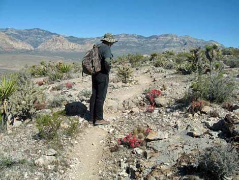
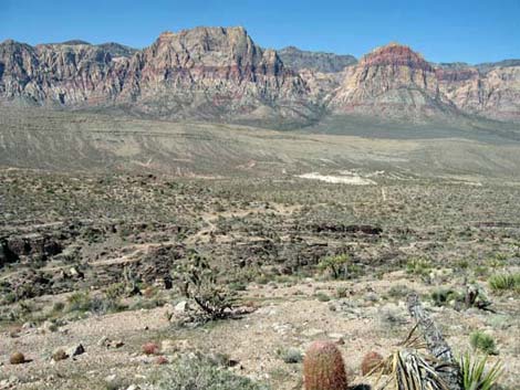 Looking across Fossil Canyon to junction of Fossil Trail and Cat-N-Hat Trail (view W) |
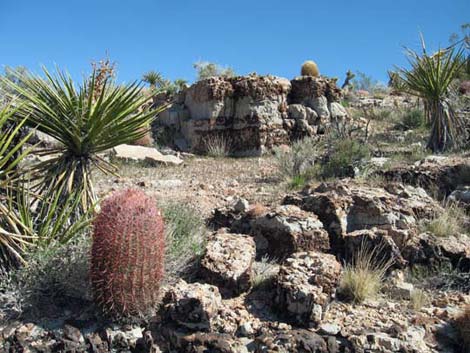
From the point, the trail loops back to the southeast, sweeps around a side canyon, and climbs to connect with the To-The-Top Trail a few yards from the start of that trail. It is interesting to note the increase in vegetation in the side canyon where plants get just a little more water than do those on the hillsides. From the end of the trail, walk back to the trailhead, make a loop by hiking back down the Jeep Trail, or continue on one of the other Blue Diamond Hill Bike Trails. |
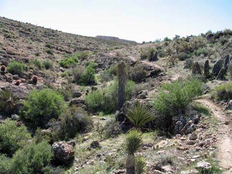 Trail runs above canyon bottom (view SE) |
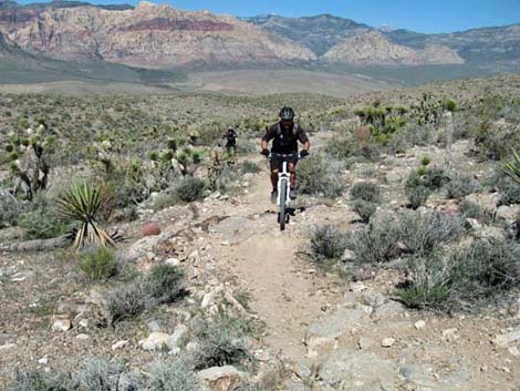 Bike riders near the end of First Finger Trail (view NW) |
Table 2. Hiking Coordinates Based on GPS Data (NAD27; UTM Zone 11S). Download Hiking GPS Waypoints (*.gpx) file.
| Wpt. | Location | Easting | Northing | Elevation (ft) | Point-to-Point Distance (mi) | Cumulative Distance (mi) | Verified |
|---|---|---|---|---|---|---|---|
| 05 | Fossil Trail Junction | 642919 | 3995982 | 4,426 | 0.00 | 0.00 | GPS |
| 10 | To-The-Top Trail Junction | 643064 | 3996217 | 4,538 | 0.59 | 0.59 | GPS |
| 20 | Tip of the Finger | 642414 | 3996705 | 4,388 | 0.70 | 1.29 | GPS |
Happy Hiking! All distances, elevations, and other facts are approximate.
![]() ; Last updated 240329
; Last updated 240329
| Hiking Around Red Rocks | Hiking Around Las Vegas | Glossary | Copyright, Conditions, Disclaimer | Home |