birdandhike.com logo
Home | Wilderness | Hiking | Mt. Charleston
Spring Mountains Trailheads Map
Hiking Around Las Vegas, Mount Charleston Area
Select trailheads by clicking names on map
Spring Mountains Trailheads Map

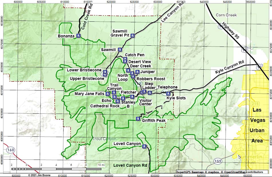
Note: Roads are black (solid = paved; dashed = unpaved). Trails and routes are red (solid = main; dashed = adjacent or alternate). Map based on USGS 7.5-minute topo map. North is at the top. UTM Grid is NAD27 CONUS. Wilderness Area boundaries (solid green) based on BLM data. US Forest Service boundaries (brown) based on USFS data. Urban Areas (yellow) based on Google Earth (8/2018 ) image.

Trailheads: Bonanza, Bristlecone Lower, Bristlecone Upper, Catch Pen, Cathedral Rock, Deer Creek, Desert View, Echo, Fletcher, Gravel Pit, Griffith Peak, Juniper, Kyle Slots, Lovell Canyon, Mary Jane Falls, North Loop, Robbers Roost, Sawmill, Sawmill Gravel Pit, Stanley B Springs, Step Ladder, Telephone Canyon Lower, Trail Canyon, Visitor Center.

Happy Hiking! All distances, elevations, and other facts are approximate.
copyright; Last updated 240329

  Hiking Around Mt. Charleston Glossary Copyright, Conditions, Disclaimer Home
Google Ads
bonanza trailhead sawmill trailhead deer creek north loop trailhead robbers trailhead harris saddle trailhead lovell canyon trailhead mary jane falls trailhead upper bristlecone trailhead lower bristlecone trailhead trail canyon trailhead fletcher trailhead echo trailhead stanley b spring kyle slots cathedral rock juniper trailhead sawmill gravel pit trailhead desert view trailhead catch pen trailhead visitor center trailhead lower telephone trailhead step ladder trailhead