Hiking Around Las Vegas, Spring Mountains (Mt. Charleston), Kyle Canyon Area
 Robbers Roost Trailhead (view W) |
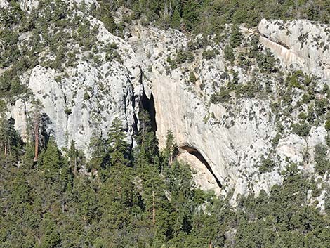
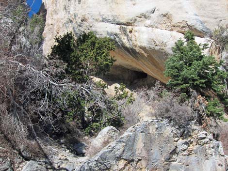
Overview The Robbers Roost Trail is a short, but moderately strenuous, loop trail that heads up a narrow canyon to limestone caves that, according to local legend, were used by bandits as a hideout while raiding travelers on the old Mormon Trail, which crosses the Las Vegas Valley. I'm not sure about that, but it is an interesting canyon with caves on both sides and a very nice slots and pour-over at the top. This is also a world-class rock climbing site, so the walls can echo from the sounds of civilization; otherwise listen for Canyon Wren and White-throated Swifts. Link to map. |
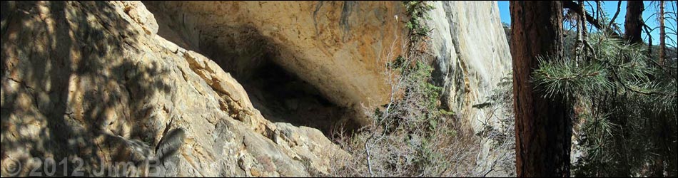
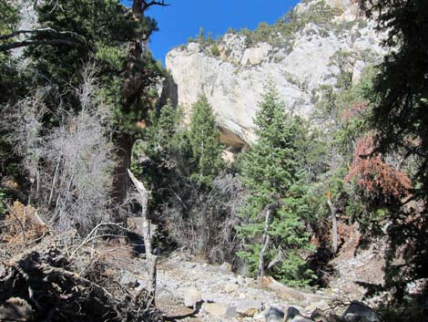
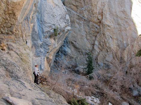
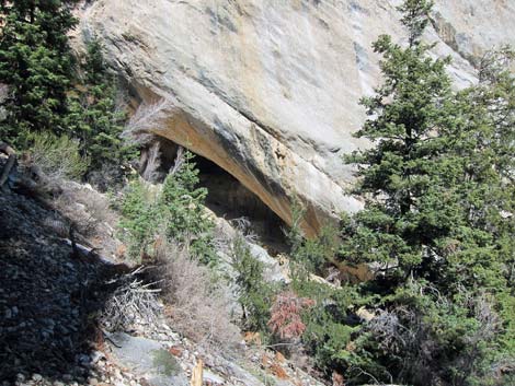
 Robbers Roost cave area (view W from trailhead parking) |
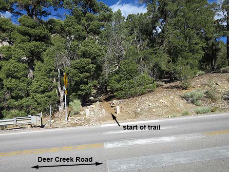
Watch Out Other than the standard warnings about hiking in the desert, this is a pretty safe trail; however, be careful when crossing the road. If you let your kids climb in or around the caves, watch them carefully near the edges; some of the limestone rock is surprisingly slick. Also, the elevation is 8,000 feet, so take it easy if you've just come up from the desert. While hiking, please respect the land and the other people out there, and try to Leave No Trace of your passage. Also, this hike is fairly short, so just bring what you need of the 10 Essentials. Getting to the Trailhead The trail is located up in the Spring Mountains National Recreation Area (generally referred to as Mt. Charleston) between Kyle and Lee Canyons, about 1 hour northwest of Las Vegas. From town, drive out to the Spring Mountains Visitor Center, then drive out Deer Creek Road to Robbers Roost Trailhead. |
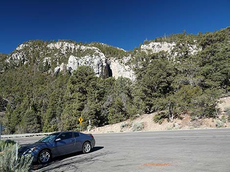
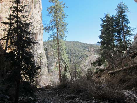
 Overview of Robbers Roost area (view W from up the highway) |
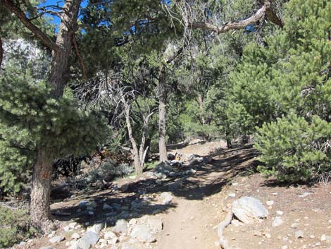
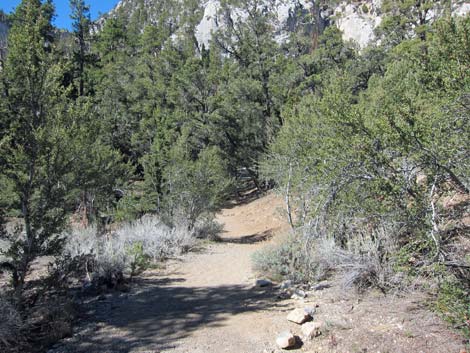
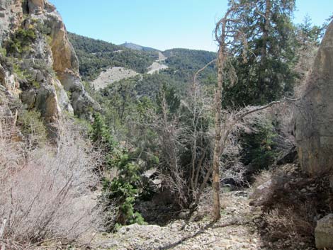
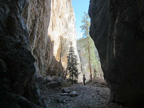
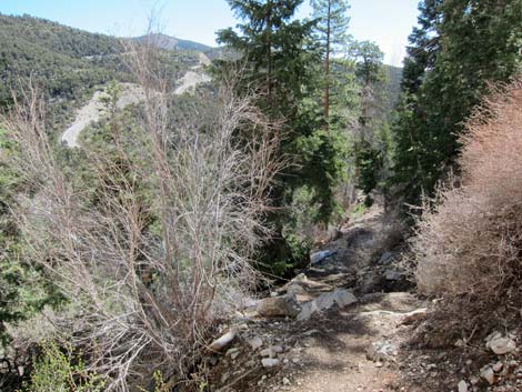
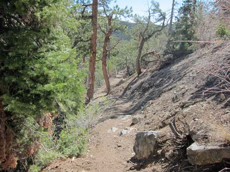
The Hike From the trailhead (Table 1, Waypoint 01), carefully walk across the road in the crosswalk (caution: the sight lines are short) and hike westward on a clearly marked trail into the forest of singleleaf pinyon pine, white fir, mountain mahogany, and rubber rabbitbrush. The mixture of lower elevation (pinyon pine) and higher elevation (white fir) trees indicates that this is a transition zone between the lower elevation Pinyon-Juniper Woodland (Upper Sonoran) and Yellow Pine Forest (Transition) life zones. The trail crosses the old original road before starting up the canyon. The original road was built by the Civilian Conservation Corps (known as the CCC), one of the government-funded public works programs that put people to work during the Great Depression. It took four years, from 1936 to 1940, to build the road connecting Kyle Canyon with Lee Canyon. |
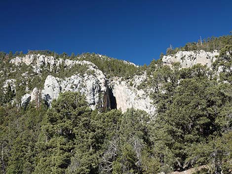
 Robbers Roost area (zoom; view W from up the highway) |
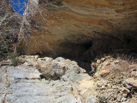
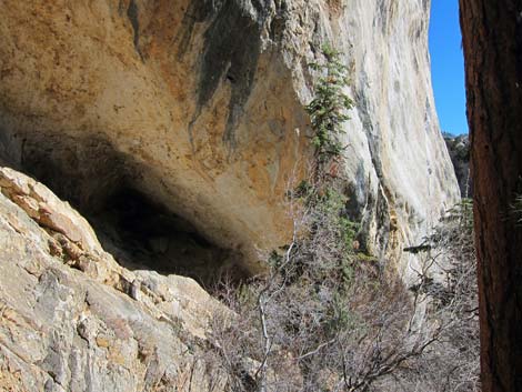
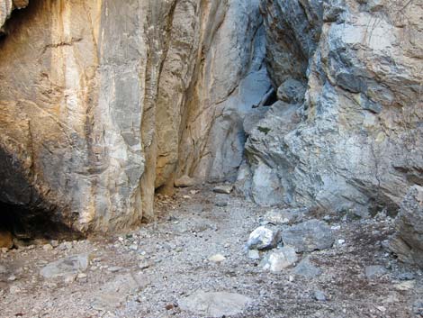
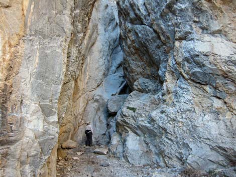
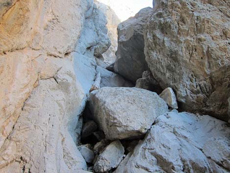
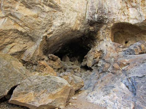
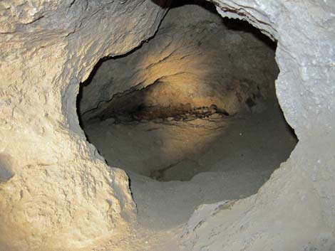
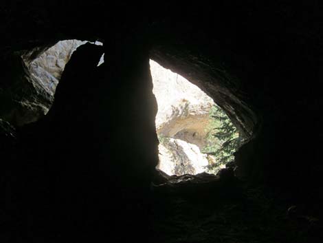
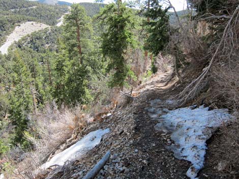
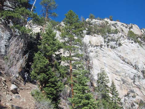
As the canyon narrows, the trail steepens, but stone and concrete steps ease the way. On the way up, notice that a trail cuts off to the south (left) at the beginning of the second set of stone and concrete steps; this trail is the end of the loop. Continue up the stone steps to the caves (Wpt. 02), which are only about 5 minutes from the trailhead. The trail leads directly to a large cave in the north (right) wall of the canyon; there is also a smaller cave in the south (left) wall. The forest is wetter here in the narrow canyon, and the extra soil moisture supports a forest of tall ponderosa pine and white fir, species typical of the Yellow Pine Forest (Transition) and Pine-Fir Forest (Canadian) Life Zones. After investigating the large cave, continue up the canyon for a minute or two. The canyon narrows and pinches off at a pour-over that blocks further progress. The canyon is only a few feet wide at this point. |
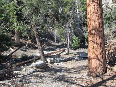
 Trailhead (view W from road) |
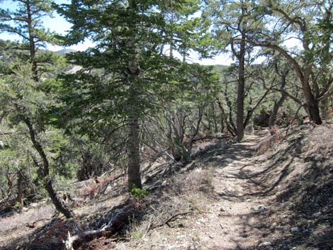
On the way down, stay on the south (right) side of the canyon and pick up the trail that heads east across the slope towards the smaller cave. After that cave, the trail continues eastward, makes one switchback (Wpt. 03), returns to the bottom of the canyon (Wpt. 04) where it rejoins the main trail and closes the loop. From there, retrace your footprints down the canyon and back to the trailhead. Local legend has it that during the pioneer days, Robbers Roost was used by horse thieves as hideout around 1885. They say the outlaws put up a fence and used the canyon for a corral, used the caves for shelter, and used high points around the caves as vantage points for spotting approaching lawmen. They also say the bandits stashed stolen goods around Robbers Roost, so perhaps there is some treasure in the hills. This makes a good story, but seeing at the cave makes me wonder if it was such a good place to live. |
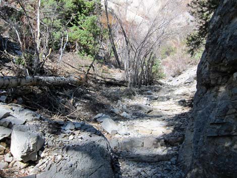
 Low on the trail (view SW) |
 Low on the trail (view W) |
 Low on the trail (view SW) |
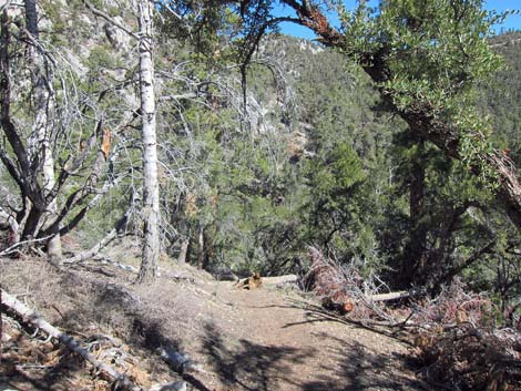
 Middle of the trail (view W) |
 Stone steps (loop ends here) (view W) |
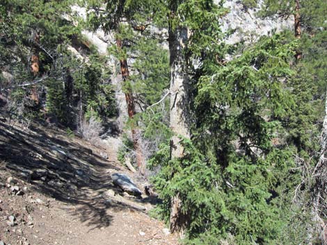
 Trail below main cave (view W) |
 Trail below cave (view W) |
 Below cave (view W from trail) |
 Trail above main cave (view E) |
 Looking back: high on the trail (view W) |
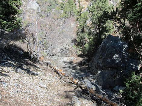
 Slot at top of the canyon (view W) |
 Slot at top of the canyon (hikers looking up pour-over; view W) |
 Boulders in pour-over at top of the canyon (view W) |
 Slot canyon above cave (view E) |
 Top of the trail (view E) |
 Looking back: hiker starting down loop trail (view NW) |
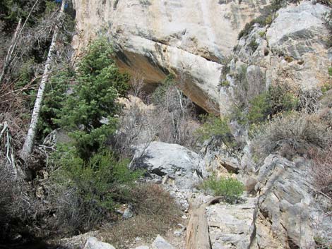
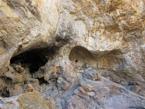 Caves on S side of canyon (view W) |
 Caves on south wall (view SW) |
 Inside cave on south wall (view S) |
 Inside cave on south wall (view N) |
 Descending middle of the trail (view E) |
 Still a bit of snow on the trail (view E) |
 Robbers Roost Cave from descent trail (view N) |
 Descending middle of the trail (view SE) |
 Looking back up middle of the trail (view NW) |
 Descending middle of the trail (view SE) |
 Low on the trail (view SW) |
 Descending middle of the trail (view NW) |
 Returning to the main trail (view NW) |
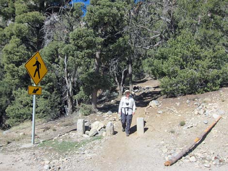 Hiker at end of the trail (view W); watch for traffic on highway! |
Table 1. Hiking Coordinates Based on GPS Data (NAD27; UTM Zone 11S). Download GPS Waypoints (*.gpx) file.
| Wpt. | Location | UTM Easting | UTM Northing | Elevation (ft) | Point-to-Point Distance (mi) | Cumulative Distance (mi) | Verified |
|---|---|---|---|---|---|---|---|
| 01 | Robbers Roost Trailhead | 624884 | 4018232 | 7,914 | 0.00 | 0.00 | GPS |
| 04 | Start Loop | 624709 | 4018120 | 8,004 | 0.14 | 0.14 | GPS |
| 02 | Head of the Canyon | 624667 | 4018104 | 8,004 | 0.03 | 0.17 | GPS |
| 03 | Bend of Switchback | 624766 | 4018093 | 8,035 | 0.07 | 0.24 | GPS |
| 04 | End Loop | 624709 | 4018120 | 8,004 | 0.05 | 0.29 | GPS |
| 01 | Robbers Roost Trailhead | 624884 | 4018232 | 7,914 | 0.14 | 0.43 | GPS |
Happy Hiking! All distances, elevations, and other facts are approximate.
![]() ; Last updated 240329
; Last updated 240329
| Hiking Around Mt Charleston | Hiking Around Las Vegas | Glossary | Copyright, Conditions, Disclaimer | Home |