Hiking Around Las Vegas, Spring Mountains NRA (Mt. Charleston)
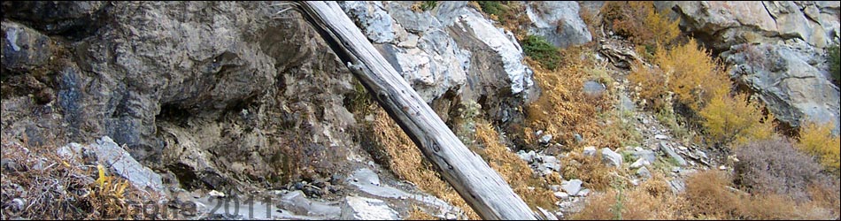
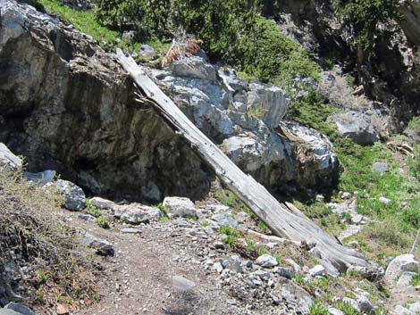
 North Loop - Mummy Spring trail junction (view W) |
Overview This is a short, easy detour off the North Loop Trail to an avalanche chute with a spring located high on the cool, east-facing slope of Mummy Mountain. The water and "alpine meadow" vegetation provide a nice, cool destination to relax and enjoy the views. However, while the Mummy Spring Trail is only 0.3-miles long, the 2.7-mile hike up the North Loop Trail to the trail junction is pretty stout. Link to map or elevation profile. |
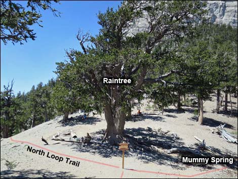
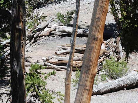
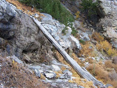
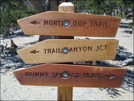 Raintree trail sign (what happened to thoughtful craftsmanship?) |
Watch Out Other than the standard warnings about hiking in the desert, this is pretty safe hike, but the elevation is high, so take it easy if you've just come up from the desert. The spring water probably is safe to drink, but it would be safer to treat or filter it first. While hiking, please respect the land and the other people out there, and try to Leave No Trace of your passage. Also, this hike is fairly long, so be sure to bring the 10 Essentials. Getting to the Trailhead The trail is located up in the Spring Mountains National Recreation Area (generally referred to as Mt. Charleston) between Kyle and Lee Canyons, about 1 hour northwest of Las Vegas. From town, drive out to the Spring Mountains Visitor Center, then continue to the North Loop Trailhead. |
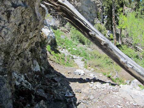
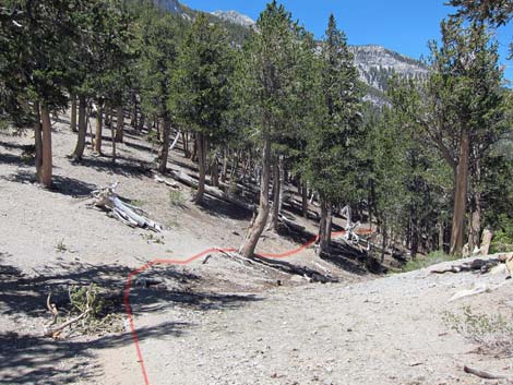 Mummy Spring Trail departing the Raintree (view N) |
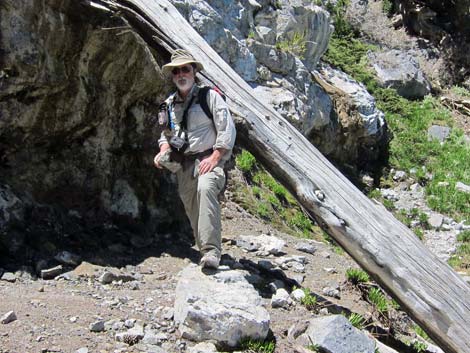
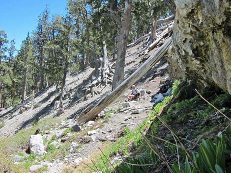
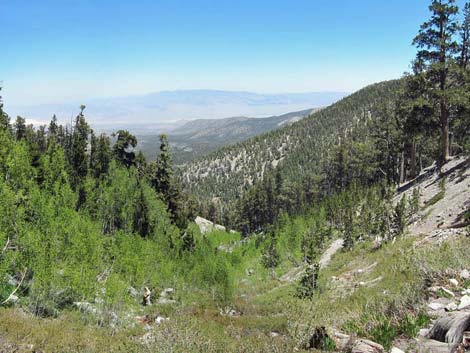
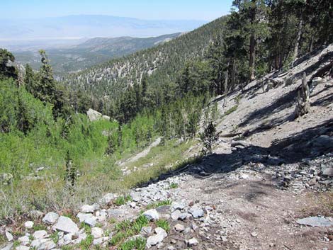
The Hike From the trailhead (Table 2, Waypoint 01), follow the clearly marked and well-maintained North Loop Trail west into the forest. Lower down, the trail passes through a mixed forest of tall ponderosa pines, single-leaf pinyon pine, Utah juniper, limber pine, white fir, mountain mahogany, and wax currents. About 1.4 miles out, the trail crosses the Viewpoint (Wpt. 02), an open, flat ridgetop with good views of Las Vegas and other points east and south (see below). The trail then switchbacks steeply up a bristlecone pine-covered hillside to the Highpoint (Wpt. 03) on the ridge east of Mummy Mountain. The North Loop trail then runs west along Highpoint Ridge to the Raintree (Wpt. 04), the 3,000-year-old bristlecone pine that stands over the intersection of the North Loop and Mummy Spring trails (2.7 miles out). |
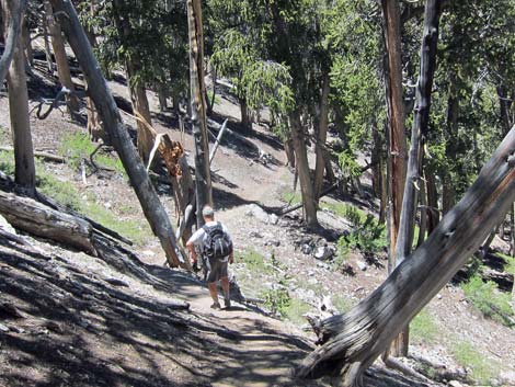
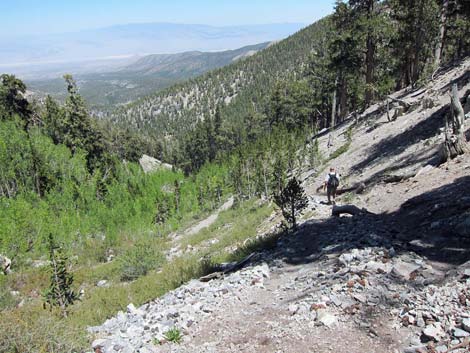
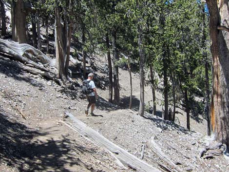 Hiker on trail to Mummy Spring (view NW) |
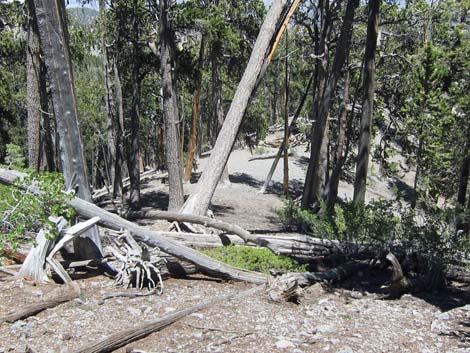
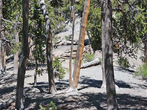
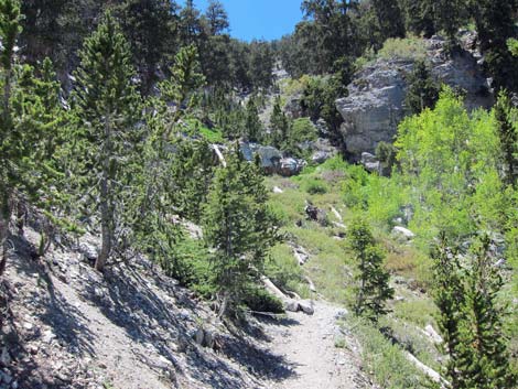
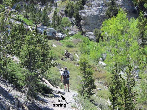
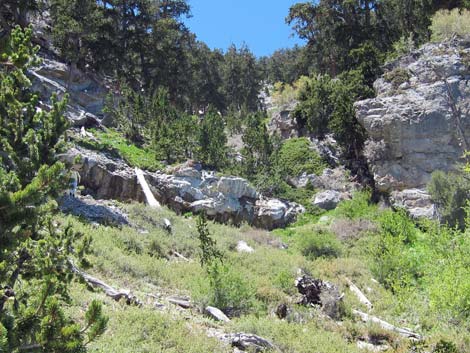
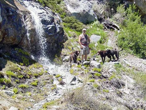
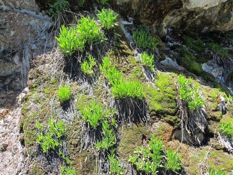
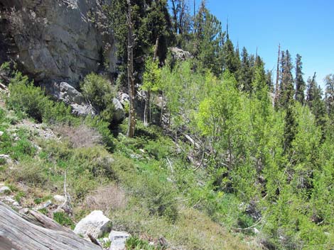
From the Raintree, the Mummy Spring trail runs northwest, drops off the ridge, and traverses the east-facing slopes beneath the Mummy's feet and ankles. Most of the way out to the spring, the trail crosses over a narrow, barely perceptible ridge. Just down the ridge, a sheltered campsite hugs the ridgetop. In total, the trail passes through a dense forest of bristlecone pines for 0.3 miles (10 minutes) to a wide gully. The gully is swept by avalanches during winter, so only quaking aspen, shrubs, and grasses grow in the gully. A spur trail runs steeply up the south side of the avalanche chute to the spring. Mummy Spring is located above a band of limestone cliffs about 50 feet up the gully (Wpt. 05). Water emerges from the ground, trickles down the rocks, and falls over the cliff as a gentle shower. The gully is an avalanche chute, so there are no trees to obstruct the view to the east. However, the avalanche chute is narrow and bordered by tall ponderosa pines and quaking aspen, so there is plenty of shade. |
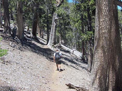 Hiker on trail to Mummy Spring (view NW) |
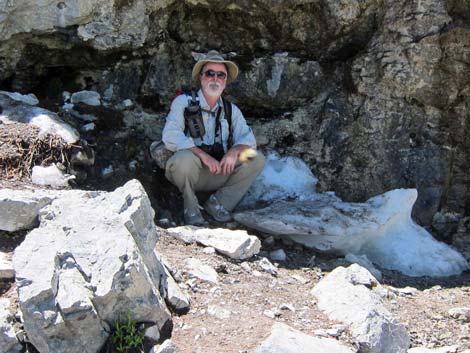
The vegetation in the chute is composed of low-growing grasses, shrubs, sedges, ferns, columbines, and other "alpine meadow" species that lie below the snowpack and are protected from avalanches. The air temperature on this east-facing slope tends to be cooler than other places along the North Loop trail, and the snow here melts off later than elsewhere, so this is a nice, cool place to relax, enjoy the view, and listen to the sounds of falling water and birds. They say that before the snow falls in the autumn, the waterfall freezes and that the ice is particularly beautiful because it resembles formations found in caves (such as cave draperies, stalagmites, stalactites). To get back to the trailhead, retrace your steps to Highway 158. If you've made prior arrangements to shuttle vehicles, you can continue west on the North Loop Trail to the Trail Canyon Trail, and head down Trail Canyon to the trailhead in the bottom of Kyle Canyon. |
 Campsite on ridge below trail to Mummy Spring (view NE) |
 Campsite below trail to Mummy Spring (view NE) |
 Campsite below trail to Mummy Spring (view NE) |
 Hiker on trail to Mummy Spring (view NW) |
 Trail arriving at avalanche chute below Mummy Spring (view NW) |
 Hiker at trail junction for spur-trail to Mummy Spring (view NW) |
 Mummy Spring area (view NW) |
 Mummy Spring during spring with water flowing over rocks (view W) |
 Hiker at Mummy Spring (view W) |
 Hiker sitting in the shade on ice at Mummy Spring (view W) |
 Mummy Spring during summer (view N) |
 Mummy Spring during fall (view N) |
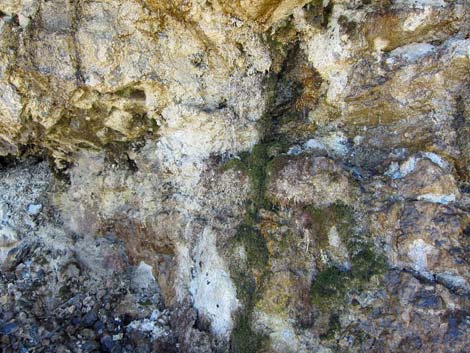
 Dripping water (view N) |
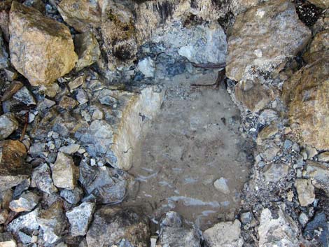 Pool of water |
 Spring flowers just getting started for the year |
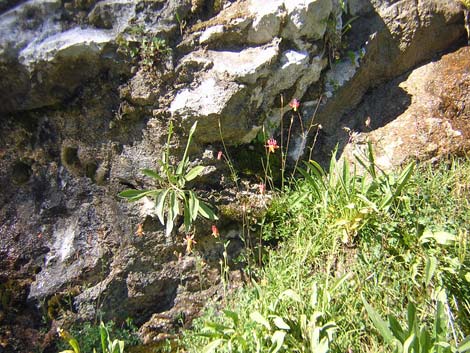 Spring wildflowers at Mummy Spring |
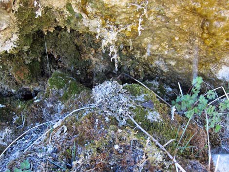 Moss and dampness at Mummy Spring |
 Moss and dampness at Mummy Spring |
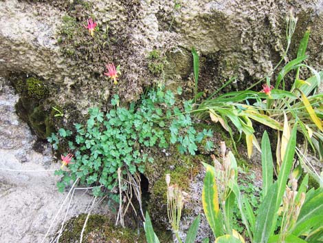 Spring wildflowers at Mummy Spring |
 Quaking Aspen at Mummy Spring (view W) |
 Hiker resting at Mummy Spring (view S) |
 View down avalanche chute below Mummy Spring (view E) |
 Trail down from Mummy Spring (view E) |
 Hiker descending trail below Mummy Spring (view E) |
Table 2. Hiking Coordinates Based on GPS Data (NAD27; UTM Zone 11S). Download GPS Waypoints (*.gpx) file.
| Wpt. | Location | UTM Easting | UTM Northing | Elevation (ft) | Point-to-Point Distance (mi) | Cumulative Distance (mi) |
|---|---|---|---|---|---|---|
| 01 | North Loop Trailhead | 624706 | 4018904 | 8,435 | 0.00 | 0.00 |
| 02 | Viewpoint | 623635 | 4018053 | 9,331 | 1.45 | 1.45 |
| 03 | Highpoint | 623419 | 4017531 | 10,023 | 0.78 | 2.23 |
| 04 | Raintree | 622786 | 4017247 | 9,968 | 0.47 | 2.70 |
| 05 | Trail below Mummy Spring | 622347 | 4017551 | 9,826 | 0.35 | 3.05 |
| 01 | North Loop Trailhead | 624706 | 4018904 | 8,435 | 3.05 | 6.10 |
Happy Hiking! All distances, elevations, and other facts are approximate.
![]() ; Last updated 240329
; Last updated 240329
| Hiking Around Mt Charleston | Hiking Around Las Vegas | Glossary | Copyright, Conditions, Disclaimer | Home |