Hiking Around Las Vegas, Spring Mountains (Mt. Charleston),
Mount Charleston Wilderness Area

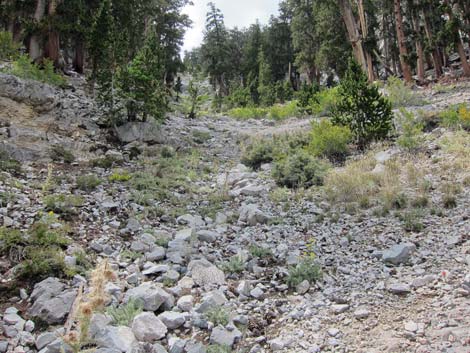
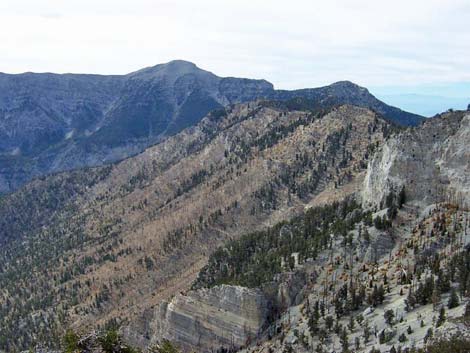
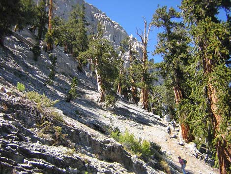
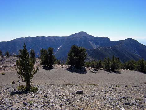
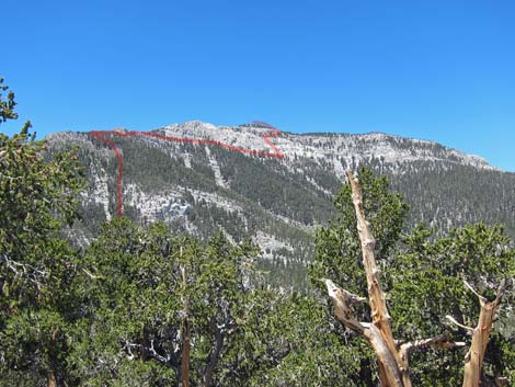 Trace of the route (view W from North Loop Trail) |
Overview This steep route (3,100 feet in 4.77 miles) runs up the North Loop Trail to the Raintree, then follows the Mummy Spring Trail to Mummy Spring. Above Mummy Spring, the route becomes quite steep, including a short 3rd-class gully, as it climbs onto the south ridge of Mummy Mountain (Mummy’s Knees). From the ridgeline, the route traverses north across steep sideslopes under the east-facing limestone cliffs that guard the summit. From beneath the summit, the route climbs a steep scree gully at a break in the summit cliffs, then follows ledges to easy slopes and the summit. Make no mistake; this is a tough route, especially the steep slopes above Mummy Spring (climbing at a rate of 2,000 ft per mile) and the steep scree gully near the summit (which includes another short, but quite airy 3rd-class section). Link to topo map or elevation profile. |
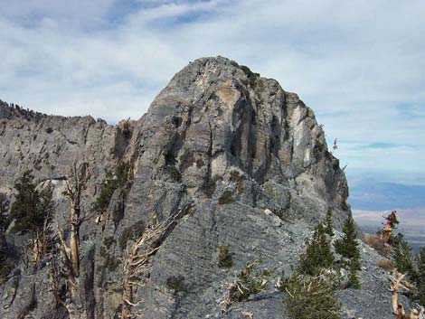
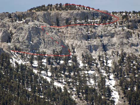
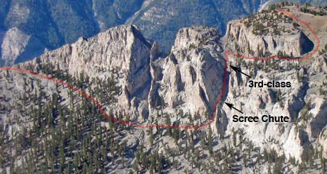 Route from Mummy's Knees to summit (enlarge) |
Watch Out Other than the standard warnings about hiking in the desert, this is a pretty rough hike. The use-trail is steep and rocky, and there are many places where you will slip and lose your footing. The only places to really fall off something and get hurt are in the 3rd-class gully, the 3rd-class chute, and along the summit cliffs, so be careful in those areas. The water at Mummy Spring is cold and tasty, but probably should be filtered. The elevations run from about 8,400 to 11,500 ft feet, so take it easy if you aren't used to the elevation. |
 Hiker arriving at Mummy Spr. gully; trail continues across (view NW) |
While hiking, please respect the land and the other people out there, and try to Leave No Trace of your passage. This hike is moderately long and difficult, so be sure to bring the 10 Essentials. Also, the route runs almost entirely within the Mount Charleston Wilderness Area, so pay particular attention to respecting the land. Getting to the Trailhead The trailhead is located up in the Spring Mountains National Recreation Area (generally referred to as Mt. Charleston) between Kyle and Lee canyons, about 1 hour northwest of Las Vegas. From town, drive out to the Spring Mountains Visitor Center, then continue to the North Loop Trailhead. |
 Trail goes into overgrown aspen thicket (view N) |
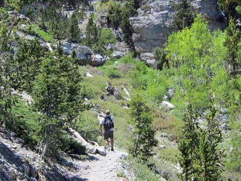
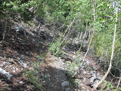
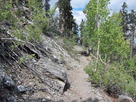
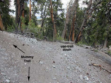
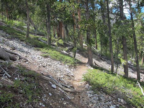
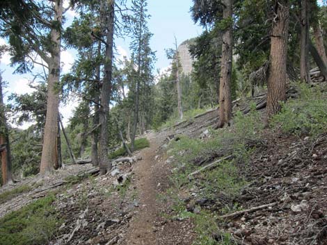
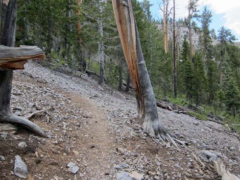
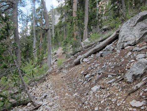
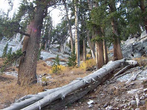
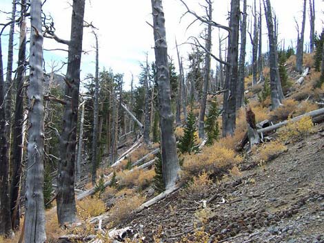
The Hike From the trailhead (Table 2, Waypoint 1), the route follows the clearly marked and well-maintained North Loop Trail west into the forest. Lower down, the trail passes through mixed woods of tall ponderosa pine, singleleaf pinyon pine, rocky mountain juniper, limber pine, white fir, bristlecone pine, mountain mahogany, and wild currents. About 1.42 miles out, the trail crosses the Viewpoint (Wpt. 2), an open, flat ridgetop with good campsites (no water) under gnarled bristlecone pines, a couple of limber pines, and grand views of the Las Vegas Valley and other points east and south. The trail then runs up a dozen switchbacks on an east-facing slope through a forest of tall, straight bristlecone pines to the Highpoint (Wpt. 3) on the ridge east of Mummy’s Toes. The North Loop Trail then runs west along the ridge to the Raintree (Wpt. 4), a 3,000-year-old Bristlecone Pine that stands over the intersection of the North Loop and Mummy Spring trails. |
 Trail continues past overgrown aspen thicket (view N) |
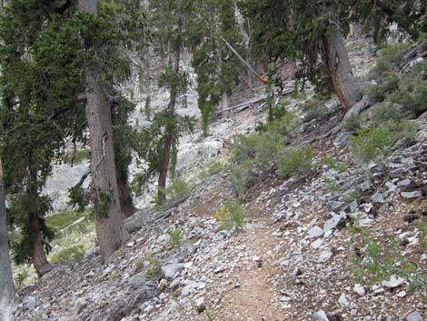
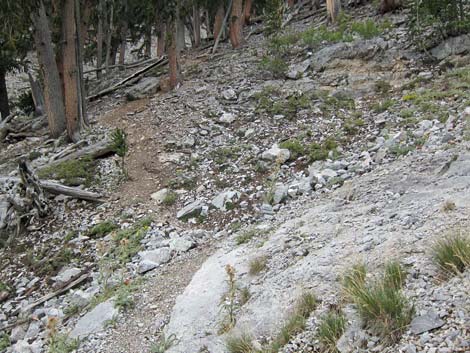
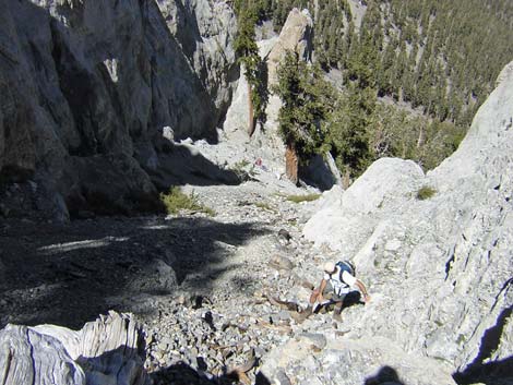
From the Raintree, the route runs north on the Mummy Spring Trail for about 0.34 miles to Mummy Spring (Wpt. 5). At the spring, stop and take a few minutes to rest and enjoy the sounds of falling water on the rocks, the birds singing as they come in for water, and the breeze shaking the quaking aspen leaves -- rest here because the route is about to get hard. For details of this part of the hike, see the descriptions of the North Loop and Mummy Spring trails. From the main trail below the spring, the trail runs north, parallel to the mummy's legs for about 0.13 miles to switchbacks (Wpt. 6) that climb the hillside to the base of the limestone cliffs overhead. The trail then runs back south and ends (Wpt. 7) in the gully some 200 vertical-feet above Mummy Spring. In the gully, the trail degrades to a straight-up-the-hillside use-trail with lots of loose dirt, rocks, and logs, and other things to work around, but it is well-worn and easy to follow. |
 A use-trail cuts down the hillside (view NE) |
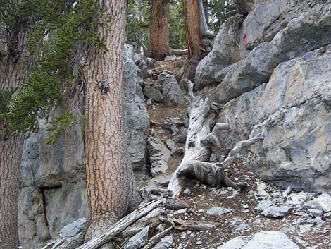
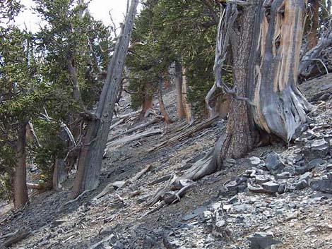
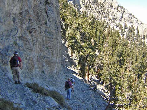
About halfway up the gully, the use-trail approaches a band of imposing cliffs that span the gully. The use-trail works up and north among rocks and boulders to just below the cliffs. The use-trail then turns west to pass through a broken band of cliffs in a short, 3rd-class gully (Wpt. 8). Orange marks (8-inch squares) painted on the rocks at the base of the gully mark the route through the cliffs. Note that there are two 3rd-class gullies here, and this route runs up through the northern (right) one. The southern (left) one leads more directly to Mummy's Toes. Immediately above the 3rd-class gully, the use-trail to Mummy's Knees angles off to the north and the grade eases somewhat, but it is still steep with lots of loose dirt and rocks. If you intend to climb Mummy's Toes, this is the place to cut southwest and up towards the ridge. Walk south into the gully, pick up the use-trail, follow it to the ridgeline, and then follow the ridge south to Mummy's Toes. I've not climbed Mummy's Toes, but I have gone about halfway to the ridge on the use-trail; use your own good judgment. |
 Trail runs through a nice patch of Common Juniper (view N) |
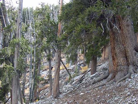
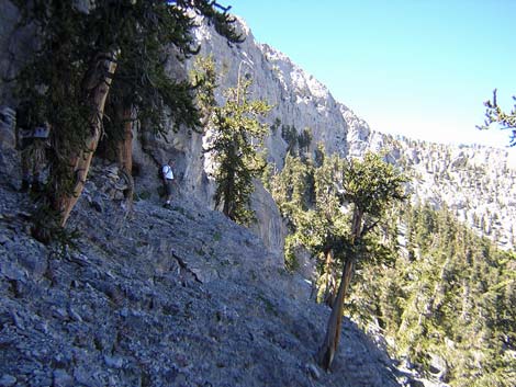
Above the 3rd-class gully, the use-trail cuts north (right) and continues up and northwest, cutting across part of an old burn area. The use-trail continues to be steep and loose, with footsteps cut into the dirt hillside in places, but eventually it hits the ridgeline (Wpt. 9) adjacent to cliffs that prevent hiking along the ridgeline (the start of the summit cliffs). This is the Mummy’s Knees, the first place where hikers can look west over the ridge and see Mt. Charleston. From the ridgeline at the Mummy Knees, the route literally runs up against the base of the east-facing summit cliffs and starts north on a long (0.5 miles) traverse across the east face of the mountain under the summit cliffs. The use-trail tends to stay high under the cliffs, and except for the rocky areas, the use-trail is fairly clear and easy to follow. There is a lot of climbing steeply up and down on steep scree sideslopes, and it seems longer than 0.5 miles. As the route traverses north, the cliffs get higher and more imposing. About 0.38 miles beyond the Mummy’s Knees, there is a break in the cliffs and a scree gully that looks like it could be a way to the summit; it is not. Continue north for another 0.1 miles on a good use-trail to the second large scree gully. They use-trail is fairly clear as it starts up the second scree-filled gully. |
 One of several switchbacks (view S) |
Follow the scree gully up, being careful not to knock loose rocks onto people below. Staying on the south side of the gully and climbing among the larger rocks and logs or on the rocky cliff at the edge of the gully is easier than trying to climb the loose scree in the middle of the gully (the loose scree is, however, a good way to go down). Near the top of the scree gully, a 10-ft pour-over blocks further passage. Climb around the north edge of the pour-over on 3rd-class rock (basically climbing onto two, chest-high ledges without handholds and huge apparent exposure) and continue up the scree gully for another 30-vertical-feet or so to gain a broad, sloping, scree-covered ledge that can be followed northward under the final summit cliffs. The route traverses the ledge and climbs a short slot that, from below, looks much worse than it really is. It might be possible to approach the slot more directly from below, but the direct route looks pretty nasty. There is a large cairn at the top of the slot. |
 Trail switching back again (view N) |
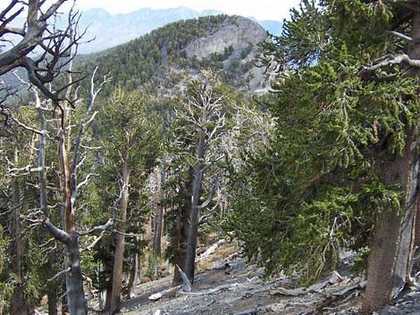
From the top of the slot, continue north on the broad, flat ledge until the cliffs overhead give way to gentle slopes leading to the summit, which is up and back to the south. The summit is broad, relatively flat, and several acres in size. Trees block most of the view from the actual summit, but grand summit views can be had by walking around the edge of the summit cliffs, which ring the mesa-top summit. To get back to the trailhead, retrace your steps to the trailhead. For photos of the descent, see Mummy Mountain, East Face Descent. If you've made prior arrangements to shuttle vehicles, you can drop off the west side of the summit in a gully, pick up the North Ridge, and hike back down the North Loop Trail to the Trail Canyon Trail, and head down Trail Canyon to the trailhead in the bottom of Kyle Canyon. |
 Last of the switchbacks (view SW) |
 Trail returning to Mummy Spring Gully (view SW) |
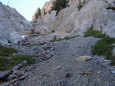
 End of constructed trail in Mummy Spring Gully (view SW) |
 The route continues up the steep gully and hillside |
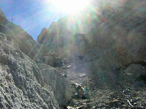
 Approaching a band of cliffs that span the canyon (view SE) |
 Class-3 gully in cliffs; (view W; doesn't look 3rd class from here) |
 Looking down: the hillside looks steeper from above (view E) |
 Getting high on the side of the ridge (view S) |
 |
 |
 |
 Mt. Charleston from the Mummy's Knees (view W) |
 Route curves right around a knob on the ridgeline (view N) |
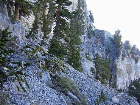
 Traversing rocky slope below summit cliffs (view N) |
 Hikers at base of limestone headwall (view N) |
 Traversing talus slope below summit cliffs (view N) |
 Route through the upper cliffs (view W) |
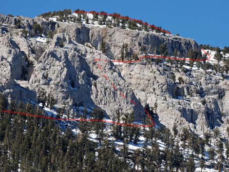 Route (light red) through upper cliffs |
 Looking back at hiker coming up the scree gully (view NE) |
 Climbing the Second Chute (view W) |
 Approaching the Class-3 scramble atop the scree gully (view W) |
 Traversing steep, loose ledge just below the summit (view N) |
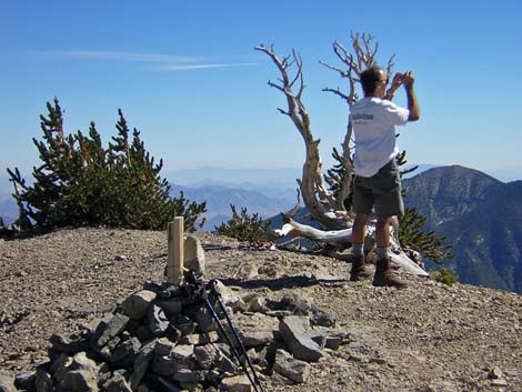 Summit cairn (view south) |
 Summit area [more summit views] |
Table 2. Hiking Coordinates Based on GPS Data (NAD27; UTM Zone 11S). Download Hiking GPS Waypoints (*.gpx) file.
| Wpt. | Location | Easting | Northing | Elevation (ft) | Point-to-Point Distance | Cumulative Distance | Verified |
|---|---|---|---|---|---|---|---|
| 01 | Trailhead | 624703 | 4018902 | 8,434 | 0.00 | 0.00 | GPS |
| 02 | Viewpoint | 623634 | 4018052 | 9,331 | 1.42 | 1.42 | GPS |
| 03 | Highpoint | 623419 | 4017531 | 10,023 | 0.80 | 2.23 | GPS |
| 04 | Raintree | 622786 | 4017246 | 9,968 | 0.47 | 2.70 | GPS |
| 05 | Mummy Spring | 622361 | 4017559 | 9,904 | 0.34 | 3.04 | GPS |
| 06 | Start Switchbacks | 622342 | 4017705 | 9,853 | 0.13 | 3.17 | GPS |
| 07 | End of Real Trail | 622272 | 4017535 | 10,110 | 0.24 | 3.41 | GPS |
| 08 | 3rd-class Gully | 622074 | 4017411 | 10,568 | 0.27 | 3.68 | GPS |
| 09 | Mummy's Knees | 621759 | 4017393 | 11,151 | 0.29 | 3.96 | GPS |
| 10 | First Chute | 621498 | 4017760 | 10,954 | 0.38 | 4.35 | GPS |
| 11 | Second Chute | 621433 | 4017848 | 11,144 | 0.10 | 4.44 | GPS |
| 12 | Summit | 621332 | 4017792 | 11,530 | 0.33 | 4.77 | GPS |
Happy Hiking! All distances, elevations, and other facts are approximate.
![]() ; Last updated 240329
; Last updated 240329
| Hiking Around Mt Charleston | Hiking Around Las Vegas | Glossary | Copyright, Conditions, Disclaimer | Home |