Hiking Around Las Vegas, Spring Mountains (Mt. Charleston)
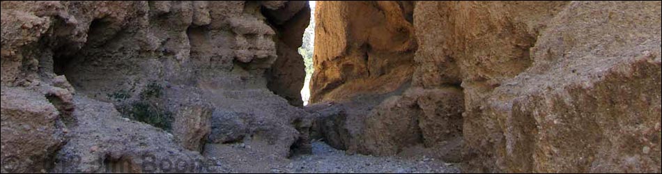
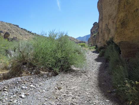
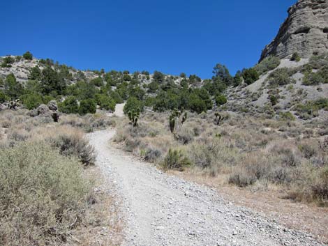
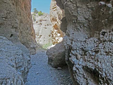
 Near the trailhead (view S into narrows) |
Overview Kyle Canyon Slots, sometimes called Harris Slots, is a short (0.2 miles one-way) walk through a narrow slot, a bit of narrow canyon, and a second narrow slot. The canyon walls are conglomerate rock (a type of sedimentary rock) that exhibits considerable differences in erosion, resulting in sculpted walls, interesting scenery, and homes for birds and small mammals. Beyond the second slot, hikers can turn around and return through the canyon, loop east and back to the trailhead using old roads, or hike farther west up Kyle Canyon Wash before returning to the trailhead. Link to map. |
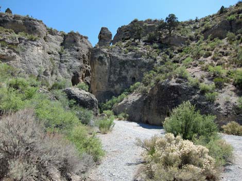
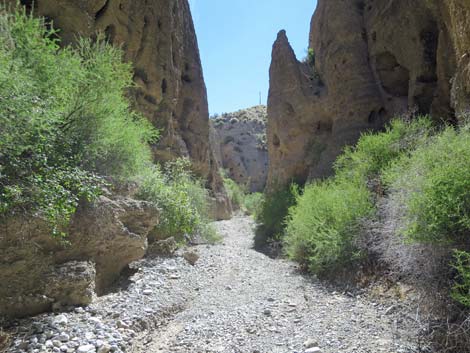
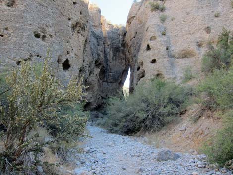
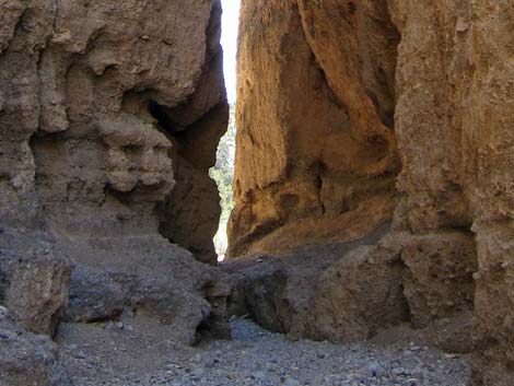
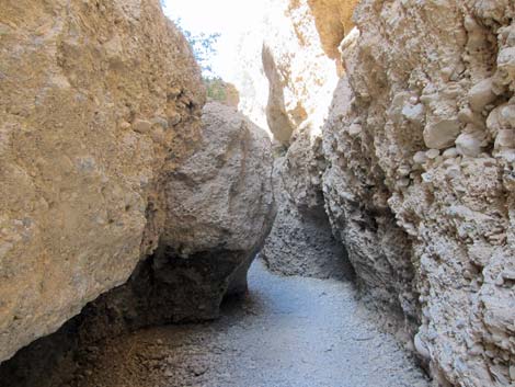
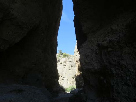
 Approaching the first slot (view S) |
Watch Out Other than the standard warnings about hiking in the desert, ...this route is safe and easy to follow if hikers resist climbing on the rocks, which do not appear sturdy. However, during summer, be aware that this gorge was formed by flashfloods, so stay out if thunderstorms threaten up the canyon -- this wash drains all of Kyle Canyon. While hiking, please respect the land and the other people out there, and try to Leave No Trace of your passage. Also, even though this hike is short, be sure to bring what you need of the 10 Essentials. The first slot is badly covered with paintball graffiti; please respect this area, don't shoot paintballs here, and report criminal activity to the US Forest Service. |
 Approaching the first slot (view S) |
Getting to the Trailhead This hike is located in lower Kyle Canyon, on the edge of the Spring Mountains National Recreation Area, about 30 minutes northwest of Las Vegas. From town, drive north on Highway 95 to Kyle Canyon Road. Turn left onto Kyle Canyon Road and drive west for 12.3 miles to Harris Springs Road, which is just past two paved and lighted "chain up" pullouts. Turn left onto Harris Springs Road and drive out to the Kyle Canyon Slots Trailhead. |
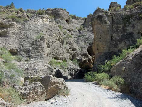
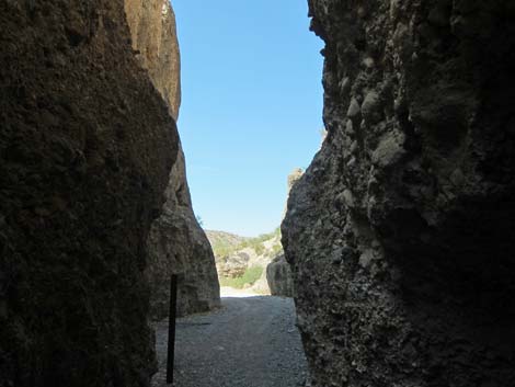
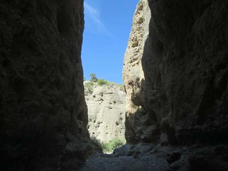
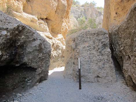 First Slot (view S) [carsonite missing July 2019] |
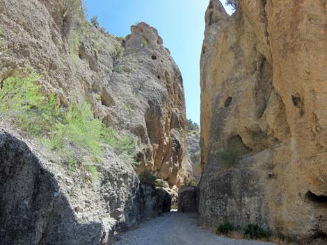
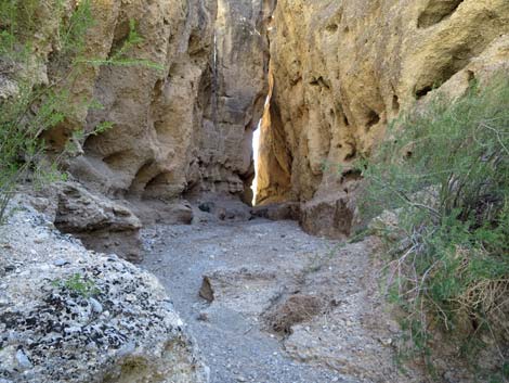
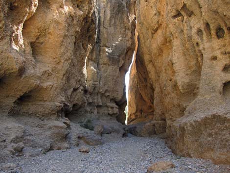
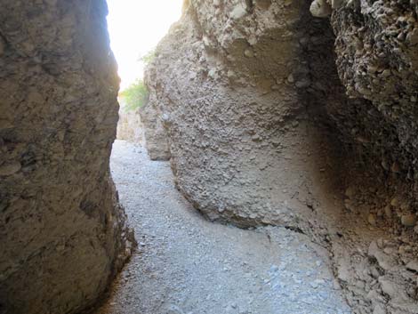
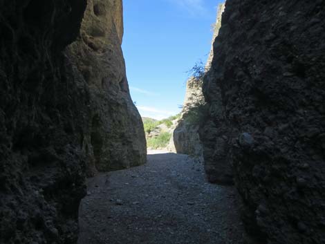
The Hike From the edge of Harris Springs Road or from Kyle Canyon Slots Trailhead, the route follows the wash upstream through the first slot. This slot is narrow, but short, and opens into a spot long used for primitive camping. Following the wash upstream, the route winds between high walls formed from sand, gravel, and rocks washed down from the Spring Mountains during previous ice ages. When the climate warmed, the wash dried, and the alluvial particles stopped moving. Eventually the alluvial particles became cemented to form a type of conglomerate rock called fanglomerate (solidified alluvial fan materials). After the fanglomerate formed, occasional flash floods in the wash cut down through the fanglomerate, leaving sculpted walls and hoodoos here and lower in Kyle Canyon Wash. Continuing upstream, the narrow canyon walls narrow again at the second slot. This slot is a bit deeper, narrower, and longer than the first, but it is short. Emerging into the sunlight on the far site, a use-trail continues upstream angling along the left wall of the canyon, and shortly it arrives at a T-intersection (Wpt. 02) with an old road. |
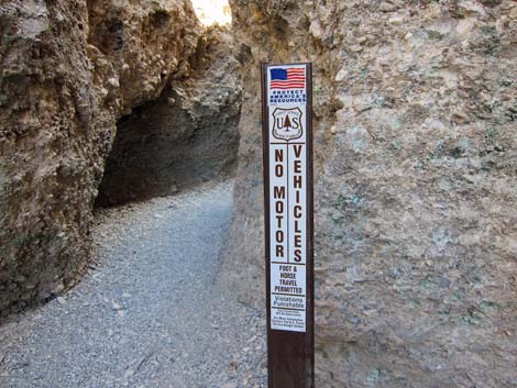 No vehicles sign outside the first slot (view N) |
Here, hikers can turn left, climb out of the canyon, and follow old roads back around to the trailhead (Wpts. 03, 04, 05, and 01; 1.6 miles). Alternatively, hikers can continue up Kyle Canyon Wash to the Resort on Mt. Charleston (4.25 miles) or Kyle Canyon Campground (5.15 miles), before returning back down the canyon to the trailhead. Hikers not interested in either of these longer hikes can just turn around at the second slot and walk back to the trailhead, as even the 0.4-mile round-trip is worth the time and minimal effort required to see these slots and the canyon that connects them. |
 Exiting the first slot (view S) |
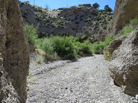
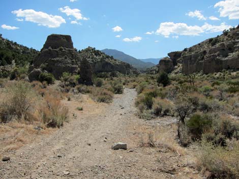
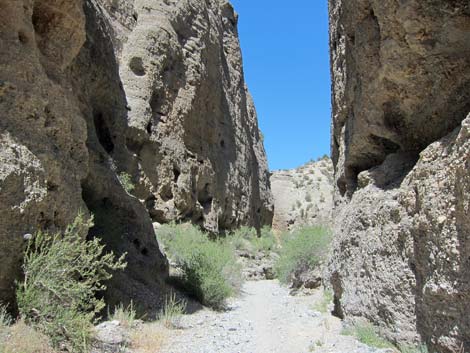
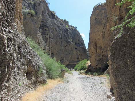 Middle Canyon (view SW) |
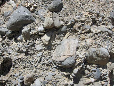 Fanglomerate rock in the wall of the canyon |
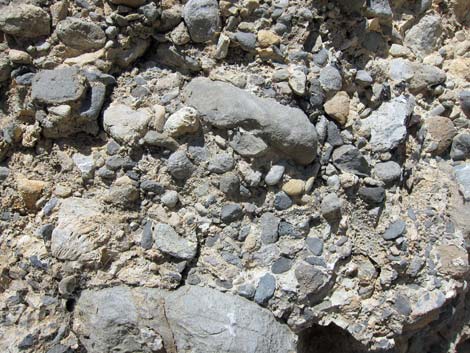 Fanglomerate rock in the wall of the canyon |
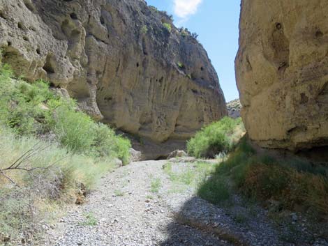 Middle Canyon (view SW) |
 |
 Middle Canyon (view SW) |
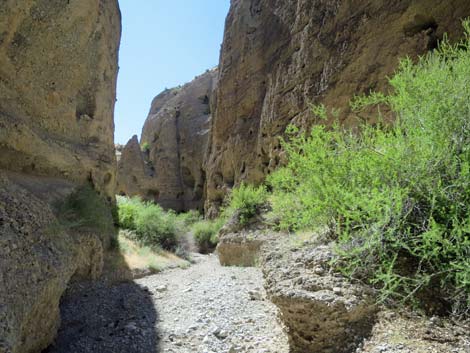
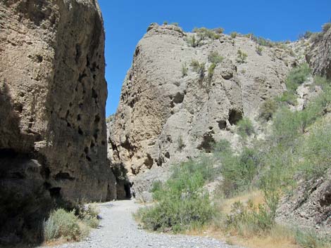
 Middle Canyon bending right (view W) |
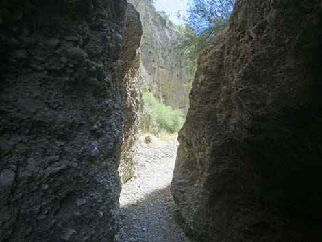
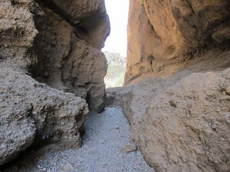
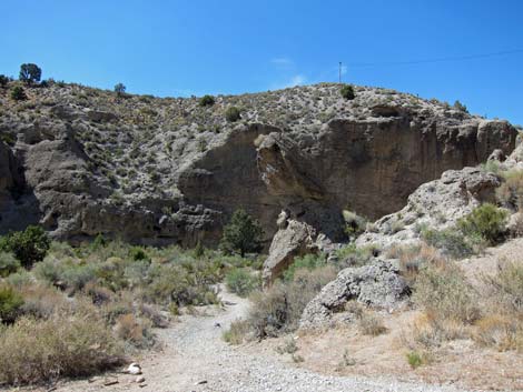
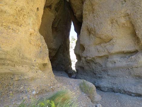
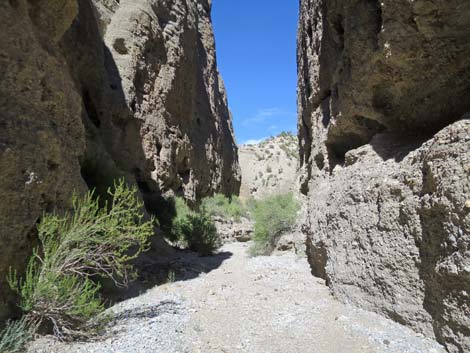
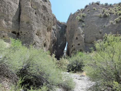 Approaching the second slot (view SW) |
 Approaching the second slot (view SW) |
 |
 |
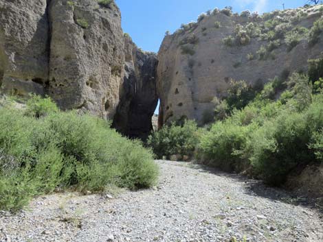
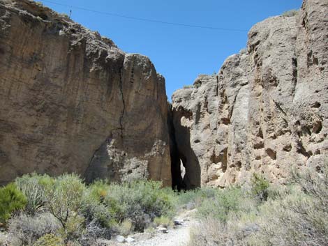
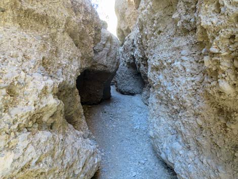
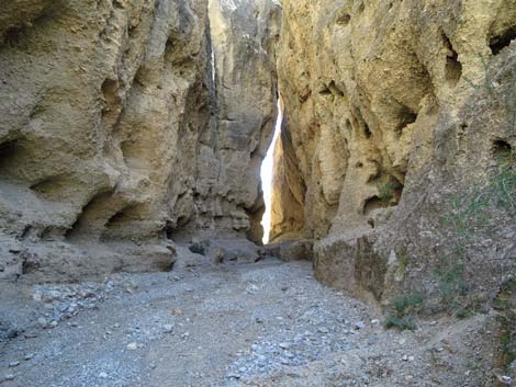 Entering the second slot (view SW) |
 Entering the second slot (view SW) |
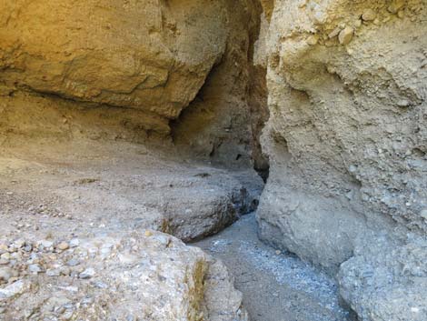
 Second slot (view SW) |
 Second slot (view SW) |
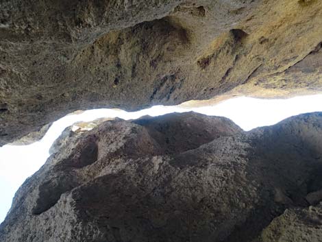 Second slot (view straight up) |
 Inside the second slot (view SW) |
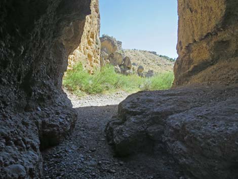 Exiting the second slot (view SW) |
 Just outside the second slot (view SW) |
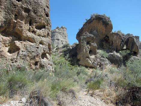 Eroded formations beyond the second slot (view SE) |
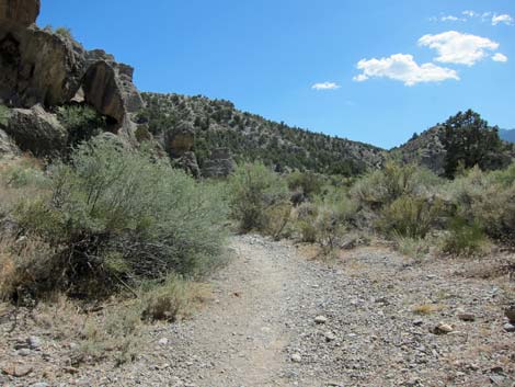 Approaching the T-intersection (view S) |
 T-intersection (Wpt. 02) with old road (view S) T-intersection (Wpt. 02) with old road (view S) |
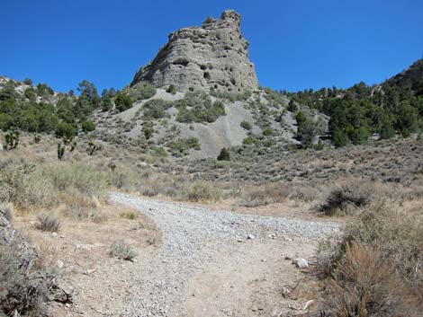
 At T-intersection: old road left climbs out of the canyon |
 At T-intersection: old road right runs up Kyle Canyon Wash |
 More to come ... |
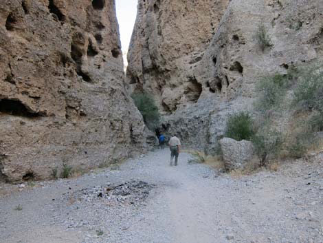
Returning down through Kyle Slots
 Returning towards the second slot (view NE) |
 Returning towards the second slot (view NE) |
 Returning inside the second slot (view NE) |
 Returning through the middle canyon (view NE) |
 Returning towards the first slot (view NE) |
 Returning into the first slot (view NE) |
 Returning through the first slot (view N) |
 Returning inside the first slot (view N) |
 |
 |
 |
 |
 |
 |
 |
 |
| More to come ... |
Table 1. Hiking Coordinates Based on GPS Data (NAD27; UTM Zone 11S). Download Hiking GPS Waypoints (*.gpx) file.
| Wpt. | Location | UTM Easting | UTM Northing | Elevation (ft) | Point-to-Point Distance (mi) | Cumulative Distance (mi) | Verified |
|---|---|---|---|---|---|---|---|
| 01 | Kyle Canyon Slot Trailhead | 632536 | 4014632 | 5,568 | 0.00 | 0.00 | GPS |
| 02 | Trail Junction | 632308 | 4014365 | 5,636 | 0.26 | 0.26 | GPS |
| 03 | Trail Junction | 632479 | 4014272 | 5,787 | 0.14 | 0.40 | GPS |
| 04 | Trail Junction | 632538 | 4014349 | 5,787 | 0.06 | 0.46 | GPS |
| 05 | Trail Junction | 632834 | 4014741 | 5,643 | 0.34 | 0.80 | GPS |
| 01 | Kyle Canyon Slot Trailhead | 632536 | 4014632 | 5,568 | 1.00 | 1.80 | GPS |
Happy Hiking! All distances, elevations, and other facts are approximate.
![]() ; Last updated 240329
; Last updated 240329
| Hiking Around Mt Charleston | Hiking Around Las Vegas | Glossary | Copyright, Conditions, Disclaimer | Home |