Hiking Around Las Vegas, Spring Mountains (Mt. Charleston)
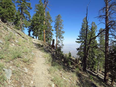
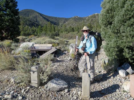 Hiker departing the trailhead (view SW) |
Overview This strenuous, 16-mile trail runs along the crest of the Spring Mountains, connecting the Bristlecone Trail (Lee Canyon; south end) with the Bonanza Peak Trail (Cold Creek; north end). Starting at either end, the trail runs west to the crest of the mountains, follows the crest, passes west of McFarland Peak, picks up the crest again, and drops eastward to the other trailhead. Much of the trail is forested with Ponderosa Pine, White Fir, and Quaking Aspen at lower elevations, and Bristlecone Pine at higher elevations. From the crest, spectacular views spread north and south along the Spring Mountains crest, and east and west across deserts and mountain ranges into the distance. This one-way hike requires shuttling vehicles or making other arrangements at the two trailheads. Water historically has been available at Wood Spring during spring and early summer, otherwise the trail is dry. Link to map. |
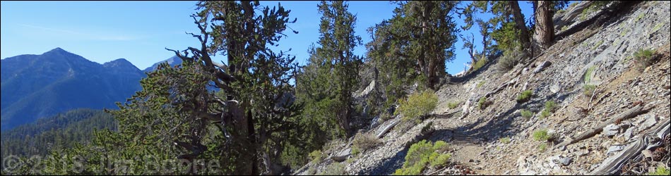
 Another hiker on trail (view W) |
Watch Out Other than the standard warnings about hiking in the desert, this is a pretty safe hike. There are some rocky spots where a slip could prove hazardous, but this is a good, safe trail. The trail is strenuous, so take it easy at these elevations if you've just come up from the desert. There is little water along this trail, and even if you are hiking during spring, don't rely on getting water at Wood Spring. Note that AllTrails and other phone-mapping systems show the old version of this trail, which was rerouted over a decade ago. Follow my maps and the trail, not your phone, and you should be okay. While hiking, please respect the land and the other people out there, and try to Leave No Trace of your passage. Also, this is a long hike, so be sure to bring the 10 Essentials. Please stay on the trail and don't cut the switchbacks. Cutting switchbacks damages the trail and the vegetation, makes trail conditions worse for everyone, and forces the cash-strapped U.S. Forest Service to waste money fixing trails. |
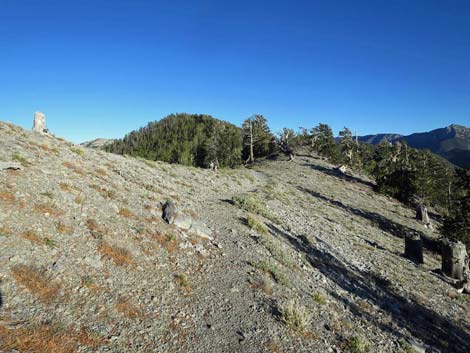
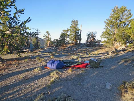 Campsite on the crest of the range (view SW) |
Getting to the Trailhead This hike is located in the Spring Mountains National Recreation Area, northwest of Las Vegas. Because this is a point-to-point trail, there are two trailheads: the Bonanza Camp Trailhead above Cold Creek and the Upper Bristlecone Trailhead or Lower Bristlecone Trailhead in Lee Canyon. For this southbound route, use the Bonanza Camp Trailhead. To get to the Bonanza Camp Trailhead, head out to the end of Cold Creek Road, which sometimes requires a high-clearance vehicle. To get to the Upper or Lower Bristlecone Trailhead, head out to the Spring Mountains National Recreation Area and drive to the end of Lee Canyon Road. |
Bonanza Trail Southbound -- Divided into 7 Segments (follow the link to details of each segment)
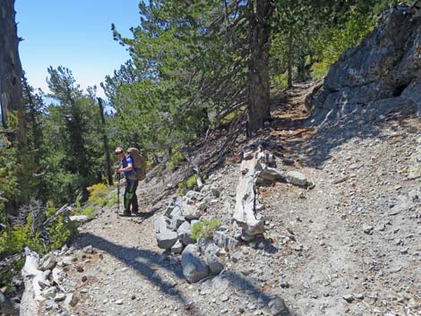
 Bonanza Trail switchbacking up the ridge (view N) |
The Hike -- Segment 1 -- Bonanza Trailhead to Bonanza Peak Trail Junction (4.6 miles) From the trailhead (Table 1, Waypoint 16), the trail departs to the southwest across an open area before slipping into the forest. The trail winds to the northwest to gain a ridgeline (0.7 miles), then begins up the ridge. The trail mostly switchbacks up the ridge, but in places it simply runs straight, and rather steeply, up the ridgeline. By 2.5 miles out, the trail has passed some 50 switchbacks and departs the ridgeline to run up and across the mountain slope heading south. In another 0.4 miles, the trail begins a series of 10 switchbacks that lead to Bonanza Saddle (Wpt 15). The saddle, on the crest of the Spring Mountain Range, provides grand views east and west and is an honorable destination, but the trail continues south climbing along the ridgeline. Staying on the west side of the ridge, the trail passes 10 switchbacks, then 2 short switchbacks, and runs out 0.25 miles to the junction (Wpt. 13) with the use-trail to Bonanza Peak (Wpt. 14). |
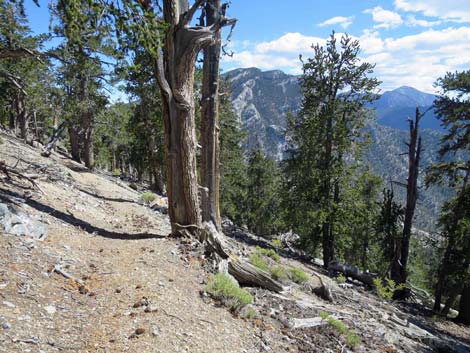 Switchbacking across the Southwest Face of Bonanza Peak (view SE) |
The Hike -- Segment 2 -- Bonanza Peak Trail Junction to Wood Spring (2.25 miles) From the junction (Wpt. 13) with the use-trail to Bonanza Peak (Wpt. 14), the Bonanza Trail begins a long descent towards Wood Spring. Starting out, the trail quickly passes 2 short downhill switchbacks, then continues across the slope to the West Ridge of Bonanza Peak. The trail turns down along the ridgeline, and about 0.3 miles from the trail junction, the trail bends left over the ridgeline (Wpt. 12) and begins down the Southwest Face of Bonanza Peak. The trail descends 4 short switchbacks, traverses the hillside, descends 4 more switchbacks, traverses the hillside again, then arrives at the top of a long series of long switchbacks (Wpt. 11). Descending at a mostly gradual pace, the trail passes 11 switchbacks on the slopes. The trail runs down a gully, passes 2 short switchbacks and quickly arrives at a trail sign, which marks a faint use-trail to campsites on the ridgeline to the right. About 40 yards farther, the trail arrives at Wood Spring (Wpt. 10). |
 Traversing hillsides with Ponderosa Pine (view S) |
The Hike -- Segment 3 -- Wood Spring to McFarland Gully-NW (0.8 miles) Water historically has been available at the spring, but with the climate changing and the land drying out, water is unreliable. The spring box is rusting too, which makes it more difficult to collect the water. From Wood Spring (Wpt. 10), the trail descends along the steep gully, then traverses the hillside to the left, and finally bends east behind a rocky knob (Wpt. 09) to switchback down the slope into the canyon below. Before long, in deep woods in the bottom of the canyon, the trail crosses the Great Northwest Gully that cuts the northwest face of McFarland Peak (Wpt. 08). |
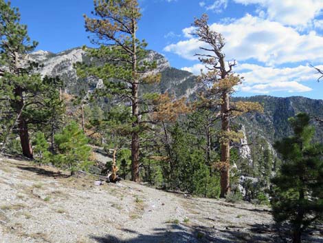
 Great view towards Charleston Peak (view S) |
The Hike -- Segment 4 -- McFarland Gully-NW to McFarland Peak Junction (1.8 miles) From the Great Northwest Gully (Wpt. 08), the trail continues across the gully and contours out to the right (south). The trail contours up and out to the south (seems like west) about 0.4 miles, then begins a long series of 14 mostly steep, short switchbacks. After passing the insult of these poorly designed switchbacks (Wpt. 07), the trail contours more gently south across the slope. Four short, then 2 long, well-designed switchbacks bring the trail to the crest of the Southwest Ridge of McFarland Peak (Wpt. 06; 1.3 miles out). From the ridgeline, the trail more-or-less contours down and east (seems like south) into the Great Southwest Gully that cuts the Southwest Face of McFarland Peak. Across the gully, the trail contours out and climbs six short switchbacks. The last switchback marks the junction with the use-trail that leads to the summit of McFarland Peak. |
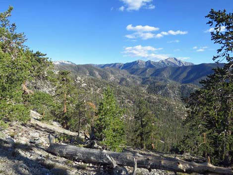
 Ridgeline south of McFarland Peak (view SE) |
The Hike -- Segment 5 -- McFarland Peak Junction to Crest of the Range (3.0 miles) From the trail junction to McFarland Peak (Wpt. 05), the Bonanza Trail contours up and off the West Face of McFarland Peak, somewhat steeply at times. Back on the crest (Wpt. 04), the trail runs down the ridge, mostly staying on the west side and mostly contouring around rocky highpoints. Passing Point 3041, the trail drops through a short series of 6 rocky switchbacks, then continues along the ridgeline for another 0.6 miles to a saddle marked with a Mt. Charleston Wilderness Area boundary sign (Wpt. 03). Here, hikers standing on the Crest of the Spring Mountain Range for the last time, enjoy expansive views west before turning east and beginning the descent into Lee Canyon. |
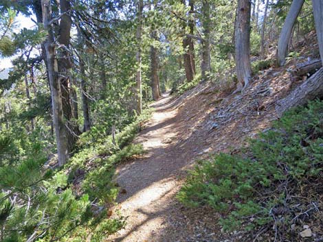 Descending forested slopes (view SE) |
The Hike -- Segment 6 -- Crest of the Range to Bristlecone Trail (0.76 miles) Before departing the Crest of the Range, hikers get their last views to the west into the Pahrump Valley and mountain ranges disappearing into the western haze. Look for the Kingston Range, Telescope Peak in Death Valley, and perhaps the Sierra Nevada Mountains in the far distance. From the saddle (Wpt. 03) by the wilderness sign, the Bonanza Trail drops off the east side of the ridge at a moderate pace. Dropping into the forest, the pure stand of Bristlecone Pine in the high country gives way to a mixed Pine-Fir Forest thick with White Fir. Farther down, Ponderosa Pine and a carpet of Common Juniper join the mix as the trail winds down through 4 long switchbacks. After turning the last switchback, the trail makes a long descent to a trail junction with the Bristlecone Trail (Wpt. 02). |
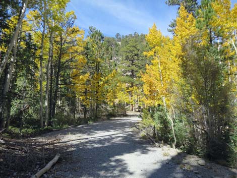 Fall colors in Quaking Aspen along the old road (view N) |
The Hike -- Segment 7 -- Bonanza Trail to Bristlecone Trailhead (2.37 or 2.93 miles) At the trail junction (Wpt. 02), the Bonanza Trail ends and hikers must choose whether to go left or right on the Bristlecone Trail. The trail to the right leads to the Upper Bristlecone Trailhead, which is about 2.37 miles out. The trail to the left leads to the Lower Bristlecone Trailhead, it is about 2.93 miles out. The hiking probably is easier to the Lower trailhead because it follows gentle grades of an old road, but hiking to the Upper trailhead follows a trail in the woods and might be more interesting. Hiking off towards either trailhead, the trail runs through a mixed Quaking Aspen and conifer forest with plenty of shade and grand views all around, although the trail from the lower trailhead has much more open sun and more expansive (tree free) views. Either way, the Bristlecone Trail is horseshoe shaped and both directions eventually lead to a trailhead. |
Table 1. Hiking Coordinates Based on GPS Data (NAD27; UTM Zone 11S). Download hiking GPS Waypoints (*.gpx) file.
| Wpt. | Location | UTM Easting | UTM Northing | Elevation (ft) | Point-to-Point Distance (mi) | Cumulative Distance (mi) |
|---|---|---|---|---|---|---|
| 16 | Bonanza Trailhead | 613021 | 4026870 | 7,513 | 0.00 | 00.00 |
| 15 | Bonanza Saddle | 611671 | 4025516 | 9,803 | 3.44 | 03.44 |
| 13 | Bonanza Peak Junction | 612373 | 4024663 | 10,230 | 1.15 | 04.59 |
| 14 | Bonanza Peak | 612465 | 4024350 | 10,397 | . | . |
| 12 | W Ridge of Bonanza Peak | 612151 | 4024328 | 10,116 | 0.29 | 04.88 |
| 11 | Top of 11 Switchbacks | 612888 | 4023969 | 9,586 | 1.03 | 05.91 |
| 10 | Wood Spring | 612673 | 4023559 | 9,039 | 0.94 | 06.85 |
| 09 | Ridge below Wood Spring | 612829 | 4023219 | 8,831 | 0.27 | 07.12 |
| 08 | McFarland Gully NW | 613426 | 4023176 | 8,652 | 0.52 | 07.64 |
| 07 | Top of 6 Switchbacks | 613410 | 4022545 | 9,100 | 0.74 | 08.38 |
| 06 | McFarland West Ridge | 613471 | 4021945 | 9,381 | 0.60 | 08.98 |
| 05 | McFarland Peak Junction | 614075 | 4021920 | 9,532 | 0.46 | 09.44 |
| 04 | McFarland South Ridge | 614661 | 4021707 | 9,751 | 0.46 | 09.90 |
| 03 | Saddle on Crest of the Range | 616561 | 4019085 | 9,756 | 2.55 | 12.45 |
| 02 | Trail Junction | 617097 | 4019064 | 9,267 | 0.76 | 13.21 |
| 01 | Bristlecone Trailhead | 618756 | 4018569 | 8,684 | 2.53 | 15.74 |
Happy Hiking! All distances, elevations, and other facts are approximate.
![]() ; Last updated 240329
; Last updated 240329
| Hiking Around Mt Charleston | Hiking Around Las Vegas | Glossary | Copyright, Conditions, Disclaimer | Home |