Hiking Around Las Vegas, Mojave National Preserve
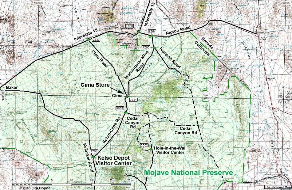
Note: Roads are black (solid = paved; dashed = unpaved). Trails and routes are red (solid = main; dashed = adjacent or alternate). Map based on USGS 15-minute topo map. North is at the top. Grid is UTM NAD27 CONUS. National Park Areas (boundaries dashed green, fill light green) based on NPS data.
Happy Hiking! All distances, elevations, and other facts are approximate.
![]() ; Last updated 130311
; Last updated 130311
| Cima Store | Hiking Around Mojave Preserve | Glossary | Copyright, Conditions, Disclaimer | Home |